Category: Latin America

  • From green and blue forests to social-ecological restoration: restoration futures in southern Chile

    From green and blue forests to social-ecological restoration: restoration futures in southern Chile

    By Matías Barceló

    Matías Barceló is an early career researcher at the Centre for Research and Innovation on Climate Change (CiiCC) at Santo Tomás University, Chile, SECOS Institute and at the Laboratory for Ecosystem Conservation and Human Well-being (LabCBH). His research focuses on local communities and the land-sea interface. In particular, he has worked on assessing the role of local knowledge in adaptive capacity in a rapidly changing world, as well as investigating the various perceived values of nature associated with the various practices of local communities. He is currently assessing how these values can reinforce various initiatives to restore and reconnect degraded and fragmented ecosystems at the land-sea interface.

    Chile is often described through its contrasts: deserts, mountains, temperate rainforests, mediterranean-type climate ecosystems, fjords, kelp forests, and one of the longest coastlines in the world with 4,200 km from north to south, roughly the distance from Lisbon, Portugal, to Moscow, Russia. When accounting for its islands, fjords, channels, and intricate geography, its total coastal perimeter exceeds 80,000 km. These ecosystems also include areas of exceptional conservation value, including the globally recognized Chilean Winter Rainfall–Valdivian Forests Biodiversity Hotspot in central and southern Chile. 

    A map of South America showing Chile (in red) surrounded – and isolated – by the very high Andes mountain range and the Pacific Ocean. Image-generated by Matías Barceló.

    Restoration in Chile is growing, but in what way, and in what direction?

    Our recent review of 95 restoration initiatives, that comes from a dataset compiled by the Chilean Ministry of the Environment, showed that most projects nation-wide are concentrated in terrestrial ecosystems, particularly in central and south-central Chile, where wildfires and forest plantations are among the main drivers of degradation and transformation (see Figure below). Our work showed that 94.7% of the initiatives were terrestrial while the other 5.3% represent wetlands and there are no initiatives in the database focused directly on marine ecosystem restoration, despite Chile’s extensive coastline. 

    This review also revealed a key social gap: only 35.7% of the initiatives explicitly involved local communities from the outset, and when communities were included, their role was often limited to operational activities such as planting, cleaning sites, or basic monitoring. In other words, people participated in restoration activities, but not necessarily in defining restoration goals, identifying priority areas, making decisions, or shaping governance processes.

    The map on the left shows the restoration initiatives recorded by Chile’s Ministry of the Environment between 2010 and 2021, marked with red dots. The panels on the right summarize key features of these initiatives, including: (A) main causes of site degradation; (B) ecosystem type; (C) land use or land cover targeted for restoration; (D) whether actions involved water bodies; (E) whether local communities were involved; (F) whether seeds were collected from nearby areas; (G) whether seedlings were produced by the initiatives; (H) whether planting was carried out; (I) whether monitoring was in place; and (J) whether a reference ecosystem was selected or assembled.

    This is relevant because as mentioned above restoration work should reach beyond ecological goals. If restoration projects focus exclusively on biophysical recovery, they may overlook local livelihoods, cultural values, traditional practices, historical relationships with species, and also the meanings that communities attach to degraded or transformed landscapes. A restoration project can be technically well designed and still fail socially if it does not engage with the people who live in, depend on, and care for those ecosystems. The challenge is to move toward social-ecological restoration, an approach that integrates ecological recovery with local knowledge, values of nature, community participation, and long-term human well-being.

    The mouth of the Chaihuín River where it flows into the Pacific Ocean is a highly representative location for studying land-sea interactions via the river. Chaihuín, Valdivia, Chile. Photo credit: Matías Barceló.

    Why land and sea must be restored together

    Although terrestrial and marine ecosystems are often managed separately, many communities experience them as interconnected territories. Changes in one part of the system can affect the others. Forest degradation can influence water quality, sediment flows, coastal habitats, and livelihoods. Marine degradation can affect food security, local economies, cultural practices, and people’s sense of belonging.

    Drying red seaweed species for marketing purposes on the southern coast of Chile. Photo credit: Matías Barceló.
    Artisanal divers checking water quality monitoring equipment. Photo credit: Matías Barceló

    For this reason, we have undertaken a project that focuses on representative coastal sites of southern Chile: Lenca, Puelo, and Cochamó (see Figure below). These places were selected because they represent different but connected expressions of the land-sea interface in the south-central Regions. Lenca combines temperate rainforest, proximity to Alerce Andino National Park, artisanal fishing, seaweed harvesting, and coastal livelihoods. Puelo connects mountain, riverine, freshwater, and marine systems. Cochamó brings together valleys, temperate forests, rivers, coastal areas, artisanal fishing, shellfish harvesting, and community-based tourism. Together, these sites offer a unique opportunity to ask and test how restoration can be conceived not only for “nature”, but also for people.

    (a) Dots indicate the study site locations: Lenca (red), Cochamó (yellow), and Puelo (light blue) in Reloncaví (Llanquihue Province, Los Lagos Region), southern Chile. (b) Pink dots show the locations of the study sites in a subcontinental geographic context. Maps created by Matías Barceló.

    From ecological restoration to social-ecological restoration

    Our project starts with the idea that restoration priorities should be defined by integrating ecological evidence with local perceptions. It combines remote sensing analysis of native and kelp forest change with interviews with local actors about perceived environmental changes, key species, threats, and meaningful places. This information will be co-validated with communities mentioned above, recognizing that scientific data alone is not enough to guide restoration, and that local knowledge is essential to understand degradation and identify restoration needs.

    Why values matter for restoration

    One of the main contributions of this project is its focus on plural values. People value ecosystems in different ways: some values are instrumental like forests and marine ecosystems that provide food, income, materials, protection, or tourism opportunities; others are intrinsic: species and ecosystems may be considered valuable in themselves, regardless of their usefulness to people. But many values are relational: they emerge from identity, care, memory, responsibility, belonging, and connection to place. These relational values are especially important for restoration.

    Our project will explore these values through photo-voice. Participants will be invited to take photographs of places and species that are meaningful to them. Each photograph will be accompanied by a short narrative explaining why the place or species may be relevant for restoration. This method will allow to communicate environmental change not only through words, but also through images, memories, emotions, and territorial experience.

    Co-creating restoration futures

    Our project moves from diagnosis to action. One approach is relevant here. Pockets of the past, which invite communities to identify values, practices, or ways of life from the past that they want to carry into the future. These may include forms of care, uses of species, relationships with rivers or forests, collective practices that remain meaningful for sustainable futures.

    This approach suggests that restoration initiatives can be more legitimate and sustainable when they are grounded in local values, ecological evidence, and community priorities. In this sense, community-led pilot initiatives and methodological guides can serve as useful tools to translate plural and relational values into restoration practice. They offer a pathway for moving from diagnosis to action, while also generating lessons that may be adapted to other land-sea territories facing similar social-ecological challenges.

    A window of opportunity: restoring relationships in southern Chile

    Chile currently finds itself in a unique institutional moment. The National Landscape Restoration Plan 2021–2030 and the newly established Biodiversity and Protected Areas Service that opens a major opportunity to embed social-ecological restoration into national policy and planning. This opportunity will only be meaningful if restoration moves beyond narrow ecological targets. 

    Land-sea interface in southern Chile, showing an area used for mussel farming, which is subject to terrestrial environmental changes resulting from potential land-sea interactions. Photo credit: Felipe Torres.

    Restoration is often imagined as the recovery of what has been lost such as forest cover, indigenous species, habitats, ecosystem functions. But degradation can also weaken what is relational: knowledge, memories, practices, livelihoods, and the sense of belonging that connects people to place. Restoring green and blue forests in southern Chile is not only about recovering trees or kelp. It is also about strengthening relationships that make restoration meaningful: relationships between people and nature. By placing plural values and community participation at the center, this project seeks to contribute to a broader transformation in restoration practice to build more sustainable, just, and place-based futures. 

    This research is funded by The National Agency for Research and Development of Chile (ANID) and it is just getting started; if you’re interested, please don’t hesitate to contact the first author at barcelo.matias@gmail.com.

    I gratefully acknowledge the collaboration of my friends and collaborators Claudia Rojas & Alejandro Venegas‐González.These gaps and lines of research stem from our recent paper in Restoration Ecology.
  • From Soil Seed Banks to Seedlings: Deciphering the Natural Regeneration of Tropical Dry Forests in the Americas

    From Soil Seed Banks to Seedlings: Deciphering the Natural Regeneration of Tropical Dry Forests in the Americas

    By Viviana Londoño-Lemos

    Viviana Londoño-Lemos is a Ph.D. candidate with the Powers Lab in the Plant and Microbial Biology Program at the University of Minnesota. Email: vivianalondonolemos@gmail.com or londo074@umn.edu

    The tropical dry forest is a unique ecosystem that challenges many preconceived assumptions about the tropics. Unlike the iconic tropical rainforest, dry forests are highly seasonal, marked by distinct dry and rainy seasons. In some areas, plants may experience up to six months without rainfall. As a result, the species inhabiting these forests have evolved remarkable adaptations to thrive in this challenging environment, giving rise to exceptionally diverse plant communities. However, this unique diversity is under threat, as tropical dry forests are among the most threatened lowland ecosystems in the tropics. Urban expansion, mining, monoculture agriculture, and livestock production are among the main threats to this ecosystem. The loss of these forests not only endangers biodiversity but also jeopardizes the livelihoods of many human communities that depend on them.

    Given their threatened status, tropical dry forests have become a major focus of restoration efforts across the tropics. However, these efforts often lack critical information on how these forests naturally regenerate and how abiotic environmental conditions, such as light, water, and nutrient availability, influence seed and seedling survival in this ecosystem. During my PhD, I have been studying how abiotic environmental conditions shape natural seedling regeneration in tropical dry forests across Colombia and Costa Rica. My research focuses on three components of this regeneration cycle: the formation of the soil seed bank, the environmental conditions that drive germination, and the establishment of young seedlings.

    Tropical dry forest during the dry season in the Natural National Park Santa Rosa, Guanacaste, Costa Rica. Note how many of the trees lose their leaves due to water stress. Photo by Viviana Londoño-Lemos.

    Germination and establishment: the great choices in a plant’s life

    Germination is the most consequential choice a plant makes. Because plants are sessile organisms and germination is an irreversible process, the location where a seed germinates determines the environment where the plant must grow, compete, and reproduce for the rest of their lives.

    This story begins with a seed, which is the fertilized ovule of a plant. Each seed is a highly specialized structure that consists of three basic components: a protective seed coat, the nutritious tissue, and the plant embryo. Many seeds also include specialized structures that aid dispersal and sense environmental conditions, helping them determine when conditions are suitable for germination.

    Once seeds mature, the next step is dispersal in both space and time. Spatial dispersal determines how far a seed travels from its parent, whereas temporal dispersal determines when it germinates. Thus, natural seed regeneration depends on seeds arriving in the right place at the right time. Spatial dispersal of many tropical plants, particularly those dispersed by animal vectors, has been widely studied. In contrast, temporal dispersal, encompassing the study of soil seed banks within plant communities, remains understudied. Understanding both dimensions of seed dispersal is essential for assessing the regeneration potential of plant communities, an important consideration when designing plant-based restoration strategies, because it provides information on what species need to be planted versus which may regenerate naturally.

    Soil seed banks are the storage of viable seeds in forest soil. In theory, the soil seed bank of a given plant community contains seeds representing the species present in the vegetation aboveground. But not all seeds behave the same way. Seeds from some species persist in the soil until the next germination season — typically the rainy season in tropical dry forests— after which they germinate or die (transient species). Others persist for years, decades, or in exceptional cases, even centuries (persistent species). Understanding soil seed bank strategies helps identify which species have the potential to regenerate naturally.

    Once the appropriate spatiotemporal conditions are met and a seedling emerges, the next step is its establishment, defined as the transition from reliance on maternal sources (the seed) to physiological self-sufficiency. This critical bottleneck in the plant life cycle depends on the biotic and abiotic interactions of the seedling with its new environment. Biotic interactions, including mutualistic associations, predators, pathogens, and natural enemies, are widely assumed to explain the extraordinary diversity of tropical ecosystems. However, in seasonal ecosystems such as the tropical dry forests, abiotic interactions such as water, light, and nutrient availability play an important role in seedling survival. Environmental shifts, particularly in water availability, directly influence whether a seed successfully germinates and whether the resulting seedling survives long enough to establish. Understanding these processes is essential for designing effective restoration strategies grounded in the biology of the species they aim to support.

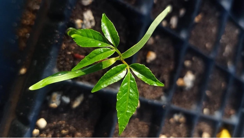
    A seedling of Enterolobium cyclocarpum at the Horizontes Forest Research Station, Guanacaste, Costa Rica. Photo by Viviana Londoño-Lemos.

    The hidden regeneration potential of tropical dry forests

    When planning a plant-based restoration project, understanding the site’s history, particularly its historical plant communities, is essential. Even after vegetation has been lost, soil often retains biological relics, such as persistent soil seed banks, of past communities. For many tropical woody species, soil seed banks are often considered transient, since tropical forests are not typically viewed as strongly seasonal systems. However, with distinct dry and wet seasons, tropical dry forests are a striking exception.

    To determine whether tropical dry forest species rely primarily on persistent or transient soil seed banks, we conducted experiments in the Tayrona National Natural Park in Colombia and at the Horizontes Forest Research Station in Costa Rica. Our goal was to assess how long selected species can survive in the soil. Because this experimental approach can be time-consuming and challenging, we also measured key seed traits such as seed dormancy type, dispersal syndrome, seed coat thickness, mass, volume, moisture content, and embryo-to-seed ratio to identify which seed traits are related to soil seed bank persistence.

    Our first experiment, conducted in Costa Rica, aimed to determine the extent to which tropical dry forest species form persistent or transient soil seed banks and whether canopy openness influences soil seed bank formation. For this experiment, we buried mesh bags that contained seeds from 15 liana and tree species under both canopy gaps and closed forest conditions. We retrieved the bags annually over three years and tested seed viability each time. After one year, only five species exhibited a persistent soil seed bank, suggesting that most species form transient soil seed banks and do not persist beyond a single rainy season.

    To explore this result in greater detail and determine whether transient species survive only until the first rainy season, we conducted a second experiment with 40 species, using shorter intervals between packet retrievals. This experiment was carried out in both Costa Rica and Colombia, in collaboration with researchers and students at the University of Magdalena. We evaluated seed viability after 3, 6, and 13 months.

    Although data analysis is still underway, preliminary results indicate that approximately half of the species employ a transient strategy, while the remaining half are persistent. Transient species tend to disappear from the soil seed bank, either by germinating or dying, by the end of the first rainy season. Persistent species, in contrast, retain their seeds longer, and in some cases germinate only a couple of seeds per year. Some species with persistent seeds tend to survive longer in canopy gaps. As for seed traits, we have observed a tendency for transient species to be wind-dispersed, possess a thinner seed coat, and lack physical dormancy (i.e., no impermeable seed coat). On the other hand, persistent species tend to have seeds with thick coats, physical dormancy, and are more commonly dispersed by gravity (autochory). We expect that our results will help inform decisions in selecting species best suited for planting in restoration efforts. More broadly, the results highlight the importance of understanding the soil seed bank strategies of candidate species in ecological restoration projects.

    Soil seed bank experimental setting at the Tayrona National Park in Magdalena, Colombia, in partnership with the University of Magdalena. Each mesh bag contains seeds of a single species; each row represents a harvesting period (3, 6, or 13 months). Photo by Viviana Londoño-Lemos.

    Germination sensitivity to hydration and dehydration pulses in the tropical dry forest

    Due to the pronounced seasonality, the main germination cue for tropical dry forest species is the onset of the rainy season. However, during the dry season, occasional rain showers may last for a couple of days. This means that the seeds of tropical dry forest species may be exposed to unpredictable rainfall pulses that can trigger premature germination at an unfavorable time of year, placing young seedlings at high risk of mortality.

    To understand how sensitive seeds are to hydration-dehydration cycles, we designed an experimental approach under lab conditions. We selected ten tropical dry forest species with varying seed morphology (e.g., seed dispersal types and sizes) and measured imbibition curves to assess the presence of physical dormancy. The imbibition curves also allowed us to determine the rate of water uptake and the time required for the water-intake percentage to reach different levels. Using data from the imbibition curves, we designed hydration and dehydration cycle experiments and set the germination chamber temperature to match the mean temperature measured in the soil seed bank experiments. We are currently working on this experiment. We expect the results of these experiments to inform us about the germination requirements of tropical dry forest species and the extent to which these species are vulnerable to changes in their normal seasonal patterns.

    Seedling of Spondias mombin in a nursery of the University of Magdalena, Colombia. This is one of the seedlings from the soil seed bank experiment that is germinating after one year. Photo by Luciano Macías Sposito.

    Demographic response of tropical dry forest seedlings to nutrient addition

    In addition to studying germination and seed persistence, we also evaluated nutrient limitation, a factor long proposed to limit seedling establishment in tropical ecosystems. A central biogeochemical dogma is that newly formed temperate soils are primarily limited by nitrogen, whereas tropical soils are typically limited by phosphorus. Although many experiments have tested this idea, results across tropical ecosystems are inconsistent, indicating the complexity of nutrient-plant interactions in the tropics.

    To investigate nutrient limitation in tropical dry forest species, the Powers lab established a factorial fertilization experiment with nitrogen and phosphorus at the Horizontes Forest Research Station in Costa Rica. This experiment tested the responses of the adult plant community to nutrient addition. One of the main findings of this experiment was that nitrogen-fixing legumes, a dominant functional group in tropical dry forests, showed a marked increase in growth to phosphorus addition, while non-nitrogen-fixing species exhibited variable responses. However, most studies evaluating seedling responses to nutrient addition are conducted in nurseries, which may not accurately represent field conditions. To determine whether nitrogen-fixing species are limited by phosphorus and whether non-nitrogen-fixing species are limited by nitrogen during their seedling stage, we planted seedlings of ten tropical dry forest species (5 nitrogen-fixing legumes, 5 non-nitrogen-fixing) directly into the existing fertilization experimental plots. We measured their survival and growth for four years. Because field experiments introduce multiple sources of variation, we also measured other environmental variables, such as litterfall, light, soil moisture, and pH.

    After tracking these seedlings for four years, we found that fertilization treatments did not increase seedling survival. However, nitrogen-fixing species tended to produce more leaves in response to nitrogen and phosphorus fertilization than non-nitrogen-fixing species. These results highlight significant demographic variation and inherently high mortality rates characteristic of the seedling stage. They also challenge the common assumption that fertilizer addition promotes plant growth and survival in restoration projects. This study will be published this year. Stay tuned if you want to learn more about the findings.

    A seedling of Dalbergia retusa at the fertilization experiment at Horizontes Research Station, Guanacaste, Costa Rica. Photo by Viviana Londoño-Lemos.

    Some seeds for thought for the future

    Together, the chapters of my dissertation aim to deepen our understanding of how tropical dry forest species regenerate from seed. My main goal is to make this information useful for designing more effective restoration strategies for this threatened ecosystem. Across ecosystems worldwide, a key challenge is that it remains difficult to generalize about the factors that enable a seed to survive, germinate, establish, and ultimately become a mature plant. This complexity underscores the importance of continued research on seed and seedling biology, especially in ecosystems as dynamic and highly seasonal as tropical dry forests. 

    At the Powers Lab, we strive not only to advance fundamental scientific understanding but also to share our findings with the general public.  To that end, we develop science communication materials that make our findings accessible and engaging to a general audience. One example of this outreach is a forthcoming book from Missouri Botanical Garden Press, created to introduce children to the tropical dry forest and inspire curiosity about this remarkable and often overlooked ecosystem.

  • The Choconexión Project: Restoring Ecological Connections in Ecuador’s Chocó Rain Forest

    The Choconexión Project: Restoring Ecological Connections in Ecuador’s Chocó Rain Forest

    By J. Leighton Reid

    J. Leighton Reid is an Associate Professor of Ecological Restoration in the School of Plant and Environmental Sciences at Virginia Tech.

    The acid test of our understanding is not whether we can take ecosystems to bits on pieces of paper, however scientifically, but whether we can put them back together in practice and make them work. Anthony Bradshaw, 1987

    Ecological analyses in the Choco region are greatly complicated by the inadequacy of the taxonomic data base. Alwyn Gentry, 1986

    In northwestern South America there is a long, thin strip of rain forest that stretches from western Ecuador through Colombia to eastern Panama. This area, known as the Chocó, contains some of the wettest rain forests on Earth, with certain areas receiving more than 11,000 mm (433 inches) of rain each year. The Chocó is isolated from the Amazon basin by the Andes, and as a result many Chocoan species are found nowhere else. Despite its relatively small size, the Chocó is home to about 3% of the world’s vascular plants and 63 endemic bird speciesMore species are described each year.

    A few Chocoan endemic species. (A) Amalophyllon miraculum (Gesneriaceae) – so called because it is a miracle that this little forb has survived in the tiny fragments of Chocó rain forest left in the Centinela near the city of Santo Domingo. This species co-occurs there with another Gesneriaceae, Gasteranuthus extinctus, so named in the early 1990s because it seemed inevitable that rapid and comprehensive deforestation in this region would cause its extinction. Photo: John Clark. (B) Little devil poison dart frog (Oophaga sylvatica) – individuals in a population just one hillside to the north are a completely different color. Photo: JL Reid. (C) Long-wattled Umbrellabird (Cephalopterus penduliger) – a beloved and much-studied disperser of surprisingly large seeds. Photo: Luis Carrasco. (D) Banded Ground-Cuckoo (Neomorphus radiolosus) – one of the rarest and most endangered (and most spectacular) birds in the Chocó. Photo: Murray Cooper. (E) Piedrita (Exarata chocoensis, Schlegeliaceae) – a canopy tree with very coriaceous leaves and one of the last species discovered by Alwyn Gentry before his untimely death in western Ecuador in 1992.

    Although the Chocó rain forest has been relatively well preserved on the west slope of the Andes and in lowland Colombia, the section in lowland Ecuador is mostly gone. More than two thirds (68%) of lowland northwestern Ecuador has been deforested to make space for cattle pastures, oil palm plantations, and cacao plantations. Federally protected areas have had mixed success in preventing or reversing this decline. The Cotacachi-Cayapas Ecological Reserve in the higher elevations of the western slope is still about 99% forested, while the Mache-Chindul Ecological Reserve in the lower coast range retains only 61% of its forest.

    Historical (left) and current (right) forest cover in the Ecuadorian Chocó. Source: Monitoring of the Andes Amazon Program (MAAP): https://www.maapprogram.org/choco/.

    Several non-profit organizations are working to shore up protection of the remaining forest and ensure an evolutionary future for Chocoan biodiversity. One of these is the Foundation for the Conservation of the Tropical Andes (FCAT), an Ecuadorian non-profit committed to achieving durable Chocoan biodiversity conservation in collaboration with local residents and scientists, who call themselves the FCATeros. To advance their mission, the FCATeros are researching local ecosystems and socio-ecological systems, building bioliteracy through youth education, developing local capacity for science and conservation, and helping local farmers diversify their income through regenerative agriculture. FCAT is also purchasing land for conservation and to connect remaining forest fragments, with a goal of conserving 10,000-hectares (~25,000 acres) to sustain healthy populations of Chocoan plants and animals. They have already acquired 700 hectares (~1700 acres) – a mix of primary rain forest and regenerating agricultural lands.

    FCATeros are local scientists and conservationists working tirelessly to understand and defend the Ecuadorian Chocó. (A) Jorge Olivo fires a nylon cord into the canopy of a piedrita tree to hang a camera trap and observe which animals disperse its seeds. Photo: JL Reid. (B) Domingo Cabrera presses a leaf and preserves fruits and seeds of Clavija eggersiana – a threatened and endemic Primulaceae. Photo: JL Reid. (C) Darwin Zambrano, Alex Gualan, Gregory Paladines, Thalia Duenas, and Cesar Munoz outplanting seedlings of a rare and recently described endemic species, Cedrela angusticarpa (Meliaceae), described this year by Walter Palacios and colleagues.

    Some of the degraded land within the FCAT Reserve is regenerating quickly into secondary rain forest. This is particularly the case in areas that were deforested recently and retain many remnant trees, a seed bank, and resprouting tree stumps. Other areas were deforested longer ago and were used more intensively for cattle grazing and cacao production. These areas have more compacted soils, fewer remnant trees, and introduced African forage grasses that inhibit native tree regeneration. As the reserve expands, FCAT will need cost-effective ecological restoration techniques to fill gaps between forest fragments.

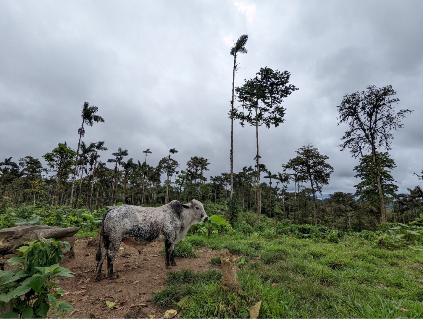
    A soon-to-be-evicted bull standing amidst remnant trees and tree stumps in a recently deforested pasture in the FCAT Reserve. This area is naturally regenerating quickly. Photo: JL Reid.

    The Choconexión Experiment

    In 2021, FCAT invited me to help develop a restoration strategy to meet this need. We formed a collaborative local and international team of scientists and conservationists to recommend restoration strategies for about 80 hectares (~200 acres) of degraded agricultural land. For roughly two thirds of the land (the less-degraded part), we recommended a natural regeneration approach; cattle were removed and the area was allowed to regenerate without further intervention. On the remaining and more degraded area, we developed an experimental restoration study to identify a cost-effective strategy for FCAT to apply on other degraded lands. In doing so, we also took the opportunity to test a basic theory about how ecological communities assemble themselves.

    Patches of pasture cleared with weedwhackers and glyphosate to prepare them for tree planting at the FCAT Reserve. Tree planting positions are marked with bamboo stakes. Photo: JL Reid.

    For our restoration experiment, we chose a technique called applied nucleation, which mimics the patchy spatial patterning of natural forest regeneration. Applied nucleation is intermediate between natural regeneration and more extensive native tree plantations. I studied this method for my PhD research in southern Costa Rica, where over more than 20 years we have found that applied nucleation produced more biodiverse secondary forest more consistently than natural regeneration, and it produced nearly equivalent biodiversity recovery compared to more extensive tree plantations for about 1/3-1/4 the cost. At FCAT, we sought to test applied nucleation in the Chocoan context and to optimize some of the tree planting parameters – including how many species to plant, which particular species to plant, and how widely to space the tree planting patches.

    Choconexión Project experimental design. Each plot is 125×125 m (1.65 hectares, ~4 acres). The aerial imagery was produced with a drone in April 2023. It shows (in negative) the tree planting patches, or islands, cleared within the degraded pasture.

    In 2022-2023, FCAT installed the experiment by clearing pasture grasses and planting more than 3,000 native tree seedlings into 116 15×15-m plots (roughly 50×50 feet). Native trees were all of which were harvested as seed from mother trees in the surrounding landscape and propagated in hand-made nurseries at the FCAT field station. In half of the plots, we planted 19 tree species, and in the other half we planted four species to test the influence of tree diversity on forest recovery. Tree planting plots were separated from one another by either 10, 20, or 30 m to test the optimal spacing. We assumed that planted trees would be able to extend their branches to fill a 10-m gap within a few years, but that it would take many years for them to fill a 30-m gap.

    Experimental treatments and planted species in the Choconexión Project. In each of the large treatment plots, only one type of tree planting composition is used.

    Finally, in half of the plots we planted three fast-growing pioneer tree species that we knew would produce a lot of fruit, and in the other half of the plots we planted fast-growing trees that would not produce much fruit, either because they were wind-dispersed or because their fruits were not appealing to most animals. We built this test into the experiment because the vast majority of plants in western Ecuador have seeds that are dispersed by animals. We thought that if we planted trees that quickly produce many fruits, these trees would attract fruit-seeking animals that would visit the sites more often and deposit plant seeds from the surrounding rain forest. If we are right and that effect is strong enough, it might be possible to plant fewer trees or a lower diversity of trees and have animals compensate by planting more trees (and other plants) for us. This would save FCAT money and allow us to reforest larger areas or put more funds into land acquisition and other mission-driven activities.

    Yellow-throated Toucan (Ramphastos ambiguus) in a Cecropia tree in lowland Costa Rica. Cecropias produce protein-rich fruits (right) that hang pendulously from beneath its large leaves and are available to fruit-eating animals of all sizes. We hypothesize that restoration plots planted with Cecropias, figs, and rubber trees will recover biodiversity and carbon faster than plots planted with other species that produce less desirable fruits. Photo: JL Reid.

    By creating differences in early successional fruit availability, this experiment also represents a basic test of how the first trees to establish in a rain forest influence the types of trees that establish later. In other words, it is a test of priority effects in rainforest reassembly.

    There are four high-level processes that determine which species will gain membership in a local ecological community. These are dispersal, selection, drift, and speciation. In many parts of the world, environmental selection imposes strict limits on which species can live in a given place. For example, there is no woody plant that can tolerate the combination of freezing temperatures and inundation in salty water. Thus, mangroves exist only in the tropical and subtropical latitudes and herbaceous salt marsh plants occupy similar environments closer to the poles.

    Mark Vellend’s Theory of Ecological Communities posits that environmental selection, ecological drift, dispersal, and speciation are the four high-level processes that determine which species will gain membership in local ecological communities.

    It is possible to make very good predictions about the kinds of plants that will form a local community if you know: (A) the traits of the plants in the community, (B) the relationship between those traits and a set of important environmental variables, and (C) the values or ranges of the important environmental variables at a local site. However, these models work best in places with relatively harsh environments, such as boreal wetlands and arid mountain ranges. Predicting rainforest community assembly is harder because the abiotic environment is more benign (generally warm and wet), and as a result, the particular species that arrive and survive may be more strongly determined by biotic gradients – potentially including fruit availability.

    A tree planted island in the Choconexión Project in June 2024. After two years of growth, some of the balsa (Ochroma pyramidale) were already 21 cm (8.2 inches) in diameter. A young fig and cecropia are visible in the bottom left; these two species are expected to begin fruiting soon. This plot backs up to a living fence composed mostly of Erythrina berteroana; these and other pre-existing trees have been mapped throughout the experiment. In this part of the experiment, tree planting patches are separated by 10 m (32.8 feet); the tops of the balsas in the adjacent patch are visible at right. Photo: JL Reid.

    As of October 2025, the Choconexión Project has been planted for 2-3 years (it was planted in two rounds in 2022 and 2023). Most species survived well (82% overall, range ~40-95%) and those that did not survive are being replanted. Some of the balsa are more than 10 m (32 feet) high after two years of growth, and a fig species (Ficus tonduzii) has begun to produce fruit. This year we will develop tree phenology and fruit availability protocols to characterize the effects that experimental treatments are having on the biotic environment.

    A growing number of collaborators and students are monitoring a wide range of ecological variables within the experiment. Last year, an expert botanist, Milton Tirado, established a baseline of the initial woody plant community at 192 points throughout the experiment. Others have also described gradients in soil quality, identified and tagged remnant trees, produced LiDAR data from a flyover at the start of the experiment, and generated annual orthomosaics with a drone. Monitoring is underway for birds, frogs, and other wildlife. Studies have also begun to measure secondary seed dispersal and recovery of the plant-frugivore network. In addition, the experimental landscape is being used for several other projects, including studies of caterpillar predation risk, volatile organic compound composition, and bat disease ecology, among others.

    An air sample collector built by Gabrielle Isaacman-VanWertz to collect samples for volatile organic compound (VOC) analysis. This summer two Tulane undergraduates conducted a pilot study to determine how well common VOCs like ethylene predict the abundance of ripe fruit and over what spatial scale. If effective, such detectors could be used to systematically monitor ripe fruit abundance across the experiment. Photo: JL Reid.

    In the next few years, we plan to replicate this experiment in additional sites and to develop protocols to measure plant and animal functional traits, abiotic environmental gradients, and seed rain. These will allow us to rigorously test how much more information about rain forest reassembly can be gained when dispersal-mediated priority effects are considered in addition to environmental filters.

    More importantly, the results of this experiment will provide pragmatic and timely information to FCAT and others working to preserve the Ecuadorian Chocó. By refining and optimizing applied nucleation designs for this unique landscape, we will make limited conservation funding go farther to restore trophic and landscape connectivity in the fragmented Mache Chindul Ecological Reserve.

    A mixed-use landscape in the Mache Chindul Ecological Reserve, where FCAT seeks to re-establish ecological connectivity with a RAMSAR wetland, the Laguna de Cube. Photo: JL Reid.

    The Choconexión Project is a collaborative effort that involves too many partners to fully enumerate. The experiment was co-designed by Zak Zahawi, Jordan Karubian, Luis Carrasco, and Carlos Aulestia, with support from many others. Carlos led the reforestation with a team of FCATeros. The restoration was funded by the US Fish and Wildlife Service to provide overwintering habitat for Neotropical migratory songbirds. Subsequent ecological monitoring is funded by the US National Science Foundation (DEB 2339839). Some of the graduate students who have worked on the experiment include Nicole Lussier (birds and bird-plant networks), Sebastián Aparicio Vera (tree seedling performance), Holden Jones (frogs), Phoebe Reuben (bats and their diseases), and Mareli Sanchez (soil). All of the scientific work performed within the Choconexión Experiment has been permitted by MAATE.

    To learn more:

  • ACCIÓN SERRANA Network: Conserving and restoring cloud forests in the mountains of Córdoba  province, central Argentina.

    ACCIÓN SERRANA Network: Conserving and restoring cloud forests in the mountains of Córdoba  province, central Argentina.

    By: Pablo Friedlander and Romina Torre

    Dr. Pablo Friedlander, Director of Acción Serrana has initiated and led pioneering restoration and intercultural education projects in Argentina, Brazil and Spain for more than two decades. He also organizes ethnobotanical research and expeditions to the Amazon and the Andes. pablofriedlander@gmail.com

    Biologist Romina Torre is the executive coordinator of Acción Serrana, with ten years of  experience in mountain restoration, research and educational activities involving rural communities, health practitioners and scientific institutions at bioregional and international levels. torre.romina@gmail.com

    Introduction to the Polylepis forests

    In the highest mountains of South America, remnants of vast stands of so-called cloud forests dominated by members of the beautiful Rose-family genus Polylepis are found throughout the Andes Cordillera, from Colombia and Venezuela to northern Chile and northwestern Argentina. In addition, in the much older Sierras Grandes de Córdoba, in central Argentina, the endemic Polylepis australis (locally known as Tabaquillo), occurs in scattered fragments of once extensive mid-altitude forests. At the continental scale, the canopies of these open, moist formations,  or what remains of them today, comprise 45 recognized species and constitute the highest altitude forests on Earth (Boza Espinoza & Kessler 2022). Sadly, their range and integrity has been drastically reduced by logging, burning, and overgrazing since the 16th century, especially with the introduction of European cattle.Their moss- and lichen-covered branches collect fog, while their roots prevent erosion and regulate water runoff. These forests also contribute to climate change mitigation,  by favoring carbon sequestration, and they support diverse endangered species dependent on these habitats. In all seven of the Andean countries where they occur, the restoration and conservation of these cloud forests is of vital importance to local communities and to protect. the headwaters of the main rivers and creeks (del Campo & Friedländer 2023).

    This locally famous ‘Grandfather’ Tabaquillo (Polylepis australis) tree grows in the heart of one of the last remaining cloud forest fragments in Córdoba  province.
    The Argentina anole, Pristidactylus achalensis, is an endemic lizard of the Pampa de Achala.

    The hand-shaped Polylepis leaves and the soft, multi-layered bark of the trees, draped with epiphytes, mosses and lichens, collect fog and give rise to the compelling and accurate image of the forest “milking” the omnipresent mist and clouds. At a continental scale, these cloud forests when they are healthy and thriving contribute to the ‘biotic pump’ connecting the Andes- the Amazon-and the Atlantic Forest biomes (Beveridge et al. 2024) and regulating water and climate cycles and  reducing the risk and severitry of wildfires. The savannas and cloud forests The recent increase of forest fires in all biomes of South – and Meso- and North America – demands more strategic and intercultural, public-private coalitions to increase restoration areas and protection of basins at multiple spatial scales for present and future generations (Argañaraz et al. 2015; Argibay & Renison 2018). Additionally, Polylepis roots and their mutualistic microorganisms retain and enrich soils. They also provide a ‘framework’ for regenerating forest communities undergoing active or assisted restoration. Indeed, when mature, these emblematic forests harbour very high biodiversity, including many endemic species of epiphytic orchids, insects, birds and reptiles, and also provide a wide range of ecosystem services to people at multiple spatial scales. Finally, they have huge cultural significance, and by working in synergy with local communities we aim to introduce and sustain biocultural as well as ecological restoration.

    Conserving and Restoring the cloud forests with Acción Serrana and Acción Andina

    In 2002, the project “Milking the Clouds” (Ordeñando Nubes, in Spanish) was launched, along with other local grassroots initiatives. Then, after a long learning curve in restoration methods and typical pioneering struggles, the five interrelated projects gradually scaled up their ‘footprint’ and their impact to a bioregional level over the next decade and a half. A big step was taken in 2018 when, together with the ECOAN (Asociación Ecosistemas Andinos) and Global Forest Generation, Acción Serrana was set up as a hub including 5 different local organizations to help in the launching of  “Acción Andina” as a a new international ecocultural restoration consortium. In that context, Acción Serrana is now managed by the Fundación de Actividades Biosféricas as part of Acción Andina

    Currently working in Peru, Ecuador, Colombia, Bolivia, Chile and Argentina, with 23 member institutions, Acción Andina partners have planted more than 7 million Polylepis trees, of many different species, and this number is rising each year, as is the success rate of the plantings. In 2023, Accion Andina received the prestigious Earthshot Prize, and in 2024 we were named one of the 7 UN World Restoration Flagships for the UN Decade on Ecosystem Restoration 2021-2030

    Map of the 12 Acción Serrana restoration sites in the Sierras Grandes de Córdoba.

    The 12 biocultural restoration areas in the Sierras Grandes of Córdoba under Acción Serrana management add up, at the time of writing, to a total of 3,170 fenced hectares. 

    The reforestation and restoration campaigns are made possible by 65 permanent staff members and over 1,500 volunteers per year on average. To date, we have produced and planted more than 860, 000 Polylepis australis nursery-grown saplings in consecutive seasons (see https://ecohealthglobal.org/network-sites/accion-serrana-argentina/). All of these trees were grown from seeds collected locally in each of the planting areas managed by the five different partnering organizations or local implementing groups  For the 2024-2025 October 2024 to March 2025 planting season, 250,000 trees were propagated in the 29 plant nurseries we maintain, and at the time of writing most of the plantings have been very successful. Since 2023, Accion Serrana has been helping to replicate the same initiative in Northwestern Argentina, with the Project Arbol y Vida in Jujuy Province (in cooperation with various high-Andean communities) and the Germinar Project in Tucuman Province (working with Diaguita communities of the Tafi del Valle bioregion), advising on and synergizing actions and application of  techniques and strategies. In addition to this biocultural restoration, another critical line of work is our environmental education program being run in local schools and municipalities for more than a decade already.

    The ecosystems of Acción Serrana are Sub-Andean and Chaco serrano forests and grasslands (sensu Cabrera 1976), composed of seasonally dry forests or open woodlands with 4 different altitudinal belts in the central Argentina mountain ranges, Sierras Grandes de Córdoba (Giorgis et al. 2011). The land tenure of the areas under restoration inside the Provincial Watershed Reserve of Pampa de Achala, which consists of private landholdings subject to Provincial Management & Conservation plans, or  public protected áreas within the National Park Quebrada del Condorito. The numerous activities we carry out include: maintenance and fencing of new areas, native forest tree and shrub seed collection, construction and improvements of nurseries, germination of seedlings, transplanting of seedlings to reusable plastic forest tubes, high mountain transfer of seedlings to the planting areas and their planting in the intervention areas during the rainy season. We establish permanent plots for scientific monitoring and we support research carried out in the intervention areas. Workshops, public talks and training programs are also organized yearly to train and recruit more enthusiastic and qualified citizen restorationists for the work in the mountains.

    Acción Serrana team planting the native Polylepis australis of Córdoba province.

    Implementation of Acción Serrana with local partners in reciprocity

    We work to  generate ecological, economic, social and cultural sustainability by reaching agreements with landowners, communities, networks and institutions (municipalities of Mina Clavero and Villa de Las Rosas, the Ministry of Education of the Province of Córdoba, and others). 

    To help with the local matching needed to be part of the Acción Andina  initiative, Acción Serrana had set up the Ayni Plan (“ayni” meaning “reciprocity” in the quechua language of the Andes). Basically this implies the commitment to generate 30% of operating costs through specific fundraising campaigns and by other quantified means. For example the constant one of inviting the public to participate by donations of the costs required for producing a forest (25 trees under monitoring), a tree or a volunteering activity. Then we promote the reception of donations of funds, lands, tools, materials, vehicles, etc.. In addition, we encourage ecotourism with a schedule for each area: summer plantations and seeds, winter transplanting of seedlings and fencing of restoration areas. Acción Serrana aims to increase reciprocity and abundance also throughout the different courses and events both virtual and in-person, and some special community parties, with raffles, concerts, talks, video screenings, and promotion of crowdfunding campaigns. Currently we are running our international matching crowdfunder campaign with the help of the Treeangle Foundation from the United Kingdom, as we have done each year from 2012, to complete the mission of this season January 2024 – March 2025. (See video here.)

    In the years ahead, Acción Serrana will propagate and plant a wider variety of native trees and shrubs in pursuit of a Framework species approach to restoration such as that being tested by EHN partner Daniel Perez and his team in Caviahue, Patagonia (Perez et al. 2019; see also here and (here). As a new initiative, we aim to  deploy 30% of funds raised to reintroduction of multipurpose Neltuma (formerly Prosopis) species and other framework species in lower altitudes of the mountain system, and 70% to ongoing Polylepis restoration in the high mountains. This year, we have begun studying how to propagate the obvious additional choices of “framework species” namely Maiten (Maytenus boaria), Escalonia (Escallonia cordobensis) and Molle (Lithraea molleoides)

    Escallonia cordobensis a formerly common shrub now considered key to restoration.
    Co-dominant Maytenus boaria and Polylepis australis ‘giants’.

    Next steps

    Following decades of reforestation and cloud forest restoration, we are working with Indigenous inhabitants in these mountains, including the Comechingones (Henia and Camiare tribes) and Sanavirones peoples, who have been historically marginalized. We are cultivating intercultural bridges (Rojas et al. 2025) in áreas like nursery propagation, environmental education, and llama and alpaca reintroduction and ancestral practices of weaving with camelid wool. This collaborative framework aims to integrate and restore  key zones around the Ansenuza Sea, Traslasierra Valley, Pampa Achala, and Pampa de Pocho. 

    In January 2025, Acción Serrana became a new member hub of the Ecological Health Network, following two fruitful visits from James Aronson. These visits facilitated knowledge sharing and collaboration, furthering our core purpose of scaling up watershed restoration, enhancing environmental education, and deepening intercultural collaboration for research projects. By integrating ecological, social, and economic perspectives and approaches, we aim to share our regenerative experiences across mountains, jungles, deserts and oceans within a quickly growing international network of networks. We are delighted to be part of this movement and consortium with a strong, clear set of values and shared purpose  – something we all need to cultivate in these critical times. As a meaningful next step of Acción Serrana, we look forward to participating in multi-site research projects based on the simultaneous monitoring and evaluation of a series of ecological and human health indicators in areas undergoing biocultural restoration protocols. Through these efforts, we are committed to enhancing ecosystem health and strengthening our relationship with nature, ensuring the longevity and health of Andean cloud forests and lower buffer zones of Chaco serrano forests -as well as the local communities living there for generations to come. 

    Learn more by watching these videos on Acción Serrana and the Biodiversity in Sierras Grandes de Córdoba.

    All images are from the archives of Acción Serrana.

  • Birdwatching and organic cacao at Hacienda Herrera: exploring alternative pathways for a sustainable future in the Peruvian Amazon

    Birdwatching and organic cacao at Hacienda Herrera: exploring alternative pathways for a sustainable future in the Peruvian Amazon

    By: Thibaud Aronson

    Thibaud Aronson is a field ornithologist based in Peru, carrying out conservation work in the Amazonas region.

    Sunset at Hacienda Herrera with Puerto Maldonado in the background. © Thibaud Aronson

    Tambopata. For anyone who knows about the Peruvian Amazon, there are few names that are more evocative. All it takes is an hour and a half flight from Lima, quickly leaving behind the parched desert of the coast, flying above snow-capped glaciers, and finally down over the rainforest that surrounds Puerto Maldonado, one of Peru’s three main Amazonian cities. 

    Established in the year 2000 and covering 270,000 hectares (1,000 square miles), Tambopata is one of Peru’s 17 National Reserves. This is a category within the country’s protected area systems that allows a certain degree of human activities within its borders by the local communities. These include scattered Ese Ejja Indigenous people and more recently established colonists from other parts of Peru. The reserve borders the much larger Bahuaja-Sonene National Park, which itself connects to Madidi National Park in Bolivia, where MoBot researchers have been working for many years.

    Blue-and-yellow macaws (Ara ararauna) in a tree along the Madre de Dios River near Puerto Maldonado. © Thibaud Aronson

    Considering it’s a city of nearly a hundred thousand souls, the surroundings of Puerto Maldonado are still surprisingly wild. Macaws and poison dart frogs, some of the most common victims of human encroachment in the lowlands due to the never-ending demands of the illegal wildlife trade, can still be found only a couple minutes outside the city. Likewise, howlers and tamarin monkeys, elsewhere either hunted for food or trapped as pets, still dwell in forest patches on the city’s outskirts.

    Bolivian red howler monkey (Alouatta sera). © Thibaud Aronson

    There are a few reasons for this. First of all, there is more of an ecological conscience here than in many other parts of Peru. Visions of giant river otters or flocks of parrots coming in at clay licks, both easily seen in Tambopata, are some of the most ubiquitous marketing features of Peru’s tourism board, right after Machu Picchu, of course. Indeed, there are daily flights between Cuzco and Puerto Maldonado, one of the only flight routes in the country that connects two provincial cities, instead of having to transit through Lima’s hub. As a result, ecotourism represents a substantial share of the region’s income. 

    Furthermore, one of the main agricultural products of Madre de Dios is the Brazil nut (Bertholletia excelsa, locally called castaña. This is a massive canopy tree, one of the largest in the Amazon Basin, whose fruits are still harvested in a traditional way, within concessions that preserve the existing forest where the castaña trees grow. And of course, much of the region is covered in large protected areas, which are reasonably easy to access, and therefore easier to actually monitor and protect. The Amazonian tracts in central Peru, for example, where ecotourism is essentially inexistent, have been facing much more trouble.

    The dock leading to an ecolodge on Lago Sandoval. © Thibaud Aronson

    However, Madre de Dios is not a perfect Eden either, far from it. The city proper has only existed for a few decades, and reaching it from Cuzco used to be a journey that could take a week, navigating dubious muddy tracks that were regularly blocked by landslides. But since 2011, the city is reachable by an asphalt road, in only 10 hours from Cuzco. This is the infamous Interoceanic Highway, the only road that connects the Pacific and Atlantic shores of South America, and cuts through an immense swath of Amazonia. Years later, the Odebrecht scandal revealed that over 20 million dollars in bribes had been paid out to ensure its building, and economic studies have since demonstrated its very underwhelming contribution to the economy of either Peru or Brazil. But the damage is done.  

    There has since been a massive influx of migrants from the Andes, with a very different culture. They practice slash-and-burn agriculture, which regularly results in out-of-control wildfires. But the main environmental plague has been the gold rush that has been gripping the region for the past two decades. There are some 30 to 50 thousand gold miners in Madre de Dios, many of them working in illegal, small-scale operations on remote river tracts. What is left after these illegal operators move away has been described as moonscapes. And they have impacts far beyond the mining sites themselves. The mercury that is used to extract the gold seeps into the water and soils, to the tune of 50 tons per year, resulting in widespread environmental contamination and serious health issues. Furthermore, the region suffers more and more from increased crime and all the other societal ills that characterize resource-rich frontier regions undergoing rapid and poorly planned development.

    Fortunately, there are people working to propose alternatives for the future of the region. For example, various NGOs, including WWF, are carrying out restoration projects on abandoned mining sites, in some cases working with the miners themselves. Limiting heavy metal contamination, which plants can help with, is in everybody’s interest, after all.

    Hacienda Herrra, an ecolodge on the Rio Madre de Dios near Puerto Maldonado. © Thibaud Aronson

    Another notable initiative is the Hacienda Herrera. This 32-hectare (79-acre) property is located 15 minutes from the city, and reachable only by peque-peque, the narrow, motorized canoes that are the most common means of transportation on the Amazonian waterways. From the small wooden jetty, a path makes its way under massive-buttressed trees towards the buildings of the Hacienda. This land has belonged to the Herrera Segara family for 4 decades, where they used to plant various crops and raise cattle, as the regional government itself gave away cows to local people in order to “settle” the land. However, showing remarkable vision, the family realized the value of the forest they had, and decided to focus on agroforestry systems, growing avocado, orange, cocoa, banana and more, while helping the native forest recover around their crops. Ten hectares of the property (about 25 acres) are occupied by the various organic orchards, while the other 22 hectares (54 acres) are covered in tall forest, which is part of the buffer zone for the Tambopata National Reserve. Then, over 10 years ago, they partnered with CECCOT, the Tambopata Education, Science and Conservation Center, led by Dr. Ursula Valdez, a Peruvian ecologist who now teaches at the University of Washington. Together, they have developed their “forest school” philosophy. 

    Visiting Lago Sandoval with students from CECCOT. © Thibaud Aronson

    Each year, the CECCOT organizes courses and workshops that bring people from all over the world to learn and train at the Hacienda, on topics as diverse as nature photography, bird banding, tree scaling (a highly valuable skill in research projects involving arboreal camera traps or the collection of botanical specimens, for example), and much more. In addition to foreigners, CECCOT always integrates people from local communities to give them new opportunities for training or simply to learn more about the natural heritage of their land. Many local students, but also children from orphanages and disadvantaged communities have been able to come and learn at Hacienda Herrera.

    One of the main goals of the Hacienda is to offer a learning space about biodiversity conservation, but always working hand in hand with sustainable development. Dr. Valdez and her students have been carrying out a long-term study of the birds that use the Hacienda’s organic cacao orchards, and which subset they represent of the avifauna of the surrounding forest matrix. The finding that some of these “cacao birds” include antbirds, understory insectivores that notoriously are some of the first to disappear from fragmented forests, is very encouraging. Camera traps placed along the trails have registered most of Peru’s lowland mammals, including the full suite of felines and even the Short-eared dog (Atelocynus microtis), one of the most elusive mammals on the continent! Sure enough, during my visit, I was lucky enough to photograph a jaguarundi crossing an orange orchard between two forest patches!

    Jaguarundi (Puma yagouaroundi) crossing an orchard at Hacienda Herrera. © Thibaud Aronson

    At the same time, it has also become a gorgeous space to receive visitors and tourists, with a very strong focus on sustainability. This can be seen through the solar panels that are now the main source of electricity for all buildings, the collection of rainwater and the vegetarian cuisine, using products from the Hacienda’s garden and local producers. These have been implemented over time, with the family and the CECCOT sharing costs for the improvements. Ruth and Kenny, the husband-and-wife team, run everyday business at the Hacienda and they have created a travel company that takes visitors to see other natural attractions in the area, such as the famous Sandoval Lake or the Inkaterra canopy bridges.

    Black caiman (Melanosuchus niger). © Thibaud Aronson

    The grounds and trails of the Hacienda are a wonderful showcase for Amazonian biodiversity, from the bats that roost under the thatched roofs of the cabins to the massive caiman lizard that hunts water snails around the seasonal pond near the main building, to the multicolored butterflies that can be seen on flowers along the paths or on the muddy riverbanks. Meanwhile, with some 350 bird species, the Hacienda is becoming a hotspot in the booming world of birdwatching, with Peru finally starting to catch up to Ecuador and Colombia, where birds have been a powerful enginefor conservation and sustainable development.

    Sac-winged bat (Saccopteryx sp.) roosting under the eaves of a cabin at Hacienda Herrera. © Thibaud Aronson

    Besides the visitors, the Herrera family is also generating positive change outside its own borders. Some of the first mammals captured on the CECCOT camera traps were neighbors carrying out timber that they’d illegally harvested from the Hacienda itself. But they slowly made inroads with them, inviting them and their children to show them what they had managed to do. The idea was to have the Hacienda be a model for sustainable living. Things such as renewable energy or clean sanitation for their homes, achieved with relatively low investments. Now some of these same neighbors are implementing agroforestry systems on their orchards and planting native trees around them, while others are opening ecolodges of their own.

    Banana orchard growing in the shade of native trees at Hacienda Herrera. © Thibaud Aronson

    Just across the river is a stark reminder of how things could have gone, with the regular wildfires, illegal land grabs and health problems. On Hacienda Herrera’s side, people seem to finally have agreed that they want to try something else. Not long ago, when there was a problem with a roaming jaguar snatching dogs from people’s backyards, the neighbors got together. With help from experts at the San Diego Zoo, they agreed to a monitoring program, instead of sending a hunting party. After all, the jaguar, or otorongo, is the most emblematic species of the Amazon, even for Peruvians who aren’t of Indigenous descent. They summed it up in one sentence: “Do we want to be the community that kills our jaguar, or the community that protects him?”

    Black-capped squirrel monkey (Saimiri boliviensis) © Thibaud Aronson
  • The relevance of species diversity and composition in restoration plantings: a case study in the Atlantic Forest in Brazil

    The relevance of species diversity and composition in restoration plantings: a case study in the Atlantic Forest in Brazil

    By Dr. Ricardo Viani

    Ricardo Viani is a professor at the Universidade Federal de São Carlos, Brazil, where he coordinates the LASPEF (viani@ufscar.br)

    The Atlantic Forest in Brazil is a highly diverse tropical forest, listed as a global hotspot for biodiversity conservation. It is also the home of the two biggest Brazilian cities, São Paulo and Rio de Janeiro, and it is where most Brazilians live; around 150 million people inhabit and depend on the Atlantic Forest for the provision of ecosystem services.

    Originally covering about 1.2 million square kilometers (297 million acres), the Atlantic Forest now covers less than 20% of its original area because of centuries of degradation. It is no wonder that the Atlantic Forest stands out globally as a region where forest restoration is urgently needed and is being taken seriously. In recent decades, many large-scale Atlantic Forest restoration programs have been implemented and, in 2009, the Pacto (Atlantic Forest Restoration Pact), a coalition of hundreds of institutions working for Atlantic Forest restoration, was launched. For its work, the Pacto was recognized as a World Restoration Flagship by the United Nations Decade on Ecosystem Restoration, highlighting it as a global example of an ongoing, large-scale, and long-term ecosystem restoration effort.

    Landscapes where forest restoration plantings are usually done in the Atlantic Forest in Brazil. A sugarcane plantation (left, photo: Paulo Molin) and a pasture matrix (right, photo: Ricardo Viani), with variable levels of scattered remaining forest.

    After decades of Atlantic Forest restoration efforts, it is time to evaluate what we have done so far, not only to assess the outcomes but also to inform other large-scale restoration initiatives worldwide. Thus, we recently investigated which tree species were included in 1,073 forest restoration plantings implemented from 2002 to 2018 in the Brazilian Atlantic Forest by restoration programs carried out by the NGO SOS Mata Atlântica.

    Overall, 423 tree species were included in the evaluated plantings, which represent less than 8% of the Atlantic Forest tree flora. In comparison with remaining forest patches, restoration plantings skewed towards nitrogen-fixing, non-animal-dispersed, and pioneer species. Plantings had poorly included endangered and endemic species as well as species that were previously indicated as priority for restoration based on their ecological interactions, carbon storage, and conservation values.

    However, the more striking result is that restoration initiatives are planting the same set of limited tree species across the whole Atlantic Forest. Although the Atlantic Forest has three types of forests (the Araucaria Forest, the Rainforest, and the Seasonal Forest), each one with their own singular floristics, restoration plantings are overall more similar in species composition to each other than to the remnants of the type of forest of the region where they exist. In other words, we plant the same species without considering spatial variation in local and regional floras.

    This pattern raises an uncomfortable question. Is large-scale restoration via tree planting contributing to biotic homogenization, that is, the tendency for distinct places to become more similar?

    A tropical forest restoration planting in the Atlantic Forest in Brazil. Plantings tend to be done with a similar set of species across the whole Atlantic Forest. Photo: Ricardo Viani

    Why should we pay attention to the trees we plant for tropical forest restoration?

    One may say that our role in tropical forest restoration is to trigger ecological succession, and it is not relevant if we plant just a few tree species across a wide, diverse region. Actually, some argue that we should plant the same species everywhere, by selecting and planting the best species to accelerate early forest development . This is one explanation for the overrepresentation of pioneer trees in restoration plantings, and a reason to increase the representation of generalist animal-dispersed trees, which attract native fauna to restoration sites and favor natural regeneration under planted trees. Another argument may be that evaluating what we plant for forest restoration is not so important because non-planted species will naturally colonize planting sites later on and change their floristic composition. However, this statement and the previous one are acceptable only if regional tree species can colonize restoration sites in fragmented landscapes – a questionable premise in typical landscapes of southeastern Brazil.

    The few studies available in rich tropical forests show that many non-planted trees species colonize restoration plantings, which is good news. However, some functional groups, such as slow-growing tree species dispersed by gravity or by larger animals tend to be bad colonizers, especially in fragmented or defaunated landscapes. In other words, if they are not planted, many tree species will not reach restoration sites on their own, and we should pay more attention to their inclusion in restoration plantings.

    Finally, we need also to consider that restoration is a strategy to promote in situ tree species conservation. The Atlantic Forest has more than 4,000 native tree species, almost half of them endemic, and dozens threatened by extinction. However, few endemic and threatened tree species are included in restoration plantings and some of the ones that are included are only used infrequently and in low abundance. Probably, some of them are also rare, absent in fragmented landscapes, and not good colonizers, which increases the importance of their planned and careful inclusion in restoration efforts.

    A practitioner planting a slow-growing tree in the understory of previously planted pioneer trees. This is part of an experiment in the Atlantic Forest in Brazil, aiming to answer when it is better to plant slow-growing species: together with pioneer trees or under their shade. Photo: Ricardo Viani

    The way forward

    Restoration initiatives have done great work for the Atlantic Forest in recent decades, but there are always points that could be improved, such as the representation of regional flora and of some groups of species currently underrepresented in plantings (e.g., animal-dispersed, endangered, high value species for conservation, etc.). Solving this issue involves much more than just recommending their inclusion in restoration initiatives. Many of these species are rare, lots of them do not have seeds or seedlings available for restoration and, many, if not most, are slow-growing trees. Knowing how restoration practitioners perceive the importance of species diversity, selection, and composition for restoration plantings and potential trade-offs in prioritizing diversity representation versus fast early recovery may give insights on strategies to overcome this challenge.

    In addition, as many underrepresented species in tropical forest restoration plantings are slow-growing, it is worth studying ways of introducing these species in restoration plantings. For instance, should we plant slow-growing trees under full-sun or under the canopy of previously planted pioneer trees? How can we balance the composition of restoration plantings to include slow-growing species without losing the benefits of rapid forest development promoted by fast-growing species? All these questions are still to be answered and part of my ongoing research project Optimizing high-diversity restoration: perceptions and approaches to add tree diversity in tropical forest restoration plantings.

     We are on our way, but there is still a long path to go before restoration will truly represent the diversity of complex and unique biomes.

    For more information, read our paper recent paper in Forest Ecology and Management or contact Dr. Viani (viani@ufscar.br).

    Part of an Atlantic Forest restoration experiment in Brazil where different abundances of fast and slow-growing species are being assessed aiming to find the best strategy to add slow-growing trees in tropical forest restoration plantings. Photo: Paulo Molin
  • Early steps towards ecocultural restoration of the ancient Araucaria araucana (Pehuén) forests in Caviahue, Northern Patagonia, Argentina. 

    Early steps towards ecocultural restoration of the ancient Araucaria araucana (Pehuén) forests in Caviahue, Northern Patagonia, Argentina. 

    By: James Aronson, Daniel R. Pérez, and Adam T. Cross 

    Daniel Pérez is head of the Laboratory for Rehabilitation and Restoration of Arid and semi-arid Ecosystems (LARREA) at the Faculty of Environmental and Health Sciences, National University of Comahue, Argentina. He also leads two ecological restoration projects in arid northern Patagonia, the first being the one described here and also the one described in his 2021 NHER post here. In addition, Daniel was coordinator of the Argentinian national Network for Ecological Restoration (ENREA) and organizer of its 3rd Congress held last November. James Aronson and Adam Cross are both members of the Steering Committee of the Ecological Health Network. James is also an Emeritus Scientist of the Center for Conservation and Sustainable Development, MBG, and Adam is Adjunct Senior Research Fellow at Curtin University, Perth, Western Australia.

    Straddling the Andes and the border between Argentina and Chile, an ancient ‘Lost World’-looking forest persists. It occurs in fragments, dominated by the extraordinary Gondwanan conifer Araucaria araucana, called Pehuén in the Mapuche Mapudungun language and widely known by that name today in southern South America. The name of this giant emergent (up to 80 m tall), and very long-lived (1500 years and more), fire resistant ‘living fossil’ tree, is evidently related to the Pehuenche, an ancient ethnic tribe of migratory hunters in south central Chile and adjacent Argentina, before the 16th century CE when Spanish colonists began to arrive and change the course of everything.

    Forest fragment of Araucaria araucana (Pehuén) right in the town of Caviahue, with an understory of the southern South American bamboo, Chusquea culeou. Credit: Laura Abraham.

    The Pehuenche were so named for their dependence on the seeds of the Pehuén as a food source. Between 1550 and 1850 CE, some of them migrated west and merged with other peoples of northern Patagonia, in a process described by historians as becoming Araucanized. In the 21st century these Peoples still retain rights to some of their ancestral lands in northern Patagonia, but just barely. Despite the name Mapuche, which means “people of the land”, their situation in modern day Argentina is truly precarious.  

    While the Pehuén forest is alive and well and regenerating in some large parks in Chile and Argentina, where livestock are excluded, the dominant species is considered critically endangered by the IUCN, and a poignant example of its vulnerability can be found around Caviahue (Roig et al. 2014).

    Typical degraded Pehuén forest remnant near the shores of Lake Caviahue. Credit: Adam Cross.

    Pehuén, the rather odd English common name of which is Monkey Puzzle Tree, is one of only two highly disjunct Araucariaceae representatives in southern South America. The other 18 extant species of this Gondwanan family all occur in the South Pacific region, in New Caledonia, eastern Australia, Papua New Guinea, and Norfolk Island. 

    In Caviahue, whose name most fittingly means “Sacred Place of Reunions”, there is an ambitious ecocultural restoration, rehabilitation, and transcultural sustainable development and educational program getting underway, centered on Pehuén (Pérez et al. 2020). The first activities began six years ago with tree plantations and restoration-based education. Since then, there have been countless meetings with all social sectors of Caviahue such as the Mapuche community elders, Caviahue-Copahue Provincial Park, the Caviahue Ski center, primary and high school principals, political decision-makers, and leaders of the tourism sector, all in search of a social consensus and support for the restoration project. This vocation to build common ideas through dialogue, respecting visions, expectations, and desires of the whole community, is one of the most notable features of the work program. It is partly inspired by the Mapuche name for the site. But, as yet there have been only very limited discussions between the dominant, Spanish speaking, sedentary Western community and the transhumant, Mapudungun-speaking Mapuche.

    Transhumance – a disappearing way of life

    Transhumance is a form of animal husbandry and pastoralism that is remarkably well-adapted to arid and semi-arid lands. The word derives from the Latin trans (beyond) and humus (land), and thus means ‘beyond the land of origin’. It involves biannual movements of flocks between high summer pastures and winter grazing grounds at lower altitudes, or vice versa. In some cases, the entire tribe or group moves with the herds, while in others, only the herders make the biannual trek. This way of life was once widespread, in drylands on most continents, but is now lost and almost forgotten in most places. In Neuquen Province it still survives among the Mapuche. They camp in their ancestral lands near Caviahue lake (1646 meters above sea level) during the warm months, and then during the cold months they and their mixed herds migrate to Huncal (1204 masl) approximately 100 km east and much drier in summer than Caviahue.

    Typical Mapuche settler in transhumance, herding Neuquén Creole goats, a genotype especially well adapted to the region. Credit: Agustín Orejas.

    Although there is a transhumance law in Neuquén that seeks to protect this ancestral practice, Mapuche farmers are often forced to travel along paved roads to reach their destinations because many fields have become the private property of the colonizers and are blocked in with wire fences.

    The Caviahue site joined the Ecological Health Network in 2022 (see here), and a lot has happened since then. The first and third authors of this blog have been offering support to weave together a holistic, ecocultural approach with a focus on human health for the program. Numerous other colleagues in restoration science, and social sciences, from Argentina, Chile, Mexico and Brazil have started getting involved following a visit to the site led by Daniel Pérez of the 3rd Congress of the Argentinian National Ecological Restoration Network held last November, in Neuquén. 

    Field trip near Caviahue. Credit: Adam Cross. 

    The project was initiated with the goal of studying how to restore the Araucaria forest in Caviahue, one tree at a time. It is daunting because the trees grow very slowly and there is little previous research on similar species in xeric regions providing a template to build upon. 

    It has gradually become clear that the restoration of this ancient, isolated Araucaria forest must be ecocultural, and include ecological rehabilitation and landscape reintegration of the degraded grazing lands of the Mapuche pastoralists who camp with their herds of sheep, goats, cows and some horses at one end of Caviahue lake for 6 months of each year. Additionally, the town of Caviahue needs restorative work, because of the planting of invasive Pinus contorta from Western North America, which is escaping and naturalizing in a heritage landscape where this highly competitive conifer does not belong (see below). 

    Araucaria araucana emerging among a dense formation of invasive Pinus contorta in the town of Caviahue. Credit: Laura Abraham.

    At the same time, Daniel and his colleagues came to understand that a truly great context for ecocultural restoration exists here. Caviahue is an extremely interesting town of ca. 1000 permanent residents. There is a strong sense of community among the westerners, and a desire to keep the quiet, nature-based quality of their lifestyle in the town and its valley, despite the interest of many real estate developers to ‘grow’ the ski station and the town, with all its charming low-key tourism services into something much bigger. They are aware that the isolated, relictual population of Pehuén is of great cultural value, but they don’t necessarily see that something can be done to change the nature of the broadly degraded and fragmented landscape where only a few ancient trees remain with little evidence of regeneration. Such change can only come about through trust-building and cooperation with the Mapuche pastoralists. 

    Xeric Araucaria araucana forest remnant, extremely degraded by intensive livestock farming. Credit: Eliane Ceccon.

    If one visits the land of the Caviahue Ski centre, not far from the ski slopes, a spectacular remnant of primary-type Pehuén forest of a few hectares there reveals what the ancestral forest was like, and provides a reference model, at least for the more mesic sites in the valley, to those who would entertain the concepts and a project of ecological restoration.

    Primary-type forest of Araucaria on the protected lands of the Caviahue Ski Center. Credit: Laura Abraham.

    There, one can see the awe-inspiring, living fossil Pehuén trees towering over a thick understorey with Araucaria seedlings and saplings emerging from the deep humus, leaf litter, and topsoil, rather than bare rock and skeletal sands seen more generally in the area. Among the spectacular Pehuén are also seen stands of Antarctic Beech (Nothofagus antarctica), locally known as Ñire, and in the more humid places, the related Lenga (Nothofagus pumilio); both species belong to another Gondwanan genus often co-occurring with Araucariaceae (Peri et al. 2016Veblen et al. 1996). These areas are in stark contrast to the heavily grazed forest remnants where the Nothofagus persist only as rare, isolated stands, the lower two meters or so of which are stripped bare of foliage (Martínez et al. 2023).

    Ñire (Nothofagus anctarctica) on pedestal caused by massive loss of topsoil over many years due in part to over-browsing by goats and cattle. Credit: Daniel Pérez.

    The impacts of tree-felling for timber, overgrazing, and resulting topsoil loss over most of the valley are clearly profound. 

    The species is listed in IUCN’s Appendix I – Threatened with extinction, trade only in exceptional circumstances. Elsewhere, in Lanin Park in Argentina, and Conguillo Park in Chile relatively large stands occur but here in Caviahue, its future depends on local people, of two highly contrasting cultures.

    The Ecocultural Restoration Program led by LARREA at Caviahue will include both the Mapuche pastoralist, transhumant communities, made up of three groups of approximately 600 people each, and the sedendary community of ca. 800 non-Indigenous, European and Levantine descended people in the growing town at the other end of the lake. But how?  At present, there is little interaction among the communities, with one major exception, namely the population of teenagers in the public high school in the town. Roughly 60% of the teenagers in town are Mapuche, and 40% are Western, or non-Indigenous. In a meeting we attended last November, with Oscar Mansegosa the Elected Intendente (Mayor) of Caviahue, and four people from his staff, we learned that many young people in Caviahue experience mental health-related challenges, no doubt linked to the intense cold weather and meters of snow present on the ground for 5-6 months of the year. 

    Additionally, we learned that approximately 80% of the Mapuche students experience some form of blockage to obtain higher education. To help reverse this problem, a programmed diploma course which is being designed by the LARREA team will comprise periods of in-person learning in classrooms combined with practical learning in the field, plus virtual classes and modules. There is an integrated list of classes to be identified, and teachers to be named. Daniel has already begun inviting several of the people who attended the conference (including James) to contribute modules or units to the training course. Daniel will be pursuing further discussions with the university about this Diploma program and hopes EHN and others are willing to help not only with the training course but also with projects in and around the town. He has had clear signals from the senior administration of his University that they are keen on moving ahead with restorative projects like this.

    Class on dormancy and germination of Araucaria araucana seeds offered by LARREA for teachers and students of the Transhumante School No. 6 of Caviahue. Credit. Daniel Pérez.

    Controlling invasive Lodgepole pines: a way to bring people together

    One thing many young and older people in Caviahue do seem to understand is the problem of invasive Lodgepole pines (Pinus contorta) which is escaping from gardens and nearby tree plantations and competing with the native Pehuén

    And that’s something that will be part and parcel of any ecological restoration proposed for this town, its lake, and its valley. If people from different cultures work together to fight the spreading of the pines, and then go on to roll up their sleeves to do other interventions in the spirit of ecological restoration, then we’re in the realm of reciprocal, ecocultural restoration. Note that this Western North American pine, known in English as Lodgepole Pine, is considered one of the world’s worst weeds (CABI Digital Library). Yet in Caviahue many families, and tourism and forestry companies continue to plant this invasive tree, despite the fact that it is invading surrounding properties and fields, radically modifying and degrading the unique heritage and life-sustaining landscape of the Araucaria araucana forest. This needs to be corrected through environmental education, citizen science and community-based restoration and horticulture.

    Indeed, a pathway to help reverse this problem has begun in Caviahue. In 2023, the educational work began at Escuela Transhumante No. 6. The identification of traits of conifers of the genera AraucariaPinusPicea, and Abies, all present in the town of Caviahue, was addressed with teachers and students. In addition, the incessant spread of Lodgepole pine was discussed and the proposal to cut and remove the unwanted pine trees from town parks was accepted.

    A Pine-cutting field course with Caviahue teenagers. Credit: Daniel Pérez.

    The joint task allowed for dialogue and reflection on the value of Araucaria seeds as food for Mapuche communities, their cultural and ecological value, and the risk of the continued invasion of Lodgepole pine to the native forest and the ecocultural restoration program getting underway.

    A young student from the National University of Comahue cutting an invasive Pinus contorta in Araucaria forest with gusto. Credit: Daniel Pérez.

    Perspectives for Restoration-Based Education and training in ecocultural restoration for local people 

    An educational program is being undertaken with the main high school in town, called CPEM 47. This has already provided results published in an article in Spanish. Among the achievements, various tasks carried out by local secondary school students to plant Araucarias and generate participatory maps stand out.

    The educational experiences carried out with students of the Transhumant school to date were extracurricular, that is, in free time. 

    The next step to be developed in 2024 is the participation of the restoration team of the LARREA in formal education programs throughout the school year. 

    Informal class in the field of a member of LARREA with young Mapuches from Transhumante School No. 6. Credit: Daniel Pérez.

    Health and political issues

    In relation to the above-mentioned, non-trivial health issues among teenagers, a very good bond has been built with the medical staff of the Caviahue Health Center. In the meetings held, addictions and depression among young people emerged as the main topics to be addressed. Medical personnel consider that activities such as plant production, plantations, and sowing can contribute to the mental health of young people and within this framework they hope to design activities that in turn will need to be evaluated for their effectiveness and feasibility in terms of time and resources.

    Finally, at the political level, the election of a new mayor for the next four years has just taken place. There are good prospects for including ecological restoration in public policies given that the newly elected mayor had the courtesy to hold a meeting with his cabinet for three hours with restoration experts who visited the town. Next, some work priorities were established, such as the promotion of restoration tourism (direct seeding of Pehuén) and the creation of a diploma course in restoration for local youth. This course will be managed at the National University of Comahue with support in infrastructure for demonstration sites from the Municipality. The training will enable the teenagers and young adults of Caviahue to be better prepared to enter the workplace and discover new opportunities. Hopefully, it will also have positive effects socially through building relationships among Mapuche and Western youth.

    The Mapuche communities have shown great pleasure in participating in actions such as plantations, sowing and extraction of Pinus, although these actions thus far have always been mobilized from LARREA. It is hoped that in the future restoration activities will be assumed as their own by the two communities, Mapuche, and Westerners.

    May it be so.

  • Understanding the contributions of restored forests for nature and people: The NewFor Project

    Understanding the contributions of restored forests for nature and people: The NewFor Project

    By Dr. Pedro Brancalion

    Dr. Brancalion is an associate professor of tropical forestry in the Department of Forest Sciences at the Luiz de Queiroz College of Agriculture (ESALQ) of the University of São Paulo. A leading expert in tropical forest restoration, Dr. Brancalion coordinates the Laboratory of Tropical Forestry (LASTROP), is partner at Re.green – a restoration company, is the Director of Innovation of the Center for Carbon Research in Tropical Agriculture, and member of the coordination board of the Center of Studies Sustainable Amazon.

    Forest Landscape Restoration (FLR) emerged as a promising approach to revitalize degraded and deforested landscapes, by recovering their biodiversity, ecosystem services, and economic value. The Bonn Challenge is a pivotal FLR initiative, with an overarching goal of restoring 350 million hectares of degraded land by 2030. Over 210 million hectares have been pledged so far, by more than 60 nations, mostly across the tropics. Given its importance for mitigating some of the most pressing environmental crises of our time, like climate change and the sixth mass extinction, the Bonn Challenge and other FLR initiatives are strongly connected to other environmental and restoration programs, such as the Paris Climate Agreement, the United Nations’ Decade on Ecosystem Restoration and the UN Sustainable Development Goals. In spite of great promises and expectations, the implementation of these pledges has lagged behind schedule, highlighting the need to better engage local people by promoting FLR approaches that maximize desired benefits and overcome critical barriers for implementation.

    FLR can be implemented through several reforestation approaches, including natural forest re-growth, mixed plantations of native species, monoculture tree plantations, and agroforestry. Planning the distribution of these approaches over space and time is a critical step towards effective FLR, and it depends on local socioecological conditions, targeted benefits, and stakeholders’ perceptions of the potential of each FLR approach to deliver these expected benefits. The aim of FLR is to establish multipurpose landscapes, where different FLR approaches are implemented in different areas to maximize various benefits.

    Two contrasting farms in Colombia: On the left, a traditional cattle ranching farm in which most of the landholding area, even the riparian buffers, is occupied by planted pastures. The variation of color of the pastures (light green in the lower lands where soil is more fertile, and brownish at the slopes where soil is shallow, and erosion is high) is a clear indication that only a small portion of the land is productive. On the right, a restored farm, which had a similar initial condition to the neighbor farm but was submitted to FLR interventions over the past 20 years by a non-governmental organization, CIPAV. Degraded pastures in the slopes were abandoned for natural forest regeneration, a eucalyptus woodlot was planted to supply wood and fencing poles, a silvopastoral system was established in the lowlands, and restoration plantations were employed to protect riparian buffers (such plantations are not shown in the photo). Photo: P. Brancalion.

    FLR relies on the increase in landscape heterogeneity for recovering multiple environmental benefits. However, nearly half of the FLR pledges to the Bonn Challenge are composed of monoculture tree plantations, which maximize financial returns in the short term but undermine the optimal recovery of biodiversity and ecosystem services. Rather than promoting landscape heterogeneity, some of these FLR initiatives may have promoted the opposite process, a form of forest landscape degradation that may magnify the impacts of climate change and the biodiversity crisis. A critical step to shift the direction is to better understand the pros and cons of different FLR approaches for delivering contributions for nature and people.

    The NewFor Project

    The Atlantic Forest of Brazil is a top global hotspot for the restoration of tropical rainforest landscapes. Since mid-2010’s, there has been a net increase in native forest cover and a fast expansion of eucalypt plantations, indicating that his region is rapidly transitioning to a mosaic of agricultural, forest, and urban landscapes. However, rather than the old-growth native forest remnants that once covered the region before deforestation, the new forest cover is now composed of a heterogeneous mosaic of different tree cover types. My colleagues and I believe it is important to understand how different tree cover types in different socioecological contexts influence human wellbeing and conservation. Doing so will allow us to develop new landscape-scale rules of thumb for FLR and will inform a menu of FLR options available to restoration practitioners to help them achieve their goals. At the same time, it would allow us to decipher some guidelines for restoration practice and offer a more robust menu of options for restoration practitioners to select the restoration approaches that better match their restoration conditions and expected benefits.

    With these premises in mind, the project “Understanding restored forest benefits for nature and people – NewFor” was established initially as a partnership between the University of São Paulo (Brazil) and Wageningen University and Research (The Netherlands), financially supported by the São Paulo Research Foundation (FAPESP) and the Dutch Research Council (NWO). However, what was initially established as a research project between two universities rapidly transformed into a broad network of research organizations, NGOs (10), private companies (13), governmental agencies (5), and farms (over 50), which greatly increased the financial and logistical support of the project and allowed us to scale up our FLR project evaluations. These organizations have actively collaborated in the co-production of knowledge with researchers, an essential step towards more effective and transformative restoration.

    The NewFor team. Photo: Gehard Waller.

    The NewFor Project was initiated in 2020 based on the application of a protocol for evaluating forest multifunctionality (soil carbon, chemical and physical evaluations, soil water infiltration, litter and dead wood stocks, forest inventory of trees with diameter at breast height ≥5 cm, counting of regenerating individuals with height ≥2 m and diameter <5 cm, in 30 x 30 m plots) in different tree cover types (natural forest re-growth, mixed species restoration plantations, monoculture tree plantations, agroforests, forest remnants and agropastoral land uses as a control) distributed across a broad range of age and biophysical conditions (soil and climate types, relief, neighboring land uses, landscape connectivity). Further, the field plots were integrated into remote sensing evaluations based on lidar and hyperspectral sensors carried on drones and airplanes. The study area is the state of São Paulo, in southeastern Brazil, where most of the biophysical gradients of interest were present and restoration projects abound.

    The NewFor Project has been implemented through the following step:

    • identification of a local partner who knows the region and can help identify and access different types of tree cover;
    • evaluation of aerial and satellite images to create land use/cover maps, which are validated with a local partner and further used to randomly allocate the position of the field plot;
    • field checking of the land use/cover, allocation of the permanent plots in the field with plastic tubes at the corners and high-precision geolocation;
    • implementation of the protocol, tagging each tree with a metallic tag;
    • flights over the field plot and the polygon with the tree cover type where the plot is located;
    • processing of the samples in laboratory; and
    • organization, storage, and validation of the data and metadata.

    So far, the project accumulated data for more than 700 plots, which includes nearly 1,200 tree species, ~80,000 stems and ~50,000 trees, and obtained lidar data for ~400,000 hectares.

    Field work by the NewFor team. Photos: Pedro Brancalion

    Activities of the geospatial team: high-precision geolocation of the plots with a GNSS GPS equipment, field checking of the delimitation of the boundaries of the polygon composed by the tree cover type of interest where the field plots are established, and flight over the polygon and plot with a drone equipped with a lidar and hyperspectral sensor. Photos: Paulo Molin

    Although few results of the project have been published in the literature so far, the bulk of data analysis, publications, and policy recommendations are about to start, as data collection has finished, and the dataset is ready to use. One of the most immediate – and perhaps most important – impacts of the NewFor Project was the inspiration for creating a similar nation-wide initiative by the Ministry of Science, Technology and Innovation, the Regenera Brasil initiative, which will employ a similar monitoring approach across all Brazilian regions and vegetation types, with the support of local research and outreach organizations. The Regenera Brasil project is about to start, which may make Brazil the first country to have a national restoration inventory.

    To learn more about the NewFor Project, visit our blog and read our scientific papers about distinguishing between different FLR-related tree cover types and monitoring the outcomes of FLR interventions using UAV-based remote sensing, or contact the author. Also, follow us in social media: Instagram, YouTube, LinkedIn, and Facebook.

    For additional information, contact Pedro Brancalion: pedrob@usp.br

  • Reforestation and Natural Regeneration:  Two approaches for Andean Forest Recovery in Ecuador

    Ximena Palomeque, Selene Báez and Hans Verbeeck, describe ongoing research on the suitability of native tree species for restoring degraded sites in the southern Andes. Ximena is a Professor in the Agriculture Faculty and researcher at Department of Water Resources and Environmental Sciences at the Universidad de Cuenca in Ecuador. Selene is an Associate Professor in the Department of Biology, National Polytechnic School of Ecuador, and Hans Verbeeck is a Professor in the Faculty of Bioscience Engineering, Department of Environment at Ghent University in Belgium. ximena.palomeque@ucuenca.edu.ec; selene.baez@epn.edu.ec; hans.verbeeck@ugent.be

    In recent decades, numerous international and regional agreements have formed the foundation for implementing restoration actions, setting ambitious goals and targets to reverse the degradation of tropical forests. For example, Ecuador has set itself a goal to restore 30,000 hectares between 2022 and 2025 as part of the National Program of Landscape Restoration, including both natural regeneration, sometimes called “passive restoration”, and reforestation, one form of “active restoration”. However, achieving lasting benefits in terms of biodiversity conservation, carbon storage, and other ecosystem services requires robust scientific guidance to ensure the implementation of the best possible restoration practices for such highly complex ecosystems as those found in the mountains of the tropical Andes,  one of the world’s biodiversity hotspots, spread across several megadiversity countries, including Ecuador.

    Andean forest landscapes are characterized by complex mosaics of different land cover types over relatively small spatial scales. Past experiences in restoration have taught us that forest recovery can be rapid and result in diverse forests, but it can be slowed down and even hindered by historical land-use practices. In particular, aggressive competitors such as invasive nonnative grasses (e.g., Festuca arundinacea, Setaria sphacelata, both introduced as fodder for livestock), and the cosmopolitan bracken fern (e.g., Pteridium arachnoideum) often impede the natural recovery of forests, especially in abandoned pastures or areas that have been repeatedly burned. Moreover, the historical use of introduced, fast-growing tree species for reforestation in the Andean region has led to extensive monocultures of Pinus spp., Eucalyptus spp., or Acacia spp., which have had disastrous consequences for local biodiversity by profoundly altering ecosystem dynamics. Given the need for information on efficient and effective reforestation practices using native tree species from the Andes of Ecuador, a large part of our research program aims to address critical knowledge gaps and provide clear guidelines for successful reforestation practices and policies. 

    To some extent, the extensive use of non-native species for reforestation reflects our limited knowledge of the diversity and potential of native Andean species when intentionally planted. This knowledge gap has hindered the production of adequate seeds and seedlings for use in local reforestation projects. Although some progress has been made in the last decade, a comprehensive understanding of the germination requirements and rates of plant establishment after planting of the most common native Andean tree species is still lacking. In order to bridge this knowledge gap, the Forest Ecology and Seed Laboratory at Universidad de Cuenca, researchers at the Department of Biology at Escuela Politécnica Nacional of Ecuador, the Department of Biology at Pontificia Universidad Católica del Ecuador, and the CAVELab at Gent University (UGENT) in Belgium collaborate to explore various aspects of reforestation using native trees and shrubs. To date, we have gathered experimental data on more than 25 Andean woody species, focusing on seed propagation in laboratory and nursery conditions, as well as the performance of outplanted seedlings on degraded lands. 

    As a natural progression, we are now conducting experimental research to assess how different outplanted native plant species perform in the field across environmental gradients. Additionally, we are evaluating the potential for carbon sequestration and biodiversity recovery in past reforestation projects, considering factors such as different types of human disturbance, environmental conditions, and landscape-scale attributes. Our findings indicate that landscapes with high natural forest cover have enhanced rates of aboveground biomass and biodiversity accrual, thanks to increased tree survival, sapling recruitment, and animal seed dispersal. In addition, as expected, undisturbed reforested areas recover faster than areas subjected to occasional cattle ranching. These research approaches encompass diverse levels of biological organization, employing a variety of research tools to study and compare plant species, plant communities, and ecosystem processes.

    Landscape mosaic illustrating the various land uses found in the area known as “Santa Rosa” in Sevilla de Oro, located at 2300 m a.s.l., Azuay province. Photo: Sebastián Tello.

    Seed germination tests of native species in the plant growth chamber at Seed Lab, Universidad de Cuenca in Ecuador. Temperature of 9°C (night) and 12°C (day) under cycles of 12 h of alternating light and darkness. Photo: Ximena Palomeque.

    Currently, our main research projects on both approaches to restoration, “active” and “passive”, are led by doctoral students. In 2020, Franklin Marin, a PhD student at the CAVELab, UGENT, Belgium, initiated a large-scale reforestation experiment along an elevation gradient of 2,000 m a.s.l. in southern Ecuador. This experiment involved the planting of over 7,000 individuals from five native woody species, namely Oreocallis grandiflora, Hedyosmum luteynii, Weinmannia fagaroides, Morella pubescens, and Vallea stipularis. The groundwork for the experiment was laid two years earlier when we collected and germinated seeds from a diverse pool of mother trees. Four treatments were implemented, including grass removal and artificial shade, to examine their effects on seedling survival, performance, and species-level trait-plasticity. Weather stations were installed at each study site to monitor conditions that could influence seedling performance over time. This study aims to shed light on the suitability of native species for reforestation projects in sites with varying environmental conditions and interspecific competition. Furthermore, we seek to gain insights into the functional traits that render tree species especially suitable for early stages of forest recovery, which may allow us to generalize our findings to a wider range of Andean tree species under scenarios of natural regeneration or reforestation. 

    A picture containing plant, outdoor, crop, cash crop

Description automatically generated

    Seedlings of five native species growing in the greenhouse at Universidad de Cuenca in Ecuador. Photo: Ximena Palomeque. 

    Reforestation experiment using the five native species named in the text on abandoned pastures, Irquis experimental farm, Universidad de Cuenca; located at 2800 m.a.s.l., Azuay province. Photo: Geomatics Lab, Facultad de Ciencias Agropecuarias, Universidad de Cuenca.

    Franklin Marín (PhD student) and Selene Báez (EPN) near the weather station and ozone diffusion tubes in the reforestation experiment, Irquis experimental farm, Universidad de Cuenca, Azuay province. Photo: Ximena Palomeque.

    A parallel research project led by Gabriela Maldonado, a PhD student at the University of Cuenca, explores the functional composition and diversity of woody plants along gradients of anthropogenic disturbance and across environmental conditions. Gabriela conducts a reforestation experiment using several key species (e.g., Oreocallis grandiflora), with functional traits (e.g., cluster root formation) that could facilitate the establishment of diverse sets of species under scenarios of natural regeneration or reforestation. These “restoration nuclei” could play a crucial role in reestablishing networks of pollinators in restored ecosystems, particularly as some of these species are essential resources for hummingbirds. Her research is conducted within the framework of the Experimental Network Ecology and Restoration, EXPER-NET project, which also involves researchers from the Swiss Federal Research Institute (WSL) and Universidad del Azuay.

    Oreocallis grandiflora (Proteaceae), commonly known as gañal is one of the five native tree species used in the reforestation experiments. This species, the only member of its genus, is found only in the high Andes of Peru and Ecuador. Hummingbirds, several types of insects, and even rodents pollinate the flowers of this tree due to its generous production of nectar. Photo: Boris Tinoco.

    A person and person standing in a field

Description automatically generated with medium confidence

    Gabriela Maldonado (PhD student at University of Cuenca) and Sebastian Tello, Director of the Latin America Department at the Missouri Botanical Garden visiting the observational plots and discussing natural regeneration of degraded pastures at the Irquis experimental farm. To the left, non-native tree species, and in the back, hills with secondary forests. Photo: Selene Báez.

    The ongoing research projects have also contributed to scientific training and cultural exchange involving numerous MSc students and dozens of undergraduates. We aim to broaden our impact on the scientific capacity of Ecuadorian and international students by extending our collaborations with scientific groups based in Germany, UK, Switzerland and USA, as well as by fostering exchange programs and field summer courses that focus on specific topics of montane forest ecology and restoration ecology. 

    We emphasize the significance of international scientific collaborations and funding partners (mainly VLIR-UOS, Belgium) in catalyzing this research initiative. These interactions have enabled us to pursue innovative research in the context of restoration, with direct implications for restoration practices and policy making. Due to the need for solid scientific information to foster natural regeneration and hands-on restoration of Andean forests, several national and international institutions have become close allies of our research group. These organizations comprise local and international NGOs, water funds, electricity production companies such as  BOS+, MCF, FONAPA, CELEC, ELECAUSTRO and – most recently – the Missouri Botanical Garden

    This video presents more complete information about one of the projects; and click here for the announcement of the 2023 field course “Linking plant functional traits and ecosystem function in tropical montane forests”. If you require additional information, please do not hesitate contacting the authors of this blog post. 

  • Bunkered ex situ plant conservation and páramo biodiversity farms

    Bunkered ex situ plant conservation and páramo biodiversity farms

    By Iván Jiménez (Center for Conservation and Sustainable Development, Missouri Botanical Garden), Carlos A. Vargas (Herbario, Jardín Botánico de Bogotá José Celestino Mutis), Carlos I. Suárez (Colecciones Vivas, Jardín Botánico de Bogotá José Celestino Mutis), and Erika Benavides (Finca Milmesetas, Pasca, Sumapaz, Cundinamarca, Colombia)

    As anthropogenic pressures on biodiversity mount, plant species conservation increasingly requires the integration of a variety approaches, including ex situ conservation: the maintenance of populations in intensively managed living collections. Conventional seed banking is commonly regarded as a particularly effective and efficient method of ex situ conservation, because a large number of seeds representing many species can be stored for long periods in relatively small spaces at seemingly low cost. It entails drying seeds to 15% relative humidity and storing them at −20 °C. For some “exceptional” species that cannot be easily represented in conventional seed banks, cryopreservation and associated methods are seen as good choices. In contrast, living collections of whole growing plants are often seen as relatively inefficient, requiring more space and care.

    A particular problem with seed banks and cryopreservation projects, however, is that they may suffer from a “bunkered” conception of biodiversity conservation. By example, the Millenium Seed Bank is a “flood, bomb and radiation proof” underground facility designed as a “global insurance policy” to conserve seed diversity. Although focused on crops rather than wild plants, the Svalbard Global Seed Vault has a similar bunker ethos, aiming to guard against the loss of plant diversity due “not only to natural catastrophes and war, but also to avoidable disasters, such as lack of funding or poor management”. These bunker-like seed banks invite obvious questions: what protects them from lack of funding, miscalculation, poor management or extreme political ideology?
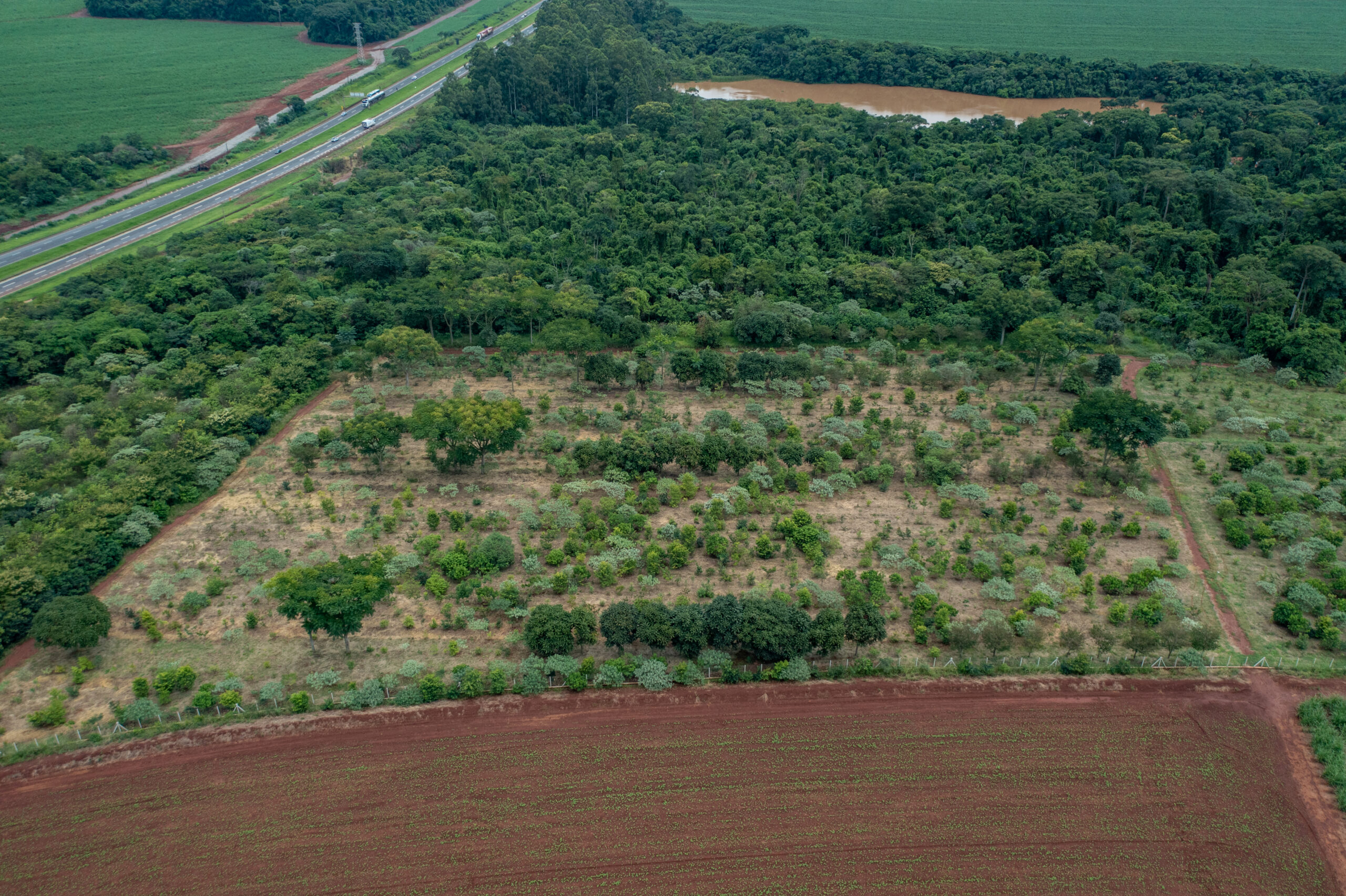
    Both bunker-like seed banks are remarkable spatial concentrations of resources for ex situ conservation, seemingly at odds with the key biological insight according to which a large spatial spread decreases the probability of extinction. At the same time, these seed banks correspond to what Bruno Latour called “centers of calculation”, institutions where observations and specimens from faraway locations are amassed, organized and combined to produce scientific knowledge. Centers of calculation were foundational to the expansion of European colonialism. The Millenium Seed Bank and the Svalbard Global Seed Vault may be seen as contemporary extensions of the same colonial mindset, repurposed in the context of biodiversity conservation.

    While other seed banks might not seem as obviously colonial, many do dislocate plant propagules from their original wild plant populations and human milieu. Most plant diversity in ex situ collections is held in the Global North, largely away from sources at the main centers of plant diversity. Even seed banks focused on nearby regional floras remove propagules from their immediate human and non-human environments.

    And while not all seed banks boast about their bunker-like properties, many do sit well within the “ark paradigm”, whereby representative samples of species must be secured away (perhaps even in the back side of the moon, as suggested by a foundational paper) in preparation for a likely apocalyptic future of widespread extinction. The ark paradigm is clearly articulated in a chapter about the role of botanical gardens in ex situ plant conservation: “The primary goal of ex situ collections is to maintain a representation of the species as a source of material for restoration, should the species be lost in the wild, and this should be done as effectively and efficiently as possible”. This salvific post-extinction role for seed banks (let alone cryopreservation projects) seems to have little support in practice.

    An alternative to the ark paradigm suggests that ex situ conservation can play a primary role before the extinction of wild populations. Ex situ collections may be used for research, training, education, awareness-raising and incentive programs that directly target the causes of primary threats to wild populations. In terms of this pre-extinction role, the conservation value of ex situ collections may be determined by their geographic location. The primary threats to many plant species are local. To address the causes of such threats, the most valuable living collections may be those able to engage the human communities coexisting with threatened plants. Bunkered living collections, removed from the human and non-human environment of the source plant populations, would likely be ineffective and inefficient at this task.

    The alternative to the ark paradigm also suggests that ex situ conservation can play a central role in offsetting the effects of threats to wild populations, through the restoration of wild populations via reinforcement. Ex situ collections may provide plant stock for population management aimed at mitigating the effects of threats. Here, again, the geographic location of ex situ collections may determine their effectiveness and efficiency. Ex situ collections in the vicinity of threatened species would seem best for reinforcement programs. Moreover, issues related to propagation of whole growing plants would seem far more germane in this context than the worries about long-term storage prioritized by the ark paradigm and pursued in seed banks and cryopreservation projects.

    An initiative adopting this alternative view of ex situ conservation is taking place in the páramo de Sumapaz, perched on the Eastern Colombian Andes. Páramos are high elevation ecosystems that are central for provisioning water to human populations in the tropical Andes. They are perilously affected by global change. The páramo de Sumapaz occupies about 315,000 hectares and, based on analysis of a recently compiled and edited database, hosts more than 3,000 plant species. Although the conservation status of 76% of these species has yet to be evaluated, currently 64 species are known to be threatened.

    In this context, a group of researchers including local campesinos as well as staff and students from the Jardín Botánico de Bogotá, Parque Nacional Natural Sumapaz, Universidad Nacional de Colombia, Washington University in St. Louis, and the Missouri Botanical Garden, are engaged in participatory action research, with partial support from the Living Earth Collaborative. The aim is to develop the concept of “páramo biodiversity farms”, provisionally defined as properties in or near the páramo that derive economic benefits from at least one of four activities: i) biodiversity research, ii) education about biodiversity, iii) ex situ conservation of threatened plant species in living collections, and iv) plant stock production for population or ecosystem restoration.

    A pilot páramo biodiversity farm began in 2019 at “El Carmen”, a 40-hectare property in the Sumapaz region. This pilot is focused on an ex situ collection of plants in the genus Espeletia (Asteraceae). Although páramo biodiversity farms would include work on many other plants, the focus on Espeletia at El Carmen is strategic. First, Espeletia are dominant “nurse-plants” in páramos and largely determine the physical structure of these ecosystems. Second, despite being locally dominant, several taxonomic species of Espeletia are threatened. Third, obtaining meaningful monitoring data for conservation is often difficult because the species boundaries in Espeletia are poorly understood and field identification is problematic.

    Espeletia plants are dominant in páramos, as shown in the picture of the páramo de Sumapaz on the left. Orlando Romero, a campesino working for the Parque Nacional Natural Sumapaz, collects Espeletia seeds for the living collection at El Carmen. Photos by Iván Jiménez.

    The living collection at El Carmen serves multiple purposes. First, it is a “common garden” experiment, designed to understand species boundaries and phenotypic characteristics of Espeletia species from Sumapaz. The experiment entails propagating plants from seeds sourced from +500 mother plants occurring across the páramo de Sumapaz, initially in a nursery and subsequently in an outdoor landscape. Second, the living collection serves as a facility to train local students in plant biology and conservation. Third, the collection conserves ex situ threatened Espeletia species that are endemic to the Sumapaz region. Finally, the living collection may serve as a seed-increase field providing Espeletia plant stock for future population or ecological restoration projects.

    The picture on the left shows part of the living collection at El Carmen, including seedling trays (forefront), germination containers (right and back), and 3-year old plants in pots on the ground (back left). On the right Rudy Ortiz (left) and Natalia Beltrán, both biology students at the Universidad Nacional de Colombia, measure Espeletia seedlings at El Carmen. Photos by Erika Benavides.

    A central theme of the project is the participation of local campesinos as co-investigators and managers, alongside researchers and officials from academic and environmental institutions. Achieving true participatory research and exchange of knowledge across these actors is far from trivial. Nonetheless, a concrete result of the project is that co-investigators, including campesinos, developed a sophisticated understanding of the phenotypic groups of Espeletia and their geographic distributions across Sumapaz, facilitating conservation monitoring programs. This increase in plant awareness among people coexisting with Espeletia plants is a key step towards addressing the causes of threats to páramo plant diversity. Campesino management of the ex situ collection at El Carmen (and the associated information) provides modest but direct economic benefits to a local family. We hope it also builds local capacity for the governance of biodiversity and collaborative relationships between campesinos and institutions focused on studying and managing biodiversity.

    Jorge Penagos (left) and Erika Benavides, both campesinos from Sumapaz, record survival of Espeletia seedlings in the living collection at El Carmen. Photo by Rudy Ortiz.

    The pilot biodiversity farm at El Carmen hints at how ex situ collections of whole growing plants may help prevent extinction of wild populations. This kind of collection is often thought to be inefficient because requirements of space and resources may be higher than for seed banks and cryopreservation. Collections of whole growing plants for ex situ conservation can indeed be costly when bunkered inside botanical gardens. But they can be more efficient when spread across lands owned by human communities coexisting with threatened plants. We suspect that páramo biodiversity farms may not be more costly than comparable seed banks in the Global North. And the benefits from páramo biodiversity farms would include ex situ collections that act not only as safeguards (the ark paradigm) but also as tools to prevent extinction in the wild and promote local (rather than colonial) biodiversity governance. Studies comparing costs and benefits, beyond back-of-the-envelope calculations, are needed to determine which approaches to ex situ conservation are more effective and efficient in different regions of the world.