Category: Missouri

  • Understanding the role of soil microbial communities in oak woodland restoration using DNA metabarcoding

    Understanding the role of soil microbial communities in oak woodland restoration using DNA metabarcoding

    By: Rachel Brant

    Rachel is a postdoctoral fellow in the Missouri Botanical Garden’s Center for Conservation & Sustainable Development whose research focuses on plant-pollinator interactions and using eDNA to advance the conservation and restoration of biodiversity.

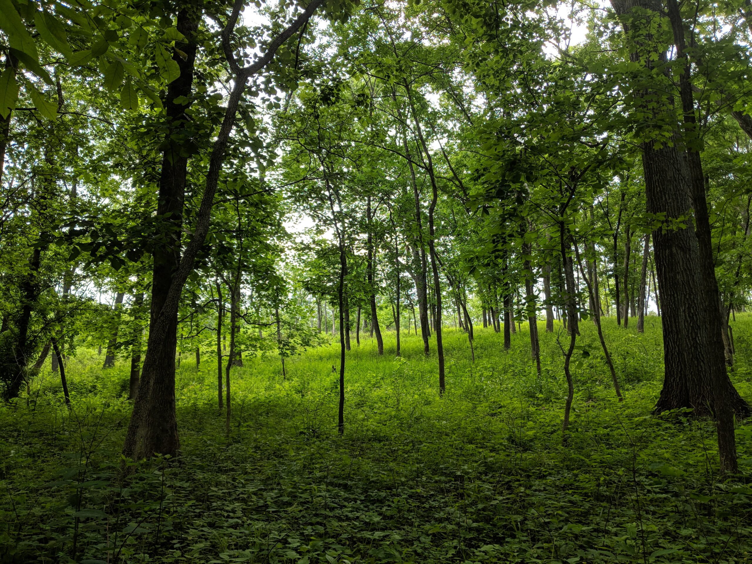
    Oak-dominated ecosystems occur in many areas of the northern hemisphere, support considerable biodiversity, and provide vast benefits to humans. Although notably absent from the southern hemisphere, oak-dominated or mixed-oak dominated forests are found across much of southern and central Europe, northeast Asia, and the eastern and central United States. Oak ecosystems range from closed forests with a dense midstory to open forests or woodlands with continuous canopy or widely spaced trees and dominance of herbaceous vegetation in the understory.

    Around 80% or more of the plant diversity in oak forest and woodland ecosystems in the eastern US, including a large proportion of rare species, resides in the herbaceous layer, which contributes significantly to nutrient cycling and overall ecosystem function. However, these forests and woodlands have suffered significant degradation over the past century, resulting in dramatic shifts in species composition and structure due to human land-use activities, invasive species, and alterations in disturbance regimes. In particular, fire exclusion has led to the encroachment of fire-intolerant tree species and nonnative shrubs, decreasing both understory light availability and the abundance and diversity of herbaceous plant species.

    Restoration of oak ecosystems usually involves prescribed burning or a combination of burning, canopy thinning, and control of undesirable woody vegetation. Although these restorative practices encourage the passive recovery of herbaceous flora, restored oak woodlands often lack conservative species in the understory. Unlike matrix or ruderal plant species, conservative plant species are those that depend on high-quality or minimally damaged sites and rapidly disappear with degradation. In addition, they often fail to recolonize sites naturally, making them potentially important targets for reintroduction.

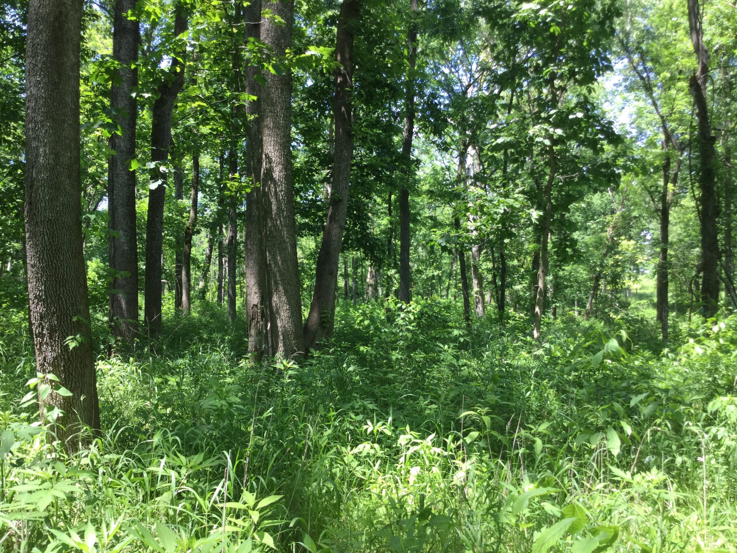
    (Top) Degraded oak woodland at Missouri Botanical Garden’s Shaw Nature Reserve infested with nonnative shrubs and fire-sensitive tree species and (Bottom) Adjacent restored oak woodland after mechanical control of woody encroachment and six prescribed burns. Note the minimal sunlight penetrating the woodland floor and lack of herbaceous species in the degraded woodland relative to the restored woodland. Photo: (Top) Brad Delfeld and (Bottom) Matthew Albrecht.

    Conservative species are notoriously challenging to reintroduce in restoration projects, with soil microbes emerging as a key factor influencing their success. Arbuscular mycorrhizal fungi (AMF) are particularly crucial in this context; they enhance nutrient uptake and improve stress resistance, benefits that are especially valuable for conservative plant species with specific habitat requirements. For example, one study found that conservative species were more dependent on AMF and exhibited higher habitat specificity compared to less conservative species (Bauer et al. 2018). The practice of soil inoculation with whole soil, which presumably contains beneficial mutualists like AMF, is increasingly employed to boost plant growth and survival in restoration projects. Despite its growing popularity, though, the effects of soil inoculation on the establishment of herbaceous species in oak-dominated ecosystems remain poorly tested.

    Another factor that may affect the establishment of conservative plant species is the timing of reintroduction. Environmental conditions are predicted to be more favorable for the establishment of conservative species later in restoration, in part because soil symbionts facilitating plant establishment may only be found in later-successional sites. Alternatively, early restorations may lack the establishment barriers potentially encountered later in restoration, such as competition with established vegetation or soil legacies from early-arriving species, but could be deficient in important microbial mutualists often required by conservative plant species.

    To test these hypotheses, we examined the potential role of soil microbial communities on the performance of conservative herbaceous species using an oak woodland restoration chronosequence at the Missouri Botanical Garden’s Shaw Nature Reserve. First, we collected bulked field soil samples from three sites representing different restoration ages (young, intermediate, and old) based on their onset since restoration began (7, 16, 29 years ago) with prescribed burning, selective tree thinning, and non-native shrub control. We quantified several soil abiotic properties (e.g., pH, phosphorus, potassium, and nitrogen) and employed DNA metabarcoding to describe the microbial composition of the soil. DNA metabarcoding is a cutting-edge technique that identifies many taxa from an environmental sample by sequencing specific genetic markers from extracted DNA. This method provides a comprehensive snapshot of the microbial diversity present, allowing one to better understand otherwise cryptic below ground communities. 

    Conservative perennial forbs used in a greenhouse study to test the effects of soil inoculation young, intermediate, and old restored woodlands on plant growth: Geum virginianum (left), Solidago argute (center), and Solidago caesia (right). Photo credit: Gerrit Davidse (left) and Missouri Botanical Garden (center and right).

    Next, we conducted a greenhouse study with three conservative forb species, Geum virginianum, Solidago arguta, and Solidago caesia, testing their growth responses to soil inoculum from sites that differ in restoration age. These species are components of the regional species pool, but absent from restored oak woodlands at Shaw Nature Reserve. We placed germinated seeds of each species in quart-sized pots filled with a sterilized topsoil mix that mimic oak woodland soils. Each sterile pot (270 in total) was then inoculated with 10 mL of the bulked live field soil (approx. 1% by volume) sourced from one of the three restored sites. Plants were grown for 12 weeks in standard greenhouse conditions and then evaluated for growth using nondestructive measurements.

    Planting seeds of conservative forb species into soil inoculum treatments in a greenhouse study. Photo credit: Leighton Reid

    Tree species and soil microbial communities in restored oak woodlands 
    Not surprisingly, we found that younger restored oak woodlands, with historically fewer prescribed fires, had a greater abundance of fire-sensitive tree species (e.g., sugar maple, Acer saccharum) than the intermediate and older restored sites. However, younger restored woodlands also exhibited lower levels of soil phosphorus compared to older sites, consistent with previous studies that have shown greater levels of potassium and phosphorus in soils post-burning. Other soil abiotic properties, however, did not differ across the restoration chronosequence. 

    A grove of sugar maples (Acer saccharum) during autumn in the young restoration site at Shaw Nature Reserve. Photo credit: Mike Saxton

    Bacterial and fungal communities varied in composition across the restoration chronosequence. For example, Firmicutes, a phylum of bacteria noted for surviving in extreme conditions, such as in severely burned areas, was more abundant in soils from the oldest restored woodland, which experienced a greater number of prescribed fires than the other sites. In contrast, the fungal phylum Ascomycota was more abundant in restored woodlands of young and intermediate age. Members of Ascomycota include decomposers that break down organic materials and endophytes that form mutualistic or commensal associations with plants. 

    Plant-soil interactions in response to soil inoculation
    After 12 weeks of plant growth in the greenhouse, we found that forbs tended to grow larger leaves when grown in soil inoculum from the younger restoration site compared to the intermediate restoration site. Additionally, S. arguta and S. caesia grew longer leaves in soil inoculated from the intermediate compared to the old site, while G. virginianum plants tended to produce longer leaves when grown in inoculum from young relative to the old restoration site.

    Leaf length (cm) of three native forbs after 12 weeks of growth in whole-soil inoculations from young, intermediate, and old restored oak woodlands at Shaw Nature Reserve. Geum virginianum (GV), Solidago arguta (SA), and Solidago caesia (SC).

    Results from the DNA metabarcoding provide a clue as to why the soil inoculum treatments induced different plant-growth responses. Soils from the young restoration exhibited increased relative abundance of mutualistic microbes, including AMF and cyanobacteria, and decreased pathogenic taxa after conditioning by each of the three species. In contrast, the oldest restoration site had the greatest relative abundance of pathogens and the lowest relative abundance of mutualists. This enhanced microbial profile in young restorations may facilitate better nutrient uptake, and disease and stress resistance in plants. From a practical perspective, early-stage restorations may provide the most favorable soil microbial community for the establishment of conservative plant species in these oak ecosystems. One possible reason for this could be a shift in the increased relative abundance of AMF-associating tree species (e.g., maple) from older to young restored woodlands. AMF-associating tree species may harbor unique AMF taxa that resulted in increased herbaceous plant growth and AMF colonization for plants conditioned with young soil inoculum.

    Interestingly, although some microbial taxa exhibited consistent patterns across all plant species within an inoculation treatment, each plant species also associated with unique microbial taxa when grown in the same soil inoculum treatment. For example, the Glomeraceae, which includes AMF, was marginally more abundant after S. caesia was grown in young inoculum, whereas Ascobolaceae – fungi that feed on decaying and dead matter – was significantly abundant only when G. virginianum was grown in old soil inoculum. This means that species reintroduced during different stages of oak ecosystem restoration could influence key ecological functions by selecting for or against certain microbes, including pathogens that regulate plant community dynamics, decomposers involved in nutrient cycling, and mutualists that enhance plant performance. 

    Overall, our study demonstrates how restoration age can shape interactions between soil microbes and herbaceous plant species in restored oak woodlands. By better understanding these interactions, we can enhance the restoration and recovery of degraded oak ecosystems. However, an important and lingering question from our study is whether differences in plant growth and microbial communities observed in the greenhouse persist after the focal plant species are transplanted into the field. A study currently underway at Shaw Nature Reserve is addressing this question across different restoration ages and competition treatments. Our study reinforces global calls that emphasize the need for more research on the dynamic nature of plant-microbe relationships and interactions over time during restoration. Advancing scientific research on the relationship between the soil microbiota and ecological restoration practices is crucial for meeting local, regional, biome level and global restoration goals.

    If you want to learn more about microbial-herbaceous plant interactions in restored oak woodland, we invite you to read our recent paper in Ecology and Evolution.
  • Reconstructing and reconnecting native habitats post-pipeline construction at the Litzsinger Road Ecology Center

    Reconstructing and reconnecting native habitats post-pipeline construction at the Litzsinger Road Ecology Center

    By James Faupel & Caity Sims 

    James Faupel is the urban ecology restoration supervisor at the Litzsinger Road Ecology Center (LREC) and Caity Sims is the Project Clear restoration coordinator. The LREC is a private, urban outdoor education site in the heart of Metropolitan St. Louis, Missouri that is managed by the Missouri Botanical Garden for educational programming with K-12 teachers and students, and supported by many local university-based researchers.

    Part 1: by James Faupel

    Anticipating Loss

    In September of 2018, when I took on the lead restoration ecologist role at the  Litzsinger Road Ecology Center (LREC), I was aware of the impending utility pipeline project (Project Clear) that would impact around a quarter of this education center’s restored habitats and the adjoining urban Deer Creek. The 15.8-hectare (39-acre) ecology center combines a mix of reconstructed bottomland prairie and restored riparian woodlands, with a stretch of urban creek in surprisingly good ecological condition. I knew this was a unique opportunity to set up a long-term study to examine the processes of reconstructing tallgrass prairie following major anthropogenic soil and landscape disturbance, a topic with little previous research, especially in urban areas.

    The 6.3 km (3.9 mile) long Deer Creek branch of Project Clear was slated to dissect a 0.8 km (0.5 mile) long swath of LREC’s restored habitats – a pretty significant amount of collateral damage. To be clear, the purpose behind Project Clear’s sanitary pipeline path is well intentioned. The Metropolitan St. Louis Sewer District’s (MSD) Project Clear is a six billion dollar, 28-year long initiative to improve water quality and alleviate many wastewater concerns related to the frequent sewage overflows of the legacy sewer system of the St. Louis region. Cleaner water in Deer Creek would mean healthier breeding and feeding conditions for a wide variety of wildlife that live in or rely on the water of the creek, as well as healthier adjoining ecosystems, and much healthier domestic water supplies for human residents of St Louis County. The collateral damage of the MSD Deer Creek branch was 6.3 km (3.9 mile) of riparian habitat was damaged, degraded or destroyed.

    In 2019, the Litzsinger Road Ecology Center (LREC)’s oldest prairie reconstruction and woodlands were dissected by the Project Clear pipeline path. The LREC is an outdoor educational facility of the Missouri Botanical Garden, and relies on functional ecosystem services to introduce children to the intricacies of nature. The pipeline project construction equipment would directly impact the LREC’s grounds and classes for three years, but its impact to the habitats here will be felt for generations. Photo by James Faupel.

    As discussed in a previous NHER blog post on the topic, urban prairie reconstructions are important tools in the toolbox of prairie education to the general public and in saving North America’s prairie remnants. Remnant prairies are invaluable fragments of a once vast grassland ecosystem of the Midwest and are now one of the most endangered ecosystems in the world. Getting the chance to expand the area covered by reconstructed prairie at an educational site like LREC was an opportunity that I did not want to miss. The downside was that the LREC restoration team would have only one year to gather baseline data before the sanitary pipeline construction began, and I also had to fit in learning all of the other ins and outs of my new role.

    Throughout 2019, with the assistance of LREC volunteers, interns, and partner researchers from local universities and organizations, we were able to gather a wide array of baseline data that could be used as a comparison in the years ahead, once the future restored prairies are older. In 2019, the previously restored habitats at LREC were 30 years old, among some of the oldest restored habitats in the St. Louis region. Restoration projects of this age are incredibly valuable for ecological research projects looking to better understand anthropogenic impacts on the environment around urban centers and to learn best practices for effective, long-lasting restoration efforts. They are priceless.

     During the growing season of 2019, we were able to survey all the vascular and nonvascular plant species growing in the proposed pipeline path and adjoining areas, as well as survey for birds, bees, spiders, ants, and algae thanks to the varied expertise of all involved. Baseline samples were collected of the upper soil horizons along the entire pipeline path, in addition to a complete inventory of all of the trees and shrubs that would be removed during construction so we could assess their value. The most significant baseline dataset is that of Elizabeth Hasenmueller and her Lab at Saint Louis University, who had been studying the water quality of Deer Creek at LREC for five years prior to the sanitary pipeline installation and are excited to continue this research, hoping to capture more data and test hypotheses concerning the hydrology and geochemistry of this urban stream as water quality improves with the removal of the sewage overflows from the creek.

    LREC volunteers assisted staff in a tree inventory of 746 native trees and shrubs ahead of the pipeline installation in 2019. The canopy trees were measured and their value assessed using the US Forest Service’s iTree database. The USFS’s estimated replacement value of the 289 mature canopy trees was half a million US dollars. This dollar value is in addition to the countless ways the ecological and environmental services provided by these trees could be valued. Photo by James Faupel.

    Deconstruction of Habitat

    On September 30th, 2019, construction vehicles arrived on the grounds of LREC, and began the month-long habitat removal on site. In what felt like the blink of an eye, a large section of one of the oldest prairie reconstructions in the St. Louis region, along with 746 individual native trees and shrubs, were gone and no longer providing any ecological or educational services. It was quick, like a bandage being ripped from the skin.

    Before and after the 0.8 km (0.5 mile) MSD pipeline construction path on the property of the LREC. 
    Left: October 2018. Right: August 2020 (Google Earth 2019, 2021).

    The pipeline installation process, from start to finish on LREC property, lasted nearly three years. Following the removal of all the preexisting habitat, work began on trenching the ground open, dynamiting the bedrock, installing the sewer pipe, reworking the now homogenized limestone bedrock/C horizon soil mix back into the trenches, restabilizing the streambanks from their stream crossings, and finally grading the soil out to pre-construction elevations. We knew from the beginning of their trenching process that we would ultimately be trying to grow native prairie plants in a “novel ecosystem” with soil conditions that would never co-occur with them in nature. 

    Throughout the construction process, there was plenty of time for planning how we would restore the land once it came back into our hands, as well as how we would monitor it long term. There is little research that has been done on the topic of prairie reconstruction following major anthropogenic soil disturbance. Initially we thought it would be beneficial to test many different methods of soil remediation ahead of the seeding of native prairie plants in different study plots. However, during the three year construction period, there were several major flooding events from the adjacent Deer Creek that changed our minds. The regularity and increasing frequency of these flash flood events of this urban creek made us take pause and the aforementioned research idea was scrapped. These events aren’t likely to lessen anytime soon, as the area covered by impervious surfaces in the surrounding watershed continues to grow. Future flooding events would introduce too many confounding variables to any kind of research that compared the outcomes of various soil remediation methods to make it a worthwhile investment of our time and resources.

    Left: Throughout the construction of the pipeline path (2019-2022), the path was impacted by Deer Creek flooding beyond its banks 11 times. It was completely covered by 4 major flash flood events as seen here. Right: The pipeline path a few months after construction had finished in late summer of 2022, covered in a growing season’s worth of early successional species. Here a contractor puts down the first annual cover crop to help break up the compacted soils and help hold the soil in place during rain events. Photos by James Faupel.

    In late summer of 2022, the property was handed back to the staff at LREC to begin the habitat reconstruction work. By this point in time, I had been promoted to a supervisor position at LREC and had many more responsibilities that took me away from being able to dedicate significant time to the Project Clear pipeline restoration project. Our two summer interns that year assisted with the second round of soil sampling for comparison to the baseline soil data and an inventory of all of the plants that naturally colonized the disturbed areas along the entirety of the pipeline path that year. For information from that botanical inventory, you can read our article that was published in the 2022 volume of Missouriensis. Our immediate reconstruction plans were to bring in a contractor that could quickly get annual cover crops down and hopefully germinate and root into the compacted soil before any fall or winter flooding events occurred. We also planned for a major seed collecting effort in 2023, so that we could sow a wide variety of early successional native species onto the pipeline path in late fall of 2023, or before the first snow of winter.

    With my role having been redirected away from the pipeline path reconstruction, I lobbied for a new staff member that could replace me and focus all their efforts on the reconstruction, research, and monitoring of this important project. Caity Sims was hired for the role of coordinator of the project in January of 2023 and hit the ground running. It has been an incredible year mentoring her throughout this process and I look forward to exploring the reconstructed prairie habitat she will be establishing and chaperoning with our amazing team of volunteers, staff, and interns over the next few years.

    Part 2: by Caity Sims 

    Before Reconstruction Began

    I was fortunate enough to witness the LREC before Project Clear as a summer intern in 2019. That summer, I assisted with collecting pre-deconstruction baseline data on trees and the algae found in Deer Creek. After my internship, I left St. Louis for Jonesboro, Arkansas to earn a master’s degree focused on botany in the Mississippi Alluvial Plain. Ready to apply my botanical and research skills in the working world, I returned to the LREC in January 2023 as the Project Clear restoration coordinator. I was shocked to finally see first-hand the impact the pipeline construction project had had on the riparian, woodland, and prairie ecosystems of LREC. What seemed in my memory like a maze of bottomland woodland was reduced to a scanty wooded edge surrounded by a sparsely vegetated brown strip of fallow land. 

    Before I joined the LREC team, a cover crop of common wheat (Triticum aestivum) had been seeded onto a majority of the pipeline path in winter 2022. Around the same time, a six-species cover crop mix, consisting of crop grasses, common pea, and field mustard (Brassica rapa) was seeded onto the southern section of the path. Cover crops mend the soil by adding nutrients, perforating the soil for better water infiltration, outcompeting weedy species, and preventing erosion of bare soil. 

    Unfortunately, the first round of cover crop mixes did not do well, and by mid-April the common wheat was barely a foot tall and had already gone to seed. The mixed species cover crop did not grow on most of the seeded area of the southern section due to flooding washing away a majority of the seeds. The path desperately needed a second cover crop at that point, so we hired contractors to seed the warm season crop, Sudan grass (Sorghum bicolor), onto the majority of the path again and a nine species cover crop mix onto the southern section. The Sudan grass did much better, growing to heights of over six feet in some areas. Although the mixed species cover crop seemed to do better, the extreme summer heat drying out the compacted soils resulted in depauperate mature plants. There were many areas directly over the pipeline that seemed unlikely to hold any vegetation at all. 

    Cover crop comparison between common wheat, taken on May 23, 2023 (A) and Sudan grass taken on August 3, 2023 (B); both photos were taken from about the same position on the path, but facing in opposite directions. Pictured in panel C are size comparisons of common wheat individuals on May 26, 2023, the two on the left were collected from the middle of the pipeline and the one on the right from the outer edge of the pipeline path. Note the numerous bare patches of soil in panels A and C. Photos: Caity Sims.

    Despite environmental conditions being heavily anthropogenically impacted, a good number of native early successional and bottomland species grew alongside the cover crops on the path. I was surrounded by many familiar disturbance-prone and riparian species, as my master’s thesis had focused on plants growing on Mississippi River islands. I recorded 310 species growing on the entire path after completing vegetation surveys in 2023. As I expected, some of the most common species were yellow foxtail grass (Setaria pumila), southern crabgrass (Digitaria ciliaris), barnyard grass (Echinochloa crusgalli and E. muricata), hairy seed crowngrass (Paspalum pubiflorum), late boneset (Eupatorium serotinum), and tall goldenrod (Solidago altissima), all of which thrive in disturbed environments. 

    As I work toward reconstructing the land to improve structure and function of the ecosystem for many native organisms, I need to quantify the results of this effort. To measure the changes in plant communities along the pipeline path over time, I established dozens of permanent vegetation monitoring plots along the path that will be monitored every summer. For each plot, I collect the presence and percent cover of each species in the plot. I am hopeful that by 2027, native prairie plants will constitute 75% of the flora and vegetation in every plot. 

    Summer interns, Karen (left) and Cicely (right), learning to identify plants from a vegetation monitoring plot on the pipeline path. Photo: Adam Rembert.

    Also found post-pipeline construction were two species new to Missouri:  Centaurium pulchellum, and Myosotis arvensis, and three new to St. Louis County records: Sesamum indicum, Cyclospermum leptophyllum, and Krigia cespitosa. All record species are not native to Missouri except K. cespitosa, which has been recorded from neighboring counties. It’s not uncommon to find new state or county records in disturbed areas. For more detailed information about those species, their identification, and potential explanations for their introduction to the LREC, check out my article in the 2023 volume of Missouriensis

    We have classified several different habitat types on the pipeline path including wet depressions and ephemeral ponds, rocky upland (i.e., “glade”), creek bank, woodland edge, and fallow ground. Due to a permanent pipeline access easement built and maintained by the Metropolitan St. Louis Sewer District (MSD), we cannot reconstruct the bottomland woodland that was destroyed. However, we can reconstruct a bottomland prairie on a majority of the path where the fallow ground with rocky and compacted soil are the most prominent. In the wider southern section, we will reconstruct a savanna that will include tree plantings outside of the MSD’s easement. 

    Going Forward

    Staff and volunteers collected seed throughout the 2023 growing season. We focused on collecting species with Coefficient of Conservatism (C-Value) ranks of six or below, which is consistent with the range of C-values observed in the 2022 vegetation survey of the path. The coefficient of conservatism (or C-scores) is an index ranging from 0-10, representing a species’ fidelity to intact remnant or long-restored habitats, as determined by local botanical experts. Species with higher C-scores are less tolerant of environmental degradation and increasingly restricted to high quality sites. Species with C-Values from 0-6 are likely to be found in disturbed and early successional environments, while species with C-Values from 7-10 are more likely to be found in near-pristine and remnant environments (Ladd and Thomas 2015). High C-Value species are harder to establish in restored and reconstructed habitats. 

    Summer and fall interns focused mainly on seed collection, cleaning, and organization to prepare for the 2023/2024 winter seeding. It was a monumental effort with amazing results. We collected seeds from 96 species in 2023 for a total weight of 49 kg (108 lbs) of mostly Pure Live Seed (PLS), with some chaff. In addition to collecting seeds, contractors have drilled 39 prairie species onto the pipeline path seeding a total of 16 kg (36 lbs) of PLS. We also added seeds collected in previous years that were housed in seed storage at the LREC. Including the 2023 collected seed, the PLS from contractors, and the previously collected seed, a total of 189 species with a total weight of 74 kg (164 lbs) was seeded on the pipeline path. To view the results of our seed collecting effort in 2023, please see our interns’ compiled end of season unpublished report.

    Boxes of Culver’s root (Veronicastrum virginicum) seed ready to be cleaned (A), fall intern, Cailyn, posing with seed to be added to the broadcasting mix (B), staff and volunteers mixing seed in preparation for broadcasting the pipeline path on January 5, 2024 (C), and staff and volunteers broadcasting the “glade” mix onto the most well-drained and rocky portion of the pipeline path on January 11, 2024 (D). Top photos by Adam Rembert, bottom photos by Caity Sims.

    I am hopeful that the seedings will be successful and signs of a prairie will begin to emerge this year. However, flooding and poor soil conditions are major issues on the pipeline path. I have already dealt with the aftermath of floods washing away cover crops and soil, and remaining soils lacking suitable nutrients and structure for plant growth. These are out of my control, so all I can do is accept them, keep trying, have patience, and not let frustration get the best of me. 

    In three years, I anticipate less introduced and early successional species as they fail to compete with the maturing perennial natives. I envision more pollinator observations on the former pipeline path as the prairie species begin to bloom. After the third growing year, we may be able to burn the young prairie and savanna. In 30 years, I hope to return to see restored prairie, savanna, woodland, and creek habitats functioning as home to a diversity of plants, insects, birds, reptiles, amphibians, mammals, and microbiota like the undisturbed LREC habitats do today. 

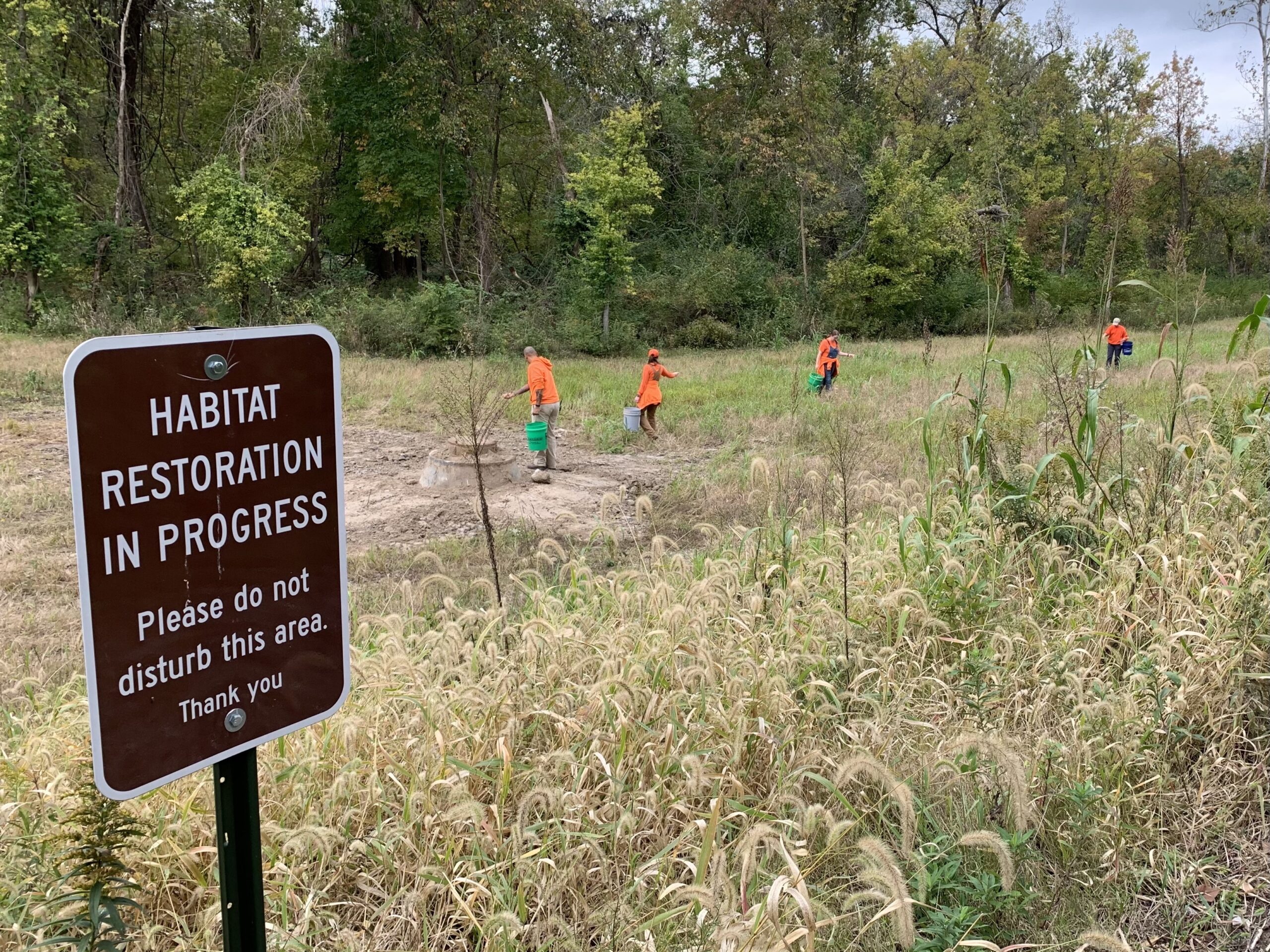
    Staff and volunteers broadcasting a spring and summer flowering seed mix onto the pipeline path on October 13, 2023. Photo: Tom Kibby.

  • Land Abandonment, Succession, and Restoration: The Wolf Run Grassland Restoration Project at the Missouri Botanical Garden’s Shaw Nature Reserve

    Land Abandonment, Succession, and Restoration: The Wolf Run Grassland Restoration Project at the Missouri Botanical Garden’s Shaw Nature Reserve

    By: Mike Saxton and Calvin Maginel

    Mike Saxton (mike.saxton@mobot.org) is the Manager of Restoration and Land Stewardship, and Calvin Maginel (cmaginel@mobot.org) is the Ecological Resource Scientist at Shaw Nature Reserve

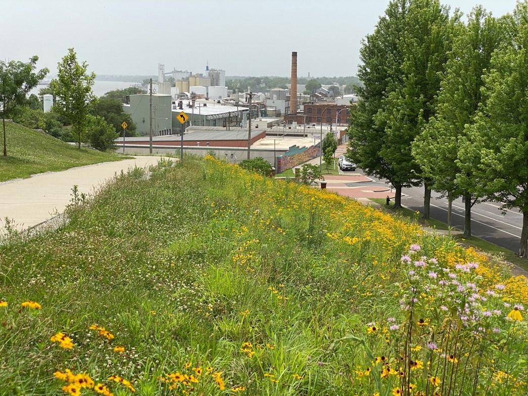
    Since 1950, over 1-billon acres of agricultural land have been abandoned worldwide. In certain landscape contexts, unassisted spontaneous recovery of high levels of native biodiversity in abandoned fields is possible while in others, like the Midwest USA, fallow fields rarely develop into biologically rich habitats. To achieve the ambitious goals of the UN Decade of Ecosystem Restoration, land managers and ecologists need to better understand how to assist the regeneration and ecological restoration of these highly altered landscapes. 

    In 1925, the Missouri Botanical Garden purchased 1,300 acres of battered farm ground in Gray Summit, MO – approximately 35 miles (56 km) west of St. Louis – to escape the deleterious impact urban air pollution was having on horticultural collections in St. Louis City. The intended uses of this acreage were to: (1) propagate and grow plants, trees, and shrubs for the main Garden’s displays and (2) establish an arboretum focusing on woody plant collections. The site was officially named the Shaw Arboretum in 1933. After decades of development, many non-essential operations at the Arboretum were eliminated in 1958 and many fields were abandoned to allow spontaneous successional change. In 2000, the Shaw Arboretum was renamed Shaw Nature Reserve to reflect its contemporary mission to demonstrate, test, and inspire responsible stewardship practices through education, restoration, and protection of natural habitats and public enjoyment of the natural world. Today the Nature Reserve consists of 2,400 acres of varied habitat in various stages of restoration and revised management, including the use of prescribed fire.  

    Prior to European settlement, the natural plant communities and ecosystems of the area were fire adapted, open oak-hickory woodlands and xeric glades with gallery forests along riparian corridors. Post-settlement, woodlands were clear-cut with some woodlots left to passively regenerate while others were converted to row crop agriculture. 

    Wolf Run Grassland Restoration 

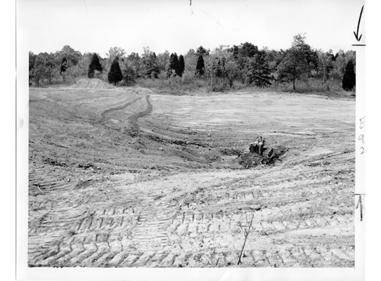
    In 2016, Nature Reserve staff set an ambitious goal to bring all 2,400 acres of the site into active management to promote native biodiversity by the year 2030. This effort will include restoring open pastures and former row crop fields, a relatively simple process. A much more challenging effort will be reclaiming 120 acres of old fields with 60+ year successional development, which is our current Wolf Run Grassland Restoration project. The 120 acre project area was initially “wasted farm ground” that had erosion gullies “where a freight train could pass without you seeing it”, according to August Beilmann, former Arboretum Director from 1941 to 1956. The entire project area was re-sculpted and smoothed by a bulldozer in 1953 and then converted to bluegrass (Poa pratensis). “Every piece of this land that looks so likely to be just right was laboriously rebuilt,” said Beilmann in a 1974 interview.

    Wolf Run Grassland Restoration project area in ca. 1945 showing open fields (light green) maintained through cattle grazing and mowing with trees occupying wet-weather streams and ditches (dark green). Photo: MBG Archives.

    Since 1958 when areas including the Wolf Run Grassland Restoration were removed from mowing and grazing, the site was encroached upon and became dominated by eastern red cedar (Juniperus virginiana), the non-native invasive shrubs Amur honeysuckle (Lonicera maackii), and border privet (Ligustrum obtusifolium), as well as slippery elm (Ulmus rubra), shingle oak (Quercus imbricaria) and ash (Fraxinus) species, the latter of which which are in severe decline due to the emerald ash borer. 

    These degraded woodlands had little native ground flora and were highly infested with non-native shrubs. Tree abundance and species composition had no historic analog. When setting ecological restoration goals for the area, staff determined that much of the site could not be managed as an open oak-hickory woodland, which would have existed at the site pre-settlement.  A new vision was needed. 

    Goals for the Wolf Run Grassland Restoration project

    • Establish a mosaic of 80 acres (~32 ha) of prairie, 15 acres (~6 ha) of savanna and 25 acres (~10 ha) of oak-hickory woodlands
    • Maximize native flora diversity and aggressively control invasive shrub species 
    • Manage with periodic, dormant-season prescribed fire 

    In 2021, Nature Reserve staff marked hundreds of native trees to retain including white, red, bur and black oaks (Quercus alba, Q. rubra, Q. macrocarpa, Q. velutina) and shagbark hickory (Carya ovata) and bitternut hickory (C. cordiformis). Drainages and wet weather streams were left with a 50 ft. (~15 m)  untreated buffer zone while a perennial creek flowing through the unit retained a 150 ft. (~46 m) untouched buffer. A logger removed unmarked trees from the area, with the commercial value of the timber offsetting the cost of the removal. Following US Fish and Wildlife Service recovery management guidelines for the Indiana bat (Myotis sodalis) — a federally endangered species — trees were only removed from November 1st to April 1st.

    Wolf Run Grassland Restoration project area pre-thinning (2021), approximately 60 years after land abandonment. Note the dark green areas are dominated by eastern red cedar (Juniperus virginiana), a native tree that rapidly colonizes abandoned or disturbed lands in the Midwest. Historically, this fire-sensitive tree species primarily occurred on rocky outcrops and bluffs that served as refugia from periodic fires that were common in the pre-European settlement landscape. Photo: ESRI
    Wolf Run Grassland Restoration project area post-thinning (2023). Photo: ESRI
    Forestry contractor equipment was used to remove most woody biomass greater than 4.5 in. (~11 cm) in diameter and left behind mostly small-diameter slash. A bulldozer was used to collect the debris into 600 piles that were subsequently burned. Photo: Mike Saxton

    The Restoration team has spent the last 9 months focusing on the removal of stumps for the project area. Stumps can be a substantial hazard for vehicles, equipment and staff safety. To seed native species and effectively manage the area for invasive species in perpetuity, the stumps must be ground down or cut flush to the ground.

    Skid loader mounted stump grinder removing stumps. Photo: M. Saxton

    Concurrent to this effort has been the site preparation step of chemically treating all of the invasive species and the disturbance driven annual vegetation that emerged post-land clearing [primarily fireweed (Erechtites hieraciifolius), mare’s tail (Erigeron canadensis), ragweed (Ambrosia artemisiifolia) and fox tail (Setaria pumila)]. This step is necessary because diverse, healthy native plant communities have not existed in these areas in more than 100 years. Consequently, there is no native seedbank to support the unassisted spontaneous recovery of native perennial herbaceous species in these highly degraded acres. 

    In areas where stumps have not been cleared, traditional equipment (tractor boom sprayers and UTV mounted spray rigs) for applying herbicide are ineffective. The Nature Reserve hired a contractor that specializes in drone-assisted aerial herbicide applications. The drone flies 12 ft. (~37 m) above vegetation and can self-navigate around trees and other hazards. The unit carries a total of 8 gallons (~30 L) and sprays approximately 3 gallons of herbicide per acre. The effective width of each pass is 25 ft. (~8 m). A single battery powers the drone, with a flight time of 7.5 minutes and a re-charge time of 6 minutes. When the herbicide tank runs out, the drone re-deploys to the fill up location, is refilled by the contractor, and then returns to where it left off. 

    Aerial drone sprayer used to eliminate undesirable vegetation. Photo: M. Saxton

    The last step after the undesirable trees have been removed, biomass/debris has been burned, the stumps have been ground and invasive species have been controlled, is the final ground preparation. Currently, in 2023, we are again smoothing out erosion gullies and clearing away the last remnants of woody debris with a bulldozer. This effort will ensure effective seed-to-soil contact when we sow native seed in January 2024 and will enhance our ability to successfully search for invasive species in the coming years by eliminating deep ruts and rills.  

    Above: Bulldozer in 1953 eliminating erosion rills in Wolf Run Grassland Restoration project area. Below: Bulldozer completing site preparation for native seed addition (2023).  Top Photo: St. Louis Globe Democrat, Bottom Photo: M. Saxton

    Native Seeding and Experimentation to promote Biodiversity Recovery 

    During the growing season of 2023, the Restoration team at the Nature Reserve has been feverishly collecting seed for this 2024 seeding effort. More than 1,100 lbs. (~500 kg) of bulk, milled seed from ~200 locally collected native tallgrass prairie and open oak-hickory woodland species will be used in the restoration planting. Additionally, these acres are enrolled in the Environmental Quality Incentives Program, EQIP – part of the Natural Resources Conservation Service, and we must purchase viability-tested seed to meet the minimum required specifications of the contract. The hand-collected seed together with the pure live seed (PLS) – percentage of viable seed in a seed lot – purchased from commercial vendors will provide us with ample species and volume of seed to effectively cover the 40 acres (~16 ha) to be planted this winter. 

    Concurrent with the preparation effort, we initiated a research study, which will help inform our work and the broader research community on plant recruitment amongst scraped soils that have been inoculated with mycorrhizal fungi and those that have not. This study includes paired species from the same genus that have different CC-values, short for coefficients of conservatism, which represents a species’ tolerance of environmental degradation, or its fidelity to intact remnant or long-restored habitats, as determined by local botanical experts. Ecologists generally expect species that are dependent on stable intact communities (higher CC-values) to be more reliant on mycorrhizae connections to establish and flourish. Species with high CC-values tend to establish poorly in restoration sites, which is one of the reasons to pursue this study. Some examples from the ten herbaceous pairs of native species include sedges (Carex bushii [CC = 4] and Carex bicknellii [CC = 10]), grasses (Sporobolus compositus [CC = 3] and Bouteloua curtipendula [CC = 7]), and forbs (Oligoneuron rigidum [CC = 5] and Oligoneuron album [CC = 9]).

    We added all 20 species at the same rate of pure live seed to provide each species an equal opportunity to establish. Initial analyses after one growing season indicate that low CC-value species germinated more successfully, producing more seedlings and greater percent cover than the high CC-value species, regardless of inoculation. We expect the addition of mycorrhizal fungi to have the greatest effects on species during the first couple of years after germination. If the mycorrhizae associate with the roots of the high-CC species more than the low-CC species, this may help them grow faster or be more resistant to future stress. Future monitoring will show us if there are long-term effects of inoculation.

    To check for updates on restoration activities and results from experimental studies, please visit our webpage.

    Barrels of hand-collected seed connected to a seed dryer, which pumps air through tubes into the barrels to eliminate mold & moisture. Photo: M. Saxton
  • Seed additions facilitate herb-layer restoration in a temperate oak woodland

    Seed additions facilitate herb-layer restoration in a temperate oak woodland

    By Andrew Kaul, a Restoration Ecology Post-doc in the Center for Conservation and Sustainable Development at the Missouri Botanical Garden. His new, open-access paper in Ecological Solutions and Evidence is available here.

    Throughout most of the eastern United States, oak woodlands were once a widespread and dominant ecosystem. These woodlands experienced periodic fires, which prevented woody trees and shrubs from growing so densely that the overstory canopy became closed. The partly open canopy allowed light to reach the ground, supporting a diverse community of herbaceous plants including wildflowers, grasses, and sedges. However, over the past two centuries, human induced changes including fire suppression, invasion by non-native shrubs, and other factors have caused most woodlands to become overgrown, and lose much of the diversity of plant species in the herbaceous ground layer.

    Research on how to manage and restore these woodlands has shown that cutting down some trees to thin out the woodland, as well as removing non-native shrubs, and reintroducing periodic fires, are all strategies that help improve the quality of these habitats. However, even after employing all of these management strategies, many desirable plant species may still not return on their own. Ecosystem restoration often involves re-introducing plant species as a seed mix distributed over a cleared area, and this method can be very effective for grassland and savanna habitats that contain few trees. Restoring wildflowers and grasses in wooded areas with the addition of a seed mix could drastically improve the diversity and quality of the herbaceous community, but this approach has not been experimentally studied, and little is known about how to select the right species for re-introduction this way.

    To address these knowledge gaps, scientists and land managers at the Missouri Botanical Garden started an experiment at the Shaw Nature Reserve in 2016, where highly diverse seed mixes of native plants were added to a degraded woodland undergoing active restoration. Throughout late 2016 and much of 2017, crews of managers and volunteer land stewards worked to thin the canopy by removing less desirable tree species, especially the aggressively fast growing native conifer, Eastern Redcedar (Juniperus virginiana). After thinning the canopy, crews used a combination of mechanical removal and herbicides to control the dense non-native shrubs. Fire was reintroduced through controlled burns starting in late 2017.

    Large Eastern Redcedars dominate a degraded woodland at Shaw Nature Reserve in Gray Summit MO. The understory is overgrown with non-native woody species including bush honeysuckle (Lonicera maackii), privet (Ligustrum obtusifolium), and wintercreeper (Euonymus fortunei). The lack of recent fire has led to a build up in leaf litter, and native herbaceous species are mostly absent. Photo: CCSD & SNR staff.

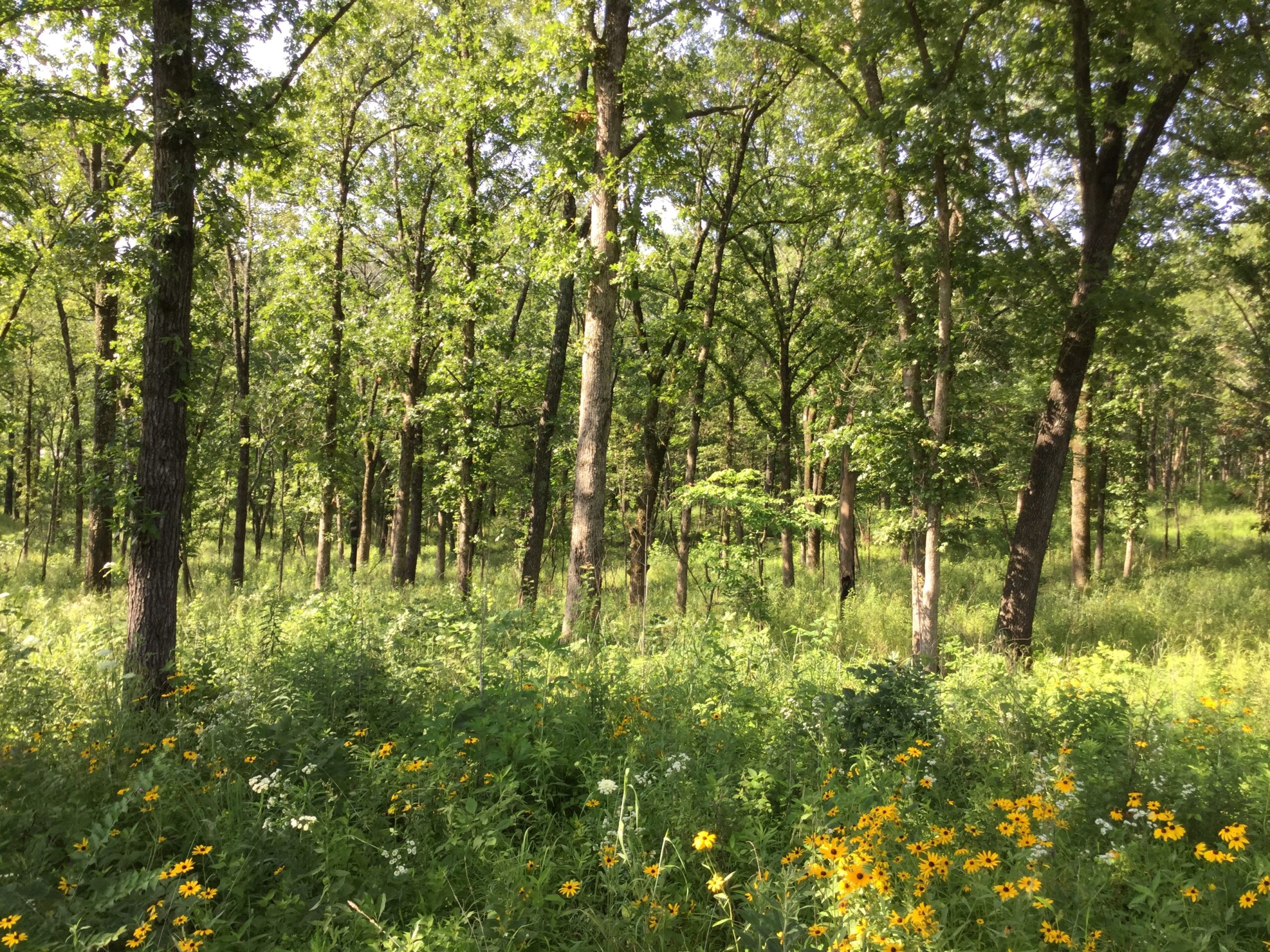
    After the woodland was thinned, in January of 2018, we added seed mixes to three different management units, along a gradient of lower/wetter to higher/drier parts of this landscape. The seed mixes contained between 79 and 93 species, and all of the seed was collected from plants growing at the nature reserve. In order to track how these seed additions influenced the establishment of the herbaceous community, we collected data on the composition of the plant communities in areas that received seed and areas that did not. We sampled the plant community in 2017 before the seed additions and in the following two years, 2018-2019.

    Top: Woodland under management at Shaw Nature Reserve in March of 2017, after selective thinning of trees to open up the canopy and removal of most woody shrubs. Leaves of some persistent bush honeysuckle can be seen. Bottom: Same woodland in June of 2019 after the addition of a seed mix in 2018. Photo: CCSD & SNR staff.

    In both the seeded and non-seeded woodlands, the effect of management actions was very clear and positive, since both the number and cover of herbaceous species dramatically increased from the sample in 2017 to later sample dates. This is consistent with previous research showing that thinning the canopy, removing shrubs, and reintroducing fire promote restoration of herbaceous plants.

    We also found substantial benefits from reintroducing species with seed mixes. The areas that received seed had about 10 more plant species present within a one square meter area, than the areas that did not get seed. We were also interested in the quality of the kinds of species that were establishing based on coefficients of conservatism, which denote how sensitive species are to human disturbances. We found that areas with seed added, contained fewer plants that were weedy ruderals, and more that were conservative and generally found only in high-quality intact habitat. Interestingly, areas that got seed additions were also more dominated by grasses and the areas that did not receive seed, although less rich in species, tended to have more abundant wildflowers (forbs). Specifically, common grasses that were sown at high rates tended to dominate areas that received seed additions, including river oats (Chasmanthium latifolium), hairy woodland brome (Bromus pubescens), and bottlebrush grass (Elymus hystrix). The restored areas that did not get a seed addition were dominated by ruderal (low conservatism) forbs such as jumpseed (Persicaria virginiana), white snakeroot (Ageratina altissima), and common yellow woodsorrel (Oxalis stricta).

    A representative area that had seed added (top) and an area that did not (bottom) in June of 2019. In the non-seeded area, a large patch of the weedy native composite, giant ragweed (Ambrosia trifida), can be seen in the foreground. Photo: CCSD & SNR staff.

    Our final goal was to examine the recruitment success of the over 100 different plant species that we added as seeds, to see if there were patterns in which kinds of species tended to establish best. Perhaps surprisingly, over half of the species we added were never detected in vegetation samples. These species might not have been sown into favorable conditions, or potentially, the quality of the seed might have been poor, since it came from wild populations and the seeds might not have been viable or mature. Still, some seeds may be dormant for many years, and more added species may break dormancy and recruit later. Among the species that did establish from added seeds, we found that recruitment was much higher for species that were sown at higher rates, suggesting that some species might have benefitted from a higher seeding rate. Both grasses and forbs tended to recruit well when sown at high rates, but the 25 sedge species we added had little or no recruitment success.

    Based on our results, future research on woodland restoration should address why sedges are difficult to restore and methods to remedy this deficit. Additionally, it will be interesting to track the development of these herbaceous communities into the future, to examine how sown and unsown areas resist re-invasion by shrubs while they are continually managed with periodic burns. Our seed mixes dramatically improved the diversity and floristic quality of the herb layer in this woodland, however many species did not recruit, and key functional groups including sedges and forbs were underrepresented in their abundance. Future research should investigate what ratios of functional groups in seed mixes produce the best restoration outcomes, since conventions established for grassland restoration may not be the best approaches for restoring herbaceous species under a tree canopy. If you are interested in learning about this project in greater depth, the paper is freely accessible here. If you have any questions, feel free to contact Andrew (akaul@mobot.org).

  • Identifying regional and restoration species pools for the Ozark Highlands

    Identifying regional and restoration species pools for the Ozark Highlands

    Andrew Kaul is a Restoration Ecology Post-doc in the Center for Conservation and Sustainable Development working with Matthew Albrecht at the Missouri Botanical Garden, and Michael Barash is a junior Biology major at Washington University in St. Louis. Here they describe Michael’s undergraduate research on commercial native seed availability for woodland restoration.

    One of the largest barriers to restoration of degraded terrestrial habitats is availability of seed for use in reintroduction of desirable native plant species. Over the past few decades, the industry of native plant seed production has grown rapidly, but most native species in the US (and globally) are still not commercially available, and there can be strong biases in which types of species tend to be selected by seed producers.

    In ecological parlance, a “species pool” represents all of the species which can colonize and occupy a certain region. Not all of the species in a regional species pool are available commercially, which is how many restoration practitioners acquire seeds, so the subset of species pool that contains only the species that are commercially available in a given region is sometimes called the “restoration species pool”.

    For most ecosystems around the world, it is not well documented what proportion of the species pool is commercially available, and why these species have been selected for commercial trade. The few studies that have been conducted on commercial seed availability for restoration have found consistently that herbaceous (rather than woody) and rare species (rather than common ones) are less likely to be available, and there are strong taxonomic biases in which plant families are more represented. In the US, these studies have focused on open-canopy habitats with few trees, such as grasslands, rather than on more closed-canopy systems like woodlands and forests.

    An open rocky glade (left), and a glade to woodland transition (middle), a woodland understory (right; Shaw Nature Reserve, Gray summit MO).

    To address this information gap, we assessed the capacity of the native seed industry to support ecological restoration across terrestrial habitats in the Ozark region of the midcontinent USA. The use of seed additions to accelerate recovery of plant diversity in Ozark woodlands and forests is not well studied, and little information is available on how to best select species for reintroduction from seed. The specific goals of this project were to:

    1) Identify the species pool of native herbaceous (non-woody) vascular plants appropriate for restoration of glades, woodlands, and forests in the Ozark Highlands;

    2) Define the restoration species pool by identifying which of these species are commercially available;

    3) Quantify biases in this restoration species pool with respect to growth form, rarity, habitat affinity, and a few important functional traits;

    4) Identify candidate species which are not available from seed vendors, but should be a priority for seed production due to their importance for Ozark habitats.

    The spatial scope of this study is the Ozark Highlands, level III ecoregion 39, which covers all of Southern Missouri, as well as parts of Northern Arkansas, and NE Oklahoma.

    We began this project by developing a targeted species list of 1,178 herbaceous species native to upland habitats in the Ozark region, based on existing datasets from the Ecological Checklist of the Missouri Flora, the Flora of Missouri, and the Biota of North America Program (BONAP).

    We predicted there would be selection, implicit or explicitly, by seed producers for species based on their growth form, conservatism score wetness rating, rarity, and functional traits. Each species’ physiognomy (growth form), conservatism score (that is, sensitivity to disturbance), and wetness ratings (a type of habitat affinity) were included in the Missouri Checklist. For each species in our pool, we compiled data on two measures of rarity including a qualitative measure –  the official Missouri State conservation ranking, and a quantitative measure – the range size of the species in the US, as measured by the number counties in the nation where there have been recorded occurrences in the BONAP database. We compiled trait data on height of adult plants, and bloom timing and duration from species descriptions in the Flora of Missouri. For each grass species, we compiled data on photosynthetic pathway from published literature.

    We made predictions that species with certain growth strategies, traits, range sizes, and habitat preferences would be under- or over-represented in the pool of species produced by seed vendors. We predicted that compared to other growth forms, perennial forbs would be over-represented in the restoration species pool because the aesthetic value of restoration projects is often a high priority, and perennial forbs with their big flowers, are “showier” and will return year after year. Similarly, taller species, and those with a longer bloom period may be selected preferentially because their blooms are more noticeable. We expected that species which have a smaller range or are not abundant in sites where they do occur are less likely to be in demand by restoration practitioners, so are less likely to be commercially available. Based on this pattern we expected species with a lower conservatism score, larger range size, and higher conservation rank (less concern for conservation) to be more commonly produced by seed vendors.

    We predicted that species with a larger range such as pale purple coneflower (Echinacea pallida; map on the left), would be more likely to be available from at least one producer than species with a smaller range, such as the related yellow coneflower (Echinacea paradoxa; right). Maps are from BONAP, and light green areas denote counties where the species has been reported.

    The cottage seed industry for prairie plants has grown especially rapidly in recent years, so we expected that species which are generally found in more open habitats like glades, prairies, and savannas, would more likely to have been selected by at least one producer than the species which occur mostly in shady habitats like woodlands and forests. Similarly, since open habitats tend to have drier soils than shaded ones, we predicted there may be a bias toward species with a higher (drier) wetness rating. Many grass species that grow in open habitats have evolved a more efficient way of conducting photosynthesis under hot sunny conditions. There are fewer of these “warm-season” grasses than “cool-season” ones, but we predict that proportionally more warm-season grasses will be commercially available, because they are common in the prairie seed market.

    Inflorescences of big bluestem (Andropogon gerardii), and Indian grass (Sorghastrum nutans) can be seen at this glade to woodland transition at Victoria Glades Conservation Area in Hillsboro, MO. These warm-season grasses are dominant in many prairies and common in glades, but generally do not occur under the canopy of wooded areas.

    In order to test these predictions, we needed to compile information on which species in our pool are available from seed vendors. We identified ten seed vendors that are likely potential sources of seed materials for species native to the Ozark Highlands. These include five seed vendors within Missouri, four large regional seed vendors located in Iowa, Minnesota, and Kentucky, and one very large seed vendor that produces seed for regions all across all the US. We were able to get information on which species each vendor produces from their website, or if they did not have a website, then through personal communication. Many vendors sell a combination of seeds and potted plants, with most species only being available in one form or the other. For this study, we were only interested in seed products because restoration of herbaceous communities through seed additions is the most common and affordable approach.

    Based on preliminary analyses, we found that 501 (43%) species were commercially available from at least one vendor. We found the strongest trends supporting the prediction that species differ in their likelihood of commercial availability based on physiognomy or “growth form”. Perennial species were twice as likely to be available as shorter-lived annual or biennial species, and as predicted, forbs were better represented in seed vendor catalogues than grasses or sedges.

    We predicted that more common species would be better represented in the restoration species pool and our results somewhat support this prediction. Conservatism scores are assigned to species by expert botanists in each region, so they reflect how rare and how disturbance tolerant species are within local areas. In the US, these scores are often assigned at the state level. In order to avoid over-interpreting these designations, we binned scores into three groups including ruderal (0-3), matrix (4-6), and conservative (7-10) for use in our analysis. We found that “matrix” species with middling conservatism scores were more likely to be available than conservative or ruderal species. This may be because ruderal species can be somewhat weedy and may be expected to recruit into restored areas as volunteers. And on the other hand, highly conservative species may be difficult to grow for seed production, or have a small range, and thus limited restoration potential or demand. The state of Missouri has designations for the conservation concern of all native species. We found that species classified as “vulnerable” (S3), “imperiled” (S2), or “critically imperiled” (S1) were less likely to be available from seed vendors, as species classified as “secure” (S5) or “apparently secure” (S4). And finally, as predicted, we found that species with larger ranges are more likely to be commercially available.

    We expected species which mostly occur in open habitats with little tree cover to be more likely to be commercially available. We classified each species as belonging to one of three habitat affinity groups, being an open habitat specialist, closed habit specialist, or a generalist. We found no bias in species availability based on habitat affinity or based on the wetness rating for Missouri. Based on the prediction that the prairie-focused seed market would promote availability of warm-season grasses, we thought they would have greater proportional representation in the seed market, but we also did not find evidence for that prediction. Warm and cool season grasses were equally likely to be available, with about a third of all species belonging to each group being available.

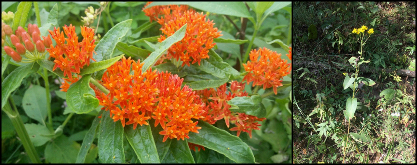
    While we did not find that species with affinity to open habitats were more likely available from at least one producer than species from closed habitats, we did notice that the species which were sold by the most producers tended to be “prairie species” like butterfly milkweed (Asclepias tuberosa; left), which was available from 9 of the 10 vendors we surveyed, or stiff goldenerod (Solidago rigida; right), which was available from 8 vendors.

    Traits of species may also contribute to seed vendors’ interest in propagating them. We found evidence that within perennial wildflowers (forbs), species with a taller maximum height are more likely to be available. We also predicted that species with a longer potential bloom period would be better represented in the seed market, but surprisingly our data shows a negative relationship, where species that can bloom for many months are less represented in the restoration species pool. This pattern may be driven by differences between functional groups or plant families and deserves further investigation.

    The final goal of this project was to identify candidate species to recommend to seed producers as valuable for restoration potential. We identified such species based on the highly detailed descriptions provided in a keystone reference for this region, Paul Nelson’s The Terrestrial Natural Communities of Missouri (2005). This book describes the geologic, climatic, and natural features of natural community types in Missouri. We only considered habitats within the broad designations of forests, woodlands, savannas, prairies, and glades, and we narrowed our focus to only habitat types that occur within the Ozark Ecoregion. For each of these 37 Ozark habitats, this reference provides lists of plant species that are “dominant”, “characteristic”, or “restricted” to that habitat. We propose that a good starting place in assessing the capacity of the native seed industry to support ecological restoration across terrestrial habitats in the Ozark region is to examine whether all of the “dominant” plant species in habitats within the Ozarks are available from vendors. Of the 120 species identified by Nelson as “dominant” in Ozark habitats, 80 of them (66%) were commercially available. This is encouraging, since it is higher than the overall availability rate of 43%, however there are still 40 species which would be difficult for restoration practitioners to acquire without hand collecting from wild populations. This highlights how biases in the restoration species pool could potentially make assembling a high-quality seed mix more difficult, if the species for sale represent those which are easiest to cultivate, rather than being the ones which have the most biological significance to restoration.

    Birdfoot violet (Viola pedata) is classified as a dominant species for dry sandstone woodlands and is common on dolomite glades. Fortunately, we found it is commercially available from two vendors. Two other violets, wood violet (Viola palmata), and arrowleaf violet (Viola sagittata) are dominant in other Ozark habitats, but are not available from any of the vendors we surveyed.

    Here, we are only scratching the surface in terms of identifying ways in which the seed production industry may inadvertently be biasing the restoration species pool and consequently the diversity and composition of restored plant communities. In the future we recommend continued collaboration between seed producers, restoration practitioners, and conservation scientists, to identify the limitations of available seed stocks and better align supply and demand for native seeds. Most seed vendors do not label products at taxonomic designations below the species level. However, conservation goals are sometimes identified for subspecies or varieties. The extent to which these taxa are commercially available is difficult to assess. Additionally, many restoration projects call for seed from a local provenance, but obtaining information on ecotypes of native seed lots from vendors can be difficult. While nearly 40% of our species pool for restoration projects in the Ozark Highlands are commercially available, the proportion of those species that are available from an Ozark ecotype is likely much lower.

    We are currently preparing this project for publication. If you are interested in learning more, or have any questions, feel free to email Andrew (akaul@mobot.org).

  • In search of a lost natural community: the Ozark savanna edition

    In search of a lost natural community: the Ozark savanna edition

    Calvin Maginel is the Ecological Resource Scientist at Shaw Nature Reserve in Gray Summit, Missouri.

    Anyone hoping to join the articulate stream of Missouri articles about natural communities ought to lovingly reference Paul Nelson’s “The Terrestrial Natural Communities of Missouri” (2010). In that vein, we will start our journey with page 233, the Savanna.

    Paul differentiates savannas largely by overstory, topography, and light level characteristics. Primarily, savannas are grasslands that happen to hold little pockets, family clusters, of trees, that mosey through the swaying grass like the slowest of turtles. The natural history of these clusters is as such: a mature parent hosts numerous offspring around her perimeter that shelter her from the repeated onslaughts of prairie fires, while she in turn nurtures offspring on the lee side which will eventually replace her. They are separate from woodlands in that savannas exhibit a tree canopy of less than 30%, while woodlands can range from 30% to 90% canopy. Paul further describes the ground flora layer of savannas as being highly indicative of a prairie, holding the majority of a site’s diversity, and being strongly adapted to frequent fire.

    Of the six savanna communities Paul describes, as nostalgia blurs the typeset, two are considered S1 (critically imperiled) and four are SH, or state historic. A glass of cold water to the face: no known examples remain when something is classified as state historic. To put numbers on this, an estimated 6.5 million acres of savanna in Missouri are now represented by <1,000 recognized acres. Robin Wall Kimmerer aptly wrote: “If grief can be a doorway to love, then let us all weep for the world we are breaking apart so we can love it back to wholeness again.”

    Stylized drawings of the prairie-forest continuum, borrowed from The Tallgrass Restoration Handbook by Packard and Mutel.

    Recognizing a savanna

    As nice as it is to reminisce about and romanticize processes long devastated by European colonizers, if there are (nearly) no savannas left, then why does it matter? Well, there still is hope! While Missouri has a fair percentage of public land (11.2%), most of which has received extensive visits by ecologists throughout the years, the other 88.8% of private lands in Missouri often harbor as-yet-undescribed natural communities that may classify as savanna. In an effort to heighten awareness of these potential gems in the fire-starved hills, I offer a photo tour of a private site in southwest Washington County, near the town of Courtois, that could be described as a savanna. A few points about this site: it is currently being managed for its ground flora character, with repeated fire and herbicide, specifically to the detriment of encroaching cedars and woody re-sprouts. For 25 years prior to the current ownership, it received two fires and periodic mowing to maintain its relatively shrub-free character. Prior to that, it is assumed that this was a hay meadow, cut annually for livestock that were grazed in the valley nearby but not itself grazed. There is a rusty but strong sickle-bar mower still parked in the grass that is set up for a mule to pull, with patent dates from the 1920s.

    Since Paul begins with the overstory, so too will this tour. Anecdotal descriptions of certain areas in the Ozarks by foresters refer to “wolf trees”, trees with spreading branches that were removed from the woodlot since those individuals were considered to be exhausting resources around themselves, much as wolves were believed to be harmful predators that exhausted prey species. An example of this can be found in Photo 1, where a large white oak shows the breadth of branches characteristic of an “undesirable” wolf tree. As mentioned in the caption, the health of the lowest branches can tell something about a site’s history. Overgrazing by cattle or other domestic animals often defoliates these branches until the tree sheds them entirely, so an observation of a tree similar to this one might mean that this site was hayed but not grazed intensively.

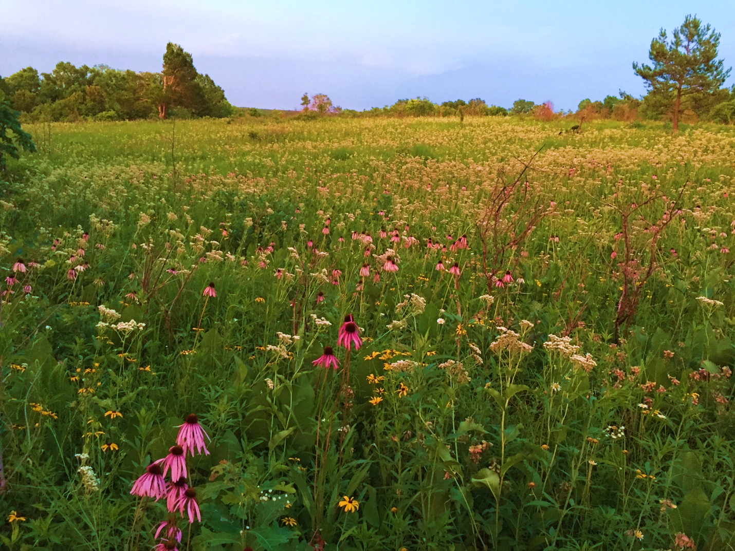
    Now that photos have been mentioned, we’ll begin the photo tour in earnest. All photos are from August 22nd, 2021, unless otherwise stated. To the right side of Photos 1, 2, and 3, you will notice a young shortleaf pine (Pinus echinata) with a wolfish future, and in Photos 2 and 3, there is a distinctive Eastern Red Cedar (Juniperus virginiana) that seems to have lost half its top. All other photos will contain at least a blurry version of those two distinctive trees, in an effort to maintain scale. Speaking of scale, the distance between the white oak wolf tree and the red cedar is a little over 250 feet (76 meters). Photos 2 and 3, of almost the same area at different phenologies, hold the first real hope of a savanna classification. The structure is distinctively grass- and forb-dominated. While clearly the floral display is greater during June, this is not unexpected in an intact prairie system where suitable micro-habitats are dominated by the best-adapted competitors for those micro-habitats. For example, the glade coneflower in Photo 3 is distributed between the foreground of the photo and the base of the pine tree, but seems to decrease in abundance towards the red cedar in the upper left of the photo. Presumably, soil or other characteristics make the former area highly suitable for glade coneflower, despite the fact that no bedrock or other glade indicators occur in those areas. That said, it stands to reason that glade coneflower, currently relatively restricted to glade communities, must have had a mechanism to lay claim to those communities. Possibly this species was historically as ubiquitous in Ozark savannas and prairies as it currently is in glades.

    Photo 1. Forgive the valiantly bolting hickory grubs and mowed path, but this white oak (Quercus alba) exemplifies the spreading nature of a relatively open-grown specimen. Note how the lower branches actually touch the warm season grasses: despite 5 recent years of annual dormant season fire, they are not set back. In fact, one telltale of current or historical colonizer-style grazing is that these perpetually-stretching side limbs are defoliated until they succumb and die. Trees with this character can tell a lot about a site’s history.
    Photo 2. With the same white oak as in Photo 1 to the left of the frame, this photo shows the vegetative structure of the site. You will notice a handful of woody re-sprout clumps, but this area is largely dominated by warm season grasses and prairie forbs.
    Photo 3. June 14, 2016 is the date on this photo. Note the profusion of wild quinine (Parthenium integrifolium) and glade coneflower (Echinacea simulata), the latter of which is commonly identified by its yellow pollen. The more westerly species with white pollen, E. pallida, does not occur on this site.

    In addition to the striking summer floral display in Photo 3, there are distinct waves of blooms throughout the season. Each species, present in profusion in its preferred micro-habitat and scattered elsewhere, blooms en masse and then fades into the background, letting another take the stage like a carefully-choreographed dance.

    At this point, you may be noticing that the common names for many of the plants listed in the photo captions refer to a habitat (eg “glade” coneflower, “upland” white goldenrod, “prairie” coreopsis). This name-relation to a community can serve to help with identifying that community, but the overall assemblage of species tells a stronger story. When you consistently encounter species that occur within multiple habitats (Ozark woodlands, glades, and/or prairies), which is true for most of the species shown in these photos, it may be a telltale sign of the missing connection between all of those communities. Similar to the previously mentioned glade coneflower, both downy gentian and the upland white goldenrod are commonly found in glades and open woodlands. They tend to fall out in areas with >60% shade. Almost all of these species are considered highly conservative; species that we expect to maintain high fidelity to intact ecosystems. Missouri is one of the states that maintains a coefficient of conservatism list, with values ranging from 0 to 10, where 9-10s are virtually only found in the highest quality habitats. For example, the downy gentian, white upland goldenrod, savanna blazing star, and southern prairie aster are all c=9 species. Most of the grasses are 4 or 5, as well as the prairie dock, prairie blazing star, and Canada lousewort. When visiting a natural community, generally the more intact, remnant sites boast a bell curve of c-values, with the peak being a good diversity of c = 4-6 species. The distinctive composition at this site, with conservative prairie and glade species present (yet located deep in the Ozarks in an area not considered historic prairie), triggers the savanna vibe.

    Photo 4. Savanna blazing star (Liatris scariosa var. nieuwlandii), wild quinine, big bluestem, and ashy sunflower. Savanna blazing star is currently listed as a species of conservation concern in Missouri.
    Photo 5. Southern prairie aster (Eurybia hemispherica, old name Aster paludosus), forms a colony with leaves reminiscent of a graminoid until it blooms with striking purple discs.

    An additional, striking character of this site is the height of the vegetation (Photos 6 and 7). In particular, Photo 6 includes a species called ashy sunflower (Helianthus mollis). Various botanists and restorationists have used disparaging terms for this species, even the socially problematic term “thuggish,” since this species tends to form thick 2-4 foot tall monocultures to the detriment of other species. Surprisingly, the ashy sunflower at this site is a whopping 0.5 – 1 foot high and comfortably interwoven with other species. The matrix grasses, consisting of mostly of big bluestem (Andropogon gerardii), little bluestem (Schizachyrium scoparium), prairie dropseed (Sporobolus heterolepis), and Indian grass (Sorghastrum nutans) are consistently knee-high or shorter, barring their flowering stems of around 5 feet. In many prairie reconstructions, the big bluestem and Indian grass commonly attain heights of more than 9 feet and encountering each clump of bunchgrass is like climbing up a small mima mound. Here, the grass ramets have presumably reached old age and no longer exhibit the mounding character. Many ecologists attribute the presence of hemi-parasitic species like Canada lousewort (Pedicularis canadensis), scarlet paintbrush (Castilleja coccinea), or blue hearts (c=10!, Buchnera americana) to decreased robustness of warm season grasses. All three of these hemiparasitic species are present at this site, yet the truth is that the science of ecology is still learning about what actually makes remnant sites look consistently different than reconstructed sites. Is it nutrient limitation, due to all niches being occupied in remnants? Maybe it’s mycorrhizal associations determining community composition and structure, since Arbuscular Mycorrhizal Fungi have been shown to strongly affect plant communities. What about beneficial or pathogenic bacteria, or soil structure, maybe parent material, or surely it’s the site’s aspect and moisture profiles? The obvious answer is that it’s a combination, and that we have much to learn about our natural communities. The quote by J. K. Rowling, “Understanding is the first step to acceptance, and only with acceptance can there be recovery,” might as easily have been about natural communities as it was directed at Harry Potter’s life.

    Photo 6. Upland white goldenrod/prairie goldenrod (Oligoneuron album) blooms amongst two Silphium species, prairie coreopsis (Coreopsis palmata), and well-mannered ashy sunflower (Helianthus mollis) stems. Rarely is the term well-mannered used in conjunction with ashy sunflower.
    Photo 7. Downy gentian (Gentiana puberulenta) looking disheveled prior to its glorious frost-triggered blooms, amidst prairie dock, prairie blazing star, and a grass/sedge matrix. A dominant sedge species here is few-flowered nut rush (Scleria pauciflora).

    The last point regarding vegetative species groups are those considered woodland species. Just like in prairies and glades, there are a handful of woodland indicator species that assist with identification of the natural community we call a woodland in Missouri. As a reminder, woodlands have a canopy cover of >30%, all the way up to 90% cover, yet have an open mid-story maintained most commonly with frequent fire. Some characteristic species present at this site that are considered common woodland indicators include deerberry (Vaccinium stamineum), Samson’s snakeroot (Orbexilum pedunculatum), and stiff aster (Ionactis lineariifolia). The last species is especially striking, as botanists and plant geeks commonly observe it in acidic, poor-nutrient woodlands or power line rights-of-way. Yet keep in mind that glade coneflower, a known calciphile, is hanging out with the stiff aster. Whatever processes are allowing this site to host such a mish-mash of Ozark woodland, glade, and prairie flora, it seems to support the understudied idea that there really was a thriving prairie-forest ecotone amongst these aged hills.

    Photo 8. Prairie willow in the foreground left (Salix humilis), vying for growing space with prairie dock (Silphium terebinthinaceum), tall tickseed (Coreopsis tripteris), little-leaf tick trefoil (Desmodium ciliare), and others.

    Wrapping Up

    As outlined above, there are few to no known savannas left in Missouri. While many agencies are trying valiantly to re-create open or closed woodlands, the sawdust of Missouri’s logging culture weighs heavily on our boots and generally there are fewer restoration practitioners aiming for savannas and their lack of timber products. The Nature Conservancy comes to mind, but the majority of their sites classify as true prairie, except maybe Bennett Spring Savanna. That site, like Ha Ha Tonka State Park, tends to maintain characteristics more similar to open woodland, but has lovely intact ground flora with a solid assemblage of prairie species. The critical missing piece is that for most natural community restorations, we have a goal in mind, dictated and informed by multiple examples of that community. With savannas and the lack of high-quality examples, we are left with a great deal more speculation. The hope mentioned in the beginning comes into play with each of you. There is a plethora of private lands that are largely inaccessible to state and federal biologists. If you get a chance to visit a friend’s farm, do so with a thought to some of the characteristics described above. Citizen science really does work, and maybe the next branch of citizen science is natural community identification! As Rachel Carson said, “The more clearly we can focus our attention on the wonders and realities of the universe about us, the less taste we shall have for destruction.”

  • A prairie resurgence?

    A prairie resurgence?

    James Faupel is the urban ecology restoration supervisor at the Litzsinger Road Ecology Center, a suburban outdoor education site managed by the Missouri Botanical Garden. The property is a mix of reconstructed bottomland prairie and restored riparian woodlands in St. Louis County, Missouri.  

    North American prairie remnants are invaluable pieces of a once vast grassland ecosystem, critical for the survival of so many plants and animals. Prairies are one of the most endangered ecosystems in the world, removed from existence by our agricultural development for crop production. According to the National Park Service, less than 1% of original prairies now remain in North America. The Missouri Prairie Foundation states that less than half of 1% of pre-settlement prairie is left here in my home state. These few remaining North American prairie remnants are vital seed banks for local ecotypes of thousands of native plant species, such as the federally endangered Mead’s milkweed (Asclepias meadii), and they are home to many species of animals that just cannot be found in any other type of habitat. Most prairie specialist species cannot survive once a fragmented prairie has been plowed or bulldozed under. Species such as the regal fritillary butterfly (Argynnis idalia) only occur on remnant prairies in Missouri and have not appeared in our human-made prairie reconstructions.

    A now rare, prairie horizon view. This one is visible at the National Tallgrass Prairie Preserve in Kansas. Photo Credit: James Faupel.

    Undiscovered remnant prairies are generally only spared thanks to practices such as consistent haying or grazing, and have sometimes been found protected in unused areas of historical sites, such as old cemeteries. Unfortunately, remnant prairies are now mostly found in rural settings far from the eyes of our growing urban populations. These sometimes small patches of prairie habitat do not have large dramatic features, such as mountains or canyons that draw vacationers’ attention from states away. Most remaining prairies are also no longer large enough to host their once charismatic herds of grazing megafauna, the American bison. The amazing views of these smaller, modern-day prairies must be experienced up close and personal. This is a problem if you want to educate the public on the importance of protecting these fragile habitats, that are now fragmented and spread far from each other across such a vast continent.

    Middle school children getting to know prairies up close and personal, at a prairie managed by the Missouri Botanical Garden. Photo credit: James Faupel.

    My home city of St. Louis was once 61% prairie pre-European settlement. The only remnant prairie still existing here is a small plot at Calvary Cemetery, which has had to have extensive restoration work done to remove trees, shrubs, and exotic invasive plants from smothering it out of existence.

    The prairie remnant at Calvary Cemetery in St. Louis City looking very open after some much needed restoration work, consisting of tree and shrub removal. Photo credit: James Faupel.

    Many organizations in St. Louis have begun to reconstruct prairies here over the years, to help regain this lost habitat for local wildlife and to be able to get these valuable grasslands back in view of the public. Some of the earliest prairie reconstructions in the Greater St. Louis Region started in the 1970s and 80s. Specifically within St. Louis City & County, this practice didn’t begin until the 80s. I have the pleasure of working on one of those prairies reconstructed in the 1980’s, at the Litzsinger Road Ecology Center, a prairie started and managed by Missouri Botanical Garden staff. The ecology center is a private education site dedicated to working with K-12 teachers, to improve upon their ability to engage their students in place-based education, using our local ecology as the framework.

    Recent work at the Litzsinger Road Ecology Center suggests that St. Louis prairies are making a comeback. Our 2021 spring intern, Lydia Soifer, began work on an independent research project looking at prairie habitat connectivity within St. Louis City & County. Through this project Lydia and I generated a count of 58 small-scale, urban prairie reconstructions managed by various entities within this highly populated area. There are also many more prairie reconstructions in the 7 surrounding counties within Missouri and Illinois.  

    With an increase of 58 small prairies slowly over 40 years, this may seem like a time to celebrate, but this prairie resurgence should not be taken lightly. Some of these new prairies are now at risk of failure. Prairie reconstructions cannot be left to their own devices in our modern, highly human influenced world. Investment in both ongoing habitat maintenance and the continued education of staff is a necessity, or these prairie reconstructions can quickly turn into fields of exotic invasive weeds or full of aggressive trees and shrubby growth. Even at 32 years old, the urban prairie I work at still needs continued maintenance to keep it a “native prairie”.

    Challenges facing urban prairie stewards range from intense seed pressure from surrounding invasive plants, severe runoff and volatile urban waterways, minimal funding and educational resources, fire & smoke restrictions that limit the chance of using prescribed fire, and heavy browsing from oversized whitetail deer populations. Many businesses and organizations outsource with private contractors for their prairie maintenance, which can have some beneficial and detrimental outcomes. There is not a constant visual presence overseeing the land they hold, but it can be much more affordable than permanent staff. Sometimes the only maintenance is periodic visits from dedicated volunteers. The decision to reconstruct a prairie should be well thought out and planned for optimal long-term care. Placement should be targeted for areas where a new prairie could help connect existing fragmented habitats to improve urban wildlife corridors.

    A prairie planting reclaims some space previously occupied by turf grass on a steep hillside at Bellerive Park, a St. Louis City Park. Photo credit: James Faupel.

    Are these human-made prairies working?

    So, it appears prairie reconstructions are gaining some ground within St. Louis and surrounding areas of the Midwest. How do we know if these reconstructions are being successful? What is success? Data collection of any kind is minimal to non-existent across these local sites, so assigning a value to these lands could be considered speculative at best.  

    When I transferred to the Litzsinger Road Ecology Center in 2018, I took notice of data previously collected there relating to pollinators (I have a passion for animal associations with native flora.). There were collection records from around the year 2000, of the now federally endangered rusty patched bumble bee (Bombus affinis), the endangered (IUCN Red List) Southern plains bumble bee (Bombus fraternus), and the vulnerable (IUCN Red List) American bumble bee (Bombus pensylvanicus). This is the only confirmed record of the rusty patched bumble bee in St. Louis, and its range has now shrunk considerably in recent times and can only be found much farther to our northeast. After surveying the reconstructed prairies at my work, I was able to find these two latter bumble bee species of concern. I was curious. Could more of the prairies around St. Louis be supporting the potentially declining populations of Southern plains and American bumble bees?  

    Left image – A Southern plains bumble bee queen nectaring on spider milkweed (Asclepias viridis). Right image – An American bumble bee worker visiting great blue lobelia (Lobelia siphilitica). Photo credits: James Faupel.

    Previously, not much was known specifically about the rare Southern plains bumble bee in the St. Louis region. According to the Checklist of the Bees of St. Louis, MO (Camilo et al. 2017) only two records within the city had been collected, in addition to the collection I mentioned earlier from the Litzsinger Road Ecology Center in St. Louis County. According to many local bee specialists, the American bumblebee used to be commonly seen all around St. Louis, but the Checklist notes only 3 sites that it was recorded at during their recent surveys. After spending a lot of my free time surveying St. Louis prairies, woodlands, and gardens over the last three years, I have found very promising results in the prairies.  

    Six of the larger and older prairie reconstructions in St. Louis City and County, with moderately rich species lists of native plants, were found to contain and support the Southern plains bumble bee, sometimes two to three years in a row. Many more of the prairies I visited supported the American bumblebee. Shutterbee, a local citizen science project I partner with, has recorded 3 Southern plains bumble bees and over a hundred American bumble bees from bi-weekly bee surveys in private home gardens in St. Louis City and County over the last two years. This shows there may be increased value in native plant gardens placed near prairies, for enlarging the foraging areas of bumble bees. 

    I am also beginning to see a trend with these two species’ floral choices. These two species of conservation concern seem much more reliant on native prairie plants than some of their more common bumble bee counterparts, that are flexible enough in their diets to visit many more exotic flowers. For the moment, this is just observational data, but at least it is showing that there is value in the hard work being done bringing these grasslands back to urban spaces. There are many other ways we could begin to assign value to man-made prairies, but more data collection needs to be done across the board on urban prairies. 

    All of these same prairie reconstructions containing milkweeds, blazing stars, sunflowers, asters, or goldenrods have also been recorded to attract in the majestic, migrating monarch butterfly (Danaus plexippus). Last December, the monarch was nearly put on the U.S. endangered species list. The US Fish and Wildlife Service put off this decision for a few years and will revisit it. If the well-known monarch butterfly does indeed get listed as endangered in the near future, will there be a vast new interest in prairie reconstruction? Will there be more investment in prairie protection and reconstruction from municipalities, utilities, corporations and other large land holders? If a quick surge of interest arises, education about these unique ecosystems and their management will be needed more than ever. 

    There are current opportunities to capitalize on the revitalized interest in the outdoors that the pandemic brought about, and with urban populations projected to outpace their rural counterparts in the future, native ecosystems will need to be brought to the people, to spark their curiosity and passion with nature. Without urban prairie reconstructions, we won’t be able to inspire the future volunteers, donors, conservation voters, and land stewards needed to care for and protect remnant lands. Urban prairie reconstructions are therefore integral in the process of preserving our rural remnant prairies, while also being ecologically biodiverse and important in their own right. We need more prairie reintroduced into North America and we need continued investment in their long-term care and monitoring. We aren’t just hoping to save endangered species, we are also hoping to save our continent’s most endangered ecosystem.

    A monarch butterfly visiting New England aster (Symphyotrichum nova-angliae) at the Donald Danforth Plant Science Center’s 5-year-old prairie reconstruction. Photo credit: James Faupel.
  • Conserving and restoring Missouri bladderpod, a US Midwestern endemic

    Conserving and restoring Missouri bladderpod, a US Midwestern endemic

    Matthew Albrecht is a Scientist in the Center for Conservation and Sustainable Development at Missouri Botanical Garden. Here he describes a recent fieldtrip to the Ouchita Mountains to study outlying populations of the federally threatened Missouri bladderpod, Physaria filiformis.

    Situated between Rocky Mountains to the west and the Appalachians to the east lies the often overlooked Ouachita (pronounced WAH-shi-tah) Mountains of central and western Arkansas and adjacent Oklahoma. Unlike the Rocky and Appalachian Mountains, the Ouachitas are a relatively small mountain chain that trends primarily east-west. Despite occupying a relatively small area, the Ouachitas harbor a large proportion of the region’s plant diversity and represent a remarkable center for endemism including many rare plants species with extremely narrow distributions.

    On a recent spring afternoon, Christy Edwards and I had the opportunity to visit the relatively rare and poorly studied shale outcroppings of the Ouachitas with botanists Brent Baker and Diana Soteropoulos of the Arkansas Natural Heritage Commission. In the Ouachitas, shale formations outcrop on gentle to steep south- or west-facing slopes and occasionally on gently sloping drainages. Upon first glance, these outcroppings with exposed fragments of thin, black shale and patches of sparse vegetation cover appear somewhat other worldly. Upon closer inspection, one finds tucked between shale fragments a number of xeric-adapted herbaceous species capable of surviving in this harsh environment, where the dark, sun-scorched shale at the surface creates extreme ecological conditions.

    Ouachita shale glade and barrens. Photo by Matthew Albrecht.
    Xeric-adapted species specialize on the thinnest soil portions of shale outcrops. Photo by Christy Edwards.

    Shale barrens and glades are mosaic plant communities consisting of a remarkable number of endemic, rare, and narrowly-distributed species. According to NatureServe, 36 plant species of state conservation concern and more than 20 globally critically imperiled, imperiled, or vulnerable species occur in this system. New species are still occasionally discovered and a few species remain undescribed in the Ouachita shale barrens. For example, we saw a striking purple-flowered undescribed species of wild hyacinth (Camassia sp. nova) during our visit.

    An undescribed wild hyacinth (Camassia sp. nova) growing in a shale glade and barren complex owned and managed by the Ross Foundation. Photo by Matthew Albrecht.

    The star of the show that day and the focus of our research expedition to the Ouachitas was the federally threatened Missouri bladderpod (Physaria filiformis).  Many members of the genus Physaria – commonly known as bladderpods due to their inflated seed pods – are recognized for their narrow distributions and edaphic endemism, or restriction to unusual soils. As a small-statured winter annual, Missouri bladderpod showcases brilliant yellow flowers in early spring and specializes on thin-soiled calcareous (dolomite and limestone) outcrops in northern Arkansas and southwestern Missouri. However, at its southern range limit in the Ouachitas, Missouri bladderpod is known from just a few isolated shale glades and barrens.

    A profusion of flowering Missouri bladderpod (Physaria filiformis). Photo by Christy Edwards.
    Missouri bladderpod (Physaria filiformis) displaying inflated fruits on a shale outcropping. Photo by Matthew Albrecht.

    Prior to visiting the Ouachitas I wondered how a presumed calciphile like Missouri bladderpod existed on shale formations, which typically produce acidic soils. Perhaps like a few other species of rocky outcrops in the region – such as Sedum pulchelum (widow’s cross), and Mononeuria patula (lime-barren sandwort) which occur on both acidic and calcareous substrates – I surmised MO bladderpod may also tolerate a broader range of edaphic conditions than previously thought. However, I soon learned the shale outcroppings we visited were interbedded with limestone and supported other calciphilic indicator species such as Ophioglossum engelmannii.

    A case of cryptic speciation in the Ouachitas

    Once known only from limestone glades in southwestern Missouri, botanists over the years have discovered populations of Missouri bladderpod on limestone, dolomite, and shale outcroppings in scattered locations throughout Arkansas, denying Missouri’s claim of its only endemic species. A recent study led by Christy Edwards at the Missouri Botanical Garden examined range-wide (Arkansas and Missouri) genetic variation in Missouri bladderpod and the degree of genetic differentiation among populations on limestone, dolomite, and shale. Interestingly, genetic data showed isolation by distance – meaning that as geographic distance increased among populations so too did genetic differentiation. Most strikingly, the geographically isolated shale populations in the Ouachitas were highly genetically divergent from dolomite and limestone glade populations further north in Arkansas and Missouri. This strong pattern of genetic differentiation points to a possible cryptic speciation event in the Ouachitas and a previously unrecognized extremely rare species. On one hand, the genetic data was somewhat surprising given there are no obvious morphological differences among Ouachita shale populations and P. filiformis. Conversely, the data do support the remarkable pattern of narrow-endemism observed throughout the Ouachita Mountains. 

    As we trekked across Arkansas for a few days – along with Brent and Diana who generously shared their time and expertise – collecting fresh material of Missouri bladderpod for a deeper research dive into whether morphological traits differentiate this previously unrecognized cryptic species in the Ouachitas, the need to conserve and restore glade habitat became ever clearer. At present, there are only three known Ouachita populations, making this cryptic species extremely rare and vulnerable to extinction. Many shale glade and barrens systems are now severely damaged or have been destroyed by mining activities. Fortunately, the largest population we visited consisted of thousands of plants scattered across a shale glade and barrens complex that has been restored and managed with fire and woody thinning by the Ross Foundation. In the absence of periodic, appropriately-timed prescribed burning, glades and barrens slowly become encroached with woody species that eventually choke-out sun-loving plants like Missouri bladderpod.

    A large, restored shale glade and barrens complex in the Ouachita Mountains.

    Other populations of Missouri bladderpod eek out an existence on small stretches of outcrops on roadsides or private property maintained as cattle pasture. These sites prove challenging to conserve and restore. Sadly, we did visit some sites where populations were barely surviving due to degraded habitat conditions. However, two sites we visited gave us a glimmer of hope that Missouri bladderpod will continue to survive and thrive. First was a newly discovered dolomite glade population on private property in north-central Arkansas. The property owners recently thinned woody vegetation and began prescribed burning to restore their glade and woodland ecosystem. When we visited, Missouri bladderpod was thriving after a recent prescribed burn. Similarly, the second site we visited on public property had been thinned and burned in recent years, resulting in a diverse plant community and flourishing Missouri bladderpod population. These success stories illustrate the importance of restoring degraded habitat to conserve our rarest components of biodiversity.

    Population of Missouri bladderpod growing on a roadside dolomite outcropping and pasture in north-central Arkansas.
    A degraded site with woody encroachment and a small, declining population of Missouri bladderpod.
    A restored hillside glade with a thriving population of Missouri bladderpod.

    To learn more about the Missouri bladderpod, read the new, open access paper by Christy Edwards, Matthew Albrecht and others.

  • Drought, flood, and fire: an unexpected habitat recipe for at-risk bats

    Drought, flood, and fire: an unexpected habitat recipe for at-risk bats

    Mike Saxton is an ecologist restoration specialist at Shaw Nature Reserve, a 10 km2 mosaic of restored and reconstructed woodlands, prairies, wetlands, and riparian forest along the Meramec River in Gray Summit, Missouri.

    For most land managers, there aren’t enough hours in the day. Between invasive species management, native seed collection and prescribed fire implementation, there are never enough boots on the ground. Add in equipment break downs, erratic weather and administrative tasks and it’s no surprise that with so many balls in the air, something gets dropped. Far too often, we drop the ball on science and monitoring, which are critically important for biodiversity-driven ecosystem management and restoration. Research and monitoring can, in some cases, be expensive; usually they take a certain amount of specialization, and they most certainly take time. For these reasons and many others, land managers build partnerships with universities, collaborate with outside agencies, and engage the public in community science to meet research and monitoring needs.

    What follows is an example of a highly successful partnership between non-profit organizations, a private consulting group, and a federal agency to better understand and protect a federally endangered species.

    A female Indiana bat, “Celeste”, captured during mist netting surveys at Shaw Nature Reserve in 2017 and 2019. Photo credit: Cassidy Moody.

    In 2017, Shaw Nature Reserve hosted a Bioblitz partnering with the non-profit Academy of Science, St. Louis. For two days, participants combed the area looking for as many plant and animal species as they could find. A single federally endangered Indiana bat (Myotis sodalis) was captured during an evening mist netting session along a riparian corridor, marking the first time this species was documented at the Nature Reserve.

    Wildheart Ecology, the local consulting firm which carried out the Bioblitz bat survey, returned in the summer of 2018 to deploy acoustic detectors to further document bat populations at the Nature Reserve. The data revealed the presence of nine different species, including the Indiana bat, the endangered gray bat (Myotis grisescens), and several other species of conservation concern.

    The audio signature of an Indiana bat, captured by detectors at Shaw Nature Reserve. Courtesy: Wildheart Ecology.

    After these surprising and impressive findings, scientists at the U.S. Fish and Wildlife Service carried out mist netting in summer 2019 at the Nature Reserve to gather more information about the federally endangered population of Indiana bats. Netted individuals were tagged and fitted with tiny transponders. Using telemetry, USFWS staff were able to locate a maternal roost colony tree in the Meramec River flood plain. After multiple emergence sampling events conducted at dusk, the population is estimated to be 150+ individuals, making it one of the largest recorded in Missouri.

    Indiana bat roost site at Shaw Nature Reserve. Photo credit: Cassidy Moody.

    So how did Shaw Nature Reserve end up with one of the state’s largest populations of at-risk bat species? The story begins in fall 2015, when a major flooding event on the Meramec River deposited large amounts of woody biomass and created logjams in the Nature Reserve’s floodplain. Another major flooding event in the spring 2017 compounded these conditions. In the fall of 2017, moderate drought gripped the region, drying leaf litter and woody fuels on the forest floor. In November of that year and on a low humidity day in drought conditions, we conducted a prescribed fire that thoroughly burned the floodplain forest, which normally does not carry fire. The flames crept into flood-debris logjams, causing a major conflagration. Dozens of floodplain forest trees died — mostly silver maple, elm and cottonwood— leaving an open patch of larger-diameter snags, or upright dead trees. It is in these snags where the federally-endangered Indiana bats have found a home. Turns out, the serendipitous convergence of flood, drought, and fire created just the ideal conditions. Couple that with high-quality foraging areas across a healthy, diverse, managed landscape and this population is thriving.

    Indiana bat roost habitat along the Meramec River at Shaw Nature Reserve in Gray Summit, Missouri. Photo credit: Cassidy Moody.

    Current status of Indiana Bats

    Unfortunately, like many bat species, the Indiana bat has been in decline and imperiled by human disturbance and disease. According to the U.S. Fish and Wildlife Service, hibernating Indiana bats are especially vulnerable to disturbance, since they often congregate in large numbers – from 20,000 to 50,000 – to overwinter. A large number of deaths can occur if humans disturb these caves during hibernation. While other factors are also responsible for their decline, the devastating wildlife disease known as white-nose syndrome — discovered in 2006 — is a serious threat to the long-term survival of the species.

    According to the U.S. Fish and Wildlife Service population status update, the states with largest net loss of Indiana Bats since 2007 (% decline since 2007) includes:

    1. Indiana: -53,220 (-22%)
    2. New York: -39,367 (-75%)
    3. Missouri: -18,157 (-9%)
    4. Kentucky: -15,220 (-21%)
    5. West Virginia: -14,125 (-96%)
    6. Tennessee -6,509 (-73%)
    7. Ohio: -4,739 (-62%)
    8. Pennsylvania: -1,027 (-99%)

    What Can Be Done

    With thoughtful management and strategic planning, conservation practitioners can conserve and restore bat habitat. Providing a continuous supply of roosting trees and maintaining a habitat structure to facilitate foraging are key aspects of restoration and management plans for bats. According to the Beneficial Forest Management Practices for White Nose Syndrome-affected Bats, below are some best-practice guidelines for achieving these goals:

    • Harvest timber during the hibernation period to eliminate or significantly reduces the likelihood of direct fatality or injury to tree-roosting bats.
    • Create large-diameter snags and canopy gaps, via girdling or chemical (e.g., “hack and squirt”) methods, to increase sun exposure to existing and potential roost trees.
    • Increasing midstory openness to facilitate travel corridors and foraging opportunities via increased mobility and insect prey detection.
    • Retain or create large-diameter snags during forest regeneration harvests or when managing stands affected by windthrow or disease/insect outbreaks.
    • Limit aerial or broadcast spraying near known hibernacula, maternity sites, and surface karst features, unless it can be demonstrated that it would have no adverse impact on bat populations or habitat.
    • Avoid disturbances near maternal roost sites or colonies when possible.
    • Fell hazard trees that appear to provide bat roosting habitat and do not pose an imminent danger to human safety or property during winter (hibernation period) and avoid removing them during June and July when non-flying bat pups may be present.
    • Avoid burning during cold periods since this can be detrimental to colonies of some species if individuals cannot escape smoke and heat from fires.
    • Apply low-intensity fires when possible since high-intensity fires are more likely to cause injury.
    • Account for caves, mines, important rock features, bridges, and other artificial structures when developing burn plans since these locations are often occupied by roosting or hibernating bats.
    • Remove hazard trees and construct fire-lines during winter, when possible, to reduce chances of removing occupied roost trees or disturbing maternity colonies.
    • Protect known maternity roost trees and exceptionally high-quality potential roost trees (e.g., large snags or large-diameter live trees with lots of exfoliating bark) from fire by removing fuels from around their base prior to ignition.
    • Limit management activities and disturbances near cave entrances.
    • Eradicate and control invasive plants to improve habitat quality for bats.
  • A ten-year woodland restoration trajectory

    A ten-year woodland restoration trajectory

    Leighton Reid describes a long-term ecological research project at Shaw Nature Reserve (Franklin County, Missouri, USA). To learn more, read the new research paper (email the author for a pdf copy – jlreid@vt.edu) or tune in for a webinar from the Natural Areas Association on April 21 (register here).

    In 2000, the Dana Brown Woods were dark and dense. Brown oak leaves and juniper needles covered the sparsely vegetated ground, and invasive honeysuckle was creeping in around the edges. Biologically, the woodland was getting dormant.

    In contrast, the woods today are lit by sunlight everywhere except the lowest-lying streambanks, and the ground is hardly visible beneath a green layer of diverse, ground-level foliage. These changes were most likely caused by two actions: burning the woods, and cutting out invasive trees and shrubs.

    Many practitioners have seen woodlands recover to some extent when they are burned, but few have documented the recovery as thoroughly and over so long a period of time as Nels Holmberg and James Trager.

    IMG_0101-001
    Nels Holmberg (left) discussing the finer points of Rubus identification with Quinn Long in the Dana Brown Woods.

    Nels is an ecologist and sheep farmer in Washington, Missouri. He has inventoried the plants at several state parks and natural areas. In 2000, Nels teamed up with Shaw Nature Reserve’s resident natural historian, James Trager, and together they designed a study to describe how ecological restoration was changing the woodland flora at the reserve. They picked the Dana Brown Woods as their study area.

    In a nutshell, Nels and James chose 30 random points on a map. They divided the points evenly across three ecological communities. They placed 10 points in mesic woodlands – the gently sloping parts of the property where white oak and shagbark hickory were most prevalent. Ten points were in areas dominated by eastern red cedar – mostly thin-soiled ridgetops that faced the south, and ten points were in forest – the lower, thicker-soiled toe slopes where northern red oak and Shumard oak were dominant in the canopy with paw paws and spicebush down below.

    Fig_RevisedHabitats_HiRes_v2.3
    Three ecological communities in the Dana Brown Woods: (A) red cedar dominated areas which, after removing red cedar, looked more like dolomite glades in some parts; (B) mesic woodlands with lots of oak and hickory in the canopy; and (C) forest – which had a much darker understory.

    At each point, Nels hammered in a t-post, then walked 50 m in the steepest direction and hammered in another t-post. This was his transect. Every year for more than a decade (2000-2012), Nels walked the transects and recorded every stem of every species that was inside of 10 0.5-m2 study plots. Actually, he did this twice per year – once in the spring to capture the ephemeral plants, and once in early summer. Over the course of the study he spent more than 200 days in the field.

    Canopy Cover
    Dana Brown Woods before (left) and after (right) red cedar removal, with Nels’s 30 transects. The horizontal axis of the image is about 0.9 km. Imagery is from Google Earth.

    During this time the stewards at Shaw Nature Reserve were busy restoring the woods. From 2001-2012, they burned the woods five times. This amounted to about one fire every three years. In 2005-2006, they brought in a logging crew to remove all of the eastern red cedars.

    Maker:L,Date:2017-8-24,Ver:5,Lens:Kan03,Act:Kan02,E-ve
    James Trager lights a fire in a woodland at Shaw Nature Reserve.

    BigJuniperStump_20151104
    One of several thousand red cedar stumps from trees that were harvested from the Dana Brown Woods in 2005-2006.

    Plot R8
    One of Nels’s sampling quadrats in the Dana Brown Woods. Photo: Nels Holmberg.

    I met Nels and James in 2014. I had just joined Missouri Botanical Garden’s Center for Conservation and Sustainable Development as a postdoc, and I was looking for a local research project. I heard that Nels Holmberg had a giant dataset about woodland restoration, so I called him and asked if I could look at it. Nels said “Sure!”. I imagined he would send me an Excel file. Instead he brought in a giant cardboard box full of yellow legal pads where he had recorded his data.

    OLYMPUS DIGITAL CAMERA
    One of hundreds of datasheets where Nels recorded his detailed observations.

    It took a long time to digitize all of the data. There were more than 50,000 data points. But once we had it all together, this is what we learned:

    After eleven years of restoration, the number of native plant species in Dana Brown Woods increased by 35%, from 155 species in 2001 to 210 species in 2012. This increase was linear. That is, the number of native species was still increasing at the end of the study. If we repeated the study today, we expect the number of native species would be even greater than in 2012.

    The number of native species increased at different speeds and to different degrees in different ecological communities. In the lower and wetter forest areas, the numbers didn’t really shift very much. They jumped around but not in one direction. In the woodland areas, the number of native species increased by about 23% in the first three years and then leveled out. But in the higher and drier areas where red cedars had been dominant, the number of plants increased linearly by 36%.

    Native Species Richness
    Changes in the number of native plant species recorded over time in the Dana Brown Woods. On the left are overall changes for the whole management unit. On the right are changes for different ecological communities within the management unit. The management interventions are shown in gray.

    The plant species that benefited from the restoration were mostly forbs and grasses. A couple of the biggest “winners” were black snakeroot (Sanicula odorata) and nodding fescue (Festuca subverticillata). There were also some “losers”: Virginia creeper (Parthenocissus quenquefolia) and spring beauty (Claytonia virginica) both declined over time. Relatively few of the species that became more common were “conservative” – i.e., dependent on intact habitat. Mostly they were more widespread and tolerant species.

    IMG_0049
    Co-author Olivia Hajek demonstrates a hog peanut (Amphicarpaea bracteata) – a good representative of the type of species that benefited most from the restoration. Hog peanut is an herbaceous legume that is common in many woodlands, including disturbed ones.

    Our study did not include a control treatment, but counterfactuals exist at Shaw Nature Reserve (although they are becoming fewer and fewer with the excellent stewardship of Mike Saxton and many others). There are still thick patches of eastern red cedar covering remnant glades on parts of the property. Woodlands that have not been regularly burned are now filled with bush honeysuckle (Lonicera maackii), wintercreeper (Euonymus fortunei), and other invaders. And low-lying forest that has not been restored is very dark with fire-intolerant sugar maple (Acer saccharum) casting much of the shade. If we had included a control treatment in our experiment, these are probably the trends we would have found – definitely not a spontaneous resurgence of diverse native plants.

    IMG_0099
    Fragrant sumac (Rhus aromatica) was present at the outset of restoration and remained relatively stable.

    Why does this work matter? The biggest value of this study is that it shows a relatively long-term restoration trajectory, and it does so in fine botanical detail. Many managers and scientists already have data to show that fire and tree thinning increase woodland plant diversity. This study adds another dimension. It shows how quickly plant diversity recovered. It also shows how the speed and shape of the recovery varied across the landscape. We hope that other scientists and practitioners will compare the recovery trajectories in the Dana Brown Woods to their own natural areas. To facilitate that, we have made all of the underlying data freely available online.

    IMG_0029
    Buffalo clover (Trifolium reflexum) is a conservative species that is present in Dana Brown Woods but was not detected in any of the survey plots.

    One of the next steps for this research is to figure out how and when to re-introduce some more conservative plants. Although the Dana Brown Woods became much more diverse as it was being restored, most of the plants were early successional or generalist species. We found very few habitat specialists that cannot tolerate disturbance, which suggested to us that some of these species may have been lost from the site at some time in the past. To learn how conservative plants might be re-introduced, we have started a new experiment testing the effects of soil microbes, competition, and time since the start of restoration on the success of introduced seedlings from seven conservative plant species. In the next year or two, we hope to have new information and recommendations for restorationists looking to add more specialized biodiversity to their woodlands.

    WP_20150502_004
    Freemont’s leather flower (Clematis fremontii) is a restricted species occurring on dolomite glades in southeastern Missouri. Although it is present at Shaw Nature Reserve less than one kilometer from Dana Brown Woods, it has not colonized the restored glade habitats there. This photo is from Valley View Glade near Hillsboro, Missouri.

    To learn more about this research, you can read the original research paper in Natural Areas Journal. Email me for a pdf copy (jlreid@vt.edu). You can also tune in on April 21 for a webinar on this work. Register here.