Matías Barceló is an early career researcher at the Centre for Research and Innovation on Climate Change (CiiCC) at Santo Tomás University, Chile, SECOS Institute and at the Laboratory for Ecosystem Conservation and Human Well-being (LabCBH). His research focuses on local communities and the land-sea interface. In particular, he has worked on assessing the role of local knowledge in adaptive capacity in a rapidly changing world, as well as investigating the various perceived values of nature associated with the various practices of local communities. He is currently assessing how these values can reinforce various initiatives to restore and reconnect degraded and fragmented ecosystems at the land-sea interface.
Chile is often described through its contrasts: deserts, mountains, temperate rainforests, mediterranean-type climate ecosystems, fjords, kelp forests, and one of the longest coastlines in the world with 4,200 km from north to south, roughly the distance from Lisbon, Portugal, to Moscow, Russia. When accounting for its islands, fjords, channels, and intricate geography, its total coastal perimeter exceeds 80,000 km. These ecosystems also include areas of exceptional conservation value, including the globally recognized Chilean Winter Rainfall–Valdivian Forests Biodiversity Hotspot in central and southern Chile.
A map of South America showing Chile (in red) surrounded – and isolated – by the very high Andes mountain range and the Pacific Ocean. Image-generated by Matías Barceló.
Restoration in Chile is growing, but in what way, and in what direction?
Our recent review of 95 restoration initiatives, that comes from a dataset compiled by the Chilean Ministry of the Environment, showed that most projects nation-wide are concentrated in terrestrial ecosystems, particularly in central and south-central Chile, where wildfires and forest plantations are among the main drivers of degradation and transformation (see Figure below). Our work showed that 94.7% of the initiatives were terrestrial while the other 5.3% represent wetlands and there are no initiatives in the database focused directly on marine ecosystem restoration, despite Chile’s extensive coastline.
This review also revealed a key social gap: only 35.7% of the initiatives explicitly involved local communities from the outset, and when communities were included, their role was often limited to operational activities such as planting, cleaning sites, or basic monitoring. In other words, people participated in restoration activities, but not necessarily in defining restoration goals, identifying priority areas, making decisions, or shaping governance processes.
The map on the left shows the restoration initiatives recorded by Chile’s Ministry of the Environment between 2010 and 2021, marked with red dots. The panels on the right summarize key features of these initiatives, including: (A) main causes of site degradation; (B) ecosystem type; (C) land use or land cover targeted for restoration; (D) whether actions involved water bodies; (E) whether local communities were involved; (F) whether seeds were collected from nearby areas; (G) whether seedlings were produced by the initiatives; (H) whether planting was carried out; (I) whether monitoring was in place; and (J) whether a reference ecosystem was selected or assembled.
This is relevant because as mentioned above restoration work should reach beyond ecological goals. If restoration projects focus exclusively on biophysical recovery, they may overlook local livelihoods, cultural values, traditional practices, historical relationships with species, and also the meanings that communities attach to degraded or transformed landscapes. A restoration project can be technically well designed and still fail socially if it does not engage with the people who live in, depend on, and care for those ecosystems. The challenge is to move toward social-ecological restoration, an approach that integrates ecological recovery with local knowledge, values of nature, community participation, and long-term human well-being.
The mouth of the Chaihuín River where it flows into the Pacific Ocean is a highly representative location for studying land-sea interactions via the river. Chaihuín, Valdivia, Chile. Photo credit: Matías Barceló.
Why land and sea must be restored together
Although terrestrial and marine ecosystems are often managed separately, many communities experience them as interconnected territories. Changes in one part of the system can affect the others. Forest degradation can influence water quality, sediment flows, coastal habitats, and livelihoods. Marine degradation can affect food security, local economies, cultural practices, and people’s sense of belonging.
Drying red seaweed species for marketing purposes on the southern coast of Chile. Photo credit: Matías Barceló.Artisanal divers checking water quality monitoring equipment. Photo credit: Matías Barceló
For this reason, we have undertaken a project that focuses on representative coastal sites of southern Chile: Lenca, Puelo, and Cochamó (see Figure below). These places were selected because they represent different but connected expressions of the land-sea interface in the south-central Regions. Lenca combines temperate rainforest, proximity to Alerce Andino National Park, artisanal fishing, seaweed harvesting, and coastal livelihoods. Puelo connects mountain, riverine, freshwater, and marine systems. Cochamó brings together valleys, temperate forests, rivers, coastal areas, artisanal fishing, shellfish harvesting, and community-based tourism. Together, these sites offer a unique opportunity to ask and test how restoration can be conceived not only for “nature”, but also for people.
(a) Dots indicate the study site locations: Lenca (red), Cochamó (yellow), and Puelo (light blue) in Reloncaví (Llanquihue Province, Los Lagos Region), southern Chile. (b) Pink dots show the locations of the study sites in a subcontinental geographic context. Maps created by Matías Barceló.
From ecological restoration to social-ecological restoration
Our project starts with the idea that restoration priorities should be defined by integrating ecological evidence with local perceptions. It combines remote sensing analysis of native and kelp forest change with interviews with local actors about perceived environmental changes, key species, threats, and meaningful places. This information will be co-validated with communities mentioned above, recognizing that scientific data alone is not enough to guide restoration, and that local knowledge is essential to understand degradation and identify restoration needs.
Why values matter for restoration
One of the main contributions of this project is its focus on plural values. People value ecosystems in different ways: some values are instrumental like forests and marine ecosystems that provide food, income, materials, protection, or tourism opportunities; others are intrinsic: species and ecosystems may be considered valuable in themselves, regardless of their usefulness to people. But many values are relational: they emerge from identity, care, memory, responsibility, belonging, and connection to place. These relational values are especially important for restoration.
Our project will explore these values through photo-voice. Participants will be invited to take photographs of places and species that are meaningful to them. Each photograph will be accompanied by a short narrative explaining why the place or species may be relevant for restoration. This method will allow to communicate environmental change not only through words, but also through images, memories, emotions, and territorial experience.
Co-creating restoration futures
Our project moves from diagnosis to action. One approach is relevant here. Pockets of the past, which invite communities to identify values, practices, or ways of life from the past that they want to carry into the future. These may include forms of care, uses of species, relationships with rivers or forests, collective practices that remain meaningful for sustainable futures.
This approach suggests that restoration initiatives can be more legitimate and sustainable when they are grounded in local values, ecological evidence, and community priorities. In this sense, community-led pilot initiatives and methodological guides can serve as useful tools to translate plural and relational values into restoration practice. They offer a pathway for moving from diagnosis to action, while also generating lessons that may be adapted to other land-sea territories facing similar social-ecological challenges.
A window of opportunity: restoring relationships in southern Chile
Chile currently finds itself in a unique institutional moment. The National Landscape Restoration Plan 2021–2030 and the newly established Biodiversity and Protected Areas Service that opens a major opportunity to embed social-ecological restoration into national policy and planning. This opportunity will only be meaningful if restoration moves beyond narrow ecological targets.
Land-sea interface in southern Chile, showing an area used for mussel farming, which is subject to terrestrial environmental changes resulting from potential land-sea interactions. Photo credit: Felipe Torres.
Restoration is often imagined as the recovery of what has been lost such as forest cover, indigenous species, habitats, ecosystem functions. But degradation can also weaken what is relational: knowledge, memories, practices, livelihoods, and the sense of belonging that connects people to place. Restoring green and blue forests in southern Chile is not only about recovering trees or kelp. It is also about strengthening relationships that make restoration meaningful: relationships between people and nature. By placing plural values and community participation at the center, this project seeks to contribute to a broader transformation in restoration practice to build more sustainable, just, and place-based futures.
This research is funded by The National Agency for Research and Development of Chile (ANID) and it is just getting started; if you’re interested, please don’t hesitate to contact the first author at barcelo.matias@gmail.com.
I gratefully acknowledge the collaboration of my friends and collaborators Claudia Rojas & Alejandro Venegas‐González.These gaps and lines of research stem from our recent paper in Restoration Ecology.
Eve Allen, Program Director for the Northeast Bioregion, James Aronson, President of the Ecological Health Network, and Sefra Alexandra, Director of The Ecotype Project, share insights and outcomes from the inaugural workshop held at the Oak Spring Garden Foundation in Upperville, VA. This workshop led to the launch of a new coalition supporting initiatives for sustainable ecosystem and landscape restoration in the Eastern United States.
Unprecedented federal and state-level investments, combined with growing environmental education programs and awareness, are increasing the demand for ecological restoration (ER) and allied activities in the US, Canada, and worldwide. This is causing a demand surge for native seed and plant material across the United States. Similar trends are coming to light in many other parts of the world as well.
In January 2023, the National Academies of Sciences, Engineering, and Medicine released a 228-page report that found the country’s current supply of native seeds is already insufficient to meet the restoration needs of agencies like the US Forest Service and the Bureau of Land Management (BLM), and the situation is even more acute in the states east of the Mississippi River.
The skewed distribution of federal land ownership in the US exacerbates this problem. To wit, the US Government owns about 46% of the land in the 11 contiguous Western states, whereas its ownership averages only 4.6% in the remaining mainland states. Given that the US government is the primary purchaser of seed and plant material nationally, for use in restoration programs on public lands, this demand serves as a strong signal for farmers and nursery professionals to ramp up production. Despite this, a notable procurement gap exists in the Eastern states, where land ownership is predominantly divided among state governments and private individuals, hindering the development and expansion of robust seed and plant material supply chains.
In 2018, a survey of 760 respondents across the Eastern US states undertaken by the Mid-Atlantic Regional Seed Bank and the University of Maryland indicated that seed buyers sourced seeds from vendors located an average of 418 miles (673 km) away from their restoration sites (typically from vendors in the Upper Midwest (Tangren, Toth, and Siegel 2022). We conclude that there is an urgent need to build stronger networks in the Eastern US to increase supply chain capacity and to improve the quantity and quality of genetically and ecologically adapted seeds and nursery-grown plants with verified provenances.
The Northeast Seed Network
To this end, in March 2023, the Native Plant Trust, Ecological Health Network, and other partners launched the Northeast Seed Network (NSN) to reinforce and build connections and trust among government agencies, Tribal Nations, educational institutions, citizen groups, farmers, nurseries, other private companies, and nonprofit organizations including botanic gardens, seedbanks, and arboreta. By fostering collaboration among all these diverse stakeholders, the NSN seeks to facilitate knowledge exchange, promote impactful research, and advocate for the adoption of best practices, thus fostering a vibrant community of practice. Building strong private, public, and nonprofit partnerships is essential for building seed supply chain capacity or the ability to ensure that we have “the right seed [or plant], in the right place, at the right time” (Oldfield and Olwell 2015). This is because there are numerous ‘public good’ aspects of the ‘supply chain’ (e.g., R&D, education, demonstration, and advocacy) that will not be supported solely through market mechanisms.
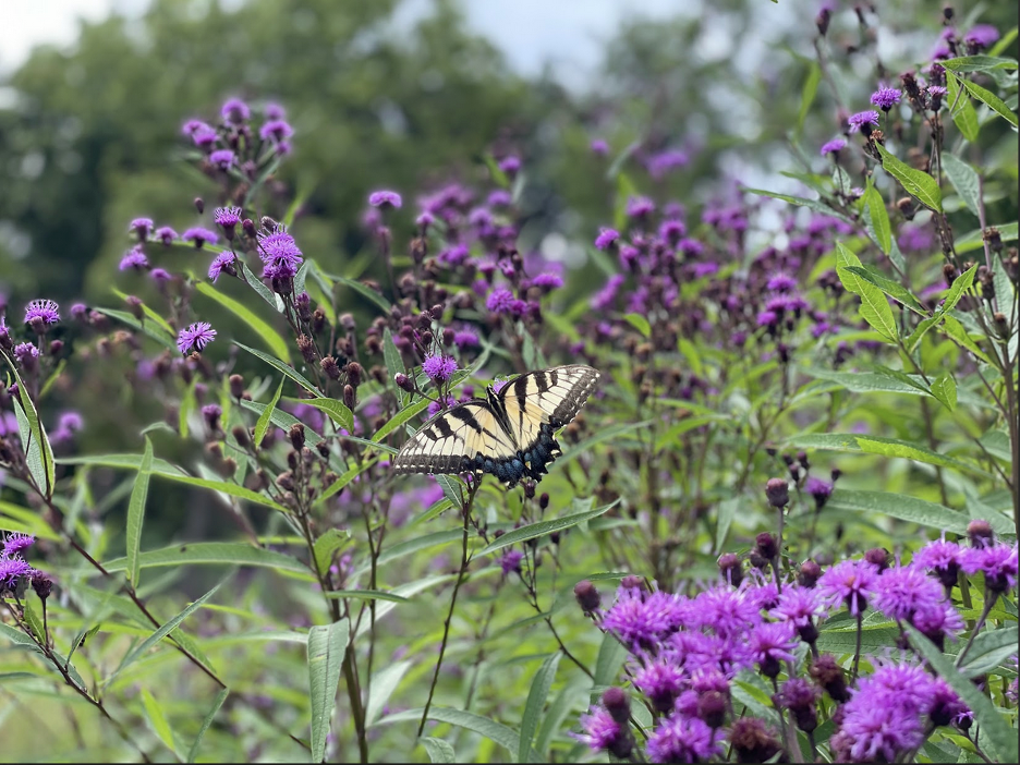
New York ironweed (Vernonia noveboracensis), an important host plant to pollinators including the Eastern Tiger Swallowtail Butterfly (Papilio glaucus), is commonly used in ecological landscaping in the US Northeast Region. Credit: Sefra Alexandra.
Recognizing the Role of Botanic Gardens
To gather more information prior to undertaking any major new steps, the Ecological Health Network carried out a social network analysis to understand existing relationship patterns among the seed supply and demand chain actors in the Northeast US (Allen et al., under review). The study’s findings align with those of Tangren, Toth, and Siegel (2022), indicating that Midwestern seed vendors predominantly dominate markets in the Eastern US. For instance, a seed vendor based in Minnesota has established connections with over 94% of the end-users of native seed and plant material in the US Northeast identified in the study.
However, the research also unveiled that producers of seed and plant materials within the US Northeast region enjoy well-established social ties with many botanic gardens, arboreta, seed banks (referred to as botanic gardens hereafter), and educational institutions in the region. These results support the argument that botanic gardens are uniquely positioned to play an essential role in ecological restoration science and practice (Hardwick et al. 2011), especially in their own regions. Botanic gardens have expertise in numerous relevant fields, including plant taxonomy, horticulture, genetics, seed science, and environmental education, as well as knowledge from ecological field research being undertaken by a growing number of botanic gardens around the world (Aronson et al. 2014; Miller et al. 2016). Furthermore, as emphasized by Crane (2022), botanical gardens share the obligation of addressing socio-ecological challenges arising from climate change, alterations in land cover, and pollution. They must actively maintain their relevance through engagement, education, and tangible actions, particularly at the local level, outside the confines of their garden walls.
Indeed, many botanic gardens across the Northeastern and Northern Mid-Atlantic USA region have programs and activities aimed at strengthening native seed and plant material supply chains, among other things. For example, the Highstead Foundation in Redding, Connecticut, is deeply involved in sustainably harvesting seeds from local, naturally occurring plant populations. Following this, the staff meticulously cleans and stratifies the seeds before growing them into plugs. Local farmers, such as those affiliated with the Northeast Seed Collective will then proceed to amplify the plant material to produce the specialty crop of ecotypic seed. (Read more here).
In Hockessin, Delaware, Mt. Cuba Center, a botanic garden dedicated to preserving native plants and ecosystems across the Mid-Atlantic and Eastern Temperate Forest Region, conducts trial garden studies aimed at evaluating native species for their horticultural and ecological value. These studies serve to educate the public about the garden performance and ecosystem services provided by native species while also fostering the development of new markets for regionally produced seed and plant materials. The garden evaluates material and, where appropriate, shares material for local native plant nursery production. Beyond the horticultural side of the trade, Mt. Cuba engages with land managers and restoration growers, working to understand needs and promote local provenance workhorse species in collaboration with others in a mid-Atlantic seed users network.
Native Plant Trust’s Nasami Farm in Whately, Massachusetts, Nasami Farm, has a longstanding practice of cultivating native plant material from hand-collected wild seeds. More recently, they have expanded their efforts by establishing seed increase plots to enhance production capacity for regional restoration projects.
These examples provide a sampler of the valuable contributions that botanic gardens across the region are already making to native seed and plant supply chains. However, in May 2023, Eve Allen and James Aronson, alongside Christopher Dunn, the Director of the Cornell Botanic Gardens, recognized a need to improve communication about these existing activities, and programs through improved networking among botanic gardens at a bioregional level.
Eve Allen, from the Ecological Health Network (EHN), and Todd Bittner, Director of Natural Areas at Cornell Botanic Gardens, discussing the Native Lawn Demonstration Area during the EHN Site visit in the fall of 2022. Photo Credit: James Aronson.Least trillium (Trillium pusillum) in bloom at the Mt. Cuba Center, a botanical garden in Delaware dedicated to preserving native plants and their ecosystems across the Mid-Atlantic and Eastern Temperate Forest Region. On the right, Eve Allen of the Ecological Health Network (EHN) stands with Élan Alford, Plant Conservation Scientist, and Jeff Downing, Executive Director of the Mt. Cuba Center, during an EHN site visit in the spring of 2023. Photo Credit: James Aronson.
Over the course of a long day and delightful evening, the participants worked together to chart a course for a new collaborative effort. Together, we recognized the distinctive responsibility botanical gardens bear to strengthen native seed and plant supply chains for landscape restoration across a spectrum of ecosystems, spanning from urban areas to suburbs, agricultural landscapes, corridors, and other protected areas of significant conservation value. More broadly, we agreed that botanic gardens are custodians of our shared plant biodiversity on our planet. By engaging in conservation, exploration, education, research, providing facilities, and leveraging expert horticultural know-how, they – and allied organizations like arboreta, herbaria, and seedbanks, should work together to bolster resilience and restore the health of people, ecosystems and landscapes. We also agreed that it would be timely to work on meeting this challenge at a bioregional level, namely in the Eastern US.
Enhancing demand signals by building better markets
The National Academies Report identifies unpredictable demand as the foremost challenge for native seed suppliers across the United States (p.98). This problem is especially pronounced in the US Northeast, as the substantial increase in demand for native seeds and plants fails to translate into intelligible markets. Current and potential suppliers within the Northeast Seed Network, including farmers and nursery professionals poised to expand their production of diverse species and ecotypes, require more consistent and transparent signals of demand.
As such, a primary objective of the Restorative Landscape Coalition is to address and surmount the various policy, regulatory, and cultural obstacles hindering the utilization of source-identified, genetically diverse seed supplies, as well as nursery-grown or propagated plant materials. For example, we addressed the necessity of conducting targeted outreach and engagement with state and municipal agencies to facilitate the development of enhanced recommended species and species substitution lists. Currently, these lists predominantly feature mid-western species, likely due to their commercial availability.
Rather than solely focusing on seed production or amplification efforts, we recognize the critical importance of fortifying the ‘demand’ side of seed and plant material supply and demand chains. This strategic emphasis not only elucidates the distinction between the Restorative Landscape Coalition and the Northeast Seed Network but also underscores their mutually reinforcing relationship. Our approach involves generating and sharing knowledge, know-how, and best practices to enhance existing markets and create new markets for high quality seed and plant material.
Leverage our living collections to amplify seed production
Citing The National Academies of Science’s 2023 report, we reaffirmed how the in situ living collections (particularly conservation collections of wild origin) housed in botanic gardens and affiliated non-profit organizations serve as a crucial safeguard for native species within the plant materials development pipeline, when reproductively isolated from other related collections, for seed amplification.
The US National Seed Strategy and National Academies of Sciences report emphasizes the imperative to increase collaboration and cooperation across agencies and with external partners. This involves sharing expertise, facilities, and optimizing the production and use of plant materials. Botanic gardens are custodians of our shared plant biodiversity. By engaging in conservation, education, research, providing facilities, and leveraging expert horticultural know-how, we are committed to providing a key link in efforts to bolster resilience and restore the health of landscapes in the Eastern US.
In the Apple Room, our workshop proved not only enjoyable but remarkably productive. As the day drew to a close, participants reached a consensus on the crucial role of botanical gardens in tackling socio-ecological challenges stemming from climate change, land cover change, and pollution. Photo Credit: Sefra Alexandra. As the evening drew to a close, together, we affirmed the unique responsibility botanical gardens bear in bolstering native seed and plant supply chains for landscape restoration. It was underscored that our institutions must actively assert our relevance through tangible actions, particularly at the local level, extending beyond the confines of our garden walls—a sentiment eloquently highlighted by Peter Crane, Director of the Oak Spring Garden Foundation, in his insightful 2022 opinion piece, Botanic gardens: Seizing the moment while imagining the future in Plants People Planet. Photo Credit: Oak Spring Garden Foundation.
Fostering bioregional collaboration to achieve lasting social-ecological impact
To advance the individual and collective missions and visions of the organizations and institutions participating in the Restorative Landscape Coalition, we will strive for a holistic perspective and approach that emphasizes the tremendous power and potential held within the concept of a bioregion. This is a spatial scale often overlooked by public, private, and government institutions. Note that a bioregion is not defined by political boundaries nor even by ecological and biogeographical boundaries alone. Rather, the concept corresponds to the geographical territories of human communities and cultural groups as well as the ecological systems on which they depend and of which they are a part. To be coherent, and useful, the boundaries of a bioregion must be delineated to uphold the integrity of its biological and human communities, ecosystems, and social-ecological systems. This includes preserving essential processes such as nutrient cycling, historical disturbance regimes, and species migration, among other biological and ecological factors. Additionally, sustainable and equitable management of resources and ecosystem services is vital, spanning generational and community boundaries within the diverse human populations inhabiting a bioregion. Bioregions vary in scale, ranging from watersheds to much larger territories, and may traverse international borders. However, they are fundamentally shaped by their flora, fauna, and human communities, each contributing to and benefiting from a distinctive identity defined by climatic, ecological, and cultural characteristics (Berg 1991).
While initially complex and possibly daunting, there are significant advantages to the approach of organizing human activities and systems based on bioregional boundaries. Most importantly, it provides a strategic framework for connecting individual and collective efforts to facilitate impactful changes at appropriate scales to address biodiversity and climate goals (Pezzoli, 2015; Wearne et al., 2023). That being said, addressing the intricate environmental challenges of the 21st century on a large spatial scale, especially with an unconventional concept like bioregionalism, demands innovative forms of network governance (Scarlett and McKinney, 2016).
Left photo: Beds holding tree saplings for reforestation projects, including urban tree planting initiatives, in the Mid-Atlantic region. Right Photo: cleaned seeds of Arrow Wood Viburnum(Viburnum dentatum) at Pinelands Nursery in New Jersey. EHN Site Visit, Summer of 2022. Photo Credit: Eve Allen.
Social impact and Social-ecological impact networks
A social impact network is one in which formal and informal institutions collaborate across diverse interests, sectors, and political arrangements to establish social norms, social capital, and trust that together can propel and sustain collective information sharing, decision-making, and action (Kapucu and Hu 2020; Ehrlichman 2021). However, when social-impact networks are operating at broader geographical and societal levels – bioregions – and developing initiatives that target ecological and environmental challenges that demand integrated ecological and social interventions, we may call them social-ecological impact networks (Ecological Health Network 2024).
The Restorative Landscape Coalition is intended to be a social-ecological impact network dedicated to working with and enhancing the capacity and impact of the Northeast Seed Network and other seed production-focused partnerships, as well as emerging, restoration- and conservation-oriented partnerships operating across the Eastern US. Our commitment is to support initiatives that sustain, conserve, and, when necessary, restore degraded ecosystems and reintegrate fragmented landscapes within our bioregion – the overlapping and adjacent EPA Level III Ecoregions of the US Northeast, Mid-Atlantic, and Southeast regions. Please note that here we use the ecological definition of “landscape,” namely an assemblage of ecosystems that are arranged in recognizable patterns and that exchange organisms and materials such as nutrients and water (Forman & Godron 1986).
While acknowledging the substantial work ahead, we are confident that the collective resources within our institutions, organizations, and like-minded networks will allow us to make inroads toward our shared goals. Collectively, we embrace an unwavering dedication to the public good and the well-being of future generations. Our shared missions encompass inspiring meaningful connections among people, plants, and the natural world, education and awareness, conservation and stewardship, and research and innovation, all aimed at enhancing society’s overall well-being, resilience to global changes, vigor, and – in a word – health.
Please join the Restorative Landscape Coalition at the American Public Gardens Association’s Annual Meeting in Boston, June 24 to 27, 2024. We will be there, hosting a 90-minute workshop entitled Fostering regional collaboration among public gardens to address native seed and plant material needs, on Thursday, June 27th, from 10:30 a.m. to 12:00 p.m.
To stay in touch and receive updates about the Restorative Landscape Coalition and the Northeast Seed Network, please sign up for our mailing list. You can also follow us at @ecohealthglobal on Instagram, @EcoHealthNet on X and Facebook, and Ecological Health Network on LinkedIn for updates.
By: James Aronson, Daniel R. Pérez, and Adam T. Cross
Daniel Pérez is head of the Laboratory for Rehabilitation and Restoration of Arid and semi-arid Ecosystems (LARREA) at the Faculty of Environmental and Health Sciences, National University of Comahue, Argentina. He also leads two ecological restoration projects in arid northern Patagonia, the first being the one described here and also the one described in his 2021 NHER post here. In addition, Daniel was coordinator of the Argentinian national Network for Ecological Restoration (ENREA) and organizer of its 3rd Congress held last November. James Aronson and Adam Cross are both members of the Steering Committee of the Ecological Health Network. James is also an Emeritus Scientist of the Center for Conservation and Sustainable Development, MBG, and Adam is Adjunct Senior Research Fellow at Curtin University, Perth, Western Australia.
Straddling the Andes and the border between Argentina and Chile, an ancient ‘Lost World’-looking forest persists. It occurs in fragments, dominated by the extraordinary Gondwanan conifer Araucaria araucana, called Pehuén in the Mapuche Mapudungun language and widely known by that name today in southern South America. The name of this giant emergent (up to 80 m tall), and very long-lived (1500 years and more), fire resistant ‘living fossil’ tree, is evidently related to the Pehuenche, an ancient ethnic tribe of migratory hunters in south central Chile and adjacent Argentina, before the 16th century CE when Spanish colonists began to arrive and change the course of everything.
Forest fragment of Araucaria araucana (Pehuén) right in the town of Caviahue, with an understory of the southern South American bamboo, Chusquea culeou. Credit: Laura Abraham.
The Pehuenche were so named for their dependence on the seeds of the Pehuén as a food source. Between 1550 and 1850 CE, some of them migrated west and merged with other peoples of northern Patagonia, in a process described by historians as becoming Araucanized. In the 21st century these Peoples still retain rights to some of their ancestral lands in northern Patagonia, but just barely. Despite the name Mapuche, which means “people of the land”, their situation in modern day Argentina is truly precarious.
While the Pehuén forest is alive and well and regenerating in some large parks in Chile and Argentina, where livestock are excluded, the dominant species is considered critically endangered by the IUCN, and a poignant example of its vulnerability can be found around Caviahue (Roig et al. 2014).
Typical degraded Pehuén forest remnant near the shores of Lake Caviahue. Credit: Adam Cross.
Pehuén, the rather odd English common name of which is Monkey Puzzle Tree, is one of only two highly disjunct Araucariaceae representatives in southern South America. The other 18 extant species of this Gondwanan family all occur in the South Pacific region, in New Caledonia, eastern Australia, Papua New Guinea, and Norfolk Island.
In Caviahue, whose name most fittingly means “Sacred Place of Reunions”, there is an ambitious ecocultural restoration, rehabilitation, and transcultural sustainable development and educational program getting underway, centered on Pehuén(Pérez et al. 2020). The first activities began six years ago with tree plantations and restoration-based education. Since then, there have been countless meetings with all social sectors of Caviahue such as the Mapuche community elders, Caviahue-Copahue Provincial Park, the Caviahue Ski center, primary and high school principals, political decision-makers, and leaders of the tourism sector, all in search of a social consensus and support for the restoration project. This vocation to build common ideas through dialogue, respecting visions, expectations, and desires of the whole community, is one of the most notable features of the work program. It is partly inspired by the Mapuche name for the site. But, as yet there have been only very limited discussions between the dominant, Spanish speaking, sedentary Western community and the transhumant, Mapudungun-speaking Mapuche.
Transhumance – a disappearing way of life
Transhumance is a form of animal husbandry and pastoralism that is remarkably well-adapted to arid and semi-arid lands. The word derives from the Latin trans (beyond) and humus (land), and thus means ‘beyond the land of origin’. It involves biannual movements of flocks between high summer pastures and winter grazing grounds at lower altitudes, or vice versa. In some cases, the entire tribe or group moves with the herds, while in others, only the herders make the biannual trek. This way of life was once widespread, in drylands on most continents, but is now lost and almost forgotten in most places. In Neuquen Province it still survives among the Mapuche. They camp in their ancestral lands near Caviahue lake (1646 meters above sea level) during the warm months, and then during the cold months they and their mixed herds migrate to Huncal (1204 masl) approximately 100 km east and much drier in summer than Caviahue.
Typical Mapuche settler in transhumance, herding Neuquén Creole goats, a genotype especially well adapted to the region. Credit: Agustín Orejas.
Although there is a transhumance law in Neuquén that seeks to protect this ancestral practice, Mapuche farmers are often forced to travel along paved roads to reach their destinations because many fields have become the private property of the colonizers and are blocked in with wire fences.
The Caviahue site joined the Ecological Health Network in 2022 (see here), and a lot has happened since then. The first and third authors of this blog have been offering support to weave together a holistic, ecocultural approach with a focus on human health for the program. Numerous other colleagues in restoration science, and social sciences, from Argentina, Chile, Mexico and Brazil have started getting involved following a visit to the site led by Daniel Pérez of the 3rd Congress of the Argentinian National Ecological Restoration Network held last November, in Neuquén.
Field trip near Caviahue. Credit: Adam Cross.
The project was initiated with the goal of studying how to restore the Araucaria forest in Caviahue, one tree at a time. It is daunting because the trees grow very slowly and there is little previous research on similar species in xeric regions providing a template to build upon.
It has gradually become clear that the restoration of this ancient, isolated Araucaria forest must be ecocultural, and include ecological rehabilitation and landscape reintegration of the degraded grazing lands of the Mapuche pastoralists who camp with their herds of sheep, goats, cows and some horses at one end of Caviahue lake for 6 months of each year. Additionally, the town of Caviahue needs restorative work, because of the planting of invasive Pinus contorta from Western North America, which is escaping and naturalizing in a heritage landscape where this highly competitive conifer does not belong (see below).
Araucaria araucana emerging among a dense formation of invasive Pinus contorta in the town of Caviahue. Credit: Laura Abraham.
At the same time, Daniel and his colleagues came to understand that a truly great context for ecocultural restoration exists here. Caviahue is an extremely interesting town of ca. 1000 permanent residents. There is a strong sense of community among the westerners, and a desire to keep the quiet, nature-based quality of their lifestyle in the town and its valley, despite the interest of many real estate developers to ‘grow’ the ski station and the town, with all its charming low-key tourism services into something much bigger. They are aware that the isolated, relictual population of Pehuén is of great cultural value, but they don’t necessarily see that something can be done to change the nature of the broadly degraded and fragmented landscape where only a few ancient trees remain with little evidence of regeneration. Such change can only come about through trust-building and cooperation with the Mapuche pastoralists.
If one visits the land of the Caviahue Ski centre, not far from the ski slopes, a spectacular remnant of primary-type Pehuén forest of a few hectares there reveals what the ancestral forest was like, and provides a reference model, at least for the more mesic sites in the valley, to those who would entertain the concepts and a project of ecological restoration.
Primary-type forest of Araucaria on the protected lands of the Caviahue Ski Center. Credit: Laura Abraham.
There, one can see the awe-inspiring, living fossil Pehuén trees towering over a thick understorey with Araucaria seedlings and saplings emerging from the deep humus, leaf litter, and topsoil, rather than bare rock and skeletal sands seen more generally in the area. Among the spectacular Pehuén are also seen stands of Antarctic Beech (Nothofagus antarctica), locally known as Ñire, and in the more humid places, the related Lenga (Nothofagus pumilio); both species belong to another Gondwanan genus often co-occurring with Araucariaceae (Peri et al. 2016; Veblen et al. 1996). These areas are in stark contrast to the heavily grazed forest remnants where the Nothofagus persist only as rare, isolated stands, the lower two meters or so of which are stripped bare of foliage (Martínez et al. 2023).
Ñire (Nothofagus anctarctica) on pedestal caused by massive loss of topsoil over many years due in part to over-browsing by goats and cattle. Credit: Daniel Pérez.
The impacts of tree-felling for timber, overgrazing, and resulting topsoil loss over most of the valley are clearly profound.
The species is listed in IUCN’s Appendix I – Threatened with extinction, trade only in exceptional circumstances. Elsewhere, in Lanin Park in Argentina, and Conguillo Park in Chile relatively large stands occur but here in Caviahue, its future depends on local people, of two highly contrasting cultures.
The Ecocultural Restoration Program led by LARREA at Caviahue will include both the Mapuche pastoralist, transhumant communities, made up of three groups of approximately 600 people each, and the sedendary community of ca. 800 non-Indigenous, European and Levantine descended people in the growing town at the other end of the lake. But how? At present, there is little interaction among the communities, with one major exception, namely the population of teenagers in the public high school in the town. Roughly 60% of the teenagers in town are Mapuche, and 40% are Western, or non-Indigenous. In a meeting we attended last November, with Oscar Mansegosa the Elected Intendente (Mayor) of Caviahue, and four people from his staff, we learned that many young people in Caviahue experience mental health-related challenges, no doubt linked to the intense cold weather and meters of snow present on the ground for 5-6 months of the year.
Additionally, we learned that approximately 80% of the Mapuche students experience some form of blockage to obtain higher education. To help reverse this problem, a programmed diploma course which is being designed by the LARREA team will comprise periods of in-person learning in classrooms combined with practical learning in the field, plus virtual classes and modules. There is an integrated list of classes to be identified, and teachers to be named. Daniel has already begun inviting several of the people who attended the conference (including James) to contribute modules or units to the training course. Daniel will be pursuing further discussions with the university about this Diploma program and hopes EHN and others are willing to help not only with the training course but also with projects in and around the town. He has had clear signals from the senior administration of his University that they are keen on moving ahead with restorative projects like this.
Class on dormancy and germination of Araucaria araucana seeds offered by LARREA for teachers and students of the Transhumante School No. 6 of Caviahue. Credit. Daniel Pérez.
Controlling invasive Lodgepole pines: a way to bring people together
One thing many young and older people in Caviahue do seem to understand is the problem of invasive Lodgepole pines (Pinus contorta) which is escaping from gardens and nearby tree plantations and competing with the native Pehuén.
And that’s something that will be part and parcel of any ecological restoration proposed for this town, its lake, and its valley. If people from different cultures work together to fight the spreading of the pines, and then go on to roll up their sleeves to do other interventions in the spirit of ecological restoration, then we’re in the realm of reciprocal, ecocultural restoration. Note that this Western North American pine, known in English as Lodgepole Pine, is considered one of the world’s worst weeds (CABI Digital Library). Yet in Caviahue many families, and tourism and forestry companies continue to plant this invasive tree, despite the fact that it is invading surrounding properties and fields, radically modifying and degrading the unique heritage and life-sustaining landscape of the Araucaria araucana forest. This needs to be corrected through environmental education, citizen science and community-based restoration and horticulture.
Indeed, a pathway to help reverse this problem has begun in Caviahue. In 2023, the educational work began at Escuela Transhumante No. 6. The identification of traits of conifers of the genera Araucaria, Pinus, Picea, and Abies, all present in the town of Caviahue, was addressed with teachers and students. In addition, the incessant spread of Lodgepole pine was discussed and the proposal to cut and remove the unwanted pine trees from town parks was accepted.
A Pine-cutting field course with Caviahue teenagers. Credit: Daniel Pérez.
The joint task allowed for dialogue and reflection on the value of Araucaria seeds as food for Mapuche communities, their cultural and ecological value, and the risk of the continued invasion of Lodgepole pine to the native forest and the ecocultural restoration program getting underway.
A young student from the National University of Comahue cutting an invasive Pinus contorta in Araucaria forest with gusto. Credit: Daniel Pérez.
Perspectives for Restoration-Based Education and training in ecocultural restoration for local people
An educational program is being undertaken with the main high school in town, called CPEM 47. This has already provided results published in an article in Spanish. Among the achievements, various tasks carried out by local secondary school students to plant Araucarias and generate participatory maps stand out.
The educational experiences carried out with students of the Transhumant school to date were extracurricular, that is, in free time.
The next step to be developed in 2024 is the participation of the restoration team of the LARREA in formal education programs throughout the school year.
Informal class in the field of a member of LARREA with young Mapuches from Transhumante School No. 6. Credit: Daniel Pérez.
Health and political issues
In relation to the above-mentioned, non-trivial health issues among teenagers, a very good bond has been built with the medical staff of the Caviahue Health Center. In the meetings held, addictions and depression among young people emerged as the main topics to be addressed. Medical personnel consider that activities such as plant production, plantations, and sowing can contribute to the mental health of young people and within this framework they hope to design activities that in turn will need to be evaluated for their effectiveness and feasibility in terms of time and resources.
Finally, at the political level, the election of a new mayor for the next four years has just taken place. There are good prospects for including ecological restoration in public policies given that the newly elected mayor had the courtesy to hold a meeting with his cabinet for three hours with restoration experts who visited the town. Next, some work priorities were established, such as the promotion of restoration tourism (direct seeding of Pehuén) and the creation of a diploma course in restoration for local youth. This course will be managed at the National University of Comahue with support in infrastructure for demonstration sites from the Municipality. The training will enable the teenagers and young adults of Caviahue to be better prepared to enter the workplace and discover new opportunities. Hopefully, it will also have positive effects socially through building relationships among Mapuche and Western youth.
The Mapuche communities have shown great pleasure in participating in actions such as plantations, sowing and extraction of Pinus, although these actions thus far have always been mobilized from LARREA. It is hoped that in the future restoration activities will be assumed as their own by the two communities, Mapuche, and Westerners.
Leighton Reid is an assistant professor of ecological restoration in the School of Plant and Environmental Sciences at Virginia Tech. Ryan Klopf is the Mountain Region supervisor and natural areas science coordinator for the Virginia Natural Heritage Program. They describe a new research project that aims to understand how an important restoration tool impacts the population dynamics of federally threatened small whorled pogonia orchids. This project has an open PhD position available to start in January 2023; details can be found at the end of this post.
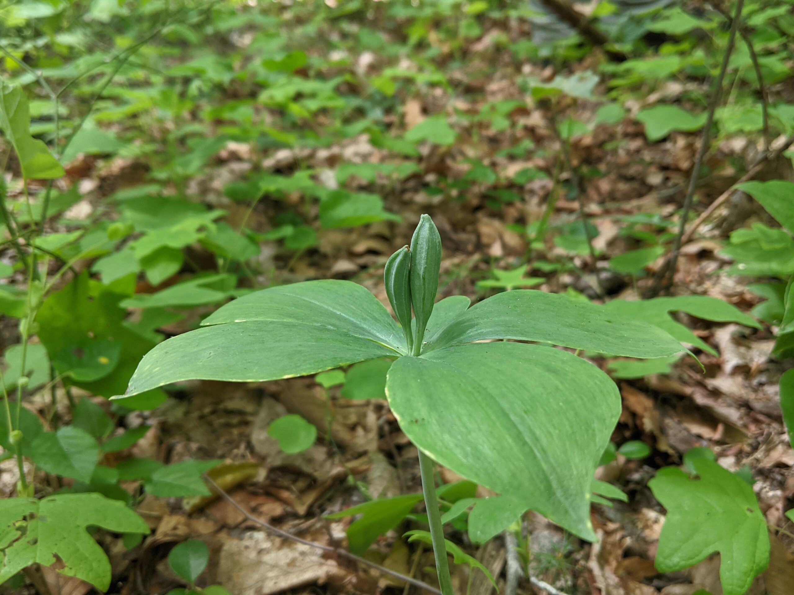
Deep in the heart of Virginia’s Shenandoah Valley, nestled against the western edge of the Blue Ridge Mountains, two clusters of small, green orchids grow in the dappled sunlight of a woodland understory. The orchids are small whorled pogonias (Isotria medeoloides) – a rare species that is considered threatened by the United States government because its population is declining so quickly that it could become endangered in the foreseeable future. We have monitored these populations for the past two summers, keeping tabs on every individual, to learn how this species is affected by one of the most important restoration tools in North America – prescribed fire.
A small whorled pogonia orchid with two flowers at Mount Joy Pond Natural Area Preserve. Photo: Lindsay Caplan.
Small whorled pogonia
As their name implies, small whorled pogonias are small (≤25 cm) and whorled (their leaves radiate outward from the stem). This species is a member of the Pogonieae, an orchid tribe that includes species in Asia and eastern North America. Its closest relative is the large whorled pogonia (I. verticillata) which sometimes grows alongside small whorled pogonia, but is distinguished by its purplish stem (small whorled pogonia has a whitish green, glaucous stem).
Small whorled pogonia (left) with a whitish, glaucous stem compared to large whorled pogonia (right) with a purplish stem base. Photos: Sara Klopf (left) & JL Reid (right).
Small whorled pogonias emerge from the leaf litter in late spring and in some years produce one or two solitary greenish yellow flowers, particularly when plants are exposed to more sunlight. Their flowers do not require any help with pollination; they produce the same amount of seed whether they are cross-pollinated or pollinate themselves.
The seeds themselves are tiny – like vanilla seeds, which are in the same orchid sub-family (Vanilloideae). The parent plant (which is usually both a mother and a father) provides almost no resources at all to its offspring. Each seed’s fate is closely linked to whether or not it finds a mycorrhizal fungus in the Russulaceae family to help it acquire the resources that it needs to survive and grow. In a typical relationship between plants and mycorrhizal fungus, the fungus scours the soil for nutrients like nitrogen and phosphorus and provides them to the plant in return for energy in the form of carbohydrates, which the plant produces through photosynthesis.
A developing fruit on a small whorled pogonia orchid at Mount Joy Pond Natural Area Preserve in June 2022. Photo: Andres Cunningham.
Fire and water at Mount Joy Pond
The story of this research project begins about 80 years ago, in a DuPont chemical plant in Waynesboro, Virginia. In the 1930s-1950s, the DuPont facility used mercury to produce rayon – a synthetic, silk-like fiber. Some of the mercury escaped from the plant and leaked into the South River – a tributary of the Shenandoah River. Mercury is a neurotoxin, and in the environment it can accumulate to dangerous levels in animals that are higher on the food chain, like fish. For many years, people living along the South River have been warned about the poor water quality and advised not to eat the fish.
In 2016, DuPont reached a $50 million USD settlement with the United States Department of Justice, the Department of the Interior, and the Commonwealth of Virginia to restore habitat for wildlife in the South River watershed, enhance water quality, and improve recreational areas. This settlement represented one of the largest environmental damage settlements in United States history.
Some of the DuPont settlement money was allocated to the Virginia Natural Heritage Program, a division of the Virginia Department of Conservation and Recreation that uses science-based conservation to protect Virginia’s plants and animals. Specifically, funds were provided to allow the Virginia Natural Heritage Program to protect and restore woodland habitat surrounding a unique wetland at the Mount Joy Pond Natural Area Preserve in Augusta County.
Briefly, Mount Joy Pond is a Shenandoah Valley Sinkhole community; that is, it is a groundwater-controlled wetland that floods intermittently when water percolates up through underlying carbonate rocks and then floods over the top of a clay lens perched in a layer of soil derived from the overlying sedimentary rocks. When this happens, the water becomes trapped, like water in a saucer. This unique situation creates wetland habitats which have persisted for the past 15,000 years and contain numerous rare and disjunct species, including the globally rare Virginia sneezeweed (Helenium virginicum). There are several dozen Shenandoah Sinkhole ponds, but only a handful of them are protected.
Virginia sneezeweed, an endemic species in the southeastern United States with disjunct populations in Virginia’s Shenandoah Valley sinkhole ponds and in a similar wetland situation in the Ozark Mountains of southern Missouri. Photo: JL Reid.
In the past, Mount Joy Pond filled with water every few years, but in recent decades it has filled up less and less often. To restore the wetland’s hydrology, the Virginia Natural Heritage Program set out to thin the surrounding forest and re-introduce fire to prevent fire intolerant trees, such as red maple, from regenerating. This may sound counterintuitive to some, but the logic is this:
Each tree is like a drinking straw sucking water out of the ground and releasing it into the air via transpiration. If there are a lot of trees, the groundwater may stay too low to fill up the pond.
Fire used to be much more common in the Shenandoah Valley. Prior to European colonization, Indigenous People burned the landscape and maintained much of it as savanna and open woodland – ecosystem types that have fewer trees than present day forests.
By removing some trees and reintroducing a regular fire cycle, land managers at Mount Joy Pond Natural Area Preserve can restore an open woodland and raise the groundwater level, causing the pond to flood more often.
The Virginia Natural Heritage Program began to implement this restoration project in 2017, and the first thinning operations and burn were a success. In the years since, the groundwater level appears to have gone up, suggesting that the hydrological restoration plan is working.
Small whorled pogonia discovery
In the first spring after that first fire, a botanist was surveying the burned woods near the pond and found something unexpected – a small population of small whorled pogonia orchids, which had not been seen previously in the preserve despite extensive surveying by the Virginia Natural Heritage Program’s inventory team. Were the orchids there all along and nobody noticed them? Maybe. Or maybe the fire helped the orchid population emerge after years of suppression in the dense leaf litter in the shady understory.
Our team uses a grid sweep survey to search for new small whorled pogonia individuals in June 2022. Photo: JL Reid.
The story became more complicated later that summer when a more intensive search turned up a second population of small whorled pogonia orchids on the preserve – this one in an area that had not been burned.
The immediate consequence of discovering the new pogonia populations was that the United States Fish and Wildlife Service expressed concerns that future fire management might be detrimental to this threatened species. Nobody had studied how small whorled pogonia responds to fire, and there was a chance that burning could damage the population, even if it was good for the nearby pond’s hydrology. Of course, there was also a chance that not burning could damage the population. With fire, inaction is still an action.
To help settle the issue, the United States Fish and Wildlife Service agreed to sponsor a PhD student to study the small whorled pogonias at Mount Joy Pond and figure out how their population dynamics are impacted by prescribed fire.
Lindsay Caplan and Jimmy Francis monitor a population of small whorled pogonias at Mount Joy Pond Natural Area Preserve in June 2022. Photo: JL Reid.
Effects of prescribed fire on small whorled pogonia orchids
The main goal of our ongoing research is to understand how prescribed fire impacts small whorled pogonias. To do this, we will map and monitor the two subpopulations and the woodland plant communities in which they live. Over the next two years, one of the two subpopulations will be burned during a winter or early spring prescribed fire, and we will continue monitoring to document changes in plant vigor, reproduction, and population size. We will pay special attention to the light environment, which seems to be important for small whorled pogonia reproduction, and to the diversity and composition of soil fungi, which are important for small whorled pogonia emergence. We will also conduct annual surveys of the entire reserve to search for additional populations.
Ethan Dunn uses a canopy imager to measure canopy cover, photosynthetically active radiation, and leaf area index over a tiny small whorled pogonia individual in July 2021. Photo: JL Reid.
This project is just beginning. To date, we have monitored the two populations for two growing seasons (2021, 2022). There is still much work to be done. One of the next steps will be to produce an accurate map of each plant’s location, which will require centimeter-level precision using high-quality GPS equipment under a forest canopy.
We are currently seeking a PhD student to lead this research project starting in January 2023. A description of this opportunity is below. This project is an excellent opportunity for a student to develop expertise in ecological restoration and threatened species conservation from both a scientific perspective and an on-the-ground land management perspective.
Ultimately, the results of from this study will inform management of natural areas and small whorled pogonia restoration projects throughout the species’ wide range – from Ontario to Georgia.
Mike Saxton is an ecologist restoration specialist at Shaw Nature Reserve, a 10 km2 mosaic of restored and reconstructed woodlands, prairies, wetlands, and riparian forest along the Meramec River in Gray Summit, Missouri.
For most land managers, there aren’t enough hours in the day. Between invasive species management, native seed collection and prescribed fire implementation, there are never enough boots on the ground. Add in equipment break downs, erratic weather and administrative tasks and it’s no surprise that with so many balls in the air, something gets dropped. Far too often, we drop the ball on science and monitoring, which are critically important for biodiversity-driven ecosystem management and restoration. Research and monitoring can, in some cases, be expensive; usually they take a certain amount of specialization, and they most certainly take time. For these reasons and many others, land managers build partnerships with universities, collaborate with outside agencies, and engage the public in community science to meet research and monitoring needs.
What follows is an example of a highly successful partnership between non-profit organizations, a private consulting group, and a federal agency to better understand and protect a federally endangered species.
A female Indiana bat, “Celeste”, captured during mist netting surveys at Shaw Nature Reserve in 2017 and 2019. Photo credit: Cassidy Moody.
In 2017, Shaw Nature Reserve hosted a Bioblitz partnering with the non-profit Academy of Science, St. Louis. For two days, participants combed the area looking for as many plant and animal species as they could find. A single federally endangered Indiana bat (Myotis sodalis) was captured during an evening mist netting session along a riparian corridor, marking the first time this species was documented at the Nature Reserve.
Wildheart Ecology, the local consulting firm which carried out the Bioblitz bat survey, returned in the summer of 2018 to deploy acoustic detectors to further document bat populations at the Nature Reserve. The data revealed the presence of nine different species, including the Indiana bat, the endangered gray bat (Myotis grisescens), and several other species of conservation concern.
The audio signature of an Indiana bat, captured by detectors at Shaw Nature Reserve. Courtesy: Wildheart Ecology.
After these surprising and impressive findings, scientists at the U.S. Fish and Wildlife Service carried out mist netting in summer 2019 at the Nature Reserve to gather more information about the federally endangered population of Indiana bats. Netted individuals were tagged and fitted with tiny transponders. Using telemetry, USFWS staff were able to locate a maternal roost colony tree in the Meramec River flood plain. After multiple emergence sampling events conducted at dusk, the population is estimated to be 150+ individuals, making it one of the largest recorded in Missouri.
Indiana bat roost site at Shaw Nature Reserve. Photo credit: Cassidy Moody.
So how did Shaw Nature Reserve end up with one of the state’s largest populations of at-risk bat species? The story begins in fall 2015, when a major flooding event on the Meramec River deposited large amounts of woody biomass and created logjams in the Nature Reserve’s floodplain. Another major flooding event in the spring 2017 compounded these conditions. In the fall of 2017, moderate drought gripped the region, drying leaf litter and woody fuels on the forest floor. In November of that year and on a low humidity day in drought conditions, we conducted a prescribed fire that thoroughly burned the floodplain forest, which normally does not carry fire. The flames crept into flood-debris logjams, causing a major conflagration. Dozens of floodplain forest trees died — mostly silver maple, elm and cottonwood— leaving an open patch of larger-diameter snags, or upright dead trees. It is in these snags where the federally-endangered Indiana bats have found a home. Turns out, the serendipitous convergence of flood, drought, and fire created just the ideal conditions. Couple that with high-quality foraging areas across a healthy, diverse, managed landscape and this population is thriving.
Indiana bat roost habitat along the Meramec River at Shaw Nature Reserve in Gray Summit, Missouri. Photo credit: Cassidy Moody.
Current status of Indiana Bats
Unfortunately, like many bat species, the Indiana bat has been in decline and imperiled by human disturbance and disease. According to the U.S. Fish and Wildlife Service, hibernating Indiana bats are especially vulnerable to disturbance, since they often congregate in large numbers – from 20,000 to 50,000 – to overwinter. A large number of deaths can occur if humans disturb these caves during hibernation. While other factors are also responsible for their decline, the devastating wildlife disease known as white-nose syndrome — discovered in 2006 — is a serious threat to the long-term survival of the species.
With thoughtful management and strategic planning, conservation practitioners can conserve and restore bat habitat. Providing a continuous supply of roosting trees and maintaining a habitat structure to facilitate foraging are key aspects of restoration and management plans for bats. According to the Beneficial Forest Management Practices for White Nose Syndrome-affected Bats, below are some best-practice guidelines for achieving these goals:
Harvest timber during the hibernation period to eliminate or significantly reduces the likelihood of direct fatality or injury to tree-roosting bats.
Create large-diameter snags and canopy gaps, via girdling or chemical (e.g., “hack and squirt”) methods, to increase sun exposure to existing and potential roost trees.
Increasing midstory openness to facilitate travel corridors and foraging opportunities via increased mobility and insect prey detection.
Retain or create large-diameter snags during forest regeneration harvests or when managing stands affected by windthrow or disease/insect outbreaks.
Limit aerial or broadcast spraying near known hibernacula, maternity sites, and surface karst features, unless it can be demonstrated that it would have no adverse impact on bat populations or habitat.
Avoid disturbances near maternal roost sites or colonies when possible.
Fell hazard trees that appear to provide bat roosting habitat and do not pose an imminent danger to human safety or property during winter (hibernation period) and avoid removing them during June and July when non-flying bat pups may be present.
Avoid burning during cold periods since this can be detrimental to colonies of some species if individuals cannot escape smoke and heat from fires.
Apply low-intensity fires when possible since high-intensity fires are more likely to cause injury.
Account for caves, mines, important rock features, bridges, and other artificial structures when developing burn plans since these locations are often occupied by roosting or hibernating bats.
Remove hazard trees and construct fire-lines during winter, when possible, to reduce chances of removing occupied roost trees or disturbing maternity colonies.
Protect known maternity roost trees and exceptionally high-quality potential roost trees (e.g., large snags or large-diameter live trees with lots of exfoliating bark) from fire by removing fuels from around their base prior to ignition.
Limit management activities and disturbances near cave entrances.
Eradicate and control invasive plants to improve habitat quality for bats.
Leighton Reid describes a long-term ecological research project at Shaw Nature Reserve (Franklin County, Missouri, USA). To learn more, read the new research paper (email the author for a pdf copy – jlreid@vt.edu) or tune in for a webinar from the Natural Areas Association on April 21 (register here).
In 2000, the Dana Brown Woods were dark and dense. Brown oak leaves and juniper needles covered the sparsely vegetated ground, and invasive honeysuckle was creeping in around the edges. Biologically, the woodland was getting dormant.
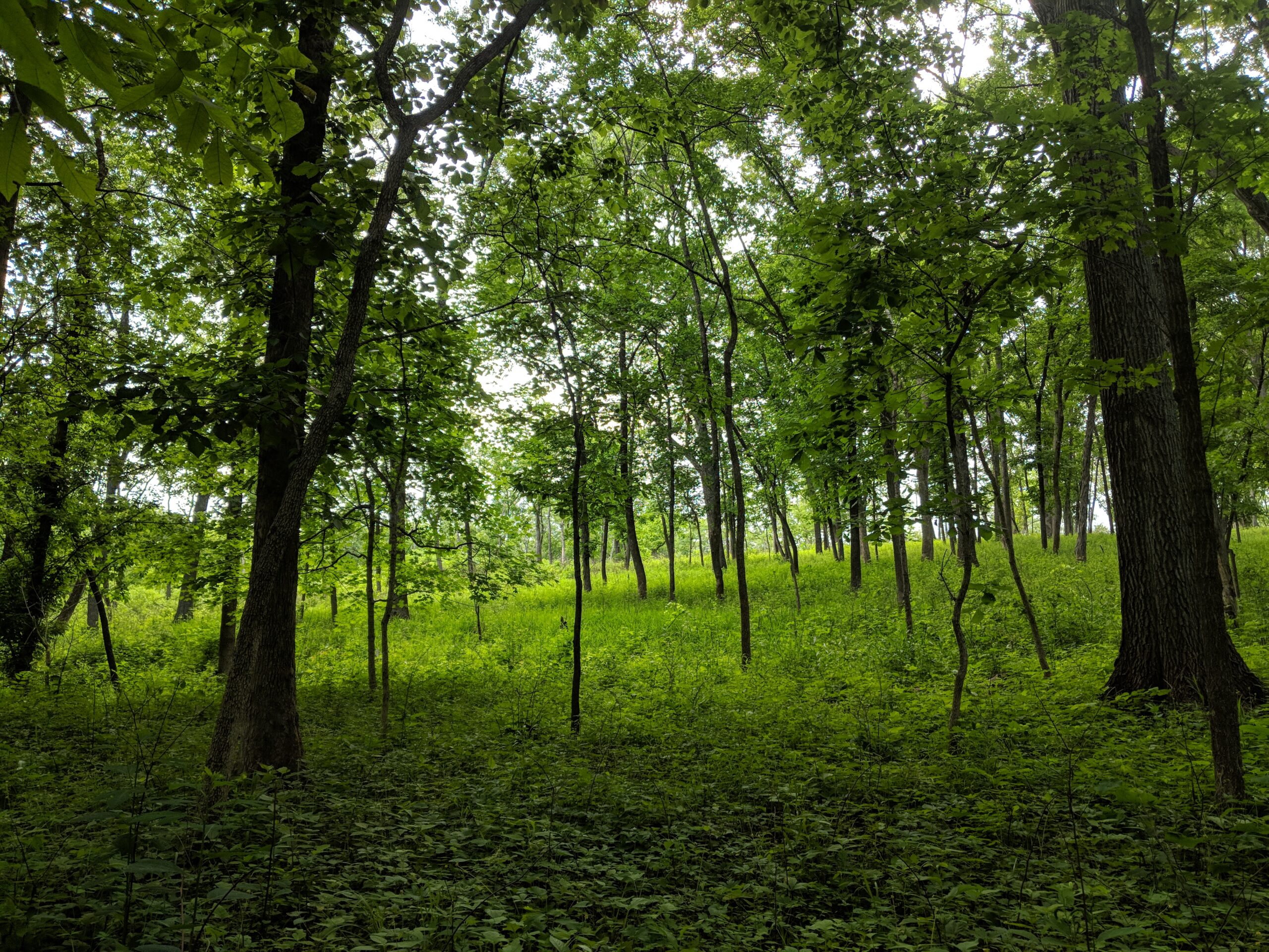
In contrast, the woods today are lit by sunlight everywhere except the lowest-lying streambanks, and the ground is hardly visible beneath a green layer of diverse, ground-level foliage. These changes were most likely caused by two actions: burning the woods, and cutting out invasive trees and shrubs.
Many practitioners have seen woodlands recover to some extent when they are burned, but few have documented the recovery as thoroughly and over so long a period of time as Nels Holmberg and James Trager.
Nels Holmberg (left) discussing the finer points of Rubus identification with Quinn Long in the Dana Brown Woods.
Nels is an ecologist and sheep farmer in Washington, Missouri. He has inventoried the plants at several state parks and natural areas. In 2000, Nels teamed up with Shaw Nature Reserve’s resident natural historian, James Trager, and together they designed a study to describe how ecological restoration was changing the woodland flora at the reserve. They picked the Dana Brown Woods as their study area.
In a nutshell, Nels and James chose 30 random points on a map. They divided the points evenly across three ecological communities. They placed 10 points in mesic woodlands – the gently sloping parts of the property where white oak and shagbark hickory were most prevalent. Ten points were in areas dominated by eastern red cedar – mostly thin-soiled ridgetops that faced the south, and ten points were in forest – the lower, thicker-soiled toe slopes where northern red oak and Shumard oak were dominant in the canopy with paw paws and spicebush down below.
Three ecological communities in the Dana Brown Woods: (A) red cedar dominated areas which, after removing red cedar, looked more like dolomite glades in some parts; (B) mesic woodlands with lots of oak and hickory in the canopy; and (C) forest – which had a much darker understory.
At each point, Nels hammered in a t-post, then walked 50 m in the steepest direction and hammered in another t-post. This was his transect. Every year for more than a decade (2000-2012), Nels walked the transects and recorded every stem of every species that was inside of 10 0.5-m2 study plots. Actually, he did this twice per year – once in the spring to capture the ephemeral plants, and once in early summer. Over the course of the study he spent more than 200 days in the field.
Dana Brown Woods before (left) and after (right) red cedar removal, with Nels’s 30 transects. The horizontal axis of the image is about 0.9 km. Imagery is from Google Earth.
During this time the stewards at Shaw Nature Reserve were busy restoring the woods. From 2001-2012, they burned the woods five times. This amounted to about one fire every three years. In 2005-2006, they brought in a logging crew to remove all of the eastern red cedars.
James Trager lights a fire in a woodland at Shaw Nature Reserve.
One of several thousand red cedar stumps from trees that were harvested from the Dana Brown Woods in 2005-2006.
One of Nels’s sampling quadrats in the Dana Brown Woods. Photo: Nels Holmberg.
I met Nels and James in 2014. I had just joined Missouri Botanical Garden’s Center for Conservation and Sustainable Development as a postdoc, and I was looking for a local research project. I heard that Nels Holmberg had a giant dataset about woodland restoration, so I called him and asked if I could look at it. Nels said “Sure!”. I imagined he would send me an Excel file. Instead he brought in a giant cardboard box full of yellow legal pads where he had recorded his data.
One of hundreds of datasheets where Nels recorded his detailed observations.
It took a long time to digitize all of the data. There were more than 50,000 data points. But once we had it all together, this is what we learned:
After eleven years of restoration, the number of native plant species in Dana Brown Woods increased by 35%, from 155 species in 2001 to 210 species in 2012. This increase was linear. That is, the number of native species was still increasing at the end of the study. If we repeated the study today, we expect the number of native species would be even greater than in 2012.
The number of native species increased at different speeds and to different degrees in different ecological communities. In the lower and wetter forest areas, the numbers didn’t really shift very much. They jumped around but not in one direction. In the woodland areas, the number of native species increased by about 23% in the first three years and then leveled out. But in the higher and drier areas where red cedars had been dominant, the number of plants increased linearly by 36%.
Changes in the number of native plant species recorded over time in the Dana Brown Woods. On the left are overall changes for the whole management unit. On the right are changes for different ecological communities within the management unit. The management interventions are shown in gray.
The plant species that benefited from the restoration were mostly forbs and grasses. A couple of the biggest “winners” were black snakeroot (Sanicula odorata) and nodding fescue (Festuca subverticillata). There were also some “losers”: Virginia creeper (Parthenocissus quenquefolia) and spring beauty (Claytonia virginica) both declined over time. Relatively few of the species that became more common were “conservative” – i.e., dependent on intact habitat. Mostly they were more widespread and tolerant species.
Co-author Olivia Hajek demonstrates a hog peanut (Amphicarpaea bracteata) – a good representative of the type of species that benefited most from the restoration. Hog peanut is an herbaceous legume that is common in many woodlands, including disturbed ones.
Our study did not include a control treatment, but counterfactuals exist at Shaw Nature Reserve (although they are becoming fewer and fewer with the excellent stewardship of Mike Saxton and many others). There are still thick patches of eastern red cedar covering remnant glades on parts of the property. Woodlands that have not been regularly burned are now filled with bush honeysuckle (Lonicera maackii), wintercreeper (Euonymus fortunei), and other invaders. And low-lying forest that has not been restored is very dark with fire-intolerant sugar maple (Acer saccharum) casting much of the shade. If we had included a control treatment in our experiment, these are probably the trends we would have found – definitely not a spontaneous resurgence of diverse native plants.
Fragrant sumac (Rhus aromatica) was present at the outset of restoration and remained relatively stable.
Why does this work matter? The biggest value of this study is that it shows a relatively long-term restoration trajectory, and it does so in fine botanical detail. Many managers and scientists already have data to show that fire and tree thinning increase woodland plant diversity. This study adds another dimension. It shows how quickly plant diversity recovered. It also shows how the speed and shape of the recovery varied across the landscape. We hope that other scientists and practitioners will compare the recovery trajectories in the Dana Brown Woods to their own natural areas. To facilitate that, we have made all of the underlying data freely available online.
Buffalo clover (Trifolium reflexum) is a conservative species that is present in Dana Brown Woods but was not detected in any of the survey plots.
One of the next steps for this research is to figure out how and when to re-introduce some more conservative plants. Although the Dana Brown Woods became much more diverse as it was being restored, most of the plants were early successional or generalist species. We found very few habitat specialists that cannot tolerate disturbance, which suggested to us that some of these species may have been lost from the site at some time in the past. To learn how conservative plants might be re-introduced, we have started a new experiment testing the effects of soil microbes, competition, and time since the start of restoration on the success of introduced seedlings from seven conservative plant species. In the next year or two, we hope to have new information and recommendations for restorationists looking to add more specialized biodiversity to their woodlands.
Freemont’s leather flower (Clematis fremontii) is a restricted species occurring on dolomite glades in southeastern Missouri. Although it is present at Shaw Nature Reserve less than one kilometer from Dana Brown Woods, it has not colonized the restored glade habitats there. This photo is from Valley View Glade near Hillsboro, Missouri.
To learn more about this research, you can read the original research paper in Natural Areas Journal. Email me for a pdf copy (jlreid@vt.edu). You can also tune in on April 21 for a webinar on this work. Register here.
Rich, cove forests are losing tree species faster than sandy, upland forest, according to long-term research in Sewanee, Tennessee led by Jon Evans (University of the South), Callie Oldfield (University of Georgia), and Leighton Reid (Virginia Tech).
The southern Cumberland Plateau in Sewanee, Tennessee is a ribbon of stacked limestone and sandstone rising above the valley by some 275 m, about four-fifths the height of the Eiffel Tower. From above, the plateau’s forests stand out dark green against the surrounding farmlands and give the impression of a large, homogeneous block of habitat.
The reality is somewhat different. The forests of the southern Cumberland Plateau are botanically distinct, and they are changing differentially over time.
The plateau’s sandstone cap is dry and craggy. Blueberries thrive in acidic soil under a canopy of oaks and hickories. Where the soil is especially shallow, the forest opens up onto exposed outcrops with fence lizards and prickly pear cacti. Just a stone’s throw away, the cove forests are a world apart. Wet and calcareous, the plateau’s deep, dark coves are famous for limestone caves and ephemeral wildflowers. Even though they are close neighbors, the two dominant forest communities of this region share less than 25% of their plant species.
Upland forest on the top of the Cumberland Plateau, underlain by the sandstone. Photo by Jon Evans.
As part of a long-term forest change study, in 2014 we surveyed tree communities in upland and cove forests that had been previously surveyed in 1995 and 2005. Our results, published in the Natural Areas Journal, showed that upland forests maintained the same suite of tree species in roughly the same numbers, but cove forests became considerably less diverse. For example, we detected nine fewer tree species in the plots in 2014 compared to 1995. Understory trees were hardest hit – less than 1/3 of the species that were present in 1995 were still represented in the understory in 2014.
Cove forest in Thumping Dick Hollow, underlain by limestone. Photo by Jon Evans.
Being neighbors, upland and cove forests have been subjected to similar disturbances over the past few decades. For example, both forests have comparable exposure to wind storms, pathogens, and herbivores – particularly deer. White-tailed deer have become overpopulated due to the loss of their natural predators, and few tree seedlings escape their browsing. We have seen PVC plot markers chewed to the ground by ravenous deer. Our observations suggest that cove forest tree species are less resistant to these disturbances than their upland counterparts.
We speculate that some trees on the sandy uplands might be pre-adapted to the new deer browsing regime. Several upland tree species are clonal. For example, sassafras, sourwood, and chestnut oak trees can share resources with smaller seedlings that sprout from their bases or roots. The parental subsidy might help these species maintain their populations in the droughty, acidic upland soils of the Cumberland Plateau. It could also help seedlings keep growing after they have been munched by a deer.
Sassafras (Sassafras albidum) is a clonal tree species common in upland forests on the Cumberland Plateau. Photo by Callie Oldfield.
Clonal species are less common in the cove forest. There the dominant trees like sugar maple and tulip poplar typically reproduce via seeds. Paw paw is one of the few clonal species that grows in the cove forest, and it is also one of the few species that increased in abundance there from 1995-2014.
Leighton Reid (left) and Callie Oldfield (right) survey tree communities on the southern Cumberland Plateau in 2005 and 2014, respectively. Photos by Jon Evans.
The southern Cumberland Plateau is regarded by some conservation groups as a resilient southeastern landscape, and indeed its variable topography and large extents of natural habitat may help many species resist or respond to new environmental challenges. However, our research highlights that the two dominant tree communities of the southern Cumberland Plateau respond to disturbances differently and may have a limited capacity to buffer one another from ongoing change.
For more information, see our new paper in Natural Areas Journal. To request a pdf, email jon.evans@sewanee.edu.
CCSD scientists Leighton Reid, Matthew Albrecht, and Quinn Long are teaming up with restoration ecologist James Trager and botanist Nels Holmberg to learn how ecological restoration has affected herbaceous plant communities in an eastern Missouri woodland.
What happens to Missouri’s grasses and forbs when you remove invasive shrubs? When you return prescribed fire to a degraded woodland? How do restoration impacts differ for summer-blooming plants and spring ephemerals? For dry hilltops versus mesic hollows? These are a few of the questions that we hope to address with a long-term dataset from Shaw Nature Reserve.
Nels Holmberg (left) and Quinn Long (right) discuss the finer points of blackberry identification at Shaw Nature Reserve.
Shaw Nature Reserve encompasses 10 km2 of woodlands and glades along the Meramec River in eastern Missouri. Missouri Botanical Garden purchased the land in 1925 when coal pollution in Saint Louis was so bad that it was killing plants; the garden decided to move its collections to the country where the air was pure. Ultimately the city cleaned up, the collections stayed in Saint Louis’s Tower Grove neighborhood, and the property along the Meramec became a nature reserve and popular hiking area.
Like other ecosystems in the Missouri Ozark foothills, Shaw Nature Reserve changed considerably during the last century. Fire, once a regular disturbance, became scarce, allowing junipers to crowd in on the glades. Invasive species, like Amur honeysuckle, spread into the woodlands and created dense, understory thickets.
Twenty five years ago, Shaw Nature Reserve began to counteract these changes through ecological restoration. Staff and volunteers cleared invasive shrubs and began to periodically burn the landscape.
In 2000, restoration ecologist James Trager and botanist Nels Holmberg designed a study to monitor restoration effects on herbaceous vegetation. Holmberg surveyed 30 transects twice per year from 2000-2012, recording the abundances of more than 360 plant species. Restoration in this area started in 2003, so the first two years of Holmberg’s transects represent a pre-restoration baseline against which we can compare data from the subsequent decade.
Holmberg’s dataset contains more than 50,000 rows. Thanks to Christian Schwarz for digitizing them!
Recently, we plotted Holmberg’s transects on Google Earth. The images show clear changes since restoration began almost 15 years ago.
Holmberg’s transects transposed on a 1995 aerial photo of Shaw Nature Reserve – zoomed in on the Dana Brown Woods. This photo was taken in early spring before most trees leafed out. Dark vegetation is predominantly eastern red cedar (Juniperus virginiana). Holmberg originally grouped the transects into three classes based on the dominant vegetation.
Juniper clearing began in 2006. This is what the summer-time forest looked like the year before…
…and after juniper clearing. By 2006 the Dana Brown Woods had been burned twice with prescribed fires, and a lot of the junipers had been cut out. Compare the open/brown areas in this photo with the solid green canopy in 2005.
The most recent imagery, from October 2014, shows some fall color. Note that “red oak” mostly refers to upland Shumard oak, Quercus shumardii.
Our plan for 2016 is to analyze changes in understory vegetation composition over twelve years. Stay tuned for more information in this ongoing project!
Some 300 million years ago, the South American plate collided with the North American continental crust. The resultant buckling formed the dramatic topography of the Ouachita Mountains, which extend from southwestern Arkansas into eastern Oklahoma, defining the southern extent of the Interior Highlands of mid-continental North America.
The fold belt topography of the Ouachita Mountains
Although the Ozark region, which forms the northern portion of the Interior Highlands, has received more attention in terms of both scientific literature and public familiarity, the Ouachita Mountains have a larger number of endemic plant taxa. In total, fourteen endemic plant taxa have been documented from the Ouachita Mountains, several of which have only been described in recent decades. As a member of the Center for Plant Conservation network of botanical gardens, we work to conserve imperiled plant species in the southeastern United States through seedbanking, reintroduction, and research to better understand the ecology and life history of these species. This research ranges from experiments to understand the ecological conditions necessary to break dormancy and induce germination, to field experiments that aim to provide guidance for ecological restoration and management of the communities and ecosystems in which these taxa occur.
Scenic vista in the southern Ouachita Mountains
Ouachita mountain goldenrod (Solidago ouachitensis) is one of the rare and endemic taxa which we are working to conserve in this region. Recently, during the week of November 17th-21st, Matthew Albrecht and I traveled to the Ouachita Mountains to collect seed of S. ouachitensis. A minor snowfall preceded our arrival, bringing with it unseasonably low temperatures. The snow remained for several days on north facing slopes, which increased both the scenic beauty of the region and the difficulty of traversing steep terrain.
Collecting seed of Solidago ouachitensis with a light dusting of snow
The trip was perfectly timed to coincide with the peak of seed maturation, which made for a successful collection effort. Solidago ouachitensis occurs predominantly in two distinct habitat types – mesic oak dominated forest near the summit of slopes and also mixed hardwood forest of riparian toe slopes. Several populations occur along the Talimena National Scenic Byway, where the ridge tops are dominated by a dwarf forest comprised of a near continuous canopy of gnarled, windswept white oak. Solidago ouachitensis occurs on several north-facing aspects down slope from these dwarf forest. Populations vary greatly in size, from no more than several individuals up to thousands of individuals. It appears that the most robust populations (in terms of total population size, the proportion of the population producing seed, and the reproductive output of individual plants) occur in areas with evidence of recent fire. Prescribed fire is used as a management tool in the Ouachita National Forest, which appears to be beneficial for Solidago ouachitensis. To further explore this, we’re initiating experiments to examine whether chemical compounds in smoke enhance germination.
– Quinn Long
Solidago ouachitensis with mature seed. A charred log in the background provides evidence of recent fire.