Category: Uncategorized

  • The Choconexión Project: Restoring Ecological Connections in Ecuador’s Chocó Rain Forest

    The Choconexión Project: Restoring Ecological Connections in Ecuador’s Chocó Rain Forest

    By J. Leighton Reid

    J. Leighton Reid is an Associate Professor of Ecological Restoration in the School of Plant and Environmental Sciences at Virginia Tech.

    The acid test of our understanding is not whether we can take ecosystems to bits on pieces of paper, however scientifically, but whether we can put them back together in practice and make them work. Anthony Bradshaw, 1987

    Ecological analyses in the Choco region are greatly complicated by the inadequacy of the taxonomic data base. Alwyn Gentry, 1986

    In northwestern South America there is a long, thin strip of rain forest that stretches from western Ecuador through Colombia to eastern Panama. This area, known as the Chocó, contains some of the wettest rain forests on Earth, with certain areas receiving more than 11,000 mm (433 inches) of rain each year. The Chocó is isolated from the Amazon basin by the Andes, and as a result many Chocoan species are found nowhere else. Despite its relatively small size, the Chocó is home to about 3% of the world’s vascular plants and 63 endemic bird speciesMore species are described each year.

    A few Chocoan endemic species. (A) Amalophyllon miraculum (Gesneriaceae) – so called because it is a miracle that this little forb has survived in the tiny fragments of Chocó rain forest left in the Centinela near the city of Santo Domingo. This species co-occurs there with another Gesneriaceae, Gasteranuthus extinctus, so named in the early 1990s because it seemed inevitable that rapid and comprehensive deforestation in this region would cause its extinction. Photo: John Clark. (B) Little devil poison dart frog (Oophaga sylvatica) – individuals in a population just one hillside to the north are a completely different color. Photo: JL Reid. (C) Long-wattled Umbrellabird (Cephalopterus penduliger) – a beloved and much-studied disperser of surprisingly large seeds. Photo: Luis Carrasco. (D) Banded Ground-Cuckoo (Neomorphus radiolosus) – one of the rarest and most endangered (and most spectacular) birds in the Chocó. Photo: Murray Cooper. (E) Piedrita (Exarata chocoensis, Schlegeliaceae) – a canopy tree with very coriaceous leaves and one of the last species discovered by Alwyn Gentry before his untimely death in western Ecuador in 1992.

    Although the Chocó rain forest has been relatively well preserved on the west slope of the Andes and in lowland Colombia, the section in lowland Ecuador is mostly gone. More than two thirds (68%) of lowland northwestern Ecuador has been deforested to make space for cattle pastures, oil palm plantations, and cacao plantations. Federally protected areas have had mixed success in preventing or reversing this decline. The Cotacachi-Cayapas Ecological Reserve in the higher elevations of the western slope is still about 99% forested, while the Mache-Chindul Ecological Reserve in the lower coast range retains only 61% of its forest.

    Historical (left) and current (right) forest cover in the Ecuadorian Chocó. Source: Monitoring of the Andes Amazon Program (MAAP): https://www.maapprogram.org/choco/.

    Several non-profit organizations are working to shore up protection of the remaining forest and ensure an evolutionary future for Chocoan biodiversity. One of these is the Foundation for the Conservation of the Tropical Andes (FCAT), an Ecuadorian non-profit committed to achieving durable Chocoan biodiversity conservation in collaboration with local residents and scientists, who call themselves the FCATeros. To advance their mission, the FCATeros are researching local ecosystems and socio-ecological systems, building bioliteracy through youth education, developing local capacity for science and conservation, and helping local farmers diversify their income through regenerative agriculture. FCAT is also purchasing land for conservation and to connect remaining forest fragments, with a goal of conserving 10,000-hectares (~25,000 acres) to sustain healthy populations of Chocoan plants and animals. They have already acquired 700 hectares (~1700 acres) – a mix of primary rain forest and regenerating agricultural lands.

    FCATeros are local scientists and conservationists working tirelessly to understand and defend the Ecuadorian Chocó. (A) Jorge Olivo fires a nylon cord into the canopy of a piedrita tree to hang a camera trap and observe which animals disperse its seeds. Photo: JL Reid. (B) Domingo Cabrera presses a leaf and preserves fruits and seeds of Clavija eggersiana – a threatened and endemic Primulaceae. Photo: JL Reid. (C) Darwin Zambrano, Alex Gualan, Gregory Paladines, Thalia Duenas, and Cesar Munoz outplanting seedlings of a rare and recently described endemic species, Cedrela angusticarpa (Meliaceae), described this year by Walter Palacios and colleagues.

    Some of the degraded land within the FCAT Reserve is regenerating quickly into secondary rain forest. This is particularly the case in areas that were deforested recently and retain many remnant trees, a seed bank, and resprouting tree stumps. Other areas were deforested longer ago and were used more intensively for cattle grazing and cacao production. These areas have more compacted soils, fewer remnant trees, and introduced African forage grasses that inhibit native tree regeneration. As the reserve expands, FCAT will need cost-effective ecological restoration techniques to fill gaps between forest fragments.

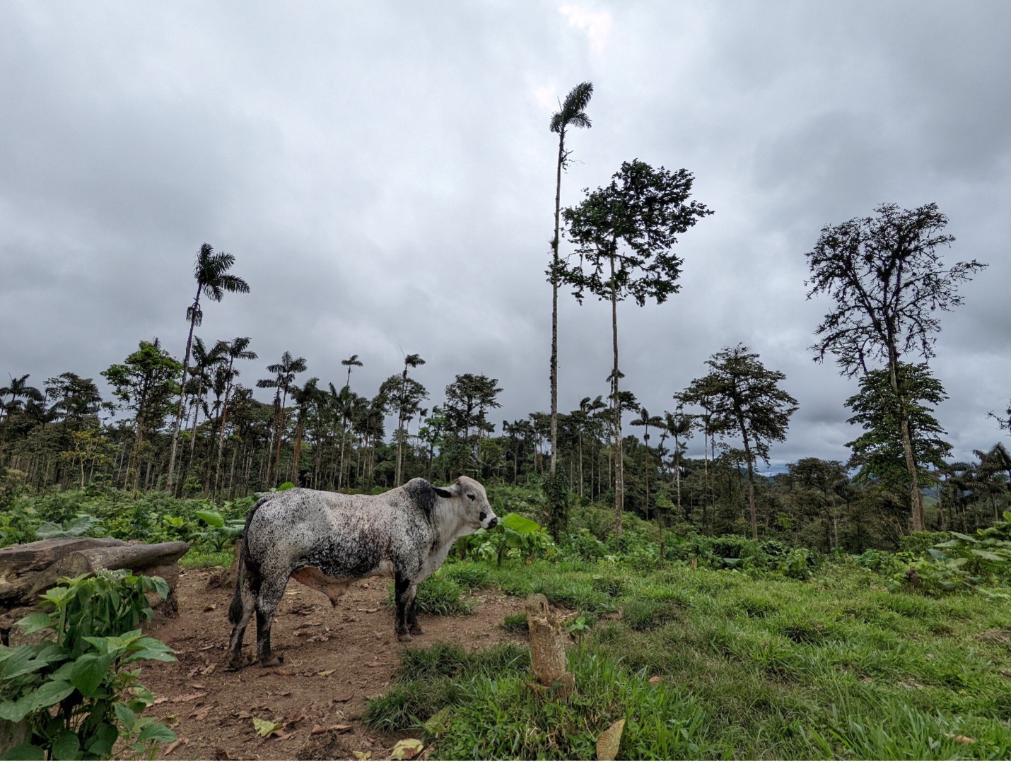
    A soon-to-be-evicted bull standing amidst remnant trees and tree stumps in a recently deforested pasture in the FCAT Reserve. This area is naturally regenerating quickly. Photo: JL Reid.

    The Choconexión Experiment

    In 2021, FCAT invited me to help develop a restoration strategy to meet this need. We formed a collaborative local and international team of scientists and conservationists to recommend restoration strategies for about 80 hectares (~200 acres) of degraded agricultural land. For roughly two thirds of the land (the less-degraded part), we recommended a natural regeneration approach; cattle were removed and the area was allowed to regenerate without further intervention. On the remaining and more degraded area, we developed an experimental restoration study to identify a cost-effective strategy for FCAT to apply on other degraded lands. In doing so, we also took the opportunity to test a basic theory about how ecological communities assemble themselves.

    Patches of pasture cleared with weedwhackers and glyphosate to prepare them for tree planting at the FCAT Reserve. Tree planting positions are marked with bamboo stakes. Photo: JL Reid.

    For our restoration experiment, we chose a technique called applied nucleation, which mimics the patchy spatial patterning of natural forest regeneration. Applied nucleation is intermediate between natural regeneration and more extensive native tree plantations. I studied this method for my PhD research in southern Costa Rica, where over more than 20 years we have found that applied nucleation produced more biodiverse secondary forest more consistently than natural regeneration, and it produced nearly equivalent biodiversity recovery compared to more extensive tree plantations for about 1/3-1/4 the cost. At FCAT, we sought to test applied nucleation in the Chocoan context and to optimize some of the tree planting parameters – including how many species to plant, which particular species to plant, and how widely to space the tree planting patches.

    Choconexión Project experimental design. Each plot is 125×125 m (1.65 hectares, ~4 acres). The aerial imagery was produced with a drone in April 2023. It shows (in negative) the tree planting patches, or islands, cleared within the degraded pasture.

    In 2022-2023, FCAT installed the experiment by clearing pasture grasses and planting more than 3,000 native tree seedlings into 116 15×15-m plots (roughly 50×50 feet). Native trees were all of which were harvested as seed from mother trees in the surrounding landscape and propagated in hand-made nurseries at the FCAT field station. In half of the plots, we planted 19 tree species, and in the other half we planted four species to test the influence of tree diversity on forest recovery. Tree planting plots were separated from one another by either 10, 20, or 30 m to test the optimal spacing. We assumed that planted trees would be able to extend their branches to fill a 10-m gap within a few years, but that it would take many years for them to fill a 30-m gap.

    Experimental treatments and planted species in the Choconexión Project. In each of the large treatment plots, only one type of tree planting composition is used.

    Finally, in half of the plots we planted three fast-growing pioneer tree species that we knew would produce a lot of fruit, and in the other half of the plots we planted fast-growing trees that would not produce much fruit, either because they were wind-dispersed or because their fruits were not appealing to most animals. We built this test into the experiment because the vast majority of plants in western Ecuador have seeds that are dispersed by animals. We thought that if we planted trees that quickly produce many fruits, these trees would attract fruit-seeking animals that would visit the sites more often and deposit plant seeds from the surrounding rain forest. If we are right and that effect is strong enough, it might be possible to plant fewer trees or a lower diversity of trees and have animals compensate by planting more trees (and other plants) for us. This would save FCAT money and allow us to reforest larger areas or put more funds into land acquisition and other mission-driven activities.

    Yellow-throated Toucan (Ramphastos ambiguus) in a Cecropia tree in lowland Costa Rica. Cecropias produce protein-rich fruits (right) that hang pendulously from beneath its large leaves and are available to fruit-eating animals of all sizes. We hypothesize that restoration plots planted with Cecropias, figs, and rubber trees will recover biodiversity and carbon faster than plots planted with other species that produce less desirable fruits. Photo: JL Reid.

    By creating differences in early successional fruit availability, this experiment also represents a basic test of how the first trees to establish in a rain forest influence the types of trees that establish later. In other words, it is a test of priority effects in rainforest reassembly.

    There are four high-level processes that determine which species will gain membership in a local ecological community. These are dispersal, selection, drift, and speciation. In many parts of the world, environmental selection imposes strict limits on which species can live in a given place. For example, there is no woody plant that can tolerate the combination of freezing temperatures and inundation in salty water. Thus, mangroves exist only in the tropical and subtropical latitudes and herbaceous salt marsh plants occupy similar environments closer to the poles.

    Mark Vellend’s Theory of Ecological Communities posits that environmental selection, ecological drift, dispersal, and speciation are the four high-level processes that determine which species will gain membership in local ecological communities.

    It is possible to make very good predictions about the kinds of plants that will form a local community if you know: (A) the traits of the plants in the community, (B) the relationship between those traits and a set of important environmental variables, and (C) the values or ranges of the important environmental variables at a local site. However, these models work best in places with relatively harsh environments, such as boreal wetlands and arid mountain ranges. Predicting rainforest community assembly is harder because the abiotic environment is more benign (generally warm and wet), and as a result, the particular species that arrive and survive may be more strongly determined by biotic gradients – potentially including fruit availability.

    A tree planted island in the Choconexión Project in June 2024. After two years of growth, some of the balsa (Ochroma pyramidale) were already 21 cm (8.2 inches) in diameter. A young fig and cecropia are visible in the bottom left; these two species are expected to begin fruiting soon. This plot backs up to a living fence composed mostly of Erythrina berteroana; these and other pre-existing trees have been mapped throughout the experiment. In this part of the experiment, tree planting patches are separated by 10 m (32.8 feet); the tops of the balsas in the adjacent patch are visible at right. Photo: JL Reid.

    As of October 2025, the Choconexión Project has been planted for 2-3 years (it was planted in two rounds in 2022 and 2023). Most species survived well (82% overall, range ~40-95%) and those that did not survive are being replanted. Some of the balsa are more than 10 m (32 feet) high after two years of growth, and a fig species (Ficus tonduzii) has begun to produce fruit. This year we will develop tree phenology and fruit availability protocols to characterize the effects that experimental treatments are having on the biotic environment.

    A growing number of collaborators and students are monitoring a wide range of ecological variables within the experiment. Last year, an expert botanist, Milton Tirado, established a baseline of the initial woody plant community at 192 points throughout the experiment. Others have also described gradients in soil quality, identified and tagged remnant trees, produced LiDAR data from a flyover at the start of the experiment, and generated annual orthomosaics with a drone. Monitoring is underway for birds, frogs, and other wildlife. Studies have also begun to measure secondary seed dispersal and recovery of the plant-frugivore network. In addition, the experimental landscape is being used for several other projects, including studies of caterpillar predation risk, volatile organic compound composition, and bat disease ecology, among others.

    An air sample collector built by Gabrielle Isaacman-VanWertz to collect samples for volatile organic compound (VOC) analysis. This summer two Tulane undergraduates conducted a pilot study to determine how well common VOCs like ethylene predict the abundance of ripe fruit and over what spatial scale. If effective, such detectors could be used to systematically monitor ripe fruit abundance across the experiment. Photo: JL Reid.

    In the next few years, we plan to replicate this experiment in additional sites and to develop protocols to measure plant and animal functional traits, abiotic environmental gradients, and seed rain. These will allow us to rigorously test how much more information about rain forest reassembly can be gained when dispersal-mediated priority effects are considered in addition to environmental filters.

    More importantly, the results of this experiment will provide pragmatic and timely information to FCAT and others working to preserve the Ecuadorian Chocó. By refining and optimizing applied nucleation designs for this unique landscape, we will make limited conservation funding go farther to restore trophic and landscape connectivity in the fragmented Mache Chindul Ecological Reserve.

    A mixed-use landscape in the Mache Chindul Ecological Reserve, where FCAT seeks to re-establish ecological connectivity with a RAMSAR wetland, the Laguna de Cube. Photo: JL Reid.

    The Choconexión Project is a collaborative effort that involves too many partners to fully enumerate. The experiment was co-designed by Zak Zahawi, Jordan Karubian, Luis Carrasco, and Carlos Aulestia, with support from many others. Carlos led the reforestation with a team of FCATeros. The restoration was funded by the US Fish and Wildlife Service to provide overwintering habitat for Neotropical migratory songbirds. Subsequent ecological monitoring is funded by the US National Science Foundation (DEB 2339839). Some of the graduate students who have worked on the experiment include Nicole Lussier (birds and bird-plant networks), Sebastián Aparicio Vera (tree seedling performance), Holden Jones (frogs), Phoebe Reuben (bats and their diseases), and Mareli Sanchez (soil). All of the scientific work performed within the Choconexión Experiment has been permitted by MAATE.

    To learn more:
  • Accurately estimating restoration efficacy across large landscapes and timeframes

    Accurately estimating restoration efficacy across large landscapes and timeframes

    By: Dr. Allison Simler-Williamson

    Note from the editors: This month marks ten years since we started Natural History of Ecological Restoration! During the last decade, we’ve posted 127 times on a wide variety of ecological restoration stories from around the world. At the same time, our global readership has grown from 4,000 viewers in our first full year to more than 14,000 viewers in each of the last five years, with readers coming from 150 countries. At their best, NHER stories illuminate ecological restoration’s natural history, taken in the most inclusive sense to mean stories about the people, places, organisms, institutions, and interactions involved in ecological restoration projects.

    This month’s post by Allison Simler-Williamson (Boise State University) exemplifies this standard. In her post, Dr. Simler-Williamson describes how environmental conditions, land manager decisions, and restoration outcomes interact in complex and confusing ways – and she charts a path forward for better understanding the real-world impacts generated by restoration projects.

    A “randomized” experiment can be a beautiful and powerful tool in restoration ecology. Randomization ensures that an experimental treatment (such as a restoration action) is unrelated to any other environmental factors that might influence the outcome we are measuring (such as plant establishment). When we confidently compare plots that received an herbicide or planting treatment to adjacent “reference” sites, our estimation of restoration effectiveness hinges on this assumption of randomization.

    But, despite their elegance, randomized experiments are labor-intensive and often spatially or temporally constrained, limiting how applicable they may be to new areas or in atypical years. Thus, randomized experiments are increasingly mismatched with widespread ecological degradation and growing needs for restoration. Emerging “big data”, such as the US Geological Survey’s Land Treatment Digital Library, which contains information about more than 65,000 restoration treatments that have occurred on Bureau of Land Management land in the western United States, could help tackle the problem of understanding restoration efficacy across wide spatial and temporal scales.

    When we pivot to using these “observational” datasets, which are opportunistically collected, we incur an important tradeoff. We gain generalizability but lose the power of randomization because (and this likely is not a surprise to anyone working in restoration!) real-world management treatments are almost never applied randomly across large landscapes. Restoration occurs in certain parts of landscapes more than others, due to a mix of ecological need, bureaucratic constraints, and stakeholder decision-making processes.

    Why is this lack of randomization a problem when we want to leverage these kinds of large datasets? In statistics courses, I like to use some of my son’s favorite bathtime toys as an analogy for what can occur. When you pour water into these colorful pipes, the wheels spin, and my son loves to create networks between them. If the pipes are arranged as below (Figure 1A) with water flowing through them, it would be immediately obvious that there is no direct relationship between the wheels “X” and “Y” – they are simply both being spun by the water flowing out of “Z”. However, if I were to obscure the connections between the pipes (Figure 1B) and instead ask you, “Based on your observations, is there a relationship between X and Y?”, you could detect a correlation. Depending on your understanding of the system, you might assume that this link is a direct cause of X on Y, or vice versa.

    Figure 1. Confounding variables (Z) jointly impact a predictor variable (X) and our response (Y), biasing our understanding of the relationship between X and Y.

    This phenomenon is an example of statistical “confounding,” in which a background driver can bias our understanding of the relationship between two other variables. This potential for confounding is a big concern if we would like to estimate the efficacy of restoration treatments that were applied in non-random places or times because it can falsely inflate or shrink apparent effects in our analyses. For instance, if restoration actions (X) are disproportionately applied in dry areas (Figure 2a), and drought stress simultaneously reduces plant establishment (Y) (Figure 2b), the correlations between variables can cause a treatment effect to shrink (even if the treatment works!), if we ignore this lack of randomization in treatment applications.

    Figure 2. Non-random application of restoration treatments in real-world settings, due to ecological, social, and institutional processes, can bias estimation of treatment effectiveness.

    In a 2022 study (Simler-Williamson and Germino 2022), we explored how the ‘non-random’ application of restoration seedings of big sagebrush (Artemisia tridentata) influenced our estimation of treatment effectiveness, using observations of post-fire seedings across the western U.S. in the Land Treatment Digital Library.

    When we used statistical models that assumed these restoration treatments were applied randomly, we found a somewhat counterintuitive result: a negative relationship between sagebrush seeding and sagebrush recovery. However, this statistical illusion emerged because of background relationships in our dataset: restoration seedings (Figure 2; X) tended to occur in hotter, drier, and more degraded places (Z), where plant establishment was already more difficult (Y). In short, restoration actions were disproportionately applied in more “dire” ecological settings, creating the illusion of failure.

    Next, we compared this approach to two sets of statistical methods designed to minimize the effects of confounders (“Z”) on our treatment effect. The first set of approaches required that we include pre-existing data about the hypothesized confounding variables directly into our model. When we accounted for some of these measured drivers of “non-random” seeding application using existing data about soil types, climate conditions, and fire impacts, restoration efficacy shifted from a negative number toward a neutral effect.

    Finally, the last set of approaches instead used repeated observations of sagebrush stands to ‘control for’ confounding variables, by accounting for pre-existing differences between treated and untreated stands before they had been seeded, rather than requiring the direct inclusion of measured variables. Only when measured and many unmeasured differences between treated and untreated sites were accounted for in our analysis, we revealed a positive impact (of ~4-6% in sagebrush cover by 10 years post-fire) of restoration seedings in degraded sagebrush ecosystems.

    The pattern we described in that paper underscores two key needs in restoration science: one social and one statistical. These results suggest that we urgently need better information about the socio-economic drivers determining where and when we apply restoration treatments, which are poorly described. The analyses that incorporated some common ecological drivers of restoration need (e.g., fire impacts, climate variables) only accounted for some of the bias in the effects of restoration seeding. The strong shift to positive impacts of restoration after “unmeasured” sources of bias were considered suggests that there are significant additional unmeasured processes that simultaneously shape where we attempt to restore and where plant populations recover. In the focal sagebrush steppe ecosystems, these may include diverse drivers such as seed availability, bureaucratic constraints, aesthetic considerations, cultural values, land use, and grazing management. Collecting and understanding these variables seems essential to advancing our understanding of restoration effectiveness broadly.

    But no matter how elegant randomized experiments are as a concept, they may not be able to generate estimates of restoration effectiveness at the broad spatial and temporal scales we require to manage rapidly changing ecosystems. As a community, I think we need to be integrating big, opportunistically collected datasets with statistical approaches that recognize the “messiness” of these data and aim to minimize the risk of confounding in treatment effects. Well-estimated treatment effects can improve how we connect restoration resources (such as seeds, time, and funding) with the locations where the ecological benefits may be greatest, both in space and time.

    For more information about Dr. Simler-Williamson’s work, see her lab website or her 2022 paper in Nature Communications.

  • Looking Back to Guide the Future: Evaluating 23 Years of Management History in Big Meadows, Shenandoah National Park

    Looking Back to Guide the Future: Evaluating 23 Years of Management History in Big Meadows, Shenandoah National Park

    By Jordan T. Coscia

    Jordan is a PhD candidate in the Restoration Ecology Lab at Virginia Tech and a Research Fellow with the Smithsonian’s Virginia Working Landscapes program whose research focuses on the characterization and restoration of Virginia’s native grasslands.

    An open landscape of grasses, forbs, and low shrubs meets the edge of a forest in the background. Three trees are in the foreground to the right, and forested mountaintops are visible in the distance.
    The western section of Big Meadows, Shenandoah National Park in June 2022. Photo by Wendy Cass.

    Located at the heart of Shenandoah National Park, the Big Meadows landscape is a site of both natural and cultural history. The 134-acre meadow is the largest open area in the Park, and it is a popular visitor destination boasting numerous walking trails and proximity to campgrounds, picnic grounds, and one of the park’s two visitor centers. Ecologically, the Big Meadows landscape includes two globally critically rare Blue Ridge Mafic Fen plant communities, and hosts plant and animal diversity not found elsewhere in Shenandoah National Park.

    Like other meadows and grasslands across the Southeastern United States, Big Meadows occurs in a climate that can support closed-canopy forests. Therefore, the open landscape and the species that rely on it only persist due to a combination of edaphic characteristics, such as shallow and poorly drained soils, and frequent disturbance, such as fires or the grazing of herbivores, that prevent the growth of woody trees and shrubs. In the post-colonial absence of large herbivores and the suppression of both cultural burning and wildfires, the open landscape of Big Meadows was maintained by livestock grazing before the establishment of Shenandoah National Park in 1935. Continuous efforts have been made to preserve the historic open landscape since the Park’s founding, including routine mowing, prescribed burns, and the targeted cutting and herbicide treatment of encroaching Robinia pseudoacacia (black locust) saplings and Rubus (blackberry) canes. While initially successful, management efforts appear to have become less effective over time, and the spread of woody and invasive species threatens the open landscape of Big Meadows.

    Close-up of a sedge with a terminal, brown, staminate spike and two lower, pistillate spikes of green, oblong perigynia sporting “racing stripes” formed by impressed nerves.
    A rare sedge, Carex conoidea, in Big Meadows. Common names for this species include the prosaic “field sedge” (Flora of Virginia) and the romantic “ancient prairie sedge” (Southeastern Flora). Photo by Leighton Reid.

    Since 1998, botanist Wendy Cass and The Inventory and Monitoring program at Shenandoah National Park have recorded land management actions and collected plant community composition data in Big Meadows. Big Meadows was split into three major management zones, and all three zones were treated with prescribed fire each spring between 2000 and 2003. In 2004, a new management schedule was created with the goal of maintaining a three-year burn-mow-fallow cycle in each zone. To determine how these management changes impacted Big Meadows, Leighton Reid (Virginia Tech), Wendy Cass, and I assessed changes in the plant community composition from 2000 to 2023 using multivariate statistics and the creation of statistical models through regression analysis.

    Five people huddle around a field tape marking a vegetation transect through a grassland with white clouds and blue sky in the background.
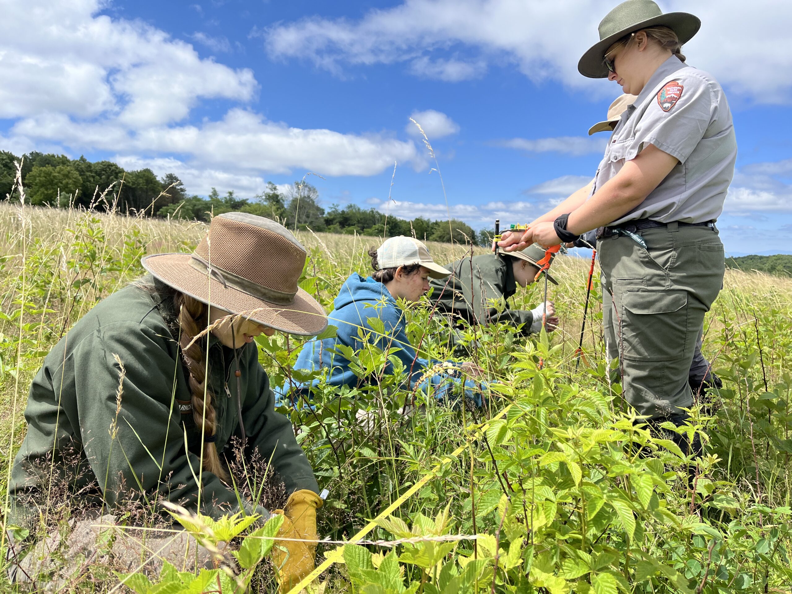
    Jordan Coscia (second from left) and Inventory and Monitoring NPS staff measuring plant community composition in Big Meadows in June 2024. Photo by Wendy Cass.

    We found that the plant community composition of Big Meadows shifted over the past 23 years, with the original mosaic of shrubs within a grass and herb-dominated community experiencing marked increases in low shrubs, young trees, and other woody plants. Though the average percentage of graminoids (grasses, rushes, and sedges) encountered along each survey transect experienced little overall change between 2000 and 2023, the average percentage of forbs (non-woody herbs that are not graminoids) encountered decreased by over 50%, while the average percentage of woody plants encountered increased by 200%-400%. This increase in woody plants was partially driven by native Rubus (blackberry) species, which increased from less than 1% of the plants encountered along each transect in 2000 to 15-20% of the plants encountered along each transect by 2023. Multivariate statistics revealed that the trajectory of change in the Big Meadows plant community shifted abruptly after the three-year burn-mow-fallow cycle was adopted in 2004. The direction of this shift was correlated with an increase in the time interval between prescribed burns.

    An open landscape of green vines interspersed with brown, leafless stems. The sky is cloudy and Big Meadows stretches into the distance, terminating in a line of trees.
    Woody encroachment near the northern edge of Big Meadows. Bare stems represent Robinia pseudoacacia (black locust) top-killed by prescribed fire. Emerging beneath them is a green carpet of invasive bittersweet (Celastrus orbiculatus). Photo by Leighton Reid.

    Our statistical models provided evidence that both climate and changes in the timing of land management actions have impacted the plant community in Big Meadows. There was moderate evidence that later springs (as indicated by the date of the last spring freeze) are correlated with desired increases in forbs, however, this positive effect may be lost as climate change brings milder winters with fewer frost days to Shenandoah National Park. There was strong evidence that longer intervals between prescribed fires are correlated with unwanted increases in woody plants and decreases in forbs and moderate evidence that longer intervals between mowings are correlated with unwanted increases in Robinia (black locust) and decreases in forbs. Together, this evidence indicates that these unwanted changes may be mitigated by increasing the frequency of prescribed burns and mowing in the future.

    Overall, our analysis revealed that the changes in land management between 2000 and 2023 have negatively impacted the plant community composition in Big Meadows. Together, the shifts in community trajectory after 2004 and the evidence from our statistical models suggest that the change from annual burning to a three-year burn-mow-fallow cycle in 2004 has contributed to the declining landscape conditions in Big Meadows. Though ad-hoc changes to the three-year management cycle and gaps in the plant data make it difficult to determine an ideal burn or mow interval from the existing data, evidence from the past 23 years suggests that more frequent burning and mowing may aid the preservation of the Big Meadows landscape for future park visitors and wildlife alike.

    An open landscape with patches of dark green trees in the left foreground and the right background, surrounded by a low, shrubby wetland. The sky is pale blue with a few wispy clouds above a forested hill that rises on the right hand side.
    A line of gray dogwoods (Cornus racemosa) accentuates a shorter canopy of narrowleaf meadowsweet (Spiraea alba) shrubs in the wet, central portion of Big Meadows. Photo by Leighton Reid.
  • Natural history is essential for reviving North America’s Southeastern Grasslands 

    Natural history is essential for reviving North America’s Southeastern Grasslands 

    Eve Allen, serving as the Program Director for the Northeast Bioregion at the Ecological Health Network, recounts her visit to the Southern Grassland Biome and highlights the pioneering efforts of the Southeastern Grassland Institute to conserve and restore endangered grassland ecosystems in the U.S. Southeast. 

    In the United States Southeast, the knowledge and practice of natural history are essential for conserving and restoring imperiled grassland ecosystems. In 2021, I met with Dwayne Estes, the Co-Founder and Executive Director of the Southeastern Grasslands Institute. Together, we toured remnant and restored grasslands in Tennessee and Kentucky, which provided the backdrop for learning about the near erasure of the expansive grasslands that once covered the region and the work required to remember and restore these biologically and culturally significant ecosystems. 

    The Southern Grassland Biome

    Spanning twenty-four states, the Southeastern region of the United States encompasses biogeographical, climatic, and geological diversity that gives rise to a wide array of ecosystems. The area includes low-lying coastal plains extending from the Atlantic Ocean to the Gulf of Mexico. As one travels inland and northward, the topography transitions into rolling hills known as the Piedmont Plateau and then rises to the rugged Appalachian Mountains. A few generations ago, the region had abundant prairies, savannas, woodlands, meadows, bogs, fens, and sparsely vegetated communities like barrens and glades. Researchers estimate that before European settlement, grasslands covered at least 40–49 million hectares (ha) (100–120 million acres) in the Southeast region [1]. Today, those grassland ecosystems have declined by more than 90 percent and, in some areas, have undergone almost complete eradication. This is because grasslands have been easy targets for land cover conversion because of the ease with which people can transform them into agricultural fields, rangelands, or suburban developments. Woody encroachment, species invasion, and altered fire and grazing regimes have also contributed to the degradation of the Southeast’s grasslands. Needless to say, the species-rich ‘grassy communities’ have suffered a major loss of species and genetic diversity. 

    Southeastern Grassland Institute’s 24-state focal region. Areas in yellowish-brown above show regions of the Southeast that historically supported large areas of grasslands and associated open, grassy woodlands. Image courtesy of SGI. 

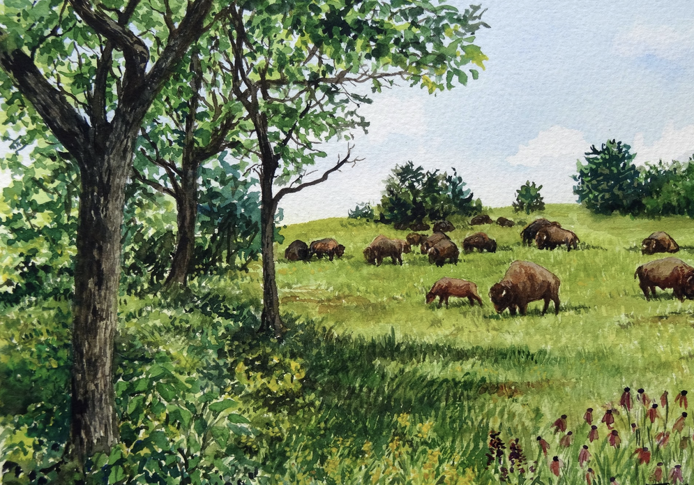
    Painting of Calcareous Oak Savanna and Meadow in the Nashville Basin, This lost and largely forgotten landscape not seen since ca. 1790. Image courtesy of SGI, Painting attributed to Flavia F. Baretto.

    However, the slivers of remaining remnant grassland ecosystems contain more species diversity than the Midwest and Great Plains combined. In 2012, E.O. Wilson characterized the region as the “Southern Grassland Biome,” which he described as “probably the richest terrestrial biome in all of North America” [2]. The Natural History of Ecological Restoration editorial team was unsure about the accuracy of Wilson’s statement. I followed up with Dwayne, who also connected us with Reed Noss, SGI’s Chief Science Advisor. They both explained that although the California Floristic Province is widely acknowledged as the most biodiverse temperate region in North America, the area includes a broad spectrum of ecosystems, including coastal rainforests and coniferous forests to grasslands, scrublands, and deserts. Therefore, it is not an apples-to-apples comparison. The Southern Grassland Biomes encompasses various grassland ecosystem types like prairies, savannas, and meadows. If one were to examine solely the plant diversity and endemism associated with the grassy ecosystems in the California Floristic Province and the Southern Grassland Biome, it’s highly probable that the latter would surpass California in terms of species richness and endemism. However, both Dwayne and Reed explained this is still just a hypothesis because, to their knowledge, no published paper has compared grassland-associated species between the two regions. 

    In 2015, the low-lying portion of the Southern Grassland Biome, the North American Coastal Plain (NACP), extending from the Gulf of Mexico to the Atlantic Ocean, was designated as the world’s 36th biodiversity hotspot [3]. To qualify as a global biodiversity hotspot, an area must have more than 1,500 endemic vascular plants and greater than 70 percent habitat loss [4]. The NACP, covering 1.13 million ​km2, contains at least 6,200 plant species, twenty-nine percent (1816) of which are endemic [5]. Nevertheless, Dwayne, Reed, and their colleagues consistently discover and record new species every year. 

    Atlantic Coastal Plain Hydric Savanna with Pitcher Plants (Sarracenia flava), Francis Marion National Forest, Berkeley County, North Carolina, Courtesy of SGI. Photo credit: Alan Cressler.

    Savanna-like landscape and the Couchville Glades and Barrens State Natural Area, Davidson Co., TN. Drone credit: Eve Allen. 

    Grasslands, encompassing forty percent of Earth’s terrestrial ecosystems, exist in all climatic zones except the polar regions, hyper-arid deserts, and the highest mountain peaks [6]. According to Petermann and Buzhdygan (2022), grasslands provide habitat for an extraordinary number of plants, birds, insects, and other animals, and especially in temperate regions, may have higher species diversity levels than some tropical rainforests at meter-squared scale [7]. From an ecosystem services perspective, grasslands supply freshwater, control soil erosion, sequester and store carbon, provision forage, support pollinator health, and provide recreational and aesthetic value to human communities [8]. The well-being of billions of people worldwide is intricately connected to the health of grassland ecosystems. Yet, grasslands are among the most endangered ecosystems on Earth. As mentioned before, grasslands are low-hanging fruit for land cover conversion and also face numerous escalating contemporaneous threats, including wildly misguided afforestation schemes [9].

    Charting a course for 21st-century conservation and restoration 

    Dwayne Estes, affectionately called the “Prairie Preacher,” is the Executive Director of the non-profit organization, the Southeastern Grasslands Institute (SGI), headquartered at Austin Peay State University in Clarksville, Tennessee. That’s a nickname he received for “spreading the gospel of grasslands” by giving over sixty-seven presentations across twenty states in one year [10]. The work of SGI focuses on the conservation, restoration, and management of native grassland ecosystems through science-based partnerships and community engagement. SGI occupies a leadership position by facilitating public, private, and non-profit collaboration to generate innovative solutions to halt and repair grassland loss. However, the organization is also building a social movement to bring back the native grasslands of the Southeast by giving them a seat at the conservation table. The lion’s share of conservation funding in the Southeast goes into protecting forests, wetlands, rivers, and the various coastal ecosystems. Traditionally, conservation dollars have been extremely scarce to protect the South’s endangered grassland ecosystems. SGI is changing that by attracting significant new funding support from philanthropic, corporate, and government sources. Dwayne explained, “Putting grasslands on the radar of conservationists has required waking people up from a collective amnesia by dispelling long-held ecological myths.”

    Dwayne Estes, Executive Director of the Southeastern Grasslands Institute (SGI). Photo credit: Thomas DePauw.

    Ecological forensics 

    I learned how much of the work to conserve and restore grasslands requires employing what Dwayne called ecological forensics since most of the Southeast’s grasslands vanished by the mid-1800s before the camera was invented. Many people, including botanists and ecologists, have long believed the Southeast was always forested. However, the dense forests that cover the region today are artifacts of fire suppression and abandoned agricultural fields. Reed Noss, SGI’s Chief Science Advisor, whom I introduced previously, is a pioneering conservation biologist and activist and one of the Southeast’s premier ecological detectives. In 2012, he published Forgotten Grasslands of the South, which helped to uproot many deeply entrenched ecological myths, including the “Myth of the Squirrel.” Legend has it that the North American continent was once densely forested, to the extent that a squirrel could traverse from the Atlantic Ocean to the Mississippi River without ever setting foot on the ground. Because the forests were so thick and continuous, the squirrel could simply hop from tree to tree, branch to branch, without needing to touch the forest floor. Nonetheless, this narrative is significantly flawed when we consider that certain researchers estimate that before European settlement, woodlands and savannas spanned more than 100 million hectares (250 million acres) throughout the eastern United States. [11]. Reed Noss’ influential work has encouraged the organization’s creation and inspired innumerable other organizations as well.

    Blackland Prairie in southern Arkansas. Typical blackland prairie plants include little bluestem (Schizachyrium scoparium), Indian grass (Sorghastrum nutans), compass-plant (Silphium laciniatum), and purple prairie-clover (Dalea purpurea). Image courtesy SGI, Photo credit: Eric Hunt.

    The Blackland Prairie in southern Arkansas supports Arkansas’ state butterfly, the Diana fritillary (Speyeria diana), male left and female center, and grassland birds like the Bachman’s Sparrow (Aimophila aestivalis). Photos courtesy of the Arkansas Natural Heritage Commission.

    On the second afternoon of my visit, I was following behind Dwayne’s pickup truck when he pulled over and parked on the side of a back country road close to the border between Tennessee and Kentucky. Dwayne jumped out of his truck and pointed to a large chinquapin oak tree (Quercus muehlenbergii) with evenly splayed-out branches. He then announced, “This tree is a storyteller species.” He explained how the tree provided a clue about what the landscape looked like 200 years ago, “If this agricultural field was once a dense forest, this tree’s form would be upright instead of beautifully open and spread out.”

    Dwayne shared another story illustrating how researchers have gathered evidence to help reassemble information about lost grassland ecosystems. In the 1990s, the southern pine beetle (Dendroctonus frontalis) was ravaging shortleaf pine trees (Pinus echinata) across the forests of the South. The Tennessee Wildlife Resources Agency (TWRA), a state agency with the mission of managing the state’s fish and wildlife and their habitats, decided to conduct a salvage timber operation on the state-owned Catoosa Wildlife Management Area, part of the Cumberland Plateau, near Crossville, Tennessee. In 1999, the TWRA foresters and biologists started to selectively thin out shortleaf pine trees while leaving behind trees like white oak (Quercus alba) and post oak (Quercus stellata). The salvage operation continued for the next two and a half years, ultimately leading to the unintended formation of a sprawling savanna spanning nearly 2,000 acres. Clarence Coffey, a forester employed by the TWRA, was captivated by the early history of the Cumberland Plateau. His research revealed that savannas and meadows were prevalent across the plateau before the American Civil War. In the early 2000s, the adoption of prescribed fire in the Southeast was on the rise. Coffey, who Dwayne described as the “Savanna Preacher,” spearheaded an initiative to reintroduce controlled burns to the Catoosa Wildlife Management Area. What unfolded next left foresters and biologists astonished and ignited a rivalry among them. Grassland plants such as big bluestem (Andropogon gerardii), little bluestem (Schizachyrium scoparium), broomsedge (Andropogon virginicus), Indiangrass (Sorghastrum nutans), and various forbs and wildflowers erupted from the forest floor. The robust growth of these native warm-season grasses was such an unexpected outcome, that some land managers accused the biologists of coming in and planting those species at night. Dwayne looked at me and said, “We all know how crazy of an idea that is, considering that it is still challenging to buy the seeds of most of those species!” 

    In the subsequent years, the TWRA continued its controlled burns, attracting the attention of researchers who began to visit the site for biodiversity studies. One PhD student from the University of Tennessee, Andrew Vander Yacht, led control studies of the closed canopy forest floor before and after thinning and burning. In 2020, Vander Yacht and his colleagues published their results in the wonderfully titled paper Litter to glitter: promoting herbaceous groundcover & diversity in mid-southern USA oak forests using canopy disturbance & fire in the Journal of Fire Ecology. The researchers found “thin-and-burn treatments increased graminoid groundcover 14-fold, forb groundcover 50-fold, herbaceous richness 9-fold, and herbaceous diversity 10-fold, relative to unmanaged stands.” Altogether, the plots subjected to thinning and burning yielded documentation of an additional 240 herbaceous species. Dwayne emphasized to me that the resurgence was not limited to just common weed species but also included rare and conservation-worthy plants, such as the white fringeless orchid (Platanthera integrilabia), which sprouted from the in situ soil-borne seed bank and rootstock bank. Moreover, it wasn’t solely about plants; biologists also witnessed the return of long-unseen insects and animals in the area, including grassland savanna birds and bats, the frosted elfin butterfly (Callophrys irus), and the golden mouse (Ochrotomys nuttalli). The thinning and controlled burns unintentionally kick-started the restoration of ecosystem structure, composition, and function. Despite these remarkable outcomes, Dwayne pointed out that many in the conservation community fail to fully recognize this as one of the most exceptional examples of savanna restoration in the Southeast.

    Influence of oak woodland and savanna restoration on groundcover at Catoosa Wildlife Management Area near Crossville, Tennessee, USA. Panel A depicts pre-treatment conditions in 2008, and panel B depicts the response by 2016 after thinning to 7 m2 ha−1 residual basal area and burning in October three years (2011, 2013, and 2015). Caption and photo courtesy of Andrew Vander Yacht. 

    To Dwayne, this story also communicates the potential of the in situ soil-borne seed and rootstock bank to aid in conserving and restoring the region’s savanna grasslands and open grassy woodlands. However, activating this potential would require reintroducing controlled fire and selective canopy thinning to the landscape, necessitating cooperation from land managers, some of whom have traditionally resisted such measures. It’s no accident that SGI’s tagline is “25 years will be too late,” which the organization has used to invoke a sense of utmost urgency. Knowledgeable botanists and restoration ecologists estimate that the incredible biodiversity of grassland species laying dormant in the seed- and rootstock bank under artificially dense forests has a shelf life that is running out of time to recover. They fear that the loss of these underground biodiversity reserves could spell one of the greatest hidden collapses in biodiversity of our era, and that most people are completely unaware.

    SGI and its collaborating partners dedicate a substantial portion of their efforts to identifying and safeguarding above-ground grassland remnants that face the immediate threat of extinction. Roadsides, powerlines, railroad corridors, and fencerows have provided grasslands a refuge from agricultural intensification and associated pesticide use, sprawling development, and the expansion of woody plants. The direct and indirect management of these land parcels, including periodic burns caused by sparks originating from power lines or train tracks or frequent mowing replicating the impacts of ruminant grazing, has enabled these remnants to persist. From these ecologically valuable scraps, including some of substantial size, SGI is confident they can reassemble historically informed reference ecosystems to restore a considerable portion of what has been lost.

    Developing a Bioregional Vision 

    Dwayne has the remarkable ability to relay in grim detail the consequences of extensive ecological loss while instilling optimism. We stood side by side in the Baker Prairie Natural Area in Russellville, Kentucky, a municipal park housing a 66-acre remnant prairie—one of few remaining traces of a once 220-mile-long crescent-shaped plain. “200 years of American Progress has almost totally erased this ecosystem,” Dwayne said. “We are only now starting to grasp how vast our grasslands used to be. However, what gives me hope is how hungry people are for this message of grassland restoration. What started as a local effort to restore a prairie for the kids in our community has now developed into a social movement involving thousands of people across a twenty-four state region.” To date, SGI has played a role in conserving and restoring hundreds of acres of grasslands. However, their vision encompasses expanding their impact to millions of acres across the Southeast Bioregion in the upcoming decades.

    66-acre remnant prairie at Baker Prairie Natural Area in Russellville, Kentucky. Drone credit: Eve Allen

    SGI’s first volunteer workday at Dunbar Cave State Park, TN, Image courtesy SGI, Photo credit: Amanda Blount.

    Southeastern Grasslands Initiative led an effort to restore a 15-acre hayfield to a tallgrass prairie, representative of what historically would have been there, at Dunbar Cave State Park in Clarksville, Tennessee. Volunteers are vital to the ongoing restoration and management activities at Dunbar Cave Grassland. Drone credit: Eve Allen 

    Earlier this year, I caught up with Dwayne to learn about the growth of SGI since my visit in 2021. I was pleased to hear that in 2023 alone, SGI has received major funding from several federal grants. The funding will help support mapping efforts across the 24-state region where they work, new grassland restoration projects on National Park Service land in the Eastern US, and the salaries of three Tribal Liaisons and ten to fifteen Interns. On this last point, Dwayne proudly shared, “We are particularly thrilled about securing funding for the recruitment of Tribal staff at SGI. The Tribal Liaisons are not only facilitating vital discussions with Southeastern Tribes concerning the cultural heritage of grasslands but also establishing Indigenous-led strike forces composed of professionals, volunteers, or experts mobilized to achieve specific objectives. These objectives encompass restoring areas affected by natural disasters, combating the proliferation of invasive species like common reed (Phragmites australis), kudzu (Pueraria montana), Japanese knotweed (Polygonum cuspidatum), and mile-a-minute weed (Persicaria perfoliata), and carrying out interventions like prescribed burns. These teams will provide invaluable support to communities, enabling them to engage in essential caretaking activities required to restore and maintain grasslands on Tribal lands in the Southeast.

    References 

    [1,2] Noss, Reed F. Forgotten grasslands of the South: Natural history and conservation. Island Press, 2012.

    [3] Noss, R.F., Platt, W.J., Sorrie, B.A., Weakley, A.S., Means, D.B., Costanza, J. and Peet, R.K., 2015. How global biodiversity hotspots may go unrecognized: lessons from the North American Coastal Plain. Diversity and Distributions, 21(2), pp.236-244.

    [4] Myers, N., Mittermeier, R.A., Mittermeier, C.G., Da Fonseca, G.A. and Kent, J., 2000. Biodiversity hotspots for conservation priorities. Nature, 403(6772), pp.853-858.

    [5] Same as #3 above. 

    [6,7] Petermann, J.S. and Buzhdygan, O.Y., 2021. Grassland biodiversity. Current Biology, 31(19), pp.R1195-R1201.

    [8] Buisson, E., Archibald, S., Fidelis, A. and Suding, K.N., 2022. Ancient grasslands guide ambitious goals in grassland restoration. Science, 377(6606), pp.594-598.

    [9] Temperton, V.M., Buchmann, N., Buisson, E., Durigan, G., Kazmierczak, Ł., Perring, M.P., de Sá Dechoum, M., Veldman, J.W. and Overbeck, G.E., 2019. Step back from the forest and step up to the Bonn Challenge: how a broad ecological perspective can promote successful landscape restoration. Restoration Ecology, 27(4), pp.705-719.

    [10] Segrasslands. (2022, October 6). Getting to Know Us: Dwayne Estes. Segrasslands Blog. https://www.segrasslands.org/blog/2022/10/6/getting-to-know-us-dwayne-estes (Accessed September 1, 2023).

    [11] Noss, R.F., Cartwright, J.M., Estes, D., Witsell, T., Elliott, K.G., Adams, D.S., Albrecht, M.A., Boyles, R., Comer, P.J., Doffitt, C. and Faber-Langendoen, D., 2021. Science needs of southeastern grassland species of conservation concern: A framework for species status assessments. Open-File Report, (2021-1047).

  • Developing an Expanded Soil Profile methodology for restoring social-ecological relations: A case study of Sunnivue Farm, a biodynamic farm in Southwestern Ontario

    By Katherine Lawless, an associate professor in the Centre for Global Studies at Huron University College in London, Ontario, Canada. Katherine is trained as a critical theorist in the humanities and social sciences. Over the past 5 years, she has been developing a new field of specialization in the environmental humanities focusing on the social dimensions of conservation, restoration and climate change adaptation. Below, she describes a pilot study in her collaborative research project on human-soil relations. klawles@uwo.ca

    In 2019, my research team (including soil scientists, social scientists, artists, and humanists) and I received an Exploration Grant from the Canadian New Frontiers in Research Fund to conduct field research in Yukon, Southern Alberta and Southwestern Ontario with communities who understand soil as a living system rather than an inert object or simple resource. We wanted to know what kinds of solutions to complex social-ecological problems might emerge by reframing soil as a relational medium, and a set of natural and cultural relations that participate in the adaptive development of living systems combining ecological and social dynamics. Here, we take our cue from media theorists (Parikka, 2015), human geographers (Kryzwoszynska and Marchesi, 2020), and Science and Technology Studies scholars (Puig de la Bellacasa, 2015) in thinking of soil as a medium that bridges nature and culture; an object that is shaped by human interaction rather than a given, natural thing; and a network of human and more-than-human actors embedded in a nested series of social and ecological networks (see also Greenhough, 2014). This approach recognizes both the biophysical agency of multiple species and the ways in which humans co-create worlds with their non-human counterparts, from flora and fauna to rocks and water. Naturally, we gravitated toward practitioners and knowledge holders with a close relationship to soil, including regenerative farmers, environmental conservationists, restoration practitioners, and Indigenous communities. This research was delayed by the COVID pandemic; so, we started close to home with a small and willing pilot site: Sunnivue Farm. In what follows, I present an overview of this ongoing study in the spirit of the Ecological Health Network and SER International principles and standards for the practice of ecological restoration (Gann et al., 2019), wherein the Restoration Continuum includes the restoration of agroecosystems. 

    Beginning in 2021, we used this pilot study to develop our transdisciplinary methodology: the Expanded Soil Profile (ESP). The idea was to begin with conventional soil profiles and soil analyses, and build out from there, incorporating layers of social and cultural history across scales and eras through interviews and archival research. We hoped this would allow us to form a clearer picture of the kind of place-based social and ecological dynamics at play in the health and wellbeing of human and non-human members of any self-organizing “multi-species soil care community”. To be clear, we define “soil care community” as a group of individuals with a shared practical and ethical commitment to the ongoing labour and attention required to maintain and repair soils in need of repair, and all those who depend on soils in a given landscape, region or place, so as to live as well as possible with a given subset of the land, water, biodiversity, and resources that comprise our world. The concept of a “multi-species soil care community” recognizes that more-than-human actors share with humans in the care work that has shaped and continues to shape this biophysical world (see Kimmerer 2016 for an example).

    Our overall goal is to better understand the connections among soil health, farm ecosystem health, and the perceived health and wellbeing of the local farming and non-farming community in each study area. More specifically, we aim to show how, in the context of internal and external social and economic pressures, local place-based knowledge can be paired with scientific analysis and historical-archival research to orient and guide efforts to restore and maintain sustainable and desirable relations among social actors and institutions in differing contexts.

    A group of people sitting around a table  Description automatically generated

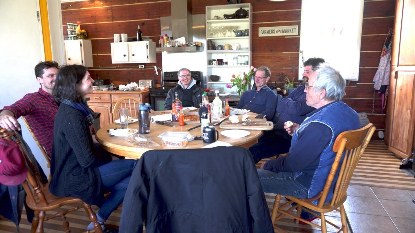
    The core members of the research team and two research participants discussing the project over lunch, Sunnivue Farmhouse, 2021. From left to right: Katherine Lawless (PI), David Janzen (co-PI), Henry Janzen (soil scientist collaborator), Ed Gregorich (soil scientist collaborator), Michael Courey (incoming farmer/research participant), and Alex Nurnberg (retiring farmer/research participant). Photo: Michelle Wilson.

    Sunnivue Farm is a 180-acre biodynamic farm about 22 mi from London, Ontario in the heart of the Carolinian forest, which boasts some of the highest biodiversity in Canada including rare and at risk species. Much of this biodiversity is threatened by urban expansion and agricultural intensification. According to a report issued by the Ecosystem Status and Trends Report (ESTR) Secretariat, “as of 2009, there were 865 species of conservation concern in the [Lake Erie Lowlands] ecozone,” including all 12 reptile and amphibian species, 7 of 8 native turtle species, and 11 of 17 snake species (ESTR Secretariat, 2016, p. 16). And, as the founders of Sunnivue Farm noted in our very first interview, bumblebees are on the decline (ESTR Secretariat, 2016, p. 16). 

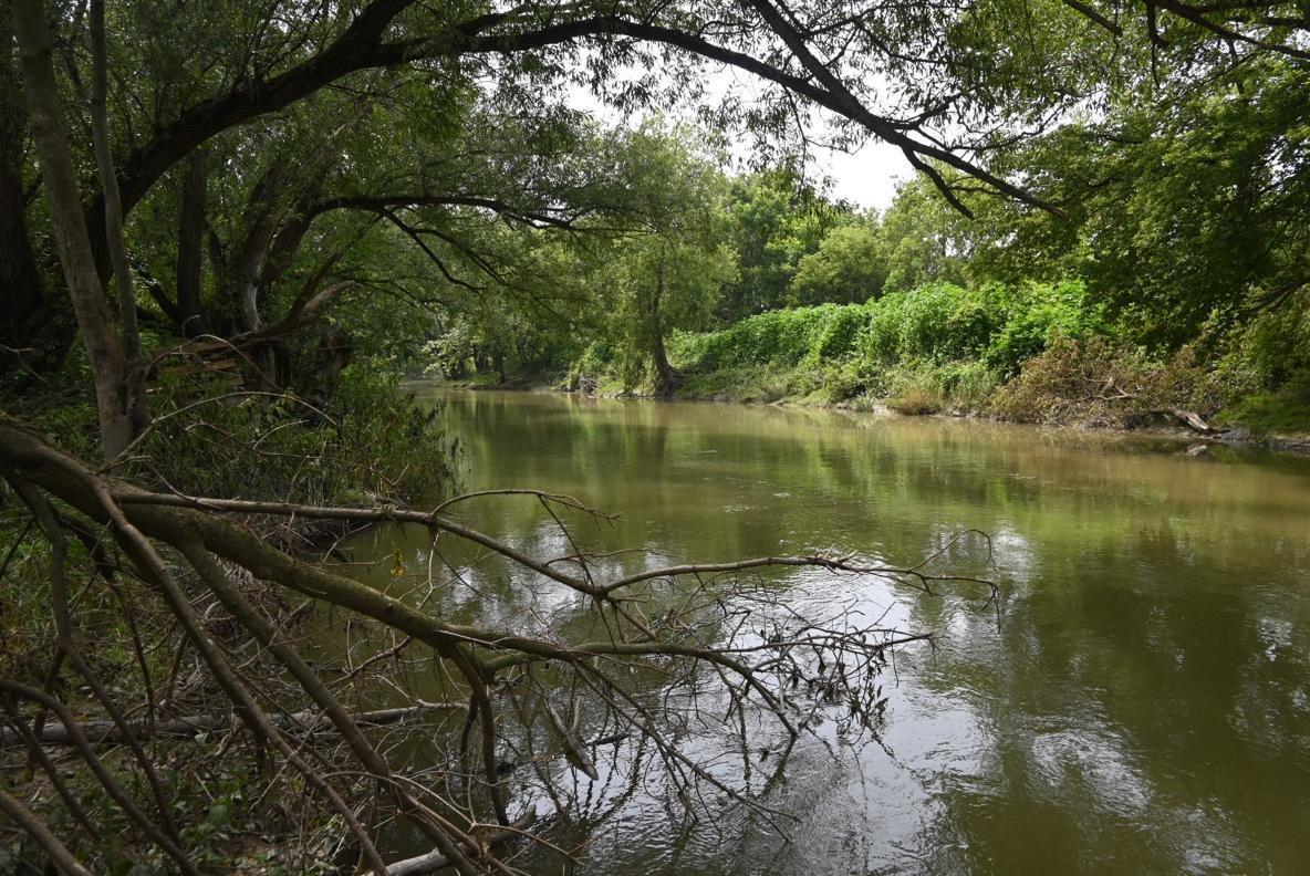
    Sunnivue rests on a Burford soil, a gravelly and cobbly soil formed by glacial-fluvial outwash, or fast-moving glacial meltwaters in a floodplain environment, and the back 20 acres is intact Carolinian forest. The farm is cut through by the Ausable River, a winding waterway flanked on both sides by a three-zone riparian buffer that runs south from West Perth to Ailsa Craig and arcs to the west before emptying into Lake Huron at Port Franks; significantly, it supports “26 species of freshwater mussels and 85 species of fish,” 6 of which are listed by the Committee on the Status of Endangered Wildlife in Canada (COSEWIC) as endangered, threatened, or of special concern (DFO, 2020, p. iii). Many of the key threats to these species—such as build up of sediments due to erosion following the loss of riparian cover, nutrient enrichment (due to tile drainage), contaminants (including pesticide and manure runoff), and habitat modification and landscape fragmentation (due to intensive land use and continuous cultivation)—are linked to the high levels of intensive agricultural practices introduced in the 1850s and that continue still today to dominate the watershed (DFO, 2020, p. iii). 

    A river with trees and bushes  Description automatically generated

    The Upper Ausable River running through Sunnivue Farm, 2023. Photo: Kate Lawless.

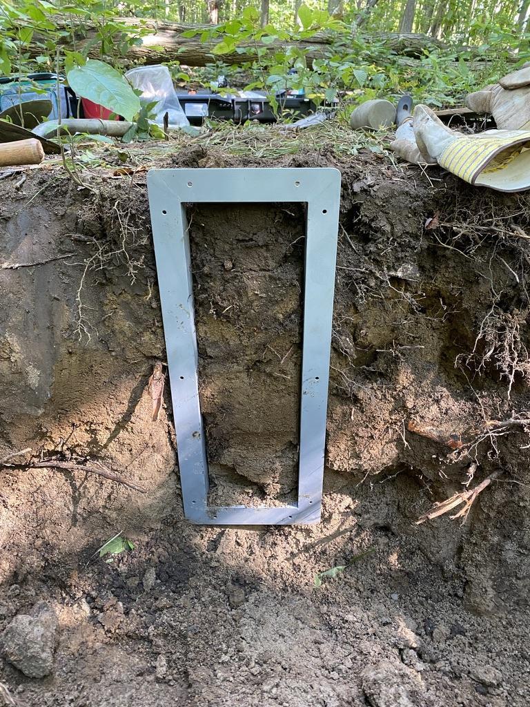
    We began field research in the summer of 2021 with in-depth oral history interviews with five key informants: Alex and Ellinor Nurnberg (the primary farmers from 1991-2021, and founding members of ROSE, a Land Care Association, the not-for-profit trust governing Sunnivue farm), Kristina and Michael Courey (the new farmers as of July 2021 and founders of the social enterprise, New Moon Community Homestead, now operating at Sunnivue) and Jens Stickling (a long-time member and then-chair of the ROSE Board of Directors). We followed these interviews by extracting soil monoliths and samples from two representative sites on the farm, one cultivated and the other uncultivated. The uncultivated site, located in a patch of forest in the back 20 acres, provided a benchmark for the cultivated site, an arable field (previously the market garden) hosting an alfalfa cover crop that has since been reconverted into a market garden. 

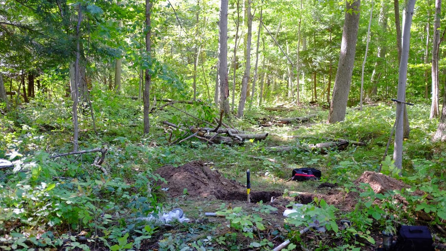
    A forest with trees and bushes  Description automatically generated Soil pit in uncultivated Carolinian forest soil, Sunnivue Farm, 2021. Photo: Ed Gregorich.
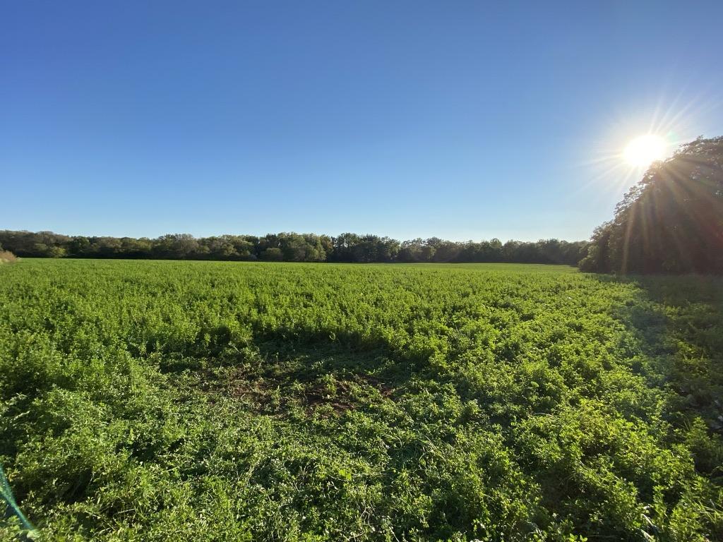
    A green field with trees and the sun  Description automatically generated

    Site of the soil pit in cultivated soil with a temporary alfalfa cover crop, Sunnivue Farm, 2021. Photo: Ed Gregorich.
    A metal frame on a dirt surface  Description automatically generated

    Extracting the forest soil monolith, Sunnivue Farm, 2021. Photo: Kate Lawless.

    From here, we began historical and archival research starting with Sunnivue Farm and ROSE: Celebrating 21 Years of Building a Dream, 1992-2013, a retrospective containing (among other things) a collection of annual newsletters written by Alex. We continued with visits to local archives and extended periods of participant observation, including a 3-day Vision Retreat in September 2021 to discuss the farm-level vision during the transition between incoming and outgoing farmers. We are continuing this background research by following threads in the interviews that lead us to broader systems-level interactions. We are especially interested in how the farmers and greater community understand their relations with non-humans on the farm, as well as how they speak about the relationship between natural and social systems and their decline or flourishing. Our aim through this process is to elucidate how local human-soil relations are shaped by the often-divergent pressures of both intimate social spheres (i.e., kinship networks) and more-or-less abstract global structures (i.e., international trade networks), and how multi-species soil care communities, or complex networks of diverse lifeforms, negotiate “ecological livelihoods”–or interdependent “habitats” of making, receiving, and providing (Miller & Gibson-Graham, 2020)–in this context. Importantly, the concept of “ecological livelihoods” refuses a clear distinction between Economy and Environment, instead recognizing the “myriad interdependencies in which our sustenance is implicated” (Miller & Gibson-Graham, 2020).

    The results of our research are preliminary but show high levels of soil health despite community perceptions of the overall decline of farm-level ecosystem health. Surprisingly, from a soil science perspective, the health of the cultivated soil (approximated here by measures of soil nutrient levels, soil organic carbon, and microbial respiration and biomass) surpasses that of the uncultivated soil in the forest on the same farm holding. While magnesium and potassium levels are comparable in both soils, phosphorus levels are much higher in the cultivated soil, which indicates good management of inputs. In addition, the total mass of soil organic carbon (which gives an estimate of the health and fertility of the soil) is roughly 40% higher in the cultivated soil (10.9 kg/m2) compared to the uncultivated soil (6.12 kg/m2) which, according to Ed Gregorich, our collaborating soil biochemist, is quite unusual. Alex and Ellinor attribute this to the incorporation of alfalfa in the rotation and the use of composted manure. In addition, the respiratory quotient of the arable soil is larger than that of the forest soil, indicating higher carbon cycling and nutrient cycling by soil microbiota.  

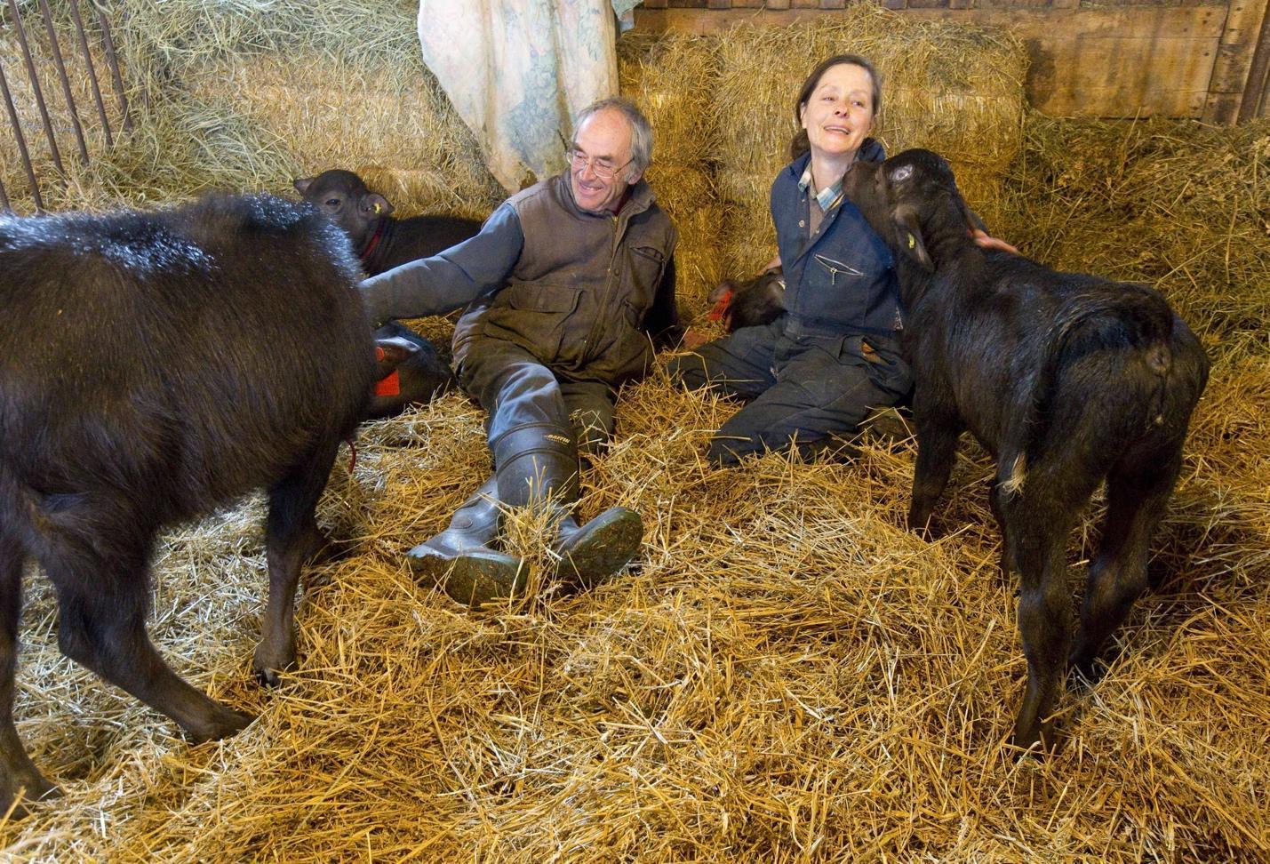
    By contrast, our qualitative analysis shows a shared perception of soil and social “crises” and farm “dis-ease” among the community members, a perception in part linked to declines in biodiversity observed by Alex and Ellinor, a worrying trend that they connect to changes in land use management. These changes were precipitated by external economic pressures, especially proposed changes to the milk quota in 2008. In response, Alex and Ellinor sold their dairy herd. Of course, this was a difficult decision for them since cows are a central component of biodynamic agriculture, which strives to operate as a closed-loop system. They replaced the herd with water buffalo (which does not have a quota), but the market for water buffalo milk is smaller, and water buffalo, as Alex explains in one of his newsletters, are not as open as cattle to being milked. Ensuing financial struggles were compounded by the difficulties of retirement and farmer succession (a significant problem across Southwestern Ontario); indeed, it took roughly 6 years for Alex and Ellinor to find a suitable incoming farm family (eventually Mike and Kristina) who would uphold the vision and objectives of the farm: promote biodynamic agriculture; make the farm a social, therapeutic and educational hub; assist with research related to these objectives; and hold the land in trust for agricultural use. In the meantime, they leased the land out to off-site farmers. 

    A person and person sitting with goats  Description automatically generated

    Alex and Ellinor with water buffalo calves, Sunnivue Farm, 2014. Photo: Craig Glover/The London Free Press.

    Throughout this transition, Alex and Ellinor claim that the health of the farm began to decline, a sentiment shared by the rest of the community at the Vision Retreat. The founding farmers explain that only a few years of “doing things differently” caused visible changes in biodiversity on the farm, in particular the disappearance of bobolinks (Dolichonyx oryzivorus), bumblebees and phlox (Phlox divaricata). A walk around the farm today shows that Common eastern bumblebees (Bombus impatiens) are on the rise, but the bobolinks have not returned and, indeed, this appears to be part of a larger dynamic that is as yet poorly understood. (To wit, bobolinks were assigned a COSEWIC status of “threatened” (T) in 2010, which was downgraded to “special concern” (SC) in 2016.) Some of these negative trends at Sunnivue Farm may have been the result of changes in farming practices (i.e., the use of liquid rather than composted manure during the transition period) and some might be attributed to broader environmental and climate changes (exemplified this past year by an unprecedented spate of Ontario wildfires and excessive precipitation). In the future, we will explore these questions. 

    The findings of this pilot study suggest at least two things: First, external political-economic pressures can disrupt sustainable social-ecological relations by prioritizing socioeconomic values over personal, cultural and ecological values (for more on the role of these values, and interactions among them, in ecological restoration see the four-quadrant model of Clewell & Aronson, 2013, Chapter 2). This results in a complex set of negotiations that has the potential to influence and indeed compromise the integrity of ecological trajectories in a site undergoing transition, and now restoration. Second, while the impacts of both systems-level and interpersonal conflict or disruption may not be visible in standard measurements of soil health, our qualitative research demonstrates that these disruptions may impact the health of the farm ecosystem. 

    Building on Henry Janzen’s claim that “the soil remembers” (Janzen, 2016), we will continue to explore how soils might “remember” or reflect past social and ecological relations, and our Expanded Soil Profile analytical tool will, we hope, help to identify the “latent and active ‘ecological memories’” (Balaguer et al., 2014, p. 12) required for the construction of multiple, sequential reference models that we expect will be needed to truly restore the Sunnivue Farm ecosystem. And we hypothesize that soil care communities with a shared conception of soil as a living system or relational medium are the best vehicles for this exploration because they are at the forefront of a broader ecosocial transformation that not only recognizes humans as part of nature (and soils) and understands the deep interdependencies of societies and ecosystems, but also recognizes the intrinsic value of nature and strives to minimize extractive practices. Moving forward, we will aim to further develop the Expanded Soil Profile as a tool for social-ecological restoration through the exploration of and collaboration with soil care communities in Dawson City, Yukon and Lethbridge, Alberta who also see soils as the foundation of both social and ecological health, integrity, vigour, care, and resilience. 

    Acknowledgments

    This research was funded by the Tri-Agencies’ (The Canadian Institutes of Health Research [CIHR], Natural Sciences and Engineering Research Council [NSERC], and Social Sciences and Humanities Research Council [SSHRC]) New Frontiers in Research Fund–Exploration Grant, which supports interdisciplinary, high risk/high reward, transformative research in Canada.

    References 

    Balaguer, L., Escudero, A., Martín-Duque, J. F., Mola, I., & Aronson, J. (2014). The historical reference in restoration ecology: Re-defining a cornerstone concept. Biological Conservation, 176, 12–20. https://doi.org/10.1016/j.biocon.2014.05.007

    Clewell, A. F., & Aronson, J. (2013). Ecological Restoration : Principles, Values, and Structure of an Emerging Profession. 2nd ed.  Island Press and SER.

    DFO. (2020). Action Plan for the Ausable River in Canada: An Ecosystem Approach (Species at Risk Act Action Plan Series. Fisheries and Oceans Canada. (see here

    ESTR Secretariat. (2016). Mixedwood Plains Ecozone: Evidence for key findings summary. Canadian Biodiversity: Ecosystem Status and Trends 2010. Canadian Councils of Resource Ministers. (see here

    Gann, G. D., McDonald, T., Walder, B., Aronson, J., Nelson, C. R., Jonson, J., Hallett, J. G., Eisenberg, C., Guariguata, M. R., Liu, J., Hua, F., Echeverría, C., Gonzales, E., Shaw, N., Decleer, K., & Dixon, K. W. (2019). International principles and standards for the practice of ecological restoration. Second edition. Restoration Ecology, 27(S1), S1–S46. https://doi.org/10.1111/rec.13035

    Greenhough, B. (2014). More-than-human Geographies. In R. Lee, N. Castree, R. Kitchin, V. Lawson, A. Paasi, C. Philo, S. Radcliffe, S. Roberts, & C. Withers (Eds.), The SAGE Handbook of Human Geography, volume 1 (pp. 94–119). SAGE Publications Ltd.

    Janzen, H. H. (2016). The Soil Remembers. Soil Science Society of America Journal, 80(6), 1429–1432. https://doi.org/10.2136/sssaj2016.05.0143

    Kimmerer, R. W. (2013). Braiding Sweetgrass: Indigenous Wisdom, Scientific Knowledge and the Teachings of Plants. Milkweed Editions.

    Krzywoszynska, A., & Marchesi, G. (2020). Toward a Relational Materiality of Soils: Introduction. Environmental Humanities, 12(1), 190–204. https://doi.org/10.1215/22011919-8142297

    Miller, E., & Gibson-Graham, J. K. (2020). Thinking with Interdependence: From Economy/Environment to Ecological Livelihoods. In:  J. Bennett & M. Zourazni (Eds.), Thinking in the World: A Reader. Bloomsbury Academic, 313-340.

    Parikka, J. (2015). A Geology of Media. U of Minnesota Press.

    Puig de la Bellacasa, M. (2015). Making time for soil: Technoscientific futurity and the pace of care. Social Studies of Science, 45(5), 691–716. https://doi.org/10.1177/0306312715599851

  • Valorising Malagasy protected areas as seed sources for forest restoration

    By Chris Birkinshaw, Tefy Andriamihajarivo and Tabita Randrianarivony, all part of the team working to conserve the Analavelona Sacred Forest as part of the Missouri Botanical Garden’s Madagascar Research and Conservation Program.

    Often, in Madagascar, the costs of the setting aside land as protected areas for biodiversity conservation is borne primarily by local people whose access to the natural goods, on which they more or less rely, is restricted.  Yet, in the absence of repressive policing, the long-term success of these reserves for conservation requires local good will. Without such support, protected area managers will continually face local resistance that, if not addressed, will lead to failure. Consequently, conservation organisations, as part of their protected area management strategies, must try not only to explain the importance of natural ecosystems to provide goods and services, but also endeavour to develop significant, tangible livelihood benefits for impacted locals, to offset, at least in part, their losses. A few favourably-placed sites do this successfully through tourism (although, often, local beneficiaries are restricted to the most educated people). Yet most sites provide relatively few benefits for those living around the reserve that are clearly linked to the protected area. Thus, managers often resort to supporting small-scale development projects (such as poultry-rearing, handicrafts cottage industries, or vegetable-growing for nearby markets). Usually, these efforts are not directly related to the protected area and, even if successful, they often merely purchase temporary good-will.

    How then can we do better in managing protected areas to provide improved livelihoods for locals? In the innovative project described here, we are trying to make this paradigm a reality, while at the same time facilitating the use of native Malagasy trees in tree-planting projects.

    View of the Analavelona Forest, SW Madagascar (Photo: Tefy Andriamihajarivo).

    Missouri Botanical Garden’s Madagascar Program has been supporting the community-based conservation of the Analavelona Forest in southwest Madagascar for a decade. This forest is considered sacred to the local Bara people and thus entered the new millennium in an almost pristine condition. However, with increasing outside influences including Christianity, cell phones, and immigrants of different ethnicities, traditional beliefs are being eroded and previously very rare incidents of timber exploitation are becoming more frequent. Therefore, while we support the local hereditary leaders in preserving the sanctity – and therefore intactness – of the forest, we now also seek to develop additional motivations for locals to conserve the forest. Specifically this project will build local capacity to collect high-quality seed samples of native trees from Analavelona that can be sold to tree-planting projects with the revenue generation supporting improved education in local schools where standards are very low and constitute an important barrier to sustainable and inclusive local economic development.

    Lamentable condition of a local primary school (Photo: Chris Birkinshaw).

    In June 2022, this project gained support from the Darwin Initiative and implementation began shortly thereafter. Our major achievements to date include: receipt of permission from the Forest Service to collect and sell seeds of wild native trees; identification of 29 tree species native to Analavelona that appear to grow well in degraded ecosystems (and therefore are strong candidates for use in reforestation); training of 12 local men as seed collectors; training of 9 local women and three local men in best practice for the propagation of native trees; training of two local women to make cotton seed collection bags; installation of three village nurseries; recruitment of a local young entrepreneur who we will support to seek clients wanting to buy seeds of native trees and then to effect legal and smooth sales with income being transparently used to improve local education; creation of a webpage to constitute a sales interface; provision of support for eight local teachers; and distribution of 150 study kits for local students. Although we wish to sell seeds, rather than seedlings, to tree-planting projects, we will use subsamples of seeds of each species in germination and seedling trials to better understand their potential responses to varying reforestation conditions.  This knowledge is important because the very high endemism in the Malagasy flora means that technical knowledge can not be borrowed from other countries.  Voucher herbarium specimens of the trees from which seeds were collected will also be made to enable scientific identification. Thus, we hope to attract buyers not merely through access to high-quality seeds but also by providing correct identification of the seed samples as well as information on the performance of each species in different reforestation settings. After building capacity to implement the project at scale, we will soon be ready to seek our first clients to purchase seeds and then ensure that income generated is used transparently to support local schools.  

    Newly trained seed collectors (Photo: Patrice Antilahimena).

    Nurserywomen cleaning seeds at the newly installed nursery (Photo: Patrice Antilahimena)

    The primary aim of this project is to provide immediate tangible benefits directly associated with the protected area for those living around the Analavelona Forest. However, the initiative, if successful, and replicated more widely in Madagascar, could address two of the issues that currently contribute to the overwhelming dominance of alien tree species in tree-planting projects in the country: absence of reliable sources of high-quality seeds of correctly named native trees; and lack of knowledge about which tree species perform well under different conditions. There is an urgent need to address these obstacles because, through AFR100, Madagascar has pledged, by 2030, to reforest 4 million hectares of degraded land (total Malagasy land area = 58 million hectares) as its national contribution to meeting the Bonn Challenge. However, under current conditions, if this target is achieved then it will be through planting non-native trees (mainly species of eucalyptus and pine) despite the multiple negative impacts (e.g., impoverishing soil, lowering water tables and reducing biodiversity) in some circumstances of planting these taxa. While we acknowledge that none of Madagascar’s native trees are likely to be able to compete with the performance of eucalyptus and pine in terms of resilience on impoverished soils, rate of growth, regrowth after burning, utility of wood as fuel and timber, and ease of propagation and cultivation; under certain circumstances planting native trees may make sense. Obviously, these circumstances include projects aiming to restore native forests, but also as part of strictly commercial reforestation whereby areas planted with native trees might improve aesthetics, help contain wildfires that easily propagate through continuous tracts of eucalyptus or pine, or help reduce erosion on slopes. Our initiative fortuitously coincides with the launch in Madagascar (and five other tropical countries), under the leadership of Botanic Gardens Conservation International, of a five-year project to define and provide a Global Biodiversity Standard that will provide certification for tree-planting projects that have a positive impact on biodiversity. One of the aims of this initiative is to promote the flow of funds into initiatives that plant native trees, and therefore it should provide momentum for our endeavours.

    Terminalia seyrigii – one of our target species – common in degraded habitats and with wide distribution in southern and western Madagascar (Photo: Chris Birkinshaw).

    In Madagascar, a number of small and medium scale tree-planting projects already seek to purchase seeds of native trees. However, the phenomenon of micro-endemism in the Malagasy flora may mean that we should sometimes resist orders coming from certain potential purchasers seeking to plant species outside of their natural range.  Madagascar’s rich array of habitats based primarily on geology, bioclimate, elevation, and topography, coupled with dramatic past climatic fluctuations, have caused remarkable speciation resulting in rapid spatial turnover in species, and many species are native only to a small part of the country. This phenomenon could seriously restrict the number of clients for the many species with a small extent of occurrence and suggests that among the attributes used to define the target species for this project we should also focus on the minority of native tree species with large ranges.

    A close-up of the canopy of the Analavelona Forest including the Critically Endangered banana Ensete perrieri (Photo: Chris Birkinshaw).

    The success of this project will depend on whether the emphasis for support remains on crude planting of trees as crops to sequester carbon or whether more funds flow into multidimensional tree-planting projects that plant at least some native tree species. If the transition to the latter scenario can be achieved, then, through projects such as that described here, it will be possible to develop seed supply chains that benefit the creation of new forests and existing forests – along with the people and local communities around them.

    Acknowledgments

    This project is funded by the UK Government through Darwin Initiative and we gratefully acknowledge this support.

  • The ’23 National Native Seed Conference – Cultivating the Restoration Supply Chain and Launching the Northeast Seed Network

    By Eve Allen and James Aronson (Ecological Health Network), Sefra Alexandra (The Ecotype Project), Geordie Elkins (Highstead Foundation), and Uli Lorimer (Native Plant Trust). At the ’23 National Native Seed Conference, the newly formed Northeast Seed Network announced their efforts to build a partnership to improve the accessibility of genetically diverse source-identified seed and plant material for the ecoregions of the Northeastern US.

    Butterfly Weed (Asclepias tuberosa) seed heads. This Northeastern native milkweed species is an important source of nectar for pollinators (Photo: Uli Lorimer).

    In late March of this year, people from all over the US and elsewhere gathered in Alexandria, Virginia, just outside of Washington D.C., for the 5th National Native Seed Conference ‘Cultivating the Restoration Supply Chain.’ This event connects research, industry, land management, and restoration professionals to share the latest findings, best practices, and success stories related to the collection, development, production, and use of native seed. The conference is the world’s largest event focused on native seed.  

    To learn more about this year’s event, we had a follow-up conversation with Tom Kaye, Executive Director, and Senior Ecologist of the Institute for Applied Ecology. This organization is the force behind the conference. Tom shared that the meeting held this year was by far the largest to date, with over 500 participants, a twenty-five percent rise in attendance from the last gathering in 2017. This signals a growing awareness and interest in addressing seed limitations for ecological restoration and other restorative actions. The momentum to ensure that we have ‘the right seed, in the right place, at the right time’ is also gaining traction at Capitol Hill. Tom explained, “there was a greater focus this year to encourage policymakers to direct Inflation Reduction Act and Bipartisan Infrastructure Law dollars at critical pieces of the restoration supply chain infrastructure.”

    Tom Kaye, Executive Director, and Senior Ecologist of the Institute for Applied Ecology, the driving force behind the 5th National Native Seed Conference (Photo: Institute for Applied Ecology).

    Furthermore, at this year’s native seed conference, Indigenous seed and plant producers and restorationists led sessions and workshops that brought Indigenous Knowledge (a.k.a., Traditional Ecological Knowledge) to the fore of conversations about ‘cultivating’ the restoration supply chain. Tom anticipates that one outcome of the conference will be more pressure toward changing how the US Government manages lands by including Indigenous voices, perspectives, and rights for sovereignty. Tom also told us that he perceives and supports a greater acceptance of the need to implement intentional genetic management through developing climate resilient adaptive admixtures of seed for restoration activities. He shared, “People are realizing that the climate has already changed, and local isn’t local anymore. Our management practices need to change now, not in the future.” What is not clear, however, is what this actually means for the practice, policy, and science of ecological restoration across the spectrum of regional and bioregional, and cultural contexts.  

    A new report from the US National Academies of Sciences, Engineering, and Medicine found that the most robust and functional seed and plant material supply chains exist in the Western US, where the federal government manages up to 40% of the land in some states. Tom explained that as a result of this, “the US Government is the biggest buyer of native seeds in the country, and they’re not buying for the Eastern states as much [as they could and should!].” However, although there are significant differences between land ownership patterns and biogeography among the different regions of the US, there are also commonalities. These include “the need for seeds at scale and the need for seeds in response to environmental disasters, whether that be extreme wildfires, floods, drought, or invasive plants,” said Tom.

    Germination flats of selected native species being propagated from seed with known provenance at Nasami Farm Nursery Whately, MA (Photo: Uli Lorimer).

    Mr. Chuck Newman, founder of Planters’ Choice Nursery in Newton, CT, with containerized plant material grown from source-identified seed (Photo: The Seed Huntress, Sefra Alexandra).

    However, what hampers the work of producers and users of native seed and nursery stock everywhere in the US and worldwide is asynchronous supply and demand. Producers of native seed want to grow at a large scale and distribute their products to as many markets as possible. Users often require seeds with locally adapted genotypes on a sporadic or project-by-project basis. This tension can stifle our ability to restore ecosystems effectively. One solution is a distributed network of seed banks and storage facilities. However, some keystone species for ecosystem and habitat restoration and reintroduction or reinforcement of populations of endangered species are recalcitrant, meaning they can’t be dried and stored for future use. For example, the seeds of smooth cordgrass (Spartina alterniflora), a matrix species in many coastal habitat restoration projects along the US Eastern Coast, are only viable when freshly harvested.

    Smooth cordgrass (Spartina alterniflora), a matrix species in many coastal habitat restoration projects along the US Eastern Coast (Photo: Uli Lorimer)

    Asynchronous seed supply and demand amidst a backdrop of accelerating climate change, ecosystem degradation, and biodiversity loss present is a complex problem. Regional seed partnerships or networks are better equipped to address such challenges than interventions by a single governmental agency or any single organization. These networks bring together social actors from industry, academia, government, non-profit and private organizations, and tribal groups to exchange thoughts, ideas, and resources, enabling collective action across conventional boundaries. A dozen or so seed networks, partnerships, or collaboratives are functioning in the US West, including The Oregon Native Seed Partnerships, East Cascades Native Plant Hub, Northwest Oregon Restoration Partnership Program, The Colorado Plateau Native Plant Program, Nevada Native Seed Partnership, and Wyoming Native Seed Strategy Partnership.

    Local and state officials, community members, and Bureau of Land Management officials celebrate the opening of the seed warehouse in Boise, Idaho—one of the largest warehouses for native seed in the US. The Eastern US does not have large public or private seed warehouses. This means that the region does not have adequate supplies of material on hand for the next large-scale natural disaster. Seed warehousing is more challenging in the eastern states than in the dry and arid western states due to the humid climate (Photo: Lukas Eggen).

    The Eastern US is experiencing a demand surge for native seed and plant material. This is due to growing investments and reallocation of land use to promote and sustain reforestation and forest, grassland, wetland, riverine, and coastline restoration, urban street tree planting and green space expansion and connection, plus forestry, agroforestry and regenerative agriculture, not to mention Pollinator Pathways design and implementation. However, the Eastern US is distinct from other regions because state governments and private individuals own most of the land. The results of a 2018 survey found that land managers and practitioners, on average, purchase seed from vendors an average of 418 miles (673 km) away! In other words, the Upper Midwest has largely captured the seed market in the Eastern US. 

    That being said, many dedicated organizations, including the Mid-Atlantic Regional Seed Bank (MARS-B), the Native Plant Trust, the Ecotype Project, Eco59, Pinelands Nursery, Planters’ Choice, the Highstead Foundation, Wild Seed Project, and Hilltop Hanover Farm have been creating supplies of genetically appropriate seed and plant material of known provenance for the US Northeast. However, beyond efforts like these, seed collection, processing, and production of genetically appropriate seed and plant material is carried out on a short-term or individual project basis. Clearly, meeting the growing demand for native seed and plant materials in our region is too big of a job for any one sector or entity to tackle independently.

    At this year’s National Native Seed Conference, the Native Plant Trust and the Ecological Health Network announced the launch of the Northeast Seed Network to bring together industry, academia, government, non-profit and private organizations, and tribal groups from the Ecoregions of the US Northeast and the Mid-Atlantic States. 

    Map of the Omernik Level III Ecoregions of the Northeastern US (Photo: Uli Lorimer).

    The conference provided an opportunity for the Northeast Seed Network to organize a symposium that brought together seven presenters to discuss the demand and lack of supply for genetically appropriate source-identified seed in the Eastern US and emerging efforts to build a network to address supply chain shortages. The symposium’s presenters highlighted the extent of the demand and lack of supply in our region, research carried out to identify and map the complex social network of supply chain actors, and how the Northeast Seed Network is leveraging that research to build the partnership’s capacity. The Northeast cohort also shared news about projects underway, including developing shared priority species lists to help spur commercial production and training programs for farmers. For example, The Ecotype Project created a Getting Started Toolkit to help build literacy amongst smallholder farmers in the region to amplify the amount of seed available for restoration and allied activities. This initiative is helping to train cohorts of seed producers in the specialty crop of source-identified ecotypic seed and led to the creation of the recently formed farmer-led seed collective Eco59. Implementing founder plots on farms has demonstrated improved ecological benefits for farmers. Incorporating founder plots of native plant species has increased the diversity of beneficial insects leading to higher pollination rates in field crops and predation reduction. 

    In short, the young but determined Northeast Seed Network, with its growing membership, aims to build and reinforce connections, at a regional scale, to reduce resource competition, leverage collective expertise, and promote trust and new synergies. This is a prerequisite to increasing the accessibility of genetically diverse source-identified seed and plant material to meet the region’s restoration goals. It is also an essential process, we think, for helping the region prepare for climate change, reverse ecosystem degradation, advance equity, generate just livelihood options, and improve the health and well-being of humans and wildlife. Sign up to receive email updates and learn about joining the Northeast Seed Network.

    Northeast Seed Network collaborators (Photo: Ecological Health Network).

    All the participants in the Northeast Seed Network’s Symposium (Photo: Ecological Health Network).

    Here’s the takeaway: inadequate seed supply hinders effective restoration efforts globally. We take heart in the news that the Committee of the US National Academies of Sciences, Engineering, and Medicine’s new report has recommended that the US Government form an interagency collaboration to coordinate and support regional partnerships. In a second piece in this blog space, later this year, we will provide more news of our efforts in the Northeast and discuss its relevance to what is going on elsewhere around the world.