Tag: Fire

  • Peter’s Mountain Mallow – Back on the brink as it approaches its 100th anniversary

    Peter’s Mountain Mallow – Back on the brink as it approaches its 100th anniversary

    By Ben Sapperstein, Quinlan Campbell, and Leighton Reid

    Ben Sapperstein and Quinlan Campbell are undergraduate researchers in Leighton Reid’s Restoration Ecology Lab at Virginia Tech.

    Peter’s Mountain Mallow (Iliamna corei) is among the rarest plants in the world. As of 2025, only five individuals remain in the wild, all of them clustered in a single population on a rocky ridge in southwestern Virginia. In the 98 years since its discovery, Peter’s Mountain Mallow has teetered on the edge of extinction and come roaring back like a phoenix from the ashes, but today its future is again uncertain.

    First discovered in 1927 by two botanists from West Virginia, Peter’s Mountain Mallow is a showy wildflower with light pink, hibiscus-like flowers. In full sun it reaches an impressive 2-m stature, with multiple stems covered in fuzzy, maple-like leaves. The blossoms are slightly smaller than the aperture of a coffee mug. They feature prominent columns of fused stamens tipped with yellow pollen. Uniquely, the flowers have no discernable scent.

    Peter’s Mountain Mallow (Iliamna corei) in full bloom during happier times. A key difference between this species and its midwestern relative the Kankakee Mallow (Iliamna remota) is that I. corei flowers have no discernable scent. Photo courtesy of the Massey Herbarium.

    The mallow’s habitat is a unique pine-oak woodland situated on a rocky ridge above the New River. The ridgetop is underlain by calcareous sandstone, which lends a richer feeling to this site than nearby ridges, which are much more acidic. For example, the plant community includes calciphiles like white-flowered leafcup (Polymnia canadensis), toothache tree (Zanthoxylum americanum), and American barberry (Berberis canadensis). Other species include honey locust (Gleditsia triacanthos) and northern leatherflower (Clematis viorna) – a distinctly rich ridgetop assemblage. Historically, the site had an open canopy that also supported sun-loving plants like Monarda and Coreopsis, but the canopy has apparently closed in and these are no longer evident.

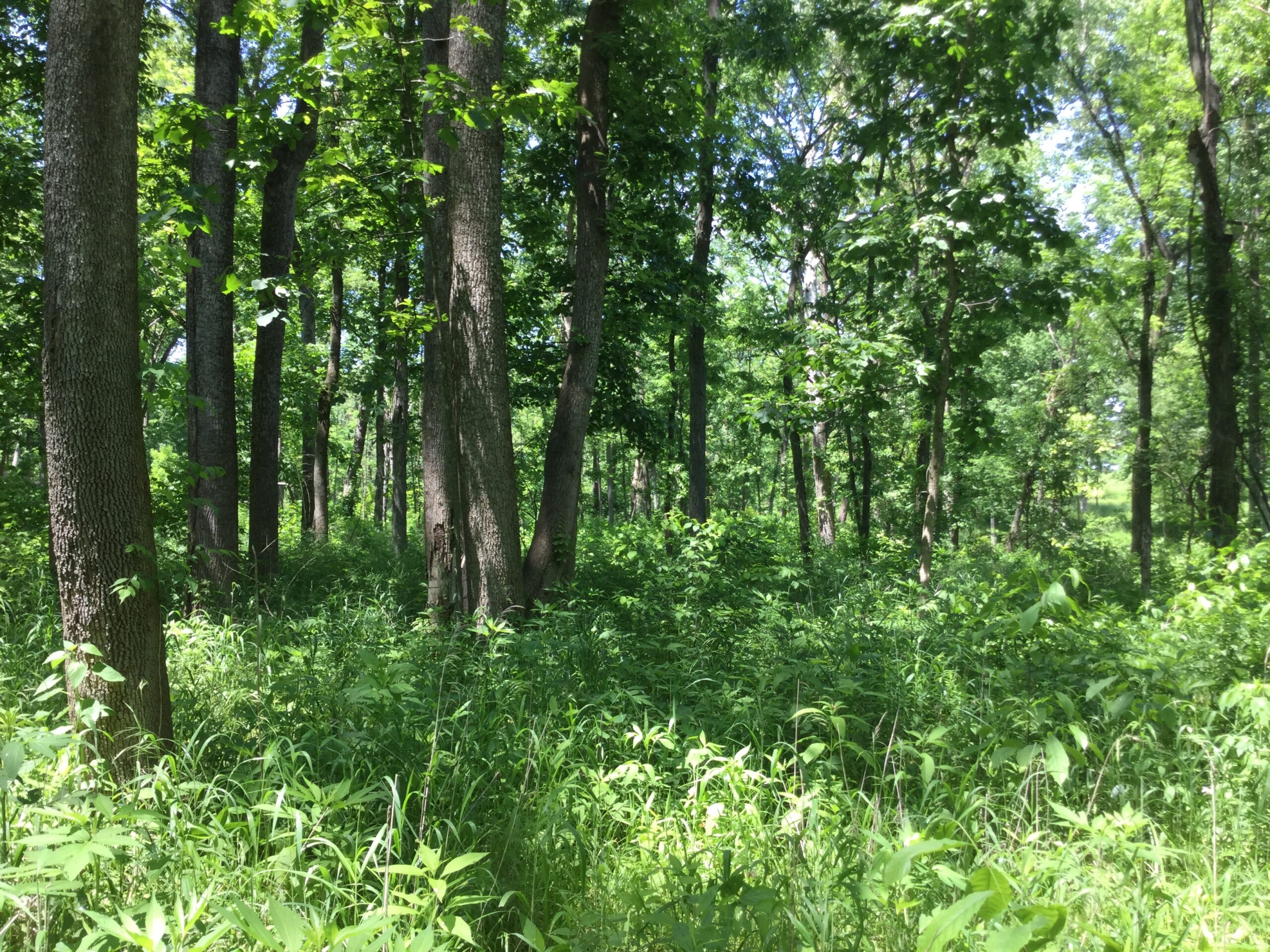
    Changing vegetation structure at the Peters Mountain Mallow habitat. Left: an open canopy in the mid 1980s afforded a view of the surrounding landscape. Right: in 2025, there was nowhere that afforded such a view, suggesting that the canopy has closed substantially over the past ~40 years. Authors Quinlan Campbell and Ben Sapperstein (right) inspect an updated version of the herbivore exclosures first built by Johnny Randall (left), Mary Lipscomb, Tom Wieboldt, and others in the 1980s. Left photo by Tom Wieboldt. Right photo by Leighton Reid.

    Fire required

    Today, Peters Mountain is densely forested, but this may not always have been the case. Pine trees there bear fire scars showing that the mountain burned many times in the past. From the late 18th Century until the 1940s, Peters Mountain burned on average every second or third year, but after the 1940s fires abruptly disappear from the record. This reflects a change in federal policy towards fire suppression that affected forests throughout the United States.

    The loss of fire coincided with a decline in the mallow population. In 1927, when Perry Strausbaugh and Earl Core discovered it, they estimated that there were no more than 50 plants. Botanists in 1962 found the population little changed, but by 1985 the population was decimated – with only five individuals remaining.

    The US Fish and Wildlife Service added the mallow to the Endangered Species List in 1986, and a recovery plan was written by 1990. Yet in 1993 the population hit rock bottom with just three plants. Researchers at Virginia Tech and elsewhere mounted investigations to understand the cause of the mallow’s decline and clues about how best to assist its recovery.

    germination experiment in the early 1990s revealed a strong connection between fire and Peters Mountain Mallow. Jerry and Carol Baskin at the University of Kentucky tried to germinate a batch of mallow seeds, but only a tiny proportion (3%) grew. When they burned the seeds, the germination rate increased 13-fold, to 39%. The Baskins further increased seed germination by repeatedly heating the burned seeds to 80-90°C, ultimately achieving a maximum germination rate of 71% – nearly 24 times the baseline rate. They concluded that Peters Mountain Mallow forms a persistent seed bank and requires fire to break seed dormancy and trigger germination.

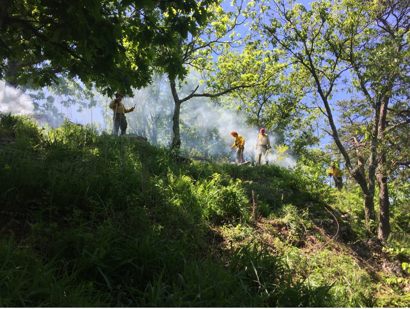
    A smoky prescribed fire on the crest of Peters Mountain in May 2017. Photo by Ryan Klopf.

    Population restoration

    These two lines of evidence – germination studies and fire history – suggested that a prescribed fire campaign would help reinvigorate the mallow population. A consortium of institutions rose to the challenge, including The Nature Conservancy and the Virginia Department of Conservation and Recreation. Burning the site was not easy. Fire crews hand-carried heavy tools, water, and drip torches off-trail up the side of the mountain. They created fire lines through steep, intact forest to prevent fire from spreading into the adjacent Jefferson National Forest.

    Initially, the ridgeline habitat was burned twice, once in 1992 and again in 1993. The return of fire led to a dramatic population increase as hundreds of seeds in the soil seed bank broke dormancy and germinated.

    In addition, the few remaining adult plants were caged to prevent wandering deer and other herbivores from eating them. Land managers removed trees, shrubs, and herbs with hand tools and herbicide to increase light availability. Two particular targets were white-flowered leafcup and garlic mustard (Alliaria petiolata) – an invasive species.

    As a further precaution, experimental populations were created offsite, including two at Virginia Tech. Some of the seeds from these garden plants were preserved frozen at the North Carolina Botanical Garden. Others were broadcast back into the habitat to await the next fire – and their opportunity to recruit into the population.

    In June 2004, lightning struck and a hot wildfire consumed the mountaintop. This conflagration followed two exceptionally dry years in which the Peters Mountain Mallow population failed to produce any fruits. The wildfire again stimulated germination of seeds in the soil seed bank, and a flush of mallows appeared over the next two years.

    Further burns in 2008, 2009, 2010, and 2011 assisted in growing the population from 74 individuals in 2005-2007 to an average of 110 individuals each year from 2012-2014. In May 2017, a multi-agency team burned the Peters Mountain Mallow habitat one last time. The vegetation was green, and the fire was smoky, but the population that year was robust. The team counted stems (an individual plant can have several) and found 345, down from 630 the year before. This was the last fire ignited on Peters Mountain before the COVID-19 outbreak. There has not been another one since.

    Reinvigorating research

    On a steamy morning in July 2024, a small group of ecologists, botanists, and land managers climbed the mountain to see how Peters Mountain Mallow was faring. One of us (Leighton) accompanied others from the Massey Herbarium, The Nature Conservancy, and the US Fish and Wildlife Service. What we found was disappointing. The mallow flowers we hoped to see were shriveled and dry from a prolonged drought. Worse, there were only a few of them. We did not do a thorough census, but this trip sparked the notion that the mallow required renewed attention.

    Drought-stressed flowers of Peters Mountain Mallow in summer 2024. Photo by Leighton Reid.

    For many years, researchers at Virginia Tech were heavily invested in this species – measuring the population, collecting seed, growing plants, performing genetic and physiological studies – even carrying jerry cans up the mountain to water plants during droughts. But this involvement waned as faculty retired and students moved on to other things. It seemed like a good time for a new wave of researchers to join the effort. Moreover, students in the newly-formed Ecological Restoration major had created a Society for Ecological Restoration student association (SER-VT) and were seeking a local project.

    Our first action was to formally survey the population. Last July, we laid out a transect to measure and map every individual. It did not take long. Since the last population inventory in 2018, the world’s only population of Peters Mountain Mallow has declined from 155 stems to just ten, representing only five individual plants. This is the same number of plants that there were when the species was first listed on the Endangered Species Act in 1986.

    What’s more, only two of the plants were large enough to produce flowers this year, and the flowering times were misaligned so that one plant was setting flower as the other was senescing. Peters Mountain Mallow requires cross-pollination, so no seeds were produced last year.

    While disappointing, this information is valuable for understanding the species’ boom-and-bust population dynamics and informing land managers about the acute need to bring fire back onto this landscape in the near future.

    Looking backwards to move ahead

    We know from the pine tree study that Peters Mountain burned frequently over the past two hundred years, but presumably the mallow has lived here for much longer. In what sort of environment did it evolve? Another undergraduate researcher, Nisha Polk, is using a different approach to construct an older, precolonial environmental history – and a potential reference for land managers to emulate.

    In October, Nisha climbed the mountain with Dr. Rachel Reid, a conservation paleoecologist in the Virginia Tech Geosciences Department. Nisha and Rachel inserted PVC tubes into the ground to collect soil cores from small pockets of earth between the boulders that make up the ridgetop. The soil is thin, no more than 25 cm, but it could contain organic matter from as much as 2,000 years ago.

    Over the next few months, Nisha will analyze the carbon isotopes from the soil organic matter to learn how old the soil is and what kinds of plants produced it. To age the soil, they will use carbon dating, which estimates when the soil was formed based on how much of the radioactive carbon-14 isotope is present. Then they will study the ratio of stable carbon-13 and carbon-12 isotopes to learn about past vegetation. In essence, lower ratios indicate plants that use a C3 photosynthetic pathway, including most broad-leaved plants that make up the temperate forests in our region, while higher ratios indicate plants that use a C4 photosynthetic pathway, such as warm-season grasses adapted to open grassland, savanna, and open woodland habitats. In other words, carbon isotopes can tell us what the predominant ecosystem was here over hundreds or thousands of years.

    Virginia Tech Ecological Restoration majors Nisha Polk (left) and Alex Owusu-Sampah (center) carefully collect a soil core on Peters Mountain with conservation paleoecologist Rachel Reid. Photo by Leighton Reid.

    A bright future?

    While Peters Mountain Mallow is again in the single digits worldwide, there are reasons for hope. First, the species produces a robust seed bank that may revitalize it when the site is next burned (hopefully soon). Second, the North Carolina Botanical Garden maintains a collection of its seeds – a back-up if the worst should happen. Third, the habitat is owned by The Nature Conservancy, whose land managers are committed to ensuring the species’ persistence. Fourth, the species is protected by the US Endangered Species Act, a 1973 law that is estimated to have prevented the extinction of more than 70 species.

    Finally, Virginians should have hope for the future of this botanical crown jewel because a new generation of undergraduate researchers is engaged, bringing fresh energy and insights to the cause, documenting the species’ ups and downs, and uncovering its natural history. Over the next five years, we envision an undergraduate-led research agenda that includes monitoring the mallow population, using paleoecology methods to learn about the long-term environmental history of the species’ habitat, and refining our understanding of its ecological niche.

    The New River cuts through Brush Mountain in southwest Virginia, just a bit upstream from Peters Mountain. Photo by Leighton Reid.
  • Accurately estimating restoration efficacy across large landscapes and timeframes

    Accurately estimating restoration efficacy across large landscapes and timeframes

    By: Dr. Allison Simler-Williamson

    Note from the editors: This month marks ten years since we started Natural History of Ecological Restoration! During the last decade, we’ve posted 127 times on a wide variety of ecological restoration stories from around the world. At the same time, our global readership has grown from 4,000 viewers in our first full year to more than 14,000 viewers in each of the last five years, with readers coming from 150 countries. At their best, NHER stories illuminate ecological restoration’s natural history, taken in the most inclusive sense to mean stories about the people, places, organisms, institutions, and interactions involved in ecological restoration projects.

    This month’s post by Allison Simler-Williamson (Boise State University) exemplifies this standard. In her post, Dr. Simler-Williamson describes how environmental conditions, land manager decisions, and restoration outcomes interact in complex and confusing ways – and she charts a path forward for better understanding the real-world impacts generated by restoration projects.

    A “randomized” experiment can be a beautiful and powerful tool in restoration ecology. Randomization ensures that an experimental treatment (such as a restoration action) is unrelated to any other environmental factors that might influence the outcome we are measuring (such as plant establishment). When we confidently compare plots that received an herbicide or planting treatment to adjacent “reference” sites, our estimation of restoration effectiveness hinges on this assumption of randomization.

    But, despite their elegance, randomized experiments are labor-intensive and often spatially or temporally constrained, limiting how applicable they may be to new areas or in atypical years. Thus, randomized experiments are increasingly mismatched with widespread ecological degradation and growing needs for restoration. Emerging “big data”, such as the US Geological Survey’s Land Treatment Digital Library, which contains information about more than 65,000 restoration treatments that have occurred on Bureau of Land Management land in the western United States, could help tackle the problem of understanding restoration efficacy across wide spatial and temporal scales.

    When we pivot to using these “observational” datasets, which are opportunistically collected, we incur an important tradeoff. We gain generalizability but lose the power of randomization because (and this likely is not a surprise to anyone working in restoration!) real-world management treatments are almost never applied randomly across large landscapes. Restoration occurs in certain parts of landscapes more than others, due to a mix of ecological need, bureaucratic constraints, and stakeholder decision-making processes.

    Why is this lack of randomization a problem when we want to leverage these kinds of large datasets? In statistics courses, I like to use some of my son’s favorite bathtime toys as an analogy for what can occur. When you pour water into these colorful pipes, the wheels spin, and my son loves to create networks between them. If the pipes are arranged as below (Figure 1A) with water flowing through them, it would be immediately obvious that there is no direct relationship between the wheels “X” and “Y” – they are simply both being spun by the water flowing out of “Z”. However, if I were to obscure the connections between the pipes (Figure 1B) and instead ask you, “Based on your observations, is there a relationship between X and Y?”, you could detect a correlation. Depending on your understanding of the system, you might assume that this link is a direct cause of X on Y, or vice versa.

    Figure 1. Confounding variables (Z) jointly impact a predictor variable (X) and our response (Y), biasing our understanding of the relationship between X and Y.

    This phenomenon is an example of statistical “confounding,” in which a background driver can bias our understanding of the relationship between two other variables. This potential for confounding is a big concern if we would like to estimate the efficacy of restoration treatments that were applied in non-random places or times because it can falsely inflate or shrink apparent effects in our analyses. For instance, if restoration actions (X) are disproportionately applied in dry areas (Figure 2a), and drought stress simultaneously reduces plant establishment (Y) (Figure 2b), the correlations between variables can cause a treatment effect to shrink (even if the treatment works!), if we ignore this lack of randomization in treatment applications.

    Figure 2. Non-random application of restoration treatments in real-world settings, due to ecological, social, and institutional processes, can bias estimation of treatment effectiveness.

    In a 2022 study (Simler-Williamson and Germino 2022), we explored how the ‘non-random’ application of restoration seedings of big sagebrush (Artemisia tridentata) influenced our estimation of treatment effectiveness, using observations of post-fire seedings across the western U.S. in the Land Treatment Digital Library.

    When we used statistical models that assumed these restoration treatments were applied randomly, we found a somewhat counterintuitive result: a negative relationship between sagebrush seeding and sagebrush recovery. However, this statistical illusion emerged because of background relationships in our dataset: restoration seedings (Figure 2; X) tended to occur in hotter, drier, and more degraded places (Z), where plant establishment was already more difficult (Y). In short, restoration actions were disproportionately applied in more “dire” ecological settings, creating the illusion of failure.

    Next, we compared this approach to two sets of statistical methods designed to minimize the effects of confounders (“Z”) on our treatment effect. The first set of approaches required that we include pre-existing data about the hypothesized confounding variables directly into our model. When we accounted for some of these measured drivers of “non-random” seeding application using existing data about soil types, climate conditions, and fire impacts, restoration efficacy shifted from a negative number toward a neutral effect.

    Finally, the last set of approaches instead used repeated observations of sagebrush stands to ‘control for’ confounding variables, by accounting for pre-existing differences between treated and untreated stands before they had been seeded, rather than requiring the direct inclusion of measured variables. Only when measured and many unmeasured differences between treated and untreated sites were accounted for in our analysis, we revealed a positive impact (of ~4-6% in sagebrush cover by 10 years post-fire) of restoration seedings in degraded sagebrush ecosystems.

    The pattern we described in that paper underscores two key needs in restoration science: one social and one statistical. These results suggest that we urgently need better information about the socio-economic drivers determining where and when we apply restoration treatments, which are poorly described. The analyses that incorporated some common ecological drivers of restoration need (e.g., fire impacts, climate variables) only accounted for some of the bias in the effects of restoration seeding. The strong shift to positive impacts of restoration after “unmeasured” sources of bias were considered suggests that there are significant additional unmeasured processes that simultaneously shape where we attempt to restore and where plant populations recover. In the focal sagebrush steppe ecosystems, these may include diverse drivers such as seed availability, bureaucratic constraints, aesthetic considerations, cultural values, land use, and grazing management. Collecting and understanding these variables seems essential to advancing our understanding of restoration effectiveness broadly.

    But no matter how elegant randomized experiments are as a concept, they may not be able to generate estimates of restoration effectiveness at the broad spatial and temporal scales we require to manage rapidly changing ecosystems. As a community, I think we need to be integrating big, opportunistically collected datasets with statistical approaches that recognize the “messiness” of these data and aim to minimize the risk of confounding in treatment effects. Well-estimated treatment effects can improve how we connect restoration resources (such as seeds, time, and funding) with the locations where the ecological benefits may be greatest, both in space and time.

    For more information about Dr. Simler-Williamson’s work, see her lab website or her 2022 paper in Nature Communications.

  • Understanding the role of soil microbial communities in oak woodland restoration using DNA metabarcoding

    Understanding the role of soil microbial communities in oak woodland restoration using DNA metabarcoding

    By: Rachel Brant

    Rachel is a postdoctoral fellow in the Missouri Botanical Garden’s Center for Conservation & Sustainable Development whose research focuses on plant-pollinator interactions and using eDNA to advance the conservation and restoration of biodiversity.

    Oak-dominated ecosystems occur in many areas of the northern hemisphere, support considerable biodiversity, and provide vast benefits to humans. Although notably absent from the southern hemisphere, oak-dominated or mixed-oak dominated forests are found across much of southern and central Europe, northeast Asia, and the eastern and central United States. Oak ecosystems range from closed forests with a dense midstory to open forests or woodlands with continuous canopy or widely spaced trees and dominance of herbaceous vegetation in the understory.

    Around 80% or more of the plant diversity in oak forest and woodland ecosystems in the eastern US, including a large proportion of rare species, resides in the herbaceous layer, which contributes significantly to nutrient cycling and overall ecosystem function. However, these forests and woodlands have suffered significant degradation over the past century, resulting in dramatic shifts in species composition and structure due to human land-use activities, invasive species, and alterations in disturbance regimes. In particular, fire exclusion has led to the encroachment of fire-intolerant tree species and nonnative shrubs, decreasing both understory light availability and the abundance and diversity of herbaceous plant species.

    Restoration of oak ecosystems usually involves prescribed burning or a combination of burning, canopy thinning, and control of undesirable woody vegetation. Although these restorative practices encourage the passive recovery of herbaceous flora, restored oak woodlands often lack conservative species in the understory. Unlike matrix or ruderal plant species, conservative plant species are those that depend on high-quality or minimally damaged sites and rapidly disappear with degradation. In addition, they often fail to recolonize sites naturally, making them potentially important targets for reintroduction.

    (Top) Degraded oak woodland at Missouri Botanical Garden’s Shaw Nature Reserve infested with nonnative shrubs and fire-sensitive tree species and (Bottom) Adjacent restored oak woodland after mechanical control of woody encroachment and six prescribed burns. Note the minimal sunlight penetrating the woodland floor and lack of herbaceous species in the degraded woodland relative to the restored woodland. Photo: (Top) Brad Delfeld and (Bottom) Matthew Albrecht.

    Conservative species are notoriously challenging to reintroduce in restoration projects, with soil microbes emerging as a key factor influencing their success. Arbuscular mycorrhizal fungi (AMF) are particularly crucial in this context; they enhance nutrient uptake and improve stress resistance, benefits that are especially valuable for conservative plant species with specific habitat requirements. For example, one study found that conservative species were more dependent on AMF and exhibited higher habitat specificity compared to less conservative species (Bauer et al. 2018). The practice of soil inoculation with whole soil, which presumably contains beneficial mutualists like AMF, is increasingly employed to boost plant growth and survival in restoration projects. Despite its growing popularity, though, the effects of soil inoculation on the establishment of herbaceous species in oak-dominated ecosystems remain poorly tested.

    Another factor that may affect the establishment of conservative plant species is the timing of reintroduction. Environmental conditions are predicted to be more favorable for the establishment of conservative species later in restoration, in part because soil symbionts facilitating plant establishment may only be found in later-successional sites. Alternatively, early restorations may lack the establishment barriers potentially encountered later in restoration, such as competition with established vegetation or soil legacies from early-arriving species, but could be deficient in important microbial mutualists often required by conservative plant species.

    To test these hypotheses, we examined the potential role of soil microbial communities on the performance of conservative herbaceous species using an oak woodland restoration chronosequence at the Missouri Botanical Garden’s Shaw Nature Reserve. First, we collected bulked field soil samples from three sites representing different restoration ages (young, intermediate, and old) based on their onset since restoration began (7, 16, 29 years ago) with prescribed burning, selective tree thinning, and non-native shrub control. We quantified several soil abiotic properties (e.g., pH, phosphorus, potassium, and nitrogen) and employed DNA metabarcoding to describe the microbial composition of the soil. DNA metabarcoding is a cutting-edge technique that identifies many taxa from an environmental sample by sequencing specific genetic markers from extracted DNA. This method provides a comprehensive snapshot of the microbial diversity present, allowing one to better understand otherwise cryptic below ground communities. 

    Conservative perennial forbs used in a greenhouse study to test the effects of soil inoculation young, intermediate, and old restored woodlands on plant growth: Geum virginianum (left), Solidago argute (center), and Solidago caesia (right). Photo credit: Gerrit Davidse (left) and Missouri Botanical Garden (center and right).

    Next, we conducted a greenhouse study with three conservative forb species, Geum virginianum, Solidago arguta, and Solidago caesia, testing their growth responses to soil inoculum from sites that differ in restoration age. These species are components of the regional species pool, but absent from restored oak woodlands at Shaw Nature Reserve. We placed germinated seeds of each species in quart-sized pots filled with a sterilized topsoil mix that mimic oak woodland soils. Each sterile pot (270 in total) was then inoculated with 10 mL of the bulked live field soil (approx. 1% by volume) sourced from one of the three restored sites. Plants were grown for 12 weeks in standard greenhouse conditions and then evaluated for growth using nondestructive measurements.

    Planting seeds of conservative forb species into soil inoculum treatments in a greenhouse study. Photo credit: Leighton Reid

    Tree species and soil microbial communities in restored oak woodlands 
    Not surprisingly, we found that younger restored oak woodlands, with historically fewer prescribed fires, had a greater abundance of fire-sensitive tree species (e.g., sugar maple, Acer saccharum) than the intermediate and older restored sites. However, younger restored woodlands also exhibited lower levels of soil phosphorus compared to older sites, consistent with previous studies that have shown greater levels of potassium and phosphorus in soils post-burning. Other soil abiotic properties, however, did not differ across the restoration chronosequence. 

    A grove of sugar maples (Acer saccharum) during autumn in the young restoration site at Shaw Nature Reserve. Photo credit: Mike Saxton

    Bacterial and fungal communities varied in composition across the restoration chronosequence. For example, Firmicutes, a phylum of bacteria noted for surviving in extreme conditions, such as in severely burned areas, was more abundant in soils from the oldest restored woodland, which experienced a greater number of prescribed fires than the other sites. In contrast, the fungal phylum Ascomycota was more abundant in restored woodlands of young and intermediate age. Members of Ascomycota include decomposers that break down organic materials and endophytes that form mutualistic or commensal associations with plants. 

    Plant-soil interactions in response to soil inoculation
    After 12 weeks of plant growth in the greenhouse, we found that forbs tended to grow larger leaves when grown in soil inoculum from the younger restoration site compared to the intermediate restoration site. Additionally, S. arguta and S. caesia grew longer leaves in soil inoculated from the intermediate compared to the old site, while G. virginianum plants tended to produce longer leaves when grown in inoculum from young relative to the old restoration site.

    Leaf length (cm) of three native forbs after 12 weeks of growth in whole-soil inoculations from young, intermediate, and old restored oak woodlands at Shaw Nature Reserve. Geum virginianum (GV), Solidago arguta (SA), and Solidago caesia (SC).

    Results from the DNA metabarcoding provide a clue as to why the soil inoculum treatments induced different plant-growth responses. Soils from the young restoration exhibited increased relative abundance of mutualistic microbes, including AMF and cyanobacteria, and decreased pathogenic taxa after conditioning by each of the three species. In contrast, the oldest restoration site had the greatest relative abundance of pathogens and the lowest relative abundance of mutualists. This enhanced microbial profile in young restorations may facilitate better nutrient uptake, and disease and stress resistance in plants. From a practical perspective, early-stage restorations may provide the most favorable soil microbial community for the establishment of conservative plant species in these oak ecosystems. One possible reason for this could be a shift in the increased relative abundance of AMF-associating tree species (e.g., maple) from older to young restored woodlands. AMF-associating tree species may harbor unique AMF taxa that resulted in increased herbaceous plant growth and AMF colonization for plants conditioned with young soil inoculum.

    Interestingly, although some microbial taxa exhibited consistent patterns across all plant species within an inoculation treatment, each plant species also associated with unique microbial taxa when grown in the same soil inoculum treatment. For example, the Glomeraceae, which includes AMF, was marginally more abundant after S. caesia was grown in young inoculum, whereas Ascobolaceae – fungi that feed on decaying and dead matter – was significantly abundant only when G. virginianum was grown in old soil inoculum. This means that species reintroduced during different stages of oak ecosystem restoration could influence key ecological functions by selecting for or against certain microbes, including pathogens that regulate plant community dynamics, decomposers involved in nutrient cycling, and mutualists that enhance plant performance. 

    Overall, our study demonstrates how restoration age can shape interactions between soil microbes and herbaceous plant species in restored oak woodlands. By better understanding these interactions, we can enhance the restoration and recovery of degraded oak ecosystems. However, an important and lingering question from our study is whether differences in plant growth and microbial communities observed in the greenhouse persist after the focal plant species are transplanted into the field. A study currently underway at Shaw Nature Reserve is addressing this question across different restoration ages and competition treatments. Our study reinforces global calls that emphasize the need for more research on the dynamic nature of plant-microbe relationships and interactions over time during restoration. Advancing scientific research on the relationship between the soil microbiota and ecological restoration practices is crucial for meeting local, regional, biome level and global restoration goals.

    If you want to learn more about microbial-herbaceous plant interactions in restored oak woodland, we invite you to read our recent paper in Ecology and Evolution.

  • Land Abandonment, Succession, and Restoration: The Wolf Run Grassland Restoration Project at the Missouri Botanical Garden’s Shaw Nature Reserve

    Land Abandonment, Succession, and Restoration: The Wolf Run Grassland Restoration Project at the Missouri Botanical Garden’s Shaw Nature Reserve

    By: Mike Saxton and Calvin Maginel

    Mike Saxton (mike.saxton@mobot.org) is the Manager of Restoration and Land Stewardship, and Calvin Maginel (cmaginel@mobot.org) is the Ecological Resource Scientist at Shaw Nature Reserve

    Since 1950, over 1-billon acres of agricultural land have been abandoned worldwide. In certain landscape contexts, unassisted spontaneous recovery of high levels of native biodiversity in abandoned fields is possible while in others, like the Midwest USA, fallow fields rarely develop into biologically rich habitats. To achieve the ambitious goals of the UN Decade of Ecosystem Restoration, land managers and ecologists need to better understand how to assist the regeneration and ecological restoration of these highly altered landscapes. 

    In 1925, the Missouri Botanical Garden purchased 1,300 acres of battered farm ground in Gray Summit, MO – approximately 35 miles (56 km) west of St. Louis – to escape the deleterious impact urban air pollution was having on horticultural collections in St. Louis City. The intended uses of this acreage were to: (1) propagate and grow plants, trees, and shrubs for the main Garden’s displays and (2) establish an arboretum focusing on woody plant collections. The site was officially named the Shaw Arboretum in 1933. After decades of development, many non-essential operations at the Arboretum were eliminated in 1958 and many fields were abandoned to allow spontaneous successional change. In 2000, the Shaw Arboretum was renamed Shaw Nature Reserve to reflect its contemporary mission to demonstrate, test, and inspire responsible stewardship practices through education, restoration, and protection of natural habitats and public enjoyment of the natural world. Today the Nature Reserve consists of 2,400 acres of varied habitat in various stages of restoration and revised management, including the use of prescribed fire.  

    Prior to European settlement, the natural plant communities and ecosystems of the area were fire adapted, open oak-hickory woodlands and xeric glades with gallery forests along riparian corridors. Post-settlement, woodlands were clear-cut with some woodlots left to passively regenerate while others were converted to row crop agriculture. 

    Wolf Run Grassland Restoration 

    In 2016, Nature Reserve staff set an ambitious goal to bring all 2,400 acres of the site into active management to promote native biodiversity by the year 2030. This effort will include restoring open pastures and former row crop fields, a relatively simple process. A much more challenging effort will be reclaiming 120 acres of old fields with 60+ year successional development, which is our current Wolf Run Grassland Restoration project. The 120 acre project area was initially “wasted farm ground” that had erosion gullies “where a freight train could pass without you seeing it”, according to August Beilmann, former Arboretum Director from 1941 to 1956. The entire project area was re-sculpted and smoothed by a bulldozer in 1953 and then converted to bluegrass (Poa pratensis). “Every piece of this land that looks so likely to be just right was laboriously rebuilt,” said Beilmann in a 1974 interview.

    Wolf Run Grassland Restoration project area in ca. 1945 showing open fields (light green) maintained through cattle grazing and mowing with trees occupying wet-weather streams and ditches (dark green). Photo: MBG Archives.

    Since 1958 when areas including the Wolf Run Grassland Restoration were removed from mowing and grazing, the site was encroached upon and became dominated by eastern red cedar (Juniperus virginiana), the non-native invasive shrubs Amur honeysuckle (Lonicera maackii), and border privet (Ligustrum obtusifolium), as well as slippery elm (Ulmus rubra), shingle oak (Quercus imbricaria) and ash (Fraxinus) species, the latter of which which are in severe decline due to the emerald ash borer. 

    These degraded woodlands had little native ground flora and were highly infested with non-native shrubs. Tree abundance and species composition had no historic analog. When setting ecological restoration goals for the area, staff determined that much of the site could not be managed as an open oak-hickory woodland, which would have existed at the site pre-settlement.  A new vision was needed. 

    Goals for the Wolf Run Grassland Restoration project

    • Establish a mosaic of 80 acres (~32 ha) of prairie, 15 acres (~6 ha) of savanna and 25 acres (~10 ha) of oak-hickory woodlands
    • Maximize native flora diversity and aggressively control invasive shrub species 
    • Manage with periodic, dormant-season prescribed fire 

    In 2021, Nature Reserve staff marked hundreds of native trees to retain including white, red, bur and black oaks (Quercus alba, Q. rubra, Q. macrocarpa, Q. velutina) and shagbark hickory (Carya ovata) and bitternut hickory (C. cordiformis). Drainages and wet weather streams were left with a 50 ft. (~15 m)  untreated buffer zone while a perennial creek flowing through the unit retained a 150 ft. (~46 m) untouched buffer. A logger removed unmarked trees from the area, with the commercial value of the timber offsetting the cost of the removal. Following US Fish and Wildlife Service recovery management guidelines for the Indiana bat (Myotis sodalis) — a federally endangered species — trees were only removed from November 1st to April 1st.

    Wolf Run Grassland Restoration project area pre-thinning (2021), approximately 60 years after land abandonment. Note the dark green areas are dominated by eastern red cedar (Juniperus virginiana), a native tree that rapidly colonizes abandoned or disturbed lands in the Midwest. Historically, this fire-sensitive tree species primarily occurred on rocky outcrops and bluffs that served as refugia from periodic fires that were common in the pre-European settlement landscape. Photo: ESRI
    Wolf Run Grassland Restoration project area post-thinning (2023). Photo: ESRI
    Forestry contractor equipment was used to remove most woody biomass greater than 4.5 in. (~11 cm) in diameter and left behind mostly small-diameter slash. A bulldozer was used to collect the debris into 600 piles that were subsequently burned. Photo: Mike Saxton

    The Restoration team has spent the last 9 months focusing on the removal of stumps for the project area. Stumps can be a substantial hazard for vehicles, equipment and staff safety. To seed native species and effectively manage the area for invasive species in perpetuity, the stumps must be ground down or cut flush to the ground.

    Skid loader mounted stump grinder removing stumps. Photo: M. Saxton

    Concurrent to this effort has been the site preparation step of chemically treating all of the invasive species and the disturbance driven annual vegetation that emerged post-land clearing [primarily fireweed (Erechtites hieraciifolius), mare’s tail (Erigeron canadensis), ragweed (Ambrosia artemisiifolia) and fox tail (Setaria pumila)]. This step is necessary because diverse, healthy native plant communities have not existed in these areas in more than 100 years. Consequently, there is no native seedbank to support the unassisted spontaneous recovery of native perennial herbaceous species in these highly degraded acres. 

    In areas where stumps have not been cleared, traditional equipment (tractor boom sprayers and UTV mounted spray rigs) for applying herbicide are ineffective. The Nature Reserve hired a contractor that specializes in drone-assisted aerial herbicide applications. The drone flies 12 ft. (~37 m) above vegetation and can self-navigate around trees and other hazards. The unit carries a total of 8 gallons (~30 L) and sprays approximately 3 gallons of herbicide per acre. The effective width of each pass is 25 ft. (~8 m). A single battery powers the drone, with a flight time of 7.5 minutes and a re-charge time of 6 minutes. When the herbicide tank runs out, the drone re-deploys to the fill up location, is refilled by the contractor, and then returns to where it left off. 

    Aerial drone sprayer used to eliminate undesirable vegetation. Photo: M. Saxton

    The last step after the undesirable trees have been removed, biomass/debris has been burned, the stumps have been ground and invasive species have been controlled, is the final ground preparation. Currently, in 2023, we are again smoothing out erosion gullies and clearing away the last remnants of woody debris with a bulldozer. This effort will ensure effective seed-to-soil contact when we sow native seed in January 2024 and will enhance our ability to successfully search for invasive species in the coming years by eliminating deep ruts and rills.  

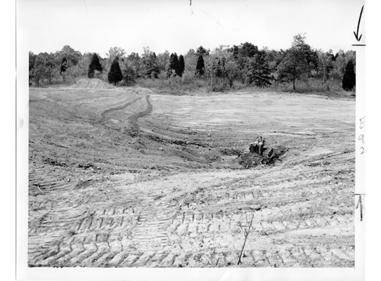
    Above: Bulldozer in 1953 eliminating erosion rills in Wolf Run Grassland Restoration project area. Below: Bulldozer completing site preparation for native seed addition (2023).  Top Photo: St. Louis Globe Democrat, Bottom Photo: M. Saxton

    Native Seeding and Experimentation to promote Biodiversity Recovery 

    During the growing season of 2023, the Restoration team at the Nature Reserve has been feverishly collecting seed for this 2024 seeding effort. More than 1,100 lbs. (~500 kg) of bulk, milled seed from ~200 locally collected native tallgrass prairie and open oak-hickory woodland species will be used in the restoration planting. Additionally, these acres are enrolled in the Environmental Quality Incentives Program, EQIP – part of the Natural Resources Conservation Service, and we must purchase viability-tested seed to meet the minimum required specifications of the contract. The hand-collected seed together with the pure live seed (PLS) – percentage of viable seed in a seed lot – purchased from commercial vendors will provide us with ample species and volume of seed to effectively cover the 40 acres (~16 ha) to be planted this winter. 

    Concurrent with the preparation effort, we initiated a research study, which will help inform our work and the broader research community on plant recruitment amongst scraped soils that have been inoculated with mycorrhizal fungi and those that have not. This study includes paired species from the same genus that have different CC-values, short for coefficients of conservatism, which represents a species’ tolerance of environmental degradation, or its fidelity to intact remnant or long-restored habitats, as determined by local botanical experts. Ecologists generally expect species that are dependent on stable intact communities (higher CC-values) to be more reliant on mycorrhizae connections to establish and flourish. Species with high CC-values tend to establish poorly in restoration sites, which is one of the reasons to pursue this study. Some examples from the ten herbaceous pairs of native species include sedges (Carex bushii [CC = 4] and Carex bicknellii [CC = 10]), grasses (Sporobolus compositus [CC = 3] and Bouteloua curtipendula [CC = 7]), and forbs (Oligoneuron rigidum [CC = 5] and Oligoneuron album [CC = 9]).

    We added all 20 species at the same rate of pure live seed to provide each species an equal opportunity to establish. Initial analyses after one growing season indicate that low CC-value species germinated more successfully, producing more seedlings and greater percent cover than the high CC-value species, regardless of inoculation. We expect the addition of mycorrhizal fungi to have the greatest effects on species during the first couple of years after germination. If the mycorrhizae associate with the roots of the high-CC species more than the low-CC species, this may help them grow faster or be more resistant to future stress. Future monitoring will show us if there are long-term effects of inoculation.

    To check for updates on restoration activities and results from experimental studies, please visit our webpage.

    Barrels of hand-collected seed connected to a seed dryer, which pumps air through tubes into the barrels to eliminate mold & moisture. Photo: M. Saxton
  • Madagascar’s unique history has created unique restoration challenges

    Madagascar’s unique history has created unique restoration challenges

    Leighton Reid describes new research linking slow forest recovery to the ancient and protracted isolation that has made Madagascar a hotspot of global endemism – plus an example of working with local farmers to overcome these challenges and restore native rain forest.

    Madagascar is a special place with a special history. Separated by ocean from Africa and India for the last 88 million years, this isolated tropical island has fostered the evolution of plants and animals found nowhere else on Earth. Lemurs, couas, and the plant family Sarcolaenaceae are all examples of organisms that evolved only in Madagascar. Collectively, such endemic species make up more than 80% of all plants and animals there.

    Crested coua (Coua cristata), one of nine species in the genus Coua – all of which are found only in Madagascar. Photo credit: Olaf Oliveiero Riemer (CC BY-SA 3.0).

    Madagascar also has special problems. Almost half of the island’s forest has been cleared for agriculture since 1953, and remaining forests are at imminent risk. One recent study projected that if deforestation rates do not diminish soon, 93% of eastern Malagasy rain forest could be gone by 2070.

    The combination of a large proportion of endemic species and a high degree of habitat loss makes Madagascar a biodiversity hotspot. Some people call Madagascar one of the hottest hotspots because its endemism and habitat loss are so extreme.

    This week, a new study led by UC Berkeley PhD student Kat Culbertson identified another special problem in Madagascar: following disturbance, Malagasy forests recovery very slowly. Compared to other tropical forests around the world, Malagasy rain forests recover only about a quarter (26%) as much biomass in their first 20 years of recovery. Dry forests in Madagascar also recover more slowly, recovering just 35% as much biomass as American tropical dry forests over the same time period.

    Slow biomass recovery following disturbance in Madagascar (dark blue) compared to Central and South America (Neotropics), Africa (Afrotropics), and Asia (Asiatic tropics). Source: Katherine Culbertson et al. (2022) Biotropica.

    Why do Malagasy forests recover more slowly than forests in other regions? The answer may be related to Madagascar’s unusual evolutionary history. Culbertson and her co-authors developed four hypotheses and reviewed an array of scientific literature to evaluate support for each one.

    Four ways that Madagascar’s unique history could lead to slow forest recovery

    1. Native Malagasy forests lack resilience to shifting nutrient and fire regimes from current farming practices. Many rural people across Madagascar practice tavy, a farming method that involves clearing forest, burning it, and then growing rice – a staple crop. After one or a few years of growing rice, the land is allowed to recuperate for several years before it is cultivated again. In other tropical forest locations, such as southern Mexico where humans have farmed for thousands of years, similar practices can coexist with native forests, but Malagasy forests seem to have little resilience to tavy, as least at the intensity with which it is practiced today. For example, in eastern Madagascar, a 3-5 year tavy cycle can cause a native forest to transition to permanent herbaceous vegetation in just 20-40 years. The soil nutrient stocks in that fallow field may be as little as 1-6.5% of soil nutrients stocks in intact forest.

    2. Madagascar is an island, and islands tend to have more problems with invasive species. Goats in the Galapagos, brown tree snakes in Guam, acacia in Hawaii, and rats everywhere – these are just some of the ways that island ecosystems have been overwhelmed and transformed by invasive species. Madagascar is no exception. Rain forest regeneration at Ranomafana is stalled by invasive guava, eucalyptus, and rose apple, while dry forest regeneration at Berenty is inhibited by a vine – Cissus quadrangularis. People in Madagascar have many more anecdotes about problems with invasive species like silver oak and Melaleuca quiquenervia, although the extent and impact of these invaders on forest recovery have not yet been studied.

    3. Old, weathered soils have favored the evolution of slow-growing native plants. Madagascar is not only an island, it is a very old island, and as such its soils have been weathered and depleted of important nutrients like phosphorus. It’s hard to separate the effect of inherently low nutrient availability due to being an old island from the effect of human-induced nutrient scarcity through tavy, but one comparison of phosphorus content in rice stalks showed that phosphorus content was 10× lower in Madagascar compared to the rest of sub-Saharan Africa. If native trees have evolved to grow more slowly in Madagascar because of low nutrient availability, then on average exotic tree species should grow faster than native Malagasy ones in the same gardens. This has been shown in a few cases, but a more compelling analysis would need more species.

    4. Finally, Malagasy forests have dysfunctional seed dispersal. One way in which Madagascar is different from other tropical areas is that by and large its trees have evolved to have their fruits dispersed by lemurs. Unfortunately, many of the lemurs that could disperse Malagasy tree fruits are either extinct or endangered – in many cases due to a combination of hunting and habitat loss. Moreover, the lemurs that remain are reluctant to venture outside of forest fragments (perhaps with good reason) and so they are unable to disperse seeds to regenerating farmlands that most need them.

    Black and white ruffed lemur (Varecia variegata) – a critically endangered seed disperser in eastern Madagascar. Photo credit: Tim Treuer.

    In essence, the ancient and protracted isolation that has made Madagascar so unique has also made it uniquely vulnerable to contemporary changes like deforestation, fire, and agriculture. The result is an unfortunate combination: Madagascar not only has some of the highest deforestation rates, it is also one of the places least ecologically equipped to rebound from those disturbances.

    A mosaic of mature tropical dry forest and forest restoration at Berenty in southern Madagascar. Photo credit: Ariadna Mondragon Botero.

    The way forward – working with local people

    Despite these challenges, Madagascar has committed to restoring four million hectares of lost habitat by 2030, an area nearly 7% the total national territory. This is a tall order in a country where technical difficulties are high and financial resources are often low, but it can be done, and the way forward, undoubtedly, is to work with local people.

    One group that exemplifies bottom-up restoration is GreenAgain, a non-profit restoring native rain forest and supporting rural livelihoods in eastern Madagascar. GreenAgain is led and staffed by farmer-practitioners whose neighbors, family, and friends contract with GreenAgain to design, plant, and monitor diverse native forests on their lands. Last year, GreenAgain staff planted 20,000 trees across central eastern Madagascar, each one carried by hand, on foot, from one of eight regional tree nurseries. The rural farmers at GreenAgain collect rigorous data on tree survival and growth and collaborate with scientists to analyze and share the results of their tree planting experiments.

    For example, one of the earliest experiments at GreenAgain was an assay of tree planting strategies intended to improve native tree seedling survival during plantings that occur in the dry season. Trees planted during the dry season typically have high mortality, sometimes in excess of 40%. One of the strategies that local farmers recommended to improve survival was to erect small teepees over each seedling using the leaves of a common fern, Dicranopteris linearis. These structures are temporary – they eventually dry out and blow away – but GreenAgain’s experiment showed that they reduced transplant shock (i.e., mortality in the first few weeks) by 75% compared to seedlings that were left to bake in the hot sun. In contrast, many of the other treatments had no discernable effect.

    To analyze and publish these findings, GreenAgain partnered with an award-winning undergraduate researcher, Chris Logan, in my lab at Virginia Tech, who led a peer-reviewed paper that is now available at Restoration Ecology.

    Leaf tent made with a ubiquitous fern, Dicranopteris linearis, placed over a native tree seedling. Photo credit: Catherine Hill.

    Could technological solutions like hydrogels or irrigation systems produce greater improvements in dry season tree survival? Yes – they probably could for a certain price, but homegrown solutions like fern leaf shade tents are free and easily accessible to any person doing restoration across eastern Madagascar. They are also more likely to be used because they were developed by local people.

    This study also showed that some native tree species are much better at coping with dry season stress than other species, so another possible solution for dry season plantings could be to plant only the tough survivors. Once those trees survive and begin to produce shade, fern leaf tents may not even be needed anymore to help more sensitive native species survive and grow.

    To read more about ongoing restoration and ecological research in Madagascar, read our new review of how Madagascar’s evolutionary history limits forest recovery and our new open-access paper about strategies for dry season plantings in eastern Madagascar.

    If you are in a position to support the work of local farmers restoring rain forests in eastern Madagascar, consider donating to GreenAgain at their website, greenagainmadagascar.org.

  • Drought, flood, and fire: an unexpected habitat recipe for at-risk bats

    Drought, flood, and fire: an unexpected habitat recipe for at-risk bats

    Mike Saxton is an ecologist restoration specialist at Shaw Nature Reserve, a 10 km2 mosaic of restored and reconstructed woodlands, prairies, wetlands, and riparian forest along the Meramec River in Gray Summit, Missouri.

    For most land managers, there aren’t enough hours in the day. Between invasive species management, native seed collection and prescribed fire implementation, there are never enough boots on the ground. Add in equipment break downs, erratic weather and administrative tasks and it’s no surprise that with so many balls in the air, something gets dropped. Far too often, we drop the ball on science and monitoring, which are critically important for biodiversity-driven ecosystem management and restoration. Research and monitoring can, in some cases, be expensive; usually they take a certain amount of specialization, and they most certainly take time. For these reasons and many others, land managers build partnerships with universities, collaborate with outside agencies, and engage the public in community science to meet research and monitoring needs.

    What follows is an example of a highly successful partnership between non-profit organizations, a private consulting group, and a federal agency to better understand and protect a federally endangered species.

    A female Indiana bat, “Celeste”, captured during mist netting surveys at Shaw Nature Reserve in 2017 and 2019. Photo credit: Cassidy Moody.

    In 2017, Shaw Nature Reserve hosted a Bioblitz partnering with the non-profit Academy of Science, St. Louis. For two days, participants combed the area looking for as many plant and animal species as they could find. A single federally endangered Indiana bat (Myotis sodalis) was captured during an evening mist netting session along a riparian corridor, marking the first time this species was documented at the Nature Reserve.

    Wildheart Ecology, the local consulting firm which carried out the Bioblitz bat survey, returned in the summer of 2018 to deploy acoustic detectors to further document bat populations at the Nature Reserve. The data revealed the presence of nine different species, including the Indiana bat, the endangered gray bat (Myotis grisescens), and several other species of conservation concern.

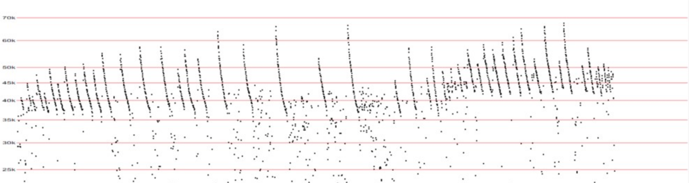
    The audio signature of an Indiana bat, captured by detectors at Shaw Nature Reserve. Courtesy: Wildheart Ecology.

    After these surprising and impressive findings, scientists at the U.S. Fish and Wildlife Service carried out mist netting in summer 2019 at the Nature Reserve to gather more information about the federally endangered population of Indiana bats. Netted individuals were tagged and fitted with tiny transponders. Using telemetry, USFWS staff were able to locate a maternal roost colony tree in the Meramec River flood plain. After multiple emergence sampling events conducted at dusk, the population is estimated to be 150+ individuals, making it one of the largest recorded in Missouri.

    Indiana bat roost site at Shaw Nature Reserve. Photo credit: Cassidy Moody.

    So how did Shaw Nature Reserve end up with one of the state’s largest populations of at-risk bat species? The story begins in fall 2015, when a major flooding event on the Meramec River deposited large amounts of woody biomass and created logjams in the Nature Reserve’s floodplain. Another major flooding event in the spring 2017 compounded these conditions. In the fall of 2017, moderate drought gripped the region, drying leaf litter and woody fuels on the forest floor. In November of that year and on a low humidity day in drought conditions, we conducted a prescribed fire that thoroughly burned the floodplain forest, which normally does not carry fire. The flames crept into flood-debris logjams, causing a major conflagration. Dozens of floodplain forest trees died — mostly silver maple, elm and cottonwood— leaving an open patch of larger-diameter snags, or upright dead trees. It is in these snags where the federally-endangered Indiana bats have found a home. Turns out, the serendipitous convergence of flood, drought, and fire created just the ideal conditions. Couple that with high-quality foraging areas across a healthy, diverse, managed landscape and this population is thriving.

    Indiana bat roost habitat along the Meramec River at Shaw Nature Reserve in Gray Summit, Missouri. Photo credit: Cassidy Moody.

    Current status of Indiana Bats

    Unfortunately, like many bat species, the Indiana bat has been in decline and imperiled by human disturbance and disease. According to the U.S. Fish and Wildlife Service, hibernating Indiana bats are especially vulnerable to disturbance, since they often congregate in large numbers – from 20,000 to 50,000 – to overwinter. A large number of deaths can occur if humans disturb these caves during hibernation. While other factors are also responsible for their decline, the devastating wildlife disease known as white-nose syndrome — discovered in 2006 — is a serious threat to the long-term survival of the species.

    According to the U.S. Fish and Wildlife Service population status update, the states with largest net loss of Indiana Bats since 2007 (% decline since 2007) includes:

    1. Indiana: -53,220 (-22%)
    2. New York: -39,367 (-75%)
    3. Missouri: -18,157 (-9%)
    4. Kentucky: -15,220 (-21%)
    5. West Virginia: -14,125 (-96%)
    6. Tennessee -6,509 (-73%)
    7. Ohio: -4,739 (-62%)
    8. Pennsylvania: -1,027 (-99%)

    What Can Be Done

    With thoughtful management and strategic planning, conservation practitioners can conserve and restore bat habitat. Providing a continuous supply of roosting trees and maintaining a habitat structure to facilitate foraging are key aspects of restoration and management plans for bats. According to the Beneficial Forest Management Practices for White Nose Syndrome-affected Bats, below are some best-practice guidelines for achieving these goals:

    • Harvest timber during the hibernation period to eliminate or significantly reduces the likelihood of direct fatality or injury to tree-roosting bats.
    • Create large-diameter snags and canopy gaps, via girdling or chemical (e.g., “hack and squirt”) methods, to increase sun exposure to existing and potential roost trees.
    • Increasing midstory openness to facilitate travel corridors and foraging opportunities via increased mobility and insect prey detection.
    • Retain or create large-diameter snags during forest regeneration harvests or when managing stands affected by windthrow or disease/insect outbreaks.
    • Limit aerial or broadcast spraying near known hibernacula, maternity sites, and surface karst features, unless it can be demonstrated that it would have no adverse impact on bat populations or habitat.
    • Avoid disturbances near maternal roost sites or colonies when possible.
    • Fell hazard trees that appear to provide bat roosting habitat and do not pose an imminent danger to human safety or property during winter (hibernation period) and avoid removing them during June and July when non-flying bat pups may be present.
    • Avoid burning during cold periods since this can be detrimental to colonies of some species if individuals cannot escape smoke and heat from fires.
    • Apply low-intensity fires when possible since high-intensity fires are more likely to cause injury.
    • Account for caves, mines, important rock features, bridges, and other artificial structures when developing burn plans since these locations are often occupied by roosting or hibernating bats.
    • Remove hazard trees and construct fire-lines during winter, when possible, to reduce chances of removing occupied roost trees or disturbing maternity colonies.
    • Protect known maternity roost trees and exceptionally high-quality potential roost trees (e.g., large snags or large-diameter live trees with lots of exfoliating bark) from fire by removing fuels from around their base prior to ignition.
    • Limit management activities and disturbances near cave entrances.
    • Eradicate and control invasive plants to improve habitat quality for bats.
  • Green Again: Restoring rain forests in eastern Madagascar

    Green Again: Restoring rain forests in eastern Madagascar

    Green Again Madagascar is a young non-profit aiming to reconnect rain forests in eastern Madagascar and collecting heaps of data in the process. Disclosure: Leighton Reid wrote this blog and is on Green Again’s board of directors.

    Matt Hill is trying to restore a rainforest corridor across eastern Madagascar. His motivation is that Madagascar’s wet, eastern flank was once blanketed by a dark, rich forest festooned by bizarre plants and teeming with unique animals. No longer. Over the last 70 years humans cleared almost half of what was there in the 1950s – mostly for farming. Although the farming is often temporary, the forest rarely grows back. Weedy ferns and exotic trees find their way onto the abandoned farms and take hold – boxing out the Malagasy species.

    Some tropical rain forests can recover swiftly on their own, but not these. Eastern Madagascar is a strong candidate for hands-on ecological restoration.

    RevisedExpansionMap
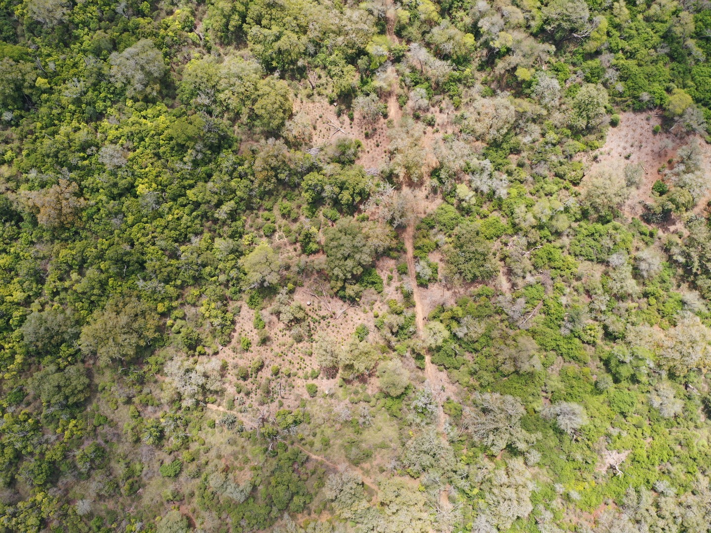
    Madagascar (left) and the region of eastern Madagascar where Green Again Madagascar operates (right). Dark green areas are intact rain forest. Colored ovals show the expanding project scope of Green Again over the past four years. Green Again hopes to one day reforest a longer corridor across the northeastern side of the island. Imagery is from Google Earth.

    Melaleuca quinquenervia Analalava
    In the landscape around Foulpointe, native forest was replaced by shifting agriculture, which was replaced by a forest of invasive Melaleuca quinquenervia, a tree native to Australia. Photo by L. Reid.

    Matt is a middle-aged ex-pat and a self-described “quant”. His father was a math professor, and Matt followed in his footsteps, earning a degree in mathematics from the University of Chicago and subsequently a masters from UCLA. Before landing in Madagascar, Matt had a career on Wall Street analyzing large databases for Putnam. He retired early seeking a simpler and more natural lifestyle, which he found in abundance in rural northeastern Madagascar.

    I first met Matt in 2015 at Parc Ivoloina – a zoo and forestry station near the port city of Toamasina. Clad in gym shorts and flip flops, Matt was buzzing between nursery beds shaded with bamboo slats and a laptop powered by a portable solar panel, where a local was entering data about tree survival and growth. Matt explained his tree planting system to me. At each stage, from seed to tree, he and his team measure plant performance – including survival, height, and diameter. Matt’s team uses these data to quickly adopt methods that work and discard methods that don’t.

    As he explained his tree planting system to me, I was impressed by Matt’s attention to rigorous data collection – a preadaptation from his Wall Street career that serves him well in his new pursuit of tropical forest restoration.

    MattQuant_Edit
    Matt Hill (left) explains database management to a local community member.

    Starting a forest restoration program in eastern Madagascar

    Matt was introduced to forest restoration by accident when he was stranded for several days in Toamasina waiting for the wild, muddy road to Maroantsetra to become passable. He visited Parc Ivoloina on a whim and learned about a recent wildfire. A local man had been making charcoal when his fire got out of hand and burned his own farm and 20 acres of a nearby forest. The experience moved Matt to begin growing and planting native trees on the burned land. This effort congealed into an NGO called Green Again Madagascar.

    From the start, Green Again has been a collaborative effort involving a team of local people. Jean François Solofo Niaina Fidy is the head forester at Parc Ivoloina and president of a nearby village association. He initially advised Matt on the project and helped build local support. Many community members joined the restoration effort – growing trees in the nursery and planting them in the burned area. It is a steep learning curve. Many local people have only a few years of school and may not have held a pencil for some time. Matt teaches them to use GPS units, record data on datasheets, and enter it into an Excel spreadsheet. When the data do not make sense, they return to the field to take repeated measurements.

    The work is hard but good by local standards. Many locals make their living by breaking large boulders into gravel by hand, with a hammer. Others spend their days shoveling sand from the river into dugout canoes and paddling it to shore where it is picked up by road construction trucks. In contrast, locals who get involved in these forest restoration projects pick up transferable skills in horticulture, computing, and business management.

    Coping with wildfire (and learning from it)

    In early November 2016, Matt called me in a panic. There was a wildfire. His plantings had burnt to a crisp.

    Fires are common in eastern Madagascar, but this was a tragedy. To make a bad situation worse, the plantings that burned were an experiment that Matt was doing for a master’s thesis at the University of Minnesota.

    fire_03
    A wildfire in 2016 that swept through a forest restoration site, destroying Matt’s master’s thesis experiment.

    In the ashes of his ruined experiment, Matt found a few survivors. He discovered that some native trees are resistant to fire. These survivors may lose their leaves and stem to fire, but they can resprout from roots.

    Importantly, Matt also learned that trees planted near the edge of plantings were more vulnerable to fire than trees planted in the center of a plantation. This is because the landscape outside of the tree plantations was more flammable than the trees inside the plantations. In particular, the thatch from a common fern (Dicranopteris linearis) would catch fire and burn for quite a long time.

    Green Again’s recent projects have taken this new information on board. Now, new plantings are designed with the fire survivor species on the outside and the delicate species on the inside. Some new plantings are also more extensive, so that the edge-to-interior ratio is lower and less of the trees are placed in the riskiest spots.

    For good measure, Matt’s team also includes some “vulnerable” tree plantings using the earlier techniques so that the next time a fire sweeps through one of the sites, Green Again will have tangible evidence about which strategy is the most fire-proof.

    forest_06
    A pristine rainforest in eastern Madagascar.

    Green Again Madagascar has a small operating budget based on charitable donations and memberships. To learn more, visit the Green Again Madagascar website or write to Matt at GreenAgainMadagascar@gmail.com.

    Photos: All photos are by Matt Hill unless otherwise noted.


  • Conservation and restoration in arid Australia – an uphill battle.

    Conservation and restoration in arid Australia – an uphill battle.

    In their third report from arid Australia, James and Thibaud Aronson discuss some of the serious issues facing conservationists and restorationists.

    Concerning the non-native animals in Australia, the general consensus today is that eradication is impossible: the only option that remains is control, in the form of fences or culling, or both. Yet, conflicts of opinion on the ethics of culling abound, even for the armies of feral cats that reportedly kill 75 million native animals every single night. Even fences have their pros and cons, in particular the interruption of the migration of thousands of emus.

    Western Australia's State Barrier Fence, 1170 km long, meant to control dingoes, dogs, foxes and other feral animals, with more or less effectiveness….
    Western Australia’s State Barrier Fence, 1170 km long, meant to control dingoes, dogs, foxes and other feral animals, with varying degrees of success.

    Both feral cats and foxes are most lethal in areas with relatively little vegetation cover, that is, the massive dry interior of the continent. This is compounded by the monster fires that have plagued Australia since European settlement. A single such fire can burn down hundreds of thousands of hectares, leaving small mammals and other animals with nowhere to hide.

    Even this rather small fire, which spared the trees, has almost entirely eliminated all low vegetation, thereby exposing small animals to predation by cats and foxes. West MacDonnell National Park, Northern Territory.
    Even this rather small fire, which spared the trees (their dead appearance is deceptive; these trees will resprout), has almost entirely eliminated all low vegetation, leaving small animals vulnerable to cats and foxes. West MacDonnell National Park, Northern Territory.

    What’s more, as mentioned in our previous blogpost, most land managers continue to burn on an annual basis without sufficient attention to the impact on animals and indeed many plants. Things are changing though.

    In the seasonally dry, tropical Kimberley region, in the northwest, the Australian Wildlife Conservancy, or AWC, is testing new methods, focusing on patchy prescribed burning in the early dry season, and controlling cattle grazing. They are having good results with this approach in preserving more plant cover for small native animals and thereby reducing the lethal impact of feral cats. The AWC has also shown that their fire management techniques are not only beneficial for native animals, but also for pasture quality, and would therefore benefit pastoralists, whom Australians call graziers. Since most landowners in the area are graziers, let’s hope they will follow suit and try new fire management regimes. It is in this region, by the way, that occurs the endemic baobab of Australia, known here as Boab. To our surprise there are thousands of them, in a wide range of habitats. Some are estimated to be well over 1000 years old. Survival of this tree, at least, is clearly not threatened by fire or foxes, even if other problems – such as climate change – do exist. Let’s hope they go on thriving for another 1000 years.

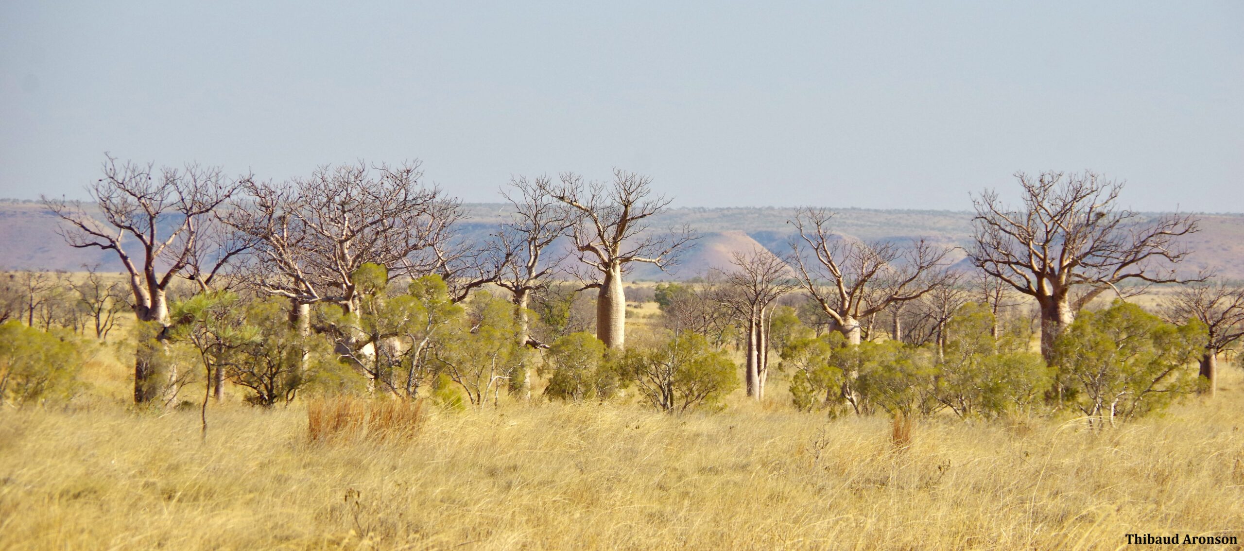
    A typical landscape of the Kimberley, dominated by the majestic boabs (Adansonia gregorii). King Leopold Ranges Conservation Park.
    A typical landscape of the Kimberley, dominated by the majestic boabs (Adansonia gregorii). King Leopold Ranges Conservation Park.

    Another reason invoked for the proliferation of cats and foxes in Australia is the virtual absence of top predators to control them. This phenomenon, called meso-predator release, is also found in North America, where coyotes have greatly expanded following the extirpation of wolves throughout large portions of the continent. Therefore, some have suggested that allowing dingoes to maintain higher population numbers would have a significant effect on controlling cats and foxes. However, dingoes are still considered pests by pastoralists, and large amounts of money go into controlling them.

    And that’s not the last of it. In the last 200 years, people have also introduced many exotic plant species, some of which have become terrible weeds, such as buffel grass (Cenchrus ciliaris) (see our previous blog post), but also Tamarix, Kutch (aka Bermuda grass, Cynodon dactylon), Karroo thorn (Acacia horrida) and others. By 2009, the Commonwealth Scientific and Industrial Research Organisation (CSIRO) estimated that introduced invasive plants were costing the country 4 billion Australian dollars a year in weed control and lost agricultural production, and causing “serious damage to the environment”. With climate change, it seems possible that numerous “lurking” or “sleeper” weeds such as the White weeping broom, Retama raetam, may increase their ranges and their negative impacts.

    Buffel grass presents a particularly severe problem – and like the cats, and dingoes, it is controversial. It was one of dozens of African grasses intentionally introduced by Australian agricultural researchers to “improve” pasture for cattle. Indeed cattle do like it, but the problem is that the grass spreads with amazing tenacity and crowds out native grasses, and all other groundstory plants where it invades, and, it carries fire like few other plants. Control is possible, but it is tedious and expensive and is never 100% effective at a large-scale. Furthermore, the ranchers prefer it to the native grasses, and their ideas on when and how to burn are very different from those concerned with conservation. Indeed, only few of the people we met envision stopping prescribed fire altogether.

    For example, Peter Latz,  a native of the Red Centre,  plant ecologist, and author we met in Alice Springs, has been conducting manual removal of buffel and Kutch on his own land. But his main focus has been on excluding fire altogether, and achieving thereby pretty impressive results.


    Peter Latz in his garden, next to the hemi-parasitic quandong tree (Santalum acuminatum). Alice Springs.
    Peter Latz in his garden, next to the hemi-parasitic quandong tree (Santalum acuminatum). Alice Springs.

    For more on Peter Latz’s views and lifetime of experience in central Australia, see The Flaming Desert: Arid Australia – a Fire Shaped Landscape.

    In our next blog post, we’ll talk about some of the other people and groups in arid and SW Australia undertaking serious steps towards restoration, while fully aware of the obstacles and the complexity of the challenge.

  • Tale of two Highlands Part I: Horton Plains, Sri Lanka

    Tale of two Highlands Part I: Horton Plains, Sri Lanka

    This post is contributed by Dr. James Aronson, a restoration ecologist at MBG’s Center for Conservation and Sustainable Development, and his son Thibaud Aronson. James is also a researcher with the CNRS (National Center for Scientific Research) in Montpellier, France.

    In Sinhalese Sri Lanka means “Resplendent Isle”, a fine name indeed for this tear-shaped island off the coast of southeastern India, just north of the equator. Last month I travelled with my son on a self-guided Natural History + Ecological Restoration visit, we are finding and photographing cloud forests and birds galore, like the endangered endemic Sri Lanka whistling thrush, Myophonus blighi, and the Kashmir flycatcher, Ficedula subrubra, which over-winters exclusively in the Sri Lanka highlands, from its very restricted breeding grounds in Kashmir, northern India.

    We were also looking at the mosaic of grasslands, cloud forests, and lowland forests we find here from a restoration ecology perspective.  That means we’re trying to “read” the landscapes we see in terms of known transformations carried out during the British colonial era (1815 and 1948, when Sri Lanka was known as Ceylon), and since independence. The remarkable Horton Plains National Park is a mosaic of montane grassland (ca. 35%) and cloud forest (ca. 65%), encompassing the headwaters of three major rivers. It was declared a sanctuary in 1969 and elevated to national park status in 1988; it became part of a large UNESCO World Heritage site in 2010. In the central highlands of Madagascar, grasslands appear to occupy about 99% and most people assume they are anthropogenic…. This month, I’m travelling with Leighton Reid in the Central Highlands of Madagascar, and we will be blogging about this soon.

    But, the history of preservation in the highlands here goes back a lot further, to the days when the Isle was part of the British empire, along with all of India. According to information we gathered at the extraordinary, and poorly known Hakgala Botanic Gardens, the great English botanist and explorer Joseph Dalton Hooker had advised the British government to leave all montane forests above 5000 ft. (ca. 1300 m) above sea level “undisturbed” and after 1873 the administration prohibited clearing and felling of forests throughout the central highlands. What a great idea that was! It is too bad there were not enlightened laws on hunting of wild animals as well. One Scottish officer in colonial service in Sri Lanka bragged he had shot and killed over 1400 elephants in Horton Plains and nearby. Today, there are none left there and, so far as we could determine, no plans to reintroduce them from the other remarkable parks, including Yalla and Uda Walawe….

    So, what is the significance of the absence of elephants in this park? And, what else can we learn from past regimes and historic periods in Sri Lanka? For starters, we discover that conservation, and respect for other organisms goes back much further than the 19th century. Consider the sign at the entrance to Udawattakele Forest Reserve, near Kandy, one of the historic capitals from the long period of successive kingdoms the island had known prior to the European colonial chapter in Sri Lanka’s history:

    O Great King, the birds of the air and the beasts have an equal right to live and move about in any part of this land as thou. The land belongs to the peoples and the other beings and thou are only the guardian of it.”

    -Arahath Mahinda (a son of the emperor Asoka the Great, who brought Buddhism to Sri Lanka)

    How would it be if we could revive that approach to the Web of Life in our own day and age?

    So, what has Horton Plains National Park, with its grassland-forest mosaic, its tourists, and its absent elephants got to do with the Central highlands of Madagascar? For one thing, we can see that fire is a big ecological driver in both areas. The abundant arborescent Rhododendrons in Horton Plains tell a vivid tale in this regard.

    Rhododendron arboreum subsp. zeylanicum at Horton Plains National Park. It appears to be fire-resistant and is the only tree species present in large areas of grasslands subject to fire.
    Rhododendron arboreum subsp. zeylanicum at Horton Plains National Park. It appears to be fire-resistant and is the only tree species present in large areas of grasslands subject to fire.

    On the grand scale of things, Sri Lanka’s Central highlands also resemble those of Madagascar’s since both are the crowns of a poor, emerging tropical island with small and very similar human population size (21 million vs. 24 million), despite being much nearly ten times smaller, and with over 30,000 years of human history, as compared to merely two millennia for Madagascar.

    Horton Plains also has remarkable conservation value both for its biodiversity and the ecosystem services it provides to people. Also, as I said, it’s a mosaic of grasslands and cloud forest, that in the past was certainly much affected by both elephants and fire.

    Finally, both Sri Lanka (along with the Western Ghats of southern India) and Madagascar count among the world’s biodiversity hotspots, easily visible in their fauna and flora, which is one of the main reasons why MBG researchers, and many others travel and work in Madagascar.

    Now, let’s turn back to fires. A big fire hit Horton Plains in 1998, and there are serious invasions of two noxious, cosmopolitan weeds, namely Gorse and Bracken fern. Some control work is underway on the Gorse, but the Bracken fern is apparently not seen as being a problem. Rainbow trout were introduced in the 19th c. and apparently have displaced all native fish, and are taking a toll on native shrimp and no doubt other fauna.