Tag: nature

  • Bee-neath the surface: Some bare ground needs no restoration!

    Bee-neath the surface: Some bare ground needs no restoration!

    By: Karin Sternberg with inputs from Sue Milton. All images were taken by the author.

    Karin Sternberg is an amateur naturalist and conservationist focused on the study of solitary bees and wild honeybees in the Great Karoo region. Over the past decade, she has conducted research into the ecologies of these essential pollinators, documenting more than one hundred wild honeybee nests during the course of her fieldwork. Her research is self-funded. Sue Milton is an arid zone restoration ecologist based in the Karoo region of South Africa. She is the owner of Wolwekraal Nature Reserve and Wolwekraal Conservation and Research Organisation (https://www.wcro.co.za) that promotes conservation, education and research in the Karoo.

    Wolwekraal Nature Reserve in the Great Karoo.

    There are 2755 bee species in sub-Saharan Africa, about 1300 of which occur in South Africa. Of these, only the honeybee and 10 species of mopane bees store honey, but all bees are important pollinators of a wide variety of plant species. They pollinate not only fruit and field crops, but most of the annuals, succulents and shrubs that make up the natural grazing lands, particularly in the more arid parts of South Africa. The arid, winter-rainfall region of South Africa known as the Succulent Karoo, is extraordinarily rich in succulent plants—and in the solitary bees that visit their flowers. Bee hotspots with around 700 bee species are found in the arid winter and aseasonal rainfall regions of South Africa.

    Nesting sites of the solitary bees Samba (left) and Colletes (right) on the inner edge of an aardvark burrow.

    In September 2024, I spent several weeks documenting the diversity and behaviour of solitary bees on Wolwekraal Nature Reserve which lies within the arid, aseasonal rainfall bee hotspot in the southern Karoo. This Nature Reserve protects rare succulent plants, most of which are pollinated by bees and flies, but the reserve is also used for conducting restoration trials. Most of these focus on revegetating patches of bare ground where over-grazing or corralling destroyed vegetation centuries ago and led to wind-blown loss of the shallow topsoil. Over millennia the vegetation here has adapted to withstand dramatic temperature fluctuations, from severe winter frosts to scorching summer heat at times exceeding 45°C, often enduring prolonged periods of drought. Extreme droughts, such as the 8-year-long dry period from 2015-2022, can kill 40 to 80% of long-lived plants, and because perennials do not maintain seed banks there is only limited regeneration of these after drought-breaking rain. Annuals, such as Gazania lichtensteinii (Asteraceae), emerge in their masses, saturating the landscape with colour and scent. This is a cue for the emergence of solitary bees which can remain dormant for months or years.

    The barren ground of a deflation hollow which is home to so much insect diversity (left) and the vegetation surrounding the deflation hollow (right).

    Most solitary bees nest in the ground and eroded patches and paths are favoured. During my studies, a seemingly desolate stretch of land caught my attention. This area, characterised by hard sediment, served as a shortcut from the jeep tracks to a wild colony of honeybees nesting in an aardvark (antbear) burrow.

    Dead honeybees and soldier termites in an aardvark burrow following a clash between the two species occupying it as nesting sites.

    The flora surrounding this bare ground is a stark reminder of the Karoo’s remarkable resilience, showcasing a rich tapestry of species that thrive in one of the world’s most harsh climates. Yet, amid this tenacity, certain areas of the landscape remain barren and hardened—perhaps trampled centuries ago by fat-tailed sheep held in corals overnight to protect them from predators, or more recently, during the 19th century when the natural rangeland was stocked way over the capacity of the vegetation to recover.

    Not long ago, I buried a wild hare—a tragic victim of roadkill—in an aardvark dugout: a deep, empty cavity in an area of hard ground I could never have dug myself. My sister, with her characteristic humour, had remarked, “Everyone needs an aardvark.” Indeed they do. For Aardvarks (Orycteropus afer) are extensive burrowers in sub-Saharan ecosystems, actively modifying their environment in the construction of shelters, and in excavating termitaria for food. This, in turn, generates nest sites and unique habitats that support a variety of other species. Burrows of aardvarks are used as shelter by foxes, porcupines, suricates, birds and honeybees. Moreover, when their large burrows collapse they form dams that capture seeds and water and initiate vegetation regeneration. As I reflected on the hare’s untimely death, I was once again captivated by the number of solitary bees nesting in holes on the inner edges of these burrows. Like the wild honeybees in these landscapes, many species are dependent on the aardvark for their nest sites; a reminder of nature’s interconnectedness. All around the dugout vibrant yellow swathes of Gazania lichtensteinii (Asteraceae) were in flower, their annual beauty enhanced by early winter rains.

    Annuals, Gazania lichtensteinii (Asteraceae), in flower on Wolwekraal Nature Reserve.

    The seemingly lifeless stretch of ground, a wind-scoured deflation hollow, was located close to this dugout. Deflation hollows form where vegetation is lost allowing wind to remove sandy topsoil and expose a hard subsoil comprising desert dust cemented with calcium carbonate. They are often associated with stone age human settlements of hunter-gatherers and herders. At this particular deflation hollow, there are various stone tools made from chert including a stone arrowhead. Standing on this hardened ground I was struck by a common misconception: that bare earth signifies death. Often ignored in environmental assessments, this apparently barren, hard ground was, in fact, teeming with life and intrigue. Initially mistaking the sounds I was hearing for a drone congregation area—where honeybee males dart through the sky waiting for a queen—I quickly realised that the sound was emanating from the ground.

    Male Tetraloniella solitary bees congregating around the nest holes, waiting for the females to emerge.

    A closer look revealed a fascinating gathering of male Tetraloniella bees. These short-horned, longhorn solitary bees were eagerly vying for a chance to mate with a female as she emerged from her underground nest. 

    Although solitary by nature—females work alone in building nests and provisioning food—these bees form dense aggregations in favourable environments. The apparent barrenness of the ground belied its role as a prime breeding ground, and I counted an astonishing 114 nests in the vicinity. 

    The evolutionary journey of bees, stretching back around 100 million years, began with solitary, predatory mud-dauber wasps, coinciding with the rise of flowering plants. Today, bees exhibit remarkable diversity. They range in size from a mere 2 mm to 39 mm and come in various forms, from densely hairy to smooth and shiny, often adorned with striking colours and patterns. Most species of solitary bees prefer to nest in the ground, often utilising plant materials or resin to line their nests. On this hard, bare ground, the thriving community of Tetraloniella served as a vivid testament to the vibrant life hidden beneath the surface.

    The deflation hollow measured 24 m by 13 m, with nests concentrated in a mere 12 square metres. The solitary male bees have one primary role: to mate. To prepare for mating in the earlier hours of the day, the males press their bodies against the sun-warmed sand, basking to boost their speed for the frenzied mating rituals to come. Many were covered in bright yellow Gazania lichtensteinii (Asteraceae) pollen, evidence of their flower visits for a source of energy-rich nectar.

    A small section of the Tetraloniella nest aggregation.

    In addition to the Tetraloniella, there were other species thriving in this environment. Among them were various species of leafcutter, dauber and mason bees (Megachilidae) that make their nests in pre-existing burrows. The leafcutters were using both leaves of Lessertia annularis (Fabaceae) as well as petals of Gazania lichtensteinii (Asteraceae) to construct thimble-like cells. One of the females used chewed reddish-pink plant pulp to line her burrow walls. The collected pollens for provision of larvae with food were from plants different from those used for nesting materials, possibly from Melobium candicans (Fabaceae) or Rushia bijliae (Aizoaceae), both in flower and in range of the nest sites and on which Megachilidae were sighted.

    Leafcutter, dauber and mason bees thriving on the deflation hollow.

    Tetraloniella female foraging on Berkheya spinosa (Asteraceae) (left) and leafcutter bees on Rushia bijlae (Aizoaceae) (centre) and Melobium candicans (Fabaceae) (right).

    A closer examination of the ground revealed a Camponotus rufopilosis ant carrying a dead conspecific. With mandibles featuring 5 to 7 teeth, these ants defend themselves by spraying formic acid when threatened. Meanwhile, a brown-and-white striped fly (probably in the genus Parisus) hovered above a bee nest, rapidly depositing 33 eggs. This Bombyliidae fly is known to parasitise a range of insects including bees. This observation might represent a new host record, and underscores the intricate relationships between host and parasite.

    The climax of my observations came when a chaotic scrum formed around a single nest hole, where male bees gathered in a frenzied attempt to mate with the emerging virgin female. As mating commenced, the male, mounted on the female, used his antennae to possibly fan a courtship pheromone believed to induce receptiveness in the female. Clasped tightly to her, other males attempted to dislodge him, displaying a complex mating struggle.

    A mating pair of short-horned longhorn Tetraloniella bees.

    While at the study site, I saw numerous other creatures including lizards (rock agama and Namaqua sand), cryptic Sphingonotis grasshoppers, beetles, robber flies (Asilidae), and a wingless female mutillid wasp, entering the nest of a solitary bee by using her abdomen to push aside stones. I also heard barking geckos and, with much patience, managed to photograph one in its burrow. Overhead many kinds of birds flew by, including two pale chanting goshawks. Beyond this deflation hollow, I discovered an extraordinary nest in the shallow of a stone with a Chalicodoma mason bee sealing it closed with mud.

    Camponotus rufopilosis ant carrying a dead conspecific (top left) Parisus fly laying eggs (top right) Cryptic Sphingonotis grasshopper (centre left) Mutilid wasp (centre right) Barking gecko (bottom left) Pale chanting goshawk (bottom right).

    This study illuminated a critical lesson: even the most unassuming, barren stretches of land may be far from lifeless. They may harbour intricate ecosystems teeming with life that defies initial perceptions. The conservation of these natural ground-nesting habitats is crucial. Therefore, these often-overlooked spaces must be included in environmental impact assessments, as they may support complex and often unnoticed biodiversity, and may be vital for the survival of solitary bees and other species. Though tiny, bees and other insects are the architects of entire ecosystems. Through pollination, they shape which plants thrive or fade, ultimately contributing to the plant composition of particular regions. This, in turn, largely determines the composition of insect communities that maintain overall biome structure. 

    Bare ground is too rich in life to be ignored; recognising such ecosystems is essential for maintaining biodiversity and ecological resilience, while still allowing for erosion control and restoration efforts such as reseeding rehabilitation and replanting on damaged lands to enhance ecosystem health. While much restoration effort in rangelands is concentrated on revegetating bare ground, some hard, bare soil patches should be left as habitat for specialised soil-nesting bees and pollen wasps. Diversity begets diversity. 

    For readers interested in a deeper exploration of wild honeybees and solitary bees, we invite you to refer to our published paper in The Science of Nature and to visit our website for additional resources and information.
  • Accurately estimating restoration efficacy across large landscapes and timeframes

    Accurately estimating restoration efficacy across large landscapes and timeframes

    By: Dr. Allison Simler-Williamson

    Note from the editors: This month marks ten years since we started Natural History of Ecological Restoration! During the last decade, we’ve posted 127 times on a wide variety of ecological restoration stories from around the world. At the same time, our global readership has grown from 4,000 viewers in our first full year to more than 14,000 viewers in each of the last five years, with readers coming from 150 countries. At their best, NHER stories illuminate ecological restoration’s natural history, taken in the most inclusive sense to mean stories about the people, places, organisms, institutions, and interactions involved in ecological restoration projects.

    This month’s post by Allison Simler-Williamson (Boise State University) exemplifies this standard. In her post, Dr. Simler-Williamson describes how environmental conditions, land manager decisions, and restoration outcomes interact in complex and confusing ways – and she charts a path forward for better understanding the real-world impacts generated by restoration projects.

    A “randomized” experiment can be a beautiful and powerful tool in restoration ecology. Randomization ensures that an experimental treatment (such as a restoration action) is unrelated to any other environmental factors that might influence the outcome we are measuring (such as plant establishment). When we confidently compare plots that received an herbicide or planting treatment to adjacent “reference” sites, our estimation of restoration effectiveness hinges on this assumption of randomization.

    But, despite their elegance, randomized experiments are labor-intensive and often spatially or temporally constrained, limiting how applicable they may be to new areas or in atypical years. Thus, randomized experiments are increasingly mismatched with widespread ecological degradation and growing needs for restoration. Emerging “big data”, such as the US Geological Survey’s Land Treatment Digital Library, which contains information about more than 65,000 restoration treatments that have occurred on Bureau of Land Management land in the western United States, could help tackle the problem of understanding restoration efficacy across wide spatial and temporal scales.

    When we pivot to using these “observational” datasets, which are opportunistically collected, we incur an important tradeoff. We gain generalizability but lose the power of randomization because (and this likely is not a surprise to anyone working in restoration!) real-world management treatments are almost never applied randomly across large landscapes. Restoration occurs in certain parts of landscapes more than others, due to a mix of ecological need, bureaucratic constraints, and stakeholder decision-making processes.

    Why is this lack of randomization a problem when we want to leverage these kinds of large datasets? In statistics courses, I like to use some of my son’s favorite bathtime toys as an analogy for what can occur. When you pour water into these colorful pipes, the wheels spin, and my son loves to create networks between them. If the pipes are arranged as below (Figure 1A) with water flowing through them, it would be immediately obvious that there is no direct relationship between the wheels “X” and “Y” – they are simply both being spun by the water flowing out of “Z”. However, if I were to obscure the connections between the pipes (Figure 1B) and instead ask you, “Based on your observations, is there a relationship between X and Y?”, you could detect a correlation. Depending on your understanding of the system, you might assume that this link is a direct cause of X on Y, or vice versa.

    Figure 1. Confounding variables (Z) jointly impact a predictor variable (X) and our response (Y), biasing our understanding of the relationship between X and Y.

    This phenomenon is an example of statistical “confounding,” in which a background driver can bias our understanding of the relationship between two other variables. This potential for confounding is a big concern if we would like to estimate the efficacy of restoration treatments that were applied in non-random places or times because it can falsely inflate or shrink apparent effects in our analyses. For instance, if restoration actions (X) are disproportionately applied in dry areas (Figure 2a), and drought stress simultaneously reduces plant establishment (Y) (Figure 2b), the correlations between variables can cause a treatment effect to shrink (even if the treatment works!), if we ignore this lack of randomization in treatment applications.

    Figure 2. Non-random application of restoration treatments in real-world settings, due to ecological, social, and institutional processes, can bias estimation of treatment effectiveness.

    In a 2022 study (Simler-Williamson and Germino 2022), we explored how the ‘non-random’ application of restoration seedings of big sagebrush (Artemisia tridentata) influenced our estimation of treatment effectiveness, using observations of post-fire seedings across the western U.S. in the Land Treatment Digital Library.

    When we used statistical models that assumed these restoration treatments were applied randomly, we found a somewhat counterintuitive result: a negative relationship between sagebrush seeding and sagebrush recovery. However, this statistical illusion emerged because of background relationships in our dataset: restoration seedings (Figure 2; X) tended to occur in hotter, drier, and more degraded places (Z), where plant establishment was already more difficult (Y). In short, restoration actions were disproportionately applied in more “dire” ecological settings, creating the illusion of failure.

    Next, we compared this approach to two sets of statistical methods designed to minimize the effects of confounders (“Z”) on our treatment effect. The first set of approaches required that we include pre-existing data about the hypothesized confounding variables directly into our model. When we accounted for some of these measured drivers of “non-random” seeding application using existing data about soil types, climate conditions, and fire impacts, restoration efficacy shifted from a negative number toward a neutral effect.

    Finally, the last set of approaches instead used repeated observations of sagebrush stands to ‘control for’ confounding variables, by accounting for pre-existing differences between treated and untreated stands before they had been seeded, rather than requiring the direct inclusion of measured variables. Only when measured and many unmeasured differences between treated and untreated sites were accounted for in our analysis, we revealed a positive impact (of ~4-6% in sagebrush cover by 10 years post-fire) of restoration seedings in degraded sagebrush ecosystems.

    The pattern we described in that paper underscores two key needs in restoration science: one social and one statistical. These results suggest that we urgently need better information about the socio-economic drivers determining where and when we apply restoration treatments, which are poorly described. The analyses that incorporated some common ecological drivers of restoration need (e.g., fire impacts, climate variables) only accounted for some of the bias in the effects of restoration seeding. The strong shift to positive impacts of restoration after “unmeasured” sources of bias were considered suggests that there are significant additional unmeasured processes that simultaneously shape where we attempt to restore and where plant populations recover. In the focal sagebrush steppe ecosystems, these may include diverse drivers such as seed availability, bureaucratic constraints, aesthetic considerations, cultural values, land use, and grazing management. Collecting and understanding these variables seems essential to advancing our understanding of restoration effectiveness broadly.

    But no matter how elegant randomized experiments are as a concept, they may not be able to generate estimates of restoration effectiveness at the broad spatial and temporal scales we require to manage rapidly changing ecosystems. As a community, I think we need to be integrating big, opportunistically collected datasets with statistical approaches that recognize the “messiness” of these data and aim to minimize the risk of confounding in treatment effects. Well-estimated treatment effects can improve how we connect restoration resources (such as seeds, time, and funding) with the locations where the ecological benefits may be greatest, both in space and time.

    For more information about Dr. Simler-Williamson’s work, see her lab website or her 2022 paper in Nature Communications.

  • Managing invasive common buckthorn (Rhamnus cathartica) in the Midwest US

    Managing invasive common buckthorn (Rhamnus cathartica) in the Midwest US

    Andrew Kaul is a Restoration Ecologist in the Center for Conservation and Sustainable Development at the Missouri Botanical Garden. Mike Schuster is a Researcher in the Department of Forest Resources at the University of Minnesota. 

    Removing invasive shrubs is a critical step in ecological restoration projects in many degraded forests and woodlands across the Eastern US. Invasive shrubs quickly spread and outcompete native plants, which leads to declines in plant species diversity and ecosystem functioning. By suppressing these aggressive non-native species, restoration efforts can promote the regeneration of native vegetation that provides habitat and food sources for local wildlife. Removing invasive shrubs also allows more sunlight to reach the forest floor, enabling the regeneration of native tree seedlings and understory plants. Establishing an understory community is necessary to conduct effective management with prescribed burns in fire-adapted systems.

    Rhamnus cathartica, also known as “common buckthorn” or “European buckthorn”, is one of the most aggressive invasive species in Eastern North American forests. This buckthorn species is a shrub/small tree originally native to Europe and Western parts of Asia, brought to North America in the 1800s, and planted as a hedge-forming species. Buckthorn biology and control have been studied extensively in recent years due to its significant ecological and economic impacts, particularly in the Midwest US.

    R. cathartica native range in Eastern Hemisphere (map from Kurylo et al. 2007).

    ​Many aspects of its growth and reproduction make buckthorn a successful invader.Buckthorn is dioecious (male and female flowers occur on separate individuals) and femalesproduce copious quantities of small berry-like fruits called drupes (like a cherry) that are widely dispersed by birds. Buckthorn can thrive in many soil and light conditions, being especially tolerant to low-light environments caused by shading from other trees and shrubs. It also has unique phenology, holding its leaves late into fall. Like many invasive shrubs, its dense branching physiognomy leads buckthorn to form thickets that shade out native vegetation, decreasing diversity of plant species in invaded forests. In addition to effects on plants, buckthorn invasion has also been linked to changes in soil chemistry and may increase soil erosion through reducing the cover of understory plants.

    R. cathartica non-native range as depicted by the Biota of North America Program (BONAP). Light blue denotes counties where buckthorn has been reported, and pink indicates where it is present and state-listed as a noxious weed. This map likely represents a conservative estimate of common buckthorn’s range, which has been expanding in recent years.

    Many of the same traits that make buckthorn a good invader also make it very difficult to remove and control when restoring natural areas. It produces extensive root systems that store nutrients, so it can re-sprout vigorously when cut. This means removal requires repeated control efforts over multiple years. The most common control methods used to manage buckthorn include mechanical and chemical treatments. Mechanically, young seedlings can be hand-pulled and saplings can be removed with a weed wrench. More mature plants are often girdled, cut, or mowed to remove most of the biomass, and then application of herbicide is necessary, otherwise, stems will survive and quickly re-sprout within only a few weeks. Herbicide can also be applied to basal bark without cutting, but this method is less effective on large individuals.

    Even with persistent effort, complete buckthorn control is rarely successful because it can quickly recolonize areas if not thoroughly removed. Fortunately, there is some good news about the feasibility of buckthorn management. It was previously believed that buckthorn seeds could form persistent “banks” in the soil, with seeds surviving for up to 6 or 7 years, waiting for the right set of conditions to trigger germination. However, our recent study showed that buckthorn seeds actually germinate in one to two years, with 97% germinating in the first year. This is a critical discovery for the management of buckthorn, as it indicates that after removing large individuals, management methods to suppress seedling establishment are key to preventing reinvasion. Moreover, if seedlings are suppressed for the first couple of years, then buckthorn control is possible. Because these fleshy-fruited invaders are so readily dispersed by birds, complete eradication is unlikely, but continued management can keep densities low enough to not impact native plant communities.

    R. cathartica seedlings forming a dense layer near the ground in a temperate deciduous forest in Eastern Minnesota USA (Photo by Andrew Kaul).

    ​Our research group at the University of Minnesota led by Peter Reich has been studying buckthorn for several years, funded by multiple grants from the Minnesota Invasive Terrestrial Plants and Pests Center (MITPPC). Recent work in our group has focused on how to suppress buckthorn regeneration after initial removal of large individuals. The Cover it up! project investigates which methods of revegetation are most effective for restoring the ground-layer with native species that can prevent buckthorn recruitment and growth. Various experimental introductions of native plants have included direct seeding shrubs, direct seeding trees, adding herbaceous seed mixes with variable ratios of grasses to forbs, and treatments with combinations of functional groups. For example, we combined sowing the Standard Cover It Up seed mix of 34 native grasses, and forbs with planting bare-root plants from other functional groups – trees, shrubs, ferns, or sedges.

    Across several experiments, one of the most important results has been that the extent to which revegetation treatments are effective in suppressing buckthorn, is mostly explained by their ability to rapidly establish vegetation, preempt space, and shade out buckthorn seedlings. Two of the most successful strategies include 1) planting native tree species and 2) seeding a mix of native Elymus spp. grasses (wild ryes) and wildflowers to establish an herbaceous understory. The native trees used in this experiment included species like Sambucus canadensis (elderberry), Abies balsamea (balsam fir), and Acer saccharum (sugar maple), planted immediately after clearing-out buckthorn. Planting woody native species can reduce buckthorn regrowth by up to 80%, and establishing a grassy herbaceous community can reduce regrowth by 77%.

    We recently published A Guide to Forest Understory Revegetation, which makes several science-based recommendations for invasive shrub management based on our research. Revegetation should occur as soon as possible after initial removal of large individuals. Additionally, restoring sites via revegetation will be most effective in areas with at least 10% open canopy so that sufficient light is present for native seedlings to establish. If opening the canopy is feasible by selectively removing some trees, this will facilitate a greater cover and diversity of herbaceous plants in the understory. When conducting revegetation with herbaceous species, planting a native seed mix with a high proportion of cool season (C3) grasses is ideal. These species grow well in shadier environments, establish rapidly, are inexpensive, and produce dense vegetation that can carry a fire to facilitate management with prescribed burns. Shade-adapted wildflowers such as Ageratina altissima (white snakeroot) or Hydrophyllum virginianum (Virginia waterleaf) should be included in the seed mix in order to add value to pollinators and other insects. When conducting revegetation with woody species, planting native tree species can be highly effective in excluding buckthorn, but revegetation through bare-root plantings has its drawbacks, being more expensive and labor intensive. This method would work well if implemented in smaller areas, especially where there are few deer. In general, revegetation plansshould prioritize reducing light reaching the ground where buckthorn seedling are growing.Counterintuitively, this can be achieved by opening the tree canopy to facilitate establishment of herbaceous cover in the understory. 

    In addition to studying methods of revegetation to suppress buckthorn seedlings, our research group is also investigating novel methods for removal of mature buckthorn plants. In June 2024, we initiated an experiment testing the efficacy of critical period cutting to kill large buckthorn without the use of chemicals. This method was pioneered by Friends of the Mississippi River (FMR) as a strategy for removing buckthorn without using herbicide, which is prohibited in Minneapolis parks. This method involves using a saw or loppers to cut off the top of a buckthorn plant about 1.5 m from the ground early in the growing season. Subsequently, a couple times throughout the growing season, each buckthorn is revisited and stripped (picked off easily by hand) of all re-growth. This process is then repeated the following year, if necessary. Cutting the stem at chest height rather than near the ground has multiple benefits of 1) reducing risk of stumps as a tripping hazard, 2) relocating previously cut stems, and 3) stripping re-sproutsthat usually occur at the end of the stem, which is near chest height.

    Given FMR’s success implementing the critical period cutting method, our experiment is examining when this method is most effective in killing buckthorn depending on the size of the individual or its light environment. We are also quantifying the minimal effort required to ensure buckthorn mortality by examining survival of buckthorn over two years of stripping re-sprouts, with 4, 6, or 10 total removals. To test how effective this method is for controlling other invasive shrub species, we are working with collaborators in Wisconsin, Maine, and Missouri, who are also conducing this experiment on the invasive shrubs Frangula alnus (glossy buckthorn) and Lonicera maackii (bush honeysuckle). These are also serious woody invaders of forests throughout the Midwest and our research aims to improve forest restoration outcomes at smaller scales when herbicide or other larger-scale methods are not possible.

    Stems of common buckthorn in a study area examining the efficacy of critical period cutting in Minnesota (Photo credit Alex Roth).
    Experimental stems of bush honeysuckle at the Missouri Botanical Garden’s Shaw Nature Reserve (Photos by Andrew Kaul). 

    If you are interested in learning about these projects in greater depth, you can read the guide to forest understory revegetation here or learn more about ongoing research in the Cover It Up! project here. If you have any questions, feel free to contact Mike (schuster@umn.edu) or Andrew (akaul@mobot.org).

  • Looking Back to Guide the Future: Evaluating 23 Years of Management History in Big Meadows, Shenandoah National Park

    Looking Back to Guide the Future: Evaluating 23 Years of Management History in Big Meadows, Shenandoah National Park

    By Jordan T. Coscia

    Jordan is a PhD candidate in the Restoration Ecology Lab at Virginia Tech and a Research Fellow with the Smithsonian’s Virginia Working Landscapes program whose research focuses on the characterization and restoration of Virginia’s native grasslands.

    An open landscape of grasses, forbs, and low shrubs meets the edge of a forest in the background. Three trees are in the foreground to the right, and forested mountaintops are visible in the distance.
    The western section of Big Meadows, Shenandoah National Park in June 2022. Photo by Wendy Cass.

    Located at the heart of Shenandoah National Park, the Big Meadows landscape is a site of both natural and cultural history. The 134-acre meadow is the largest open area in the Park, and it is a popular visitor destination boasting numerous walking trails and proximity to campgrounds, picnic grounds, and one of the park’s two visitor centers. Ecologically, the Big Meadows landscape includes two globally critically rare Blue Ridge Mafic Fen plant communities, and hosts plant and animal diversity not found elsewhere in Shenandoah National Park.

    Like other meadows and grasslands across the Southeastern United States, Big Meadows occurs in a climate that can support closed-canopy forests. Therefore, the open landscape and the species that rely on it only persist due to a combination of edaphic characteristics, such as shallow and poorly drained soils, and frequent disturbance, such as fires or the grazing of herbivores, that prevent the growth of woody trees and shrubs. In the post-colonial absence of large herbivores and the suppression of both cultural burning and wildfires, the open landscape of Big Meadows was maintained by livestock grazing before the establishment of Shenandoah National Park in 1935. Continuous efforts have been made to preserve the historic open landscape since the Park’s founding, including routine mowing, prescribed burns, and the targeted cutting and herbicide treatment of encroaching Robinia pseudoacacia (black locust) saplings and Rubus (blackberry) canes. While initially successful, management efforts appear to have become less effective over time, and the spread of woody and invasive species threatens the open landscape of Big Meadows.

    Close-up of a sedge with a terminal, brown, staminate spike and two lower, pistillate spikes of green, oblong perigynia sporting “racing stripes” formed by impressed nerves.
    A rare sedge, Carex conoidea, in Big Meadows. Common names for this species include the prosaic “field sedge” (Flora of Virginia) and the romantic “ancient prairie sedge” (Southeastern Flora). Photo by Leighton Reid.

    Since 1998, botanist Wendy Cass and The Inventory and Monitoring program at Shenandoah National Park have recorded land management actions and collected plant community composition data in Big Meadows. Big Meadows was split into three major management zones, and all three zones were treated with prescribed fire each spring between 2000 and 2003. In 2004, a new management schedule was created with the goal of maintaining a three-year burn-mow-fallow cycle in each zone. To determine how these management changes impacted Big Meadows, Leighton Reid (Virginia Tech), Wendy Cass, and I assessed changes in the plant community composition from 2000 to 2023 using multivariate statistics and the creation of statistical models through regression analysis.

    Five people huddle around a field tape marking a vegetation transect through a grassland with white clouds and blue sky in the background.
    Jordan Coscia (second from left) and Inventory and Monitoring NPS staff measuring plant community composition in Big Meadows in June 2024. Photo by Wendy Cass.

    We found that the plant community composition of Big Meadows shifted over the past 23 years, with the original mosaic of shrubs within a grass and herb-dominated community experiencing marked increases in low shrubs, young trees, and other woody plants. Though the average percentage of graminoids (grasses, rushes, and sedges) encountered along each survey transect experienced little overall change between 2000 and 2023, the average percentage of forbs (non-woody herbs that are not graminoids) encountered decreased by over 50%, while the average percentage of woody plants encountered increased by 200%-400%. This increase in woody plants was partially driven by native Rubus (blackberry) species, which increased from less than 1% of the plants encountered along each transect in 2000 to 15-20% of the plants encountered along each transect by 2023. Multivariate statistics revealed that the trajectory of change in the Big Meadows plant community shifted abruptly after the three-year burn-mow-fallow cycle was adopted in 2004. The direction of this shift was correlated with an increase in the time interval between prescribed burns.

    An open landscape of green vines interspersed with brown, leafless stems. The sky is cloudy and Big Meadows stretches into the distance, terminating in a line of trees.
    Woody encroachment near the northern edge of Big Meadows. Bare stems represent Robinia pseudoacacia (black locust) top-killed by prescribed fire. Emerging beneath them is a green carpet of invasive bittersweet (Celastrus orbiculatus). Photo by Leighton Reid.

    Our statistical models provided evidence that both climate and changes in the timing of land management actions have impacted the plant community in Big Meadows. There was moderate evidence that later springs (as indicated by the date of the last spring freeze) are correlated with desired increases in forbs, however, this positive effect may be lost as climate change brings milder winters with fewer frost days to Shenandoah National Park. There was strong evidence that longer intervals between prescribed fires are correlated with unwanted increases in woody plants and decreases in forbs and moderate evidence that longer intervals between mowings are correlated with unwanted increases in Robinia (black locust) and decreases in forbs. Together, this evidence indicates that these unwanted changes may be mitigated by increasing the frequency of prescribed burns and mowing in the future.

    Overall, our analysis revealed that the changes in land management between 2000 and 2023 have negatively impacted the plant community composition in Big Meadows. Together, the shifts in community trajectory after 2004 and the evidence from our statistical models suggest that the change from annual burning to a three-year burn-mow-fallow cycle in 2004 has contributed to the declining landscape conditions in Big Meadows. Though ad-hoc changes to the three-year management cycle and gaps in the plant data make it difficult to determine an ideal burn or mow interval from the existing data, evidence from the past 23 years suggests that more frequent burning and mowing may aid the preservation of the Big Meadows landscape for future park visitors and wildlife alike.

    An open landscape with patches of dark green trees in the left foreground and the right background, surrounded by a low, shrubby wetland. The sky is pale blue with a few wispy clouds above a forested hill that rises on the right hand side.
    A line of gray dogwoods (Cornus racemosa) accentuates a shorter canopy of narrowleaf meadowsweet (Spiraea alba) shrubs in the wet, central portion of Big Meadows. Photo by Leighton Reid.
  • Land Abandonment, Succession, and Restoration: The Wolf Run Grassland Restoration Project at the Missouri Botanical Garden’s Shaw Nature Reserve

    Land Abandonment, Succession, and Restoration: The Wolf Run Grassland Restoration Project at the Missouri Botanical Garden’s Shaw Nature Reserve

    By: Mike Saxton and Calvin Maginel

    Mike Saxton (mike.saxton@mobot.org) is the Manager of Restoration and Land Stewardship, and Calvin Maginel (cmaginel@mobot.org) is the Ecological Resource Scientist at Shaw Nature Reserve

    Since 1950, over 1-billon acres of agricultural land have been abandoned worldwide. In certain landscape contexts, unassisted spontaneous recovery of high levels of native biodiversity in abandoned fields is possible while in others, like the Midwest USA, fallow fields rarely develop into biologically rich habitats. To achieve the ambitious goals of the UN Decade of Ecosystem Restoration, land managers and ecologists need to better understand how to assist the regeneration and ecological restoration of these highly altered landscapes. 

    In 1925, the Missouri Botanical Garden purchased 1,300 acres of battered farm ground in Gray Summit, MO – approximately 35 miles (56 km) west of St. Louis – to escape the deleterious impact urban air pollution was having on horticultural collections in St. Louis City. The intended uses of this acreage were to: (1) propagate and grow plants, trees, and shrubs for the main Garden’s displays and (2) establish an arboretum focusing on woody plant collections. The site was officially named the Shaw Arboretum in 1933. After decades of development, many non-essential operations at the Arboretum were eliminated in 1958 and many fields were abandoned to allow spontaneous successional change. In 2000, the Shaw Arboretum was renamed Shaw Nature Reserve to reflect its contemporary mission to demonstrate, test, and inspire responsible stewardship practices through education, restoration, and protection of natural habitats and public enjoyment of the natural world. Today the Nature Reserve consists of 2,400 acres of varied habitat in various stages of restoration and revised management, including the use of prescribed fire.  

    Prior to European settlement, the natural plant communities and ecosystems of the area were fire adapted, open oak-hickory woodlands and xeric glades with gallery forests along riparian corridors. Post-settlement, woodlands were clear-cut with some woodlots left to passively regenerate while others were converted to row crop agriculture. 

    Wolf Run Grassland Restoration 

    In 2016, Nature Reserve staff set an ambitious goal to bring all 2,400 acres of the site into active management to promote native biodiversity by the year 2030. This effort will include restoring open pastures and former row crop fields, a relatively simple process. A much more challenging effort will be reclaiming 120 acres of old fields with 60+ year successional development, which is our current Wolf Run Grassland Restoration project. The 120 acre project area was initially “wasted farm ground” that had erosion gullies “where a freight train could pass without you seeing it”, according to August Beilmann, former Arboretum Director from 1941 to 1956. The entire project area was re-sculpted and smoothed by a bulldozer in 1953 and then converted to bluegrass (Poa pratensis). “Every piece of this land that looks so likely to be just right was laboriously rebuilt,” said Beilmann in a 1974 interview.

    Wolf Run Grassland Restoration project area in ca. 1945 showing open fields (light green) maintained through cattle grazing and mowing with trees occupying wet-weather streams and ditches (dark green). Photo: MBG Archives.

    Since 1958 when areas including the Wolf Run Grassland Restoration were removed from mowing and grazing, the site was encroached upon and became dominated by eastern red cedar (Juniperus virginiana), the non-native invasive shrubs Amur honeysuckle (Lonicera maackii), and border privet (Ligustrum obtusifolium), as well as slippery elm (Ulmus rubra), shingle oak (Quercus imbricaria) and ash (Fraxinus) species, the latter of which which are in severe decline due to the emerald ash borer. 

    These degraded woodlands had little native ground flora and were highly infested with non-native shrubs. Tree abundance and species composition had no historic analog. When setting ecological restoration goals for the area, staff determined that much of the site could not be managed as an open oak-hickory woodland, which would have existed at the site pre-settlement.  A new vision was needed. 

    Goals for the Wolf Run Grassland Restoration project

    • Establish a mosaic of 80 acres (~32 ha) of prairie, 15 acres (~6 ha) of savanna and 25 acres (~10 ha) of oak-hickory woodlands
    • Maximize native flora diversity and aggressively control invasive shrub species 
    • Manage with periodic, dormant-season prescribed fire 

    In 2021, Nature Reserve staff marked hundreds of native trees to retain including white, red, bur and black oaks (Quercus alba, Q. rubra, Q. macrocarpa, Q. velutina) and shagbark hickory (Carya ovata) and bitternut hickory (C. cordiformis). Drainages and wet weather streams were left with a 50 ft. (~15 m)  untreated buffer zone while a perennial creek flowing through the unit retained a 150 ft. (~46 m) untouched buffer. A logger removed unmarked trees from the area, with the commercial value of the timber offsetting the cost of the removal. Following US Fish and Wildlife Service recovery management guidelines for the Indiana bat (Myotis sodalis) — a federally endangered species — trees were only removed from November 1st to April 1st.

    Wolf Run Grassland Restoration project area pre-thinning (2021), approximately 60 years after land abandonment. Note the dark green areas are dominated by eastern red cedar (Juniperus virginiana), a native tree that rapidly colonizes abandoned or disturbed lands in the Midwest. Historically, this fire-sensitive tree species primarily occurred on rocky outcrops and bluffs that served as refugia from periodic fires that were common in the pre-European settlement landscape. Photo: ESRI
    Wolf Run Grassland Restoration project area post-thinning (2023). Photo: ESRI
    Forestry contractor equipment was used to remove most woody biomass greater than 4.5 in. (~11 cm) in diameter and left behind mostly small-diameter slash. A bulldozer was used to collect the debris into 600 piles that were subsequently burned. Photo: Mike Saxton

    The Restoration team has spent the last 9 months focusing on the removal of stumps for the project area. Stumps can be a substantial hazard for vehicles, equipment and staff safety. To seed native species and effectively manage the area for invasive species in perpetuity, the stumps must be ground down or cut flush to the ground.

    Skid loader mounted stump grinder removing stumps. Photo: M. Saxton

    Concurrent to this effort has been the site preparation step of chemically treating all of the invasive species and the disturbance driven annual vegetation that emerged post-land clearing [primarily fireweed (Erechtites hieraciifolius), mare’s tail (Erigeron canadensis), ragweed (Ambrosia artemisiifolia) and fox tail (Setaria pumila)]. This step is necessary because diverse, healthy native plant communities have not existed in these areas in more than 100 years. Consequently, there is no native seedbank to support the unassisted spontaneous recovery of native perennial herbaceous species in these highly degraded acres. 

    In areas where stumps have not been cleared, traditional equipment (tractor boom sprayers and UTV mounted spray rigs) for applying herbicide are ineffective. The Nature Reserve hired a contractor that specializes in drone-assisted aerial herbicide applications. The drone flies 12 ft. (~37 m) above vegetation and can self-navigate around trees and other hazards. The unit carries a total of 8 gallons (~30 L) and sprays approximately 3 gallons of herbicide per acre. The effective width of each pass is 25 ft. (~8 m). A single battery powers the drone, with a flight time of 7.5 minutes and a re-charge time of 6 minutes. When the herbicide tank runs out, the drone re-deploys to the fill up location, is refilled by the contractor, and then returns to where it left off. 

    Aerial drone sprayer used to eliminate undesirable vegetation. Photo: M. Saxton

    The last step after the undesirable trees have been removed, biomass/debris has been burned, the stumps have been ground and invasive species have been controlled, is the final ground preparation. Currently, in 2023, we are again smoothing out erosion gullies and clearing away the last remnants of woody debris with a bulldozer. This effort will ensure effective seed-to-soil contact when we sow native seed in January 2024 and will enhance our ability to successfully search for invasive species in the coming years by eliminating deep ruts and rills.  

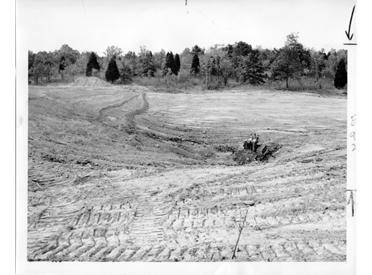
    Above: Bulldozer in 1953 eliminating erosion rills in Wolf Run Grassland Restoration project area. Below: Bulldozer completing site preparation for native seed addition (2023).  Top Photo: St. Louis Globe Democrat, Bottom Photo: M. Saxton

    Native Seeding and Experimentation to promote Biodiversity Recovery 

    During the growing season of 2023, the Restoration team at the Nature Reserve has been feverishly collecting seed for this 2024 seeding effort. More than 1,100 lbs. (~500 kg) of bulk, milled seed from ~200 locally collected native tallgrass prairie and open oak-hickory woodland species will be used in the restoration planting. Additionally, these acres are enrolled in the Environmental Quality Incentives Program, EQIP – part of the Natural Resources Conservation Service, and we must purchase viability-tested seed to meet the minimum required specifications of the contract. The hand-collected seed together with the pure live seed (PLS) – percentage of viable seed in a seed lot – purchased from commercial vendors will provide us with ample species and volume of seed to effectively cover the 40 acres (~16 ha) to be planted this winter. 

    Concurrent with the preparation effort, we initiated a research study, which will help inform our work and the broader research community on plant recruitment amongst scraped soils that have been inoculated with mycorrhizal fungi and those that have not. This study includes paired species from the same genus that have different CC-values, short for coefficients of conservatism, which represents a species’ tolerance of environmental degradation, or its fidelity to intact remnant or long-restored habitats, as determined by local botanical experts. Ecologists generally expect species that are dependent on stable intact communities (higher CC-values) to be more reliant on mycorrhizae connections to establish and flourish. Species with high CC-values tend to establish poorly in restoration sites, which is one of the reasons to pursue this study. Some examples from the ten herbaceous pairs of native species include sedges (Carex bushii [CC = 4] and Carex bicknellii [CC = 10]), grasses (Sporobolus compositus [CC = 3] and Bouteloua curtipendula [CC = 7]), and forbs (Oligoneuron rigidum [CC = 5] and Oligoneuron album [CC = 9]).

    We added all 20 species at the same rate of pure live seed to provide each species an equal opportunity to establish. Initial analyses after one growing season indicate that low CC-value species germinated more successfully, producing more seedlings and greater percent cover than the high CC-value species, regardless of inoculation. We expect the addition of mycorrhizal fungi to have the greatest effects on species during the first couple of years after germination. If the mycorrhizae associate with the roots of the high-CC species more than the low-CC species, this may help them grow faster or be more resistant to future stress. Future monitoring will show us if there are long-term effects of inoculation.

    To check for updates on restoration activities and results from experimental studies, please visit our webpage.

    Barrels of hand-collected seed connected to a seed dryer, which pumps air through tubes into the barrels to eliminate mold & moisture. Photo: M. Saxton