Tag: south america

  • From green and blue forests to social-ecological restoration: restoration futures in southern Chile

    From green and blue forests to social-ecological restoration: restoration futures in southern Chile

    By Matías Barceló

    Matías Barceló is an early career researcher at the Centre for Research and Innovation on Climate Change (CiiCC) at Santo Tomás University, Chile, SECOS Institute and at the Laboratory for Ecosystem Conservation and Human Well-being (LabCBH). His research focuses on local communities and the land-sea interface. In particular, he has worked on assessing the role of local knowledge in adaptive capacity in a rapidly changing world, as well as investigating the various perceived values of nature associated with the various practices of local communities. He is currently assessing how these values can reinforce various initiatives to restore and reconnect degraded and fragmented ecosystems at the land-sea interface.

    Chile is often described through its contrasts: deserts, mountains, temperate rainforests, mediterranean-type climate ecosystems, fjords, kelp forests, and one of the longest coastlines in the world with 4,200 km from north to south, roughly the distance from Lisbon, Portugal, to Moscow, Russia. When accounting for its islands, fjords, channels, and intricate geography, its total coastal perimeter exceeds 80,000 km. These ecosystems also include areas of exceptional conservation value, including the globally recognized Chilean Winter Rainfall–Valdivian Forests Biodiversity Hotspot in central and southern Chile. 

    A map of South America showing Chile (in red) surrounded – and isolated – by the very high Andes mountain range and the Pacific Ocean. Image-generated by Matías Barceló.

    Restoration in Chile is growing, but in what way, and in what direction?

    Our recent review of 95 restoration initiatives, that comes from a dataset compiled by the Chilean Ministry of the Environment, showed that most projects nation-wide are concentrated in terrestrial ecosystems, particularly in central and south-central Chile, where wildfires and forest plantations are among the main drivers of degradation and transformation (see Figure below). Our work showed that 94.7% of the initiatives were terrestrial while the other 5.3% represent wetlands and there are no initiatives in the database focused directly on marine ecosystem restoration, despite Chile’s extensive coastline. 

    This review also revealed a key social gap: only 35.7% of the initiatives explicitly involved local communities from the outset, and when communities were included, their role was often limited to operational activities such as planting, cleaning sites, or basic monitoring. In other words, people participated in restoration activities, but not necessarily in defining restoration goals, identifying priority areas, making decisions, or shaping governance processes.

    The map on the left shows the restoration initiatives recorded by Chile’s Ministry of the Environment between 2010 and 2021, marked with red dots. The panels on the right summarize key features of these initiatives, including: (A) main causes of site degradation; (B) ecosystem type; (C) land use or land cover targeted for restoration; (D) whether actions involved water bodies; (E) whether local communities were involved; (F) whether seeds were collected from nearby areas; (G) whether seedlings were produced by the initiatives; (H) whether planting was carried out; (I) whether monitoring was in place; and (J) whether a reference ecosystem was selected or assembled.

    This is relevant because as mentioned above restoration work should reach beyond ecological goals. If restoration projects focus exclusively on biophysical recovery, they may overlook local livelihoods, cultural values, traditional practices, historical relationships with species, and also the meanings that communities attach to degraded or transformed landscapes. A restoration project can be technically well designed and still fail socially if it does not engage with the people who live in, depend on, and care for those ecosystems. The challenge is to move toward social-ecological restoration, an approach that integrates ecological recovery with local knowledge, values of nature, community participation, and long-term human well-being.

    The mouth of the Chaihuín River where it flows into the Pacific Ocean is a highly representative location for studying land-sea interactions via the river. Chaihuín, Valdivia, Chile. Photo credit: Matías Barceló.

    Why land and sea must be restored together

    Although terrestrial and marine ecosystems are often managed separately, many communities experience them as interconnected territories. Changes in one part of the system can affect the others. Forest degradation can influence water quality, sediment flows, coastal habitats, and livelihoods. Marine degradation can affect food security, local economies, cultural practices, and people’s sense of belonging.

    Drying red seaweed species for marketing purposes on the southern coast of Chile. Photo credit: Matías Barceló.
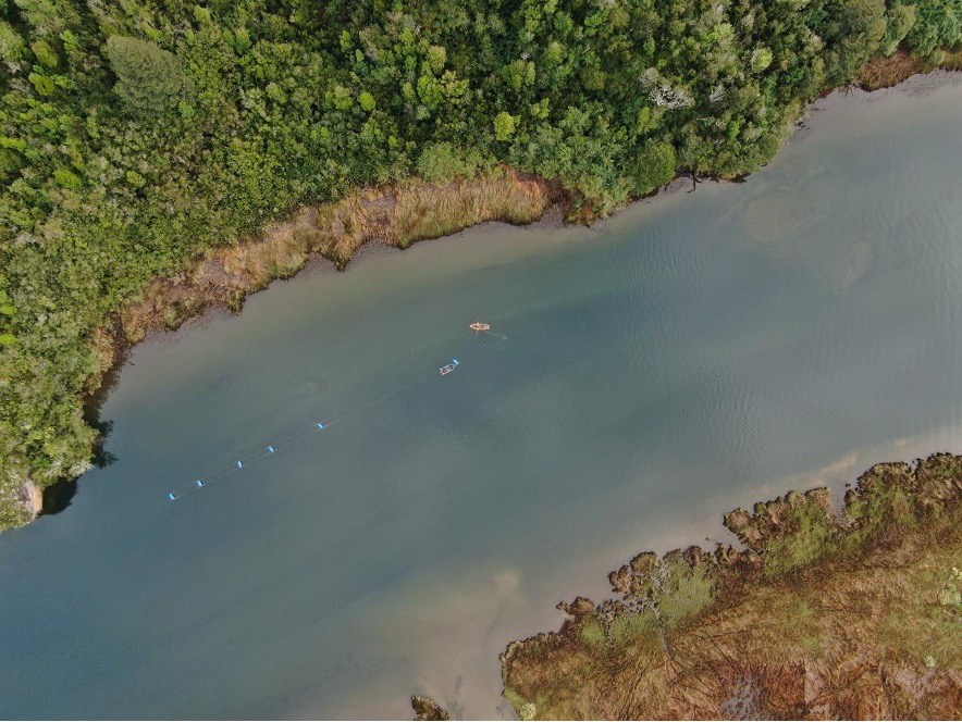
    Artisanal divers checking water quality monitoring equipment. Photo credit: Matías Barceló

    For this reason, we have undertaken a project that focuses on representative coastal sites of southern Chile: Lenca, Puelo, and Cochamó (see Figure below). These places were selected because they represent different but connected expressions of the land-sea interface in the south-central Regions. Lenca combines temperate rainforest, proximity to Alerce Andino National Park, artisanal fishing, seaweed harvesting, and coastal livelihoods. Puelo connects mountain, riverine, freshwater, and marine systems. Cochamó brings together valleys, temperate forests, rivers, coastal areas, artisanal fishing, shellfish harvesting, and community-based tourism. Together, these sites offer a unique opportunity to ask and test how restoration can be conceived not only for “nature”, but also for people.

    (a) Dots indicate the study site locations: Lenca (red), Cochamó (yellow), and Puelo (light blue) in Reloncaví (Llanquihue Province, Los Lagos Region), southern Chile. (b) Pink dots show the locations of the study sites in a subcontinental geographic context. Maps created by Matías Barceló.

    From ecological restoration to social-ecological restoration

    Our project starts with the idea that restoration priorities should be defined by integrating ecological evidence with local perceptions. It combines remote sensing analysis of native and kelp forest change with interviews with local actors about perceived environmental changes, key species, threats, and meaningful places. This information will be co-validated with communities mentioned above, recognizing that scientific data alone is not enough to guide restoration, and that local knowledge is essential to understand degradation and identify restoration needs.

    Why values matter for restoration

    One of the main contributions of this project is its focus on plural values. People value ecosystems in different ways: some values are instrumental like forests and marine ecosystems that provide food, income, materials, protection, or tourism opportunities; others are intrinsic: species and ecosystems may be considered valuable in themselves, regardless of their usefulness to people. But many values are relational: they emerge from identity, care, memory, responsibility, belonging, and connection to place. These relational values are especially important for restoration.

    Our project will explore these values through photo-voice. Participants will be invited to take photographs of places and species that are meaningful to them. Each photograph will be accompanied by a short narrative explaining why the place or species may be relevant for restoration. This method will allow to communicate environmental change not only through words, but also through images, memories, emotions, and territorial experience.

    Co-creating restoration futures

    Our project moves from diagnosis to action. One approach is relevant here. Pockets of the past, which invite communities to identify values, practices, or ways of life from the past that they want to carry into the future. These may include forms of care, uses of species, relationships with rivers or forests, collective practices that remain meaningful for sustainable futures.

    This approach suggests that restoration initiatives can be more legitimate and sustainable when they are grounded in local values, ecological evidence, and community priorities. In this sense, community-led pilot initiatives and methodological guides can serve as useful tools to translate plural and relational values into restoration practice. They offer a pathway for moving from diagnosis to action, while also generating lessons that may be adapted to other land-sea territories facing similar social-ecological challenges.

    A window of opportunity: restoring relationships in southern Chile

    Chile currently finds itself in a unique institutional moment. The National Landscape Restoration Plan 2021–2030 and the newly established Biodiversity and Protected Areas Service that opens a major opportunity to embed social-ecological restoration into national policy and planning. This opportunity will only be meaningful if restoration moves beyond narrow ecological targets. 

    Land-sea interface in southern Chile, showing an area used for mussel farming, which is subject to terrestrial environmental changes resulting from potential land-sea interactions. Photo credit: Felipe Torres.

    Restoration is often imagined as the recovery of what has been lost such as forest cover, indigenous species, habitats, ecosystem functions. But degradation can also weaken what is relational: knowledge, memories, practices, livelihoods, and the sense of belonging that connects people to place. Restoring green and blue forests in southern Chile is not only about recovering trees or kelp. It is also about strengthening relationships that make restoration meaningful: relationships between people and nature. By placing plural values and community participation at the center, this project seeks to contribute to a broader transformation in restoration practice to build more sustainable, just, and place-based futures. 

    This research is funded by The National Agency for Research and Development of Chile (ANID) and it is just getting started; if you’re interested, please don’t hesitate to contact the first author at barcelo.matias@gmail.com.

    I gratefully acknowledge the collaboration of my friends and collaborators Claudia Rojas & Alejandro Venegas‐González.These gaps and lines of research stem from our recent paper in Restoration Ecology.
  • Trouble in Paradise: Why the Galapagos Islands Need Ecological Restoration

    Trouble in Paradise: Why the Galapagos Islands Need Ecological Restoration

    By: Anna Calle-Loor

    MESM Anna Calle-Loor has nearly five years of experience working in ecological restoration and biodiversity conservation in the Galapagos Islands. She is a former researcher for the Galapagos Verde 2050 (GV2050) Program of the Charles Darwin Foundation (CDF). She is also a member of the Galapagos’ Plants Specialists Group of the IUCN’s Species Survival Commission and the Society for Ecological Restoration. annagcalle@gmail.com

    The Galapagos archipelago is famous for inspiring Charles Darwin’s theory of evolution by natural selection after his visit in 1835. Its geographic and environmental characteristics have given rise to unique creatures like giant tortoises, pink iguanas, the second smallest penguins in the world, flightless cormorants, and the only marine iguana. Due to its extraordinary biodiversity, it was established as Ecuador’s first national park in 1959 and declared a UNESCO World Heritage Site in 1979.

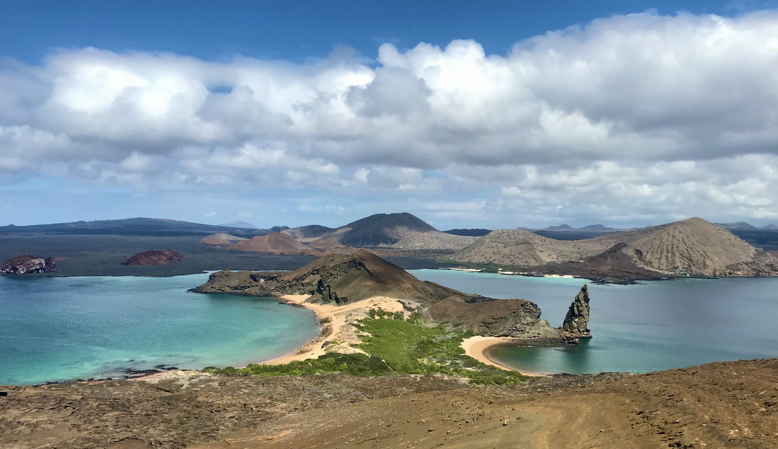
    Bartolomé Island, one of the most photographed landscapes in the Galapagos, offering a view of turquoise bays and the Pinnacle Rock formation. Photo credit: Anna Calle

    Today, the islands’ biodiversity and volcanic landscapes continue to astonish visitors. But behind their reputation as a pristine paradise lies a story of vulnerability, degradation, and a need for ecological restoration.

    Islands: Biodiversity Hotspots and Extinction Hotspots

    Islands often have high levels of endemic species, but they are also highly vulnerable to extinctions. With small populations, restricted geographical ranges, and often having evolved with no predators, many island species are especially sensitive to disturbances.

    We have seen the consequences before. On Easter Island, deforestation and overexploitation of limited resources led to ecological collapse and the downfall of a once-thriving society. Mauritius Island lost the dodo, one of the first species recognized as extinct due to human activity, in the 1600s. Hawaii has earned the unfortunate title of “the extinction capital of the world” because of its high extinction rates of plants, insects, and birds. Guam has lost most of its native birds following the introduction of the invasive brown tree snake. All of these are reminders of how quickly biodiversity can disappear when island ecosystems are disrupted.

    The Galapagos are no exception. With ecosystems that have already suffered degradation, efforts now go beyond species conservation to include ecological restoration.

    A History of Degradation

    With a recorded human history that starts in 1535 with the arrival of the bishop Tomás de Berlanga, there have been many people that have visited the islands and inevitably have left a mark on them. The first visitors were pirates, whalers, prisoners, and a few early settlers. But they did not come alone. They brought rats, cats, goats, and other animals, many of which became invasive and highly destructive. To give you a scale of the problem, an eradication campaign known as Isabela Project was launched in 1997 and eliminated >140K goats from three islands. 

    Today, the pressure continues. Around 30,000 people live in the Galápagos, and nearly 300,000 tourists visit every year. Of course, this level of human activity requires infrastructure. The islands now have roads, towns, gravel mines, agricultural fields, and landfills, all of which exert pressure on the surrounding environment. The continuous flow of tourists and imported goods make introduced species a growing threat.

    In response, the Galápagos National Park Directorate and conservation NGOs like the CDF have launched multiple ecological restoration projects. I have collaborated in several of these efforts through the GV2050 Program, combining endangered species recovery with ecological restoration strategies.

    Recovering Galapagos Endangered Flora

    About 60% of Galapagos flora is threatened with extinction. This includes Lecocarpus lecocarpoides, a shrub with yellow daisy flowers that is found only on Española Island and a few nearby islets. Unfortunately, it has almost disappeared from the main island, with a single population left, likely due to past goat herbivory. Although goats were eradicated from Española in the 1970s, L. lecocarpoides has not recovered.

    That led us to investigate deeper into its biology. Were the remaining plants producing viable seeds? A study found that yes, there was a large number of seeds in the soil and 80% were viable. Then, why did we rarely see any germination? There was something preventing the seeds from germinating, and the same study hinted at the thick outer seed coat. 

    In our laboratory, we found that using a scarification technique consisting of carefully cutting the seeds under a stereoscope leads to high germination rates of 75%. As part of the investigation, we returned 29 adult plants to Española and produced over 6000 seeds to continue restoration efforts. These were promising results, but they also led to more questions.

    Lankester composite dissection plate of Lecocarpus lecocarpoides showing key plant structures. Created by N. Espinosa-Ortega. Originally published in Calle-Loor & Jaramillo (2024).

    How does the scarification process happen in nature? The interactions with other species might play a key role. We have seen moth larvae feeding on the seed coat without damaging the embryo. And we suspect Darwin’s finches might also be involved. They feed on the hard and spiny seeds of Tribulus, which are very similar to Lecocarpus seeds. Could they be helping L. lecocarpoides germinate? This remains to be investigated.

    Restoration of Arid Ecosystems

    The first island most visitors arrive to in the Galapagos is Baltra Island, where the main airport is located. But few realize it is one of the most degraded islands in the archipelago. A combination of invasive especies and the construction of a U.S. military base during World War II led to habitat destruction and likely to the local extinction of land iguanas, the main seed dispersers. Although they have since been successfully reintroduced through a successful captive breeding program, much of the vegetation has not recovered.

    Aerial photo of the U.S. military base “The Rock” in Baltra. Two airstrips, roads, and several buildings can be appreciated. Photo credit: U.S. Army

    A challenge when restoring an ecosystem that has been significantly altered, especially when historical records are scarce, is defining what restoration should aim to achieve. To help answer that, we compared Baltra with its neighbor island, North Seymour, which shares similar ecological conditions but has suffered less degradation. 

    Through two vegetation surveys we identified the plant composition and community structure that once likely existed on Baltra. For example, we found that the five most dominant woody and cacti species in North Seymour are Bursera graveolens, Castela galapageia, Cordia lutea, Opuntia echios, and Parkinsonia aculeata. The surveys also showed that Baltra’s most intact vegetation remains in the north and southwest, while the central region is sparsely vegetated.

    These results can serve as guides for future restoration efforts. For example, for choosing what species to plant and where to plant them. On Baltra, where infrastructure like the airport, roads, and Ecuadorian military base already shape the landscape, restoration should minimize potential conflicts with these other land uses. Instead of trying to recreate the past, efforts should aim to increase connectivity between the two remaining patches of native vegetation to support wildlife movement and seed dispersal.

    Recovering Keystone Species: The Opuntia Genus

    If there is one Galapagos plant that is underrated, is the Opuntia prickly pear cactus. These cacti are a food source for two of the most charismatic animals of the Galapagos, giant tortoises and land iguanas. They also provide native birds with food, shelter, and nesting structures, including Darwin finches and Galapagos mockingbirds, two groups of birds that inspired Darwin’s theory of evolution by natural selection. 

    Additionally, they are one of the best examples of plant adaptive radiation in the Galapagos. Their 14 endemic taxa show great variation in form and size, with up to 4-fold differences in height and 100-fold in seed size. Some grow as tall as 12 meters, about the height of a pine tree! Interestingly, tree-like forms are found on islands with giant tortoises, while shorter forms occur where tortoises are absent.

    Unfortunately, populations have declined in some islands and low regeneration is a pattern throughout the archipelago. This is exacerbated by the pressure from introduced and native herbivores.

    Because of its ecological importance, Opuntia was included in a restoration plan for four islands. Among the actions proposed for increasing its numbers is testing different propagation methods: planting seedlings, cactus pads, seeds from fresh fruits, and perhaps most intriguingly, seeds collected from tortoise and iguana droppings. There is evidence that passing through the digestive system of these animals helps scarify the seeds, improving germination.*

    But giant tortoises and land iguanas are not the only species that seem to be helping Opuntia regenerate. We have observed Opuntia growing underneath the protection of trees and spiny shrubs. Could they be shielding them from herbivores or ameliorating harsh environmental conditions? The answer remains unknown, as there have been no formal studies on plant-plant facilitation in the Galapagos. This presents a unique opportunity to deepen our understanding of plant facilitation in island ecosystems and how these interactions can be used to improve restoration outcomes.

    Left: Giant tortoise feeding on a broken branch of Opuntia cactus. Photo credit: Anna Calle-Loor.
    Right: Cactus finch feeding on the pollen of an Opuntia flower. Photo credit: Elena Espín.

    From Evolution to Restoration
    The Galapagos changed our understanding of how new species emerge. Now, they are challenging us to learn how to repair the ecosystems that sustain those unique species. This extraordinary archipelago is no longer just a living laboratory for evolution. It’s becoming a living laboratory for restoration ecology. And if we get it right, the Galápagos can once again inspire the world, this time by showing what successful ecological restoration can look like, not just here, but everywhere.

    * Estupiñán, S., & Mauchamp, A. (1995). Interacción planta–animal en la dispersión de Opuntia de Galápagos. Charles Darwin Foundation, Puerto Ayora.

  • Birdwatching and organic cacao at Hacienda Herrera: exploring alternative pathways for a sustainable future in the Peruvian Amazon

    Birdwatching and organic cacao at Hacienda Herrera: exploring alternative pathways for a sustainable future in the Peruvian Amazon

    By: Thibaud Aronson

    Thibaud Aronson is a field ornithologist based in Peru, carrying out conservation work in the Amazonas region.

    Sunset at Hacienda Herrera with Puerto Maldonado in the background. © Thibaud Aronson

    Tambopata. For anyone who knows about the Peruvian Amazon, there are few names that are more evocative. All it takes is an hour and a half flight from Lima, quickly leaving behind the parched desert of the coast, flying above snow-capped glaciers, and finally down over the rainforest that surrounds Puerto Maldonado, one of Peru’s three main Amazonian cities. 

    Established in the year 2000 and covering 270,000 hectares (1,000 square miles), Tambopata is one of Peru’s 17 National Reserves. This is a category within the country’s protected area systems that allows a certain degree of human activities within its borders by the local communities. These include scattered Ese Ejja Indigenous people and more recently established colonists from other parts of Peru. The reserve borders the much larger Bahuaja-Sonene National Park, which itself connects to Madidi National Park in Bolivia, where MoBot researchers have been working for many years.

    Blue-and-yellow macaws (Ara ararauna) in a tree along the Madre de Dios River near Puerto Maldonado. © Thibaud Aronson

    Considering it’s a city of nearly a hundred thousand souls, the surroundings of Puerto Maldonado are still surprisingly wild. Macaws and poison dart frogs, some of the most common victims of human encroachment in the lowlands due to the never-ending demands of the illegal wildlife trade, can still be found only a couple minutes outside the city. Likewise, howlers and tamarin monkeys, elsewhere either hunted for food or trapped as pets, still dwell in forest patches on the city’s outskirts.

    Bolivian red howler monkey (Alouatta sera). © Thibaud Aronson

    There are a few reasons for this. First of all, there is more of an ecological conscience here than in many other parts of Peru. Visions of giant river otters or flocks of parrots coming in at clay licks, both easily seen in Tambopata, are some of the most ubiquitous marketing features of Peru’s tourism board, right after Machu Picchu, of course. Indeed, there are daily flights between Cuzco and Puerto Maldonado, one of the only flight routes in the country that connects two provincial cities, instead of having to transit through Lima’s hub. As a result, ecotourism represents a substantial share of the region’s income. 

    Furthermore, one of the main agricultural products of Madre de Dios is the Brazil nut (Bertholletia excelsa, locally called castaña. This is a massive canopy tree, one of the largest in the Amazon Basin, whose fruits are still harvested in a traditional way, within concessions that preserve the existing forest where the castaña trees grow. And of course, much of the region is covered in large protected areas, which are reasonably easy to access, and therefore easier to actually monitor and protect. The Amazonian tracts in central Peru, for example, where ecotourism is essentially inexistent, have been facing much more trouble.

    The dock leading to an ecolodge on Lago Sandoval. © Thibaud Aronson

    However, Madre de Dios is not a perfect Eden either, far from it. The city proper has only existed for a few decades, and reaching it from Cuzco used to be a journey that could take a week, navigating dubious muddy tracks that were regularly blocked by landslides. But since 2011, the city is reachable by an asphalt road, in only 10 hours from Cuzco. This is the infamous Interoceanic Highway, the only road that connects the Pacific and Atlantic shores of South America, and cuts through an immense swath of Amazonia. Years later, the Odebrecht scandal revealed that over 20 million dollars in bribes had been paid out to ensure its building, and economic studies have since demonstrated its very underwhelming contribution to the economy of either Peru or Brazil. But the damage is done.  

    There has since been a massive influx of migrants from the Andes, with a very different culture. They practice slash-and-burn agriculture, which regularly results in out-of-control wildfires. But the main environmental plague has been the gold rush that has been gripping the region for the past two decades. There are some 30 to 50 thousand gold miners in Madre de Dios, many of them working in illegal, small-scale operations on remote river tracts. What is left after these illegal operators move away has been described as moonscapes. And they have impacts far beyond the mining sites themselves. The mercury that is used to extract the gold seeps into the water and soils, to the tune of 50 tons per year, resulting in widespread environmental contamination and serious health issues. Furthermore, the region suffers more and more from increased crime and all the other societal ills that characterize resource-rich frontier regions undergoing rapid and poorly planned development.

    Fortunately, there are people working to propose alternatives for the future of the region. For example, various NGOs, including WWF, are carrying out restoration projects on abandoned mining sites, in some cases working with the miners themselves. Limiting heavy metal contamination, which plants can help with, is in everybody’s interest, after all.

    Hacienda Herrra, an ecolodge on the Rio Madre de Dios near Puerto Maldonado. © Thibaud Aronson

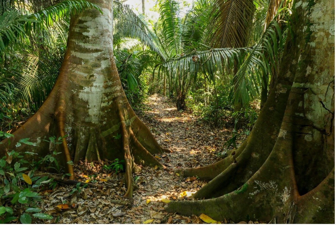
    Another notable initiative is the Hacienda Herrera. This 32-hectare (79-acre) property is located 15 minutes from the city, and reachable only by peque-peque, the narrow, motorized canoes that are the most common means of transportation on the Amazonian waterways. From the small wooden jetty, a path makes its way under massive-buttressed trees towards the buildings of the Hacienda. This land has belonged to the Herrera Segara family for 4 decades, where they used to plant various crops and raise cattle, as the regional government itself gave away cows to local people in order to “settle” the land. However, showing remarkable vision, the family realized the value of the forest they had, and decided to focus on agroforestry systems, growing avocado, orange, cocoa, banana and more, while helping the native forest recover around their crops. Ten hectares of the property (about 25 acres) are occupied by the various organic orchards, while the other 22 hectares (54 acres) are covered in tall forest, which is part of the buffer zone for the Tambopata National Reserve. Then, over 10 years ago, they partnered with CECCOT, the Tambopata Education, Science and Conservation Center, led by Dr. Ursula Valdez, a Peruvian ecologist who now teaches at the University of Washington. Together, they have developed their “forest school” philosophy. 

    Visiting Lago Sandoval with students from CECCOT. © Thibaud Aronson

    Each year, the CECCOT organizes courses and workshops that bring people from all over the world to learn and train at the Hacienda, on topics as diverse as nature photography, bird banding, tree scaling (a highly valuable skill in research projects involving arboreal camera traps or the collection of botanical specimens, for example), and much more. In addition to foreigners, CECCOT always integrates people from local communities to give them new opportunities for training or simply to learn more about the natural heritage of their land. Many local students, but also children from orphanages and disadvantaged communities have been able to come and learn at Hacienda Herrera.

    One of the main goals of the Hacienda is to offer a learning space about biodiversity conservation, but always working hand in hand with sustainable development. Dr. Valdez and her students have been carrying out a long-term study of the birds that use the Hacienda’s organic cacao orchards, and which subset they represent of the avifauna of the surrounding forest matrix. The finding that some of these “cacao birds” include antbirds, understory insectivores that notoriously are some of the first to disappear from fragmented forests, is very encouraging. Camera traps placed along the trails have registered most of Peru’s lowland mammals, including the full suite of felines and even the Short-eared dog (Atelocynus microtis), one of the most elusive mammals on the continent! Sure enough, during my visit, I was lucky enough to photograph a jaguarundi crossing an orange orchard between two forest patches!

    Jaguarundi (Puma yagouaroundi) crossing an orchard at Hacienda Herrera. © Thibaud Aronson

    At the same time, it has also become a gorgeous space to receive visitors and tourists, with a very strong focus on sustainability. This can be seen through the solar panels that are now the main source of electricity for all buildings, the collection of rainwater and the vegetarian cuisine, using products from the Hacienda’s garden and local producers. These have been implemented over time, with the family and the CECCOT sharing costs for the improvements. Ruth and Kenny, the husband-and-wife team, run everyday business at the Hacienda and they have created a travel company that takes visitors to see other natural attractions in the area, such as the famous Sandoval Lake or the Inkaterra canopy bridges.

    Black caiman (Melanosuchus niger). © Thibaud Aronson

    The grounds and trails of the Hacienda are a wonderful showcase for Amazonian biodiversity, from the bats that roost under the thatched roofs of the cabins to the massive caiman lizard that hunts water snails around the seasonal pond near the main building, to the multicolored butterflies that can be seen on flowers along the paths or on the muddy riverbanks. Meanwhile, with some 350 bird species, the Hacienda is becoming a hotspot in the booming world of birdwatching, with Peru finally starting to catch up to Ecuador and Colombia, where birds have been a powerful enginefor conservation and sustainable development.

    Sac-winged bat (Saccopteryx sp.) roosting under the eaves of a cabin at Hacienda Herrera. © Thibaud Aronson

    Besides the visitors, the Herrera family is also generating positive change outside its own borders. Some of the first mammals captured on the CECCOT camera traps were neighbors carrying out timber that they’d illegally harvested from the Hacienda itself. But they slowly made inroads with them, inviting them and their children to show them what they had managed to do. The idea was to have the Hacienda be a model for sustainable living. Things such as renewable energy or clean sanitation for their homes, achieved with relatively low investments. Now some of these same neighbors are implementing agroforestry systems on their orchards and planting native trees around them, while others are opening ecolodges of their own.

    Banana orchard growing in the shade of native trees at Hacienda Herrera. © Thibaud Aronson

    Just across the river is a stark reminder of how things could have gone, with the regular wildfires, illegal land grabs and health problems. On Hacienda Herrera’s side, people seem to finally have agreed that they want to try something else. Not long ago, when there was a problem with a roaming jaguar snatching dogs from people’s backyards, the neighbors got together. With help from experts at the San Diego Zoo, they agreed to a monitoring program, instead of sending a hunting party. After all, the jaguar, or otorongo, is the most emblematic species of the Amazon, even for Peruvians who aren’t of Indigenous descent. They summed it up in one sentence: “Do we want to be the community that kills our jaguar, or the community that protects him?”

    Black-capped squirrel monkey (Saimiri boliviensis) © Thibaud Aronson
  • Early steps towards ecocultural restoration of the ancient Araucaria araucana (Pehuén) forests in Caviahue, Northern Patagonia, Argentina. 

    Early steps towards ecocultural restoration of the ancient Araucaria araucana (Pehuén) forests in Caviahue, Northern Patagonia, Argentina. 

    By: James Aronson, Daniel R. Pérez, and Adam T. Cross 

    Daniel Pérez is head of the Laboratory for Rehabilitation and Restoration of Arid and semi-arid Ecosystems (LARREA) at the Faculty of Environmental and Health Sciences, National University of Comahue, Argentina. He also leads two ecological restoration projects in arid northern Patagonia, the first being the one described here and also the one described in his 2021 NHER post here. In addition, Daniel was coordinator of the Argentinian national Network for Ecological Restoration (ENREA) and organizer of its 3rd Congress held last November. James Aronson and Adam Cross are both members of the Steering Committee of the Ecological Health Network. James is also an Emeritus Scientist of the Center for Conservation and Sustainable Development, MBG, and Adam is Adjunct Senior Research Fellow at Curtin University, Perth, Western Australia.

    Straddling the Andes and the border between Argentina and Chile, an ancient ‘Lost World’-looking forest persists. It occurs in fragments, dominated by the extraordinary Gondwanan conifer Araucaria araucana, called Pehuén in the Mapuche Mapudungun language and widely known by that name today in southern South America. The name of this giant emergent (up to 80 m tall), and very long-lived (1500 years and more), fire resistant ‘living fossil’ tree, is evidently related to the Pehuenche, an ancient ethnic tribe of migratory hunters in south central Chile and adjacent Argentina, before the 16th century CE when Spanish colonists began to arrive and change the course of everything.

    Forest fragment of Araucaria araucana (Pehuén) right in the town of Caviahue, with an understory of the southern South American bamboo, Chusquea culeou. Credit: Laura Abraham.

    The Pehuenche were so named for their dependence on the seeds of the Pehuén as a food source. Between 1550 and 1850 CE, some of them migrated west and merged with other peoples of northern Patagonia, in a process described by historians as becoming Araucanized. In the 21st century these Peoples still retain rights to some of their ancestral lands in northern Patagonia, but just barely. Despite the name Mapuche, which means “people of the land”, their situation in modern day Argentina is truly precarious.  

    While the Pehuén forest is alive and well and regenerating in some large parks in Chile and Argentina, where livestock are excluded, the dominant species is considered critically endangered by the IUCN, and a poignant example of its vulnerability can be found around Caviahue (Roig et al. 2014).

    Typical degraded Pehuén forest remnant near the shores of Lake Caviahue. Credit: Adam Cross.

    Pehuén, the rather odd English common name of which is Monkey Puzzle Tree, is one of only two highly disjunct Araucariaceae representatives in southern South America. The other 18 extant species of this Gondwanan family all occur in the South Pacific region, in New Caledonia, eastern Australia, Papua New Guinea, and Norfolk Island. 

    In Caviahue, whose name most fittingly means “Sacred Place of Reunions”, there is an ambitious ecocultural restoration, rehabilitation, and transcultural sustainable development and educational program getting underway, centered on Pehuén (Pérez et al. 2020). The first activities began six years ago with tree plantations and restoration-based education. Since then, there have been countless meetings with all social sectors of Caviahue such as the Mapuche community elders, Caviahue-Copahue Provincial Park, the Caviahue Ski center, primary and high school principals, political decision-makers, and leaders of the tourism sector, all in search of a social consensus and support for the restoration project. This vocation to build common ideas through dialogue, respecting visions, expectations, and desires of the whole community, is one of the most notable features of the work program. It is partly inspired by the Mapuche name for the site. But, as yet there have been only very limited discussions between the dominant, Spanish speaking, sedentary Western community and the transhumant, Mapudungun-speaking Mapuche.

    Transhumance – a disappearing way of life

    Transhumance is a form of animal husbandry and pastoralism that is remarkably well-adapted to arid and semi-arid lands. The word derives from the Latin trans (beyond) and humus (land), and thus means ‘beyond the land of origin’. It involves biannual movements of flocks between high summer pastures and winter grazing grounds at lower altitudes, or vice versa. In some cases, the entire tribe or group moves with the herds, while in others, only the herders make the biannual trek. This way of life was once widespread, in drylands on most continents, but is now lost and almost forgotten in most places. In Neuquen Province it still survives among the Mapuche. They camp in their ancestral lands near Caviahue lake (1646 meters above sea level) during the warm months, and then during the cold months they and their mixed herds migrate to Huncal (1204 masl) approximately 100 km east and much drier in summer than Caviahue.

    Typical Mapuche settler in transhumance, herding Neuquén Creole goats, a genotype especially well adapted to the region. Credit: Agustín Orejas.

    Although there is a transhumance law in Neuquén that seeks to protect this ancestral practice, Mapuche farmers are often forced to travel along paved roads to reach their destinations because many fields have become the private property of the colonizers and are blocked in with wire fences.

    The Caviahue site joined the Ecological Health Network in 2022 (see here), and a lot has happened since then. The first and third authors of this blog have been offering support to weave together a holistic, ecocultural approach with a focus on human health for the program. Numerous other colleagues in restoration science, and social sciences, from Argentina, Chile, Mexico and Brazil have started getting involved following a visit to the site led by Daniel Pérez of the 3rd Congress of the Argentinian National Ecological Restoration Network held last November, in Neuquén. 

    Field trip near Caviahue. Credit: Adam Cross. 

    The project was initiated with the goal of studying how to restore the Araucaria forest in Caviahue, one tree at a time. It is daunting because the trees grow very slowly and there is little previous research on similar species in xeric regions providing a template to build upon. 

    It has gradually become clear that the restoration of this ancient, isolated Araucaria forest must be ecocultural, and include ecological rehabilitation and landscape reintegration of the degraded grazing lands of the Mapuche pastoralists who camp with their herds of sheep, goats, cows and some horses at one end of Caviahue lake for 6 months of each year. Additionally, the town of Caviahue needs restorative work, because of the planting of invasive Pinus contorta from Western North America, which is escaping and naturalizing in a heritage landscape where this highly competitive conifer does not belong (see below). 

    Araucaria araucana emerging among a dense formation of invasive Pinus contorta in the town of Caviahue. Credit: Laura Abraham.

    At the same time, Daniel and his colleagues came to understand that a truly great context for ecocultural restoration exists here. Caviahue is an extremely interesting town of ca. 1000 permanent residents. There is a strong sense of community among the westerners, and a desire to keep the quiet, nature-based quality of their lifestyle in the town and its valley, despite the interest of many real estate developers to ‘grow’ the ski station and the town, with all its charming low-key tourism services into something much bigger. They are aware that the isolated, relictual population of Pehuén is of great cultural value, but they don’t necessarily see that something can be done to change the nature of the broadly degraded and fragmented landscape where only a few ancient trees remain with little evidence of regeneration. Such change can only come about through trust-building and cooperation with the Mapuche pastoralists. 

    Xeric Araucaria araucana forest remnant, extremely degraded by intensive livestock farming. Credit: Eliane Ceccon.

    If one visits the land of the Caviahue Ski centre, not far from the ski slopes, a spectacular remnant of primary-type Pehuén forest of a few hectares there reveals what the ancestral forest was like, and provides a reference model, at least for the more mesic sites in the valley, to those who would entertain the concepts and a project of ecological restoration.

    Primary-type forest of Araucaria on the protected lands of the Caviahue Ski Center. Credit: Laura Abraham.

    There, one can see the awe-inspiring, living fossil Pehuén trees towering over a thick understorey with Araucaria seedlings and saplings emerging from the deep humus, leaf litter, and topsoil, rather than bare rock and skeletal sands seen more generally in the area. Among the spectacular Pehuén are also seen stands of Antarctic Beech (Nothofagus antarctica), locally known as Ñire, and in the more humid places, the related Lenga (Nothofagus pumilio); both species belong to another Gondwanan genus often co-occurring with Araucariaceae (Peri et al. 2016Veblen et al. 1996). These areas are in stark contrast to the heavily grazed forest remnants where the Nothofagus persist only as rare, isolated stands, the lower two meters or so of which are stripped bare of foliage (Martínez et al. 2023).

    Ñire (Nothofagus anctarctica) on pedestal caused by massive loss of topsoil over many years due in part to over-browsing by goats and cattle. Credit: Daniel Pérez.

    The impacts of tree-felling for timber, overgrazing, and resulting topsoil loss over most of the valley are clearly profound. 

    The species is listed in IUCN’s Appendix I – Threatened with extinction, trade only in exceptional circumstances. Elsewhere, in Lanin Park in Argentina, and Conguillo Park in Chile relatively large stands occur but here in Caviahue, its future depends on local people, of two highly contrasting cultures.

    The Ecocultural Restoration Program led by LARREA at Caviahue will include both the Mapuche pastoralist, transhumant communities, made up of three groups of approximately 600 people each, and the sedendary community of ca. 800 non-Indigenous, European and Levantine descended people in the growing town at the other end of the lake. But how?  At present, there is little interaction among the communities, with one major exception, namely the population of teenagers in the public high school in the town. Roughly 60% of the teenagers in town are Mapuche, and 40% are Western, or non-Indigenous. In a meeting we attended last November, with Oscar Mansegosa the Elected Intendente (Mayor) of Caviahue, and four people from his staff, we learned that many young people in Caviahue experience mental health-related challenges, no doubt linked to the intense cold weather and meters of snow present on the ground for 5-6 months of the year. 

    Additionally, we learned that approximately 80% of the Mapuche students experience some form of blockage to obtain higher education. To help reverse this problem, a programmed diploma course which is being designed by the LARREA team will comprise periods of in-person learning in classrooms combined with practical learning in the field, plus virtual classes and modules. There is an integrated list of classes to be identified, and teachers to be named. Daniel has already begun inviting several of the people who attended the conference (including James) to contribute modules or units to the training course. Daniel will be pursuing further discussions with the university about this Diploma program and hopes EHN and others are willing to help not only with the training course but also with projects in and around the town. He has had clear signals from the senior administration of his University that they are keen on moving ahead with restorative projects like this.

    Class on dormancy and germination of Araucaria araucana seeds offered by LARREA for teachers and students of the Transhumante School No. 6 of Caviahue. Credit. Daniel Pérez.

    Controlling invasive Lodgepole pines: a way to bring people together

    One thing many young and older people in Caviahue do seem to understand is the problem of invasive Lodgepole pines (Pinus contorta) which is escaping from gardens and nearby tree plantations and competing with the native Pehuén

    And that’s something that will be part and parcel of any ecological restoration proposed for this town, its lake, and its valley. If people from different cultures work together to fight the spreading of the pines, and then go on to roll up their sleeves to do other interventions in the spirit of ecological restoration, then we’re in the realm of reciprocal, ecocultural restoration. Note that this Western North American pine, known in English as Lodgepole Pine, is considered one of the world’s worst weeds (CABI Digital Library). Yet in Caviahue many families, and tourism and forestry companies continue to plant this invasive tree, despite the fact that it is invading surrounding properties and fields, radically modifying and degrading the unique heritage and life-sustaining landscape of the Araucaria araucana forest. This needs to be corrected through environmental education, citizen science and community-based restoration and horticulture.

    Indeed, a pathway to help reverse this problem has begun in Caviahue. In 2023, the educational work began at Escuela Transhumante No. 6. The identification of traits of conifers of the genera AraucariaPinusPicea, and Abies, all present in the town of Caviahue, was addressed with teachers and students. In addition, the incessant spread of Lodgepole pine was discussed and the proposal to cut and remove the unwanted pine trees from town parks was accepted.

    A Pine-cutting field course with Caviahue teenagers. Credit: Daniel Pérez.

    The joint task allowed for dialogue and reflection on the value of Araucaria seeds as food for Mapuche communities, their cultural and ecological value, and the risk of the continued invasion of Lodgepole pine to the native forest and the ecocultural restoration program getting underway.

    A young student from the National University of Comahue cutting an invasive Pinus contorta in Araucaria forest with gusto. Credit: Daniel Pérez.

    Perspectives for Restoration-Based Education and training in ecocultural restoration for local people 

    An educational program is being undertaken with the main high school in town, called CPEM 47. This has already provided results published in an article in Spanish. Among the achievements, various tasks carried out by local secondary school students to plant Araucarias and generate participatory maps stand out.

    The educational experiences carried out with students of the Transhumant school to date were extracurricular, that is, in free time. 

    The next step to be developed in 2024 is the participation of the restoration team of the LARREA in formal education programs throughout the school year. 

    Informal class in the field of a member of LARREA with young Mapuches from Transhumante School No. 6. Credit: Daniel Pérez.

    Health and political issues

    In relation to the above-mentioned, non-trivial health issues among teenagers, a very good bond has been built with the medical staff of the Caviahue Health Center. In the meetings held, addictions and depression among young people emerged as the main topics to be addressed. Medical personnel consider that activities such as plant production, plantations, and sowing can contribute to the mental health of young people and within this framework they hope to design activities that in turn will need to be evaluated for their effectiveness and feasibility in terms of time and resources.

    Finally, at the political level, the election of a new mayor for the next four years has just taken place. There are good prospects for including ecological restoration in public policies given that the newly elected mayor had the courtesy to hold a meeting with his cabinet for three hours with restoration experts who visited the town. Next, some work priorities were established, such as the promotion of restoration tourism (direct seeding of Pehuén) and the creation of a diploma course in restoration for local youth. This course will be managed at the National University of Comahue with support in infrastructure for demonstration sites from the Municipality. The training will enable the teenagers and young adults of Caviahue to be better prepared to enter the workplace and discover new opportunities. Hopefully, it will also have positive effects socially through building relationships among Mapuche and Western youth.

    The Mapuche communities have shown great pleasure in participating in actions such as plantations, sowing and extraction of Pinus, although these actions thus far have always been mobilized from LARREA. It is hoped that in the future restoration activities will be assumed as their own by the two communities, Mapuche, and Westerners.

    May it be so.