October 20, 2026
By Erich Hester and Les Naylor
Erich Hester is Professor at Virginia Polytechnic Institute and State University and Adjunct Professor at the University of Idaho. Email: ehester@vt.edu
Les Naylor is Project Lead for the Confederated Tribes of the Umatilla Indian Reservation’s Grande Ronde Research and Monitoring. Email: lesnaylor@ctuir.org
Information presented is reproduced from The Meadow Creek Storymap and the Meadow Creek Collaborative Restoration and Research Plan.
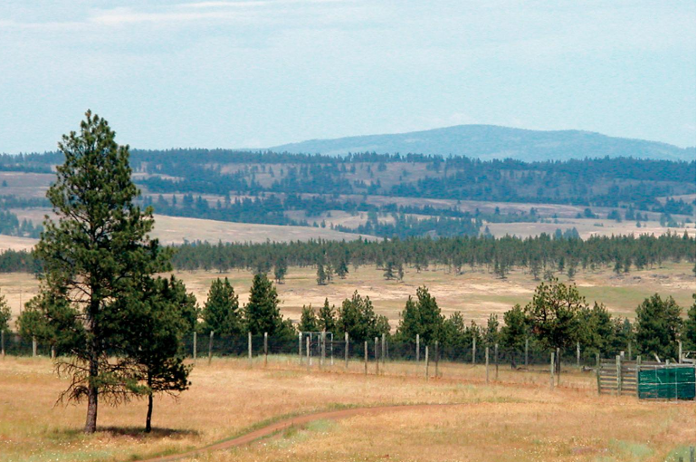
The Meadow Creek Watershed arises in the Blue Mountains of northeast Oregon and flows through more than 100,000 acres (>40,400 hectares) of tribal, federal, and private land before joining the Grande Ronde River. Its steep forests, thin-soiled grasslands, and meandering stream valleys have sustained the Confederated Tribes of the Umatilla Indian Reservation (CTUIR) since time immemorial, providing the First Foods such as salmon, lamprey, elk, deer, roots, and berries that underpin tribal culture, diet, and identity. Yet decades of intensive use have frayed the ecological fabric. Today, an ambitious collaboration is working to mend it, pairing valley-floor stream restoration with upland forest and grassland treatments in one of the most comprehensive, co-stewarded restoration experiments in the western United States.

A History of Alteration
The current condition of the watershed reflects a legacy of management that treated rivers, forests, and rangelands as separate commodities rather than connected living systems. In the valley bottoms, splash dam logging, railroad construction, road building, and sustained livestock grazing converted diverse riparian plant communities to monocultures of exotic forage grasses. Stream channels entrenched and disconnected from their floodplains, summer water temperatures climbed to levels stressful for coldwater fish, and culverts and other barriers blocked access to upstream spawning and rearing habitat for chinook salmon (Oncorhynchus tsawytscha), steelhead (O. mykiss), Pacific lamprey (Entosphenus tridentatus), western river lamprey (Occidentis ayresii), and freshwater mussels, including western pearlshell (Margaritifera falcata) and western ridged mussel (Gonidea angulata).

Meanwhile, the uplands were transformed by fire exclusion and intensive timber harvest. Forests that once sustained open canopy conditions conducive to berry production and quality wildlife forage grew into dense, overstocked stands with uncharacteristically high canopy cover and heavy fuel loads. In the grasslands, invasive annual grasses (particularly North Africa grass, Ventenata dubia) now dominate more than 95% of thin-soiled sites, outcompeting native forbs such as cous biscuitroot (Lomatium cous) and degrading the nutritional value of the landscape for white-tailed deer (Odocoileus virginianus), mule deer (O. hemionus), and elk (Cervus canadensis). These changes have depressed populations of more than 30 vertebrate species of conservation interest and reduced habitat for thinleaf huckleberry (Vaccinium membranaceum), a key berry First Food that thrives when forest canopy is moderated.
Climate change is compounding these legacy effects. Over the past 30 years, the watershed has experienced longer, more intense summer droughts punctuated by higher temperatures and reduced precipitation. Without intervention, stream temperature models project that thermal conditions in most watershed streams will eventually exceed tolerances for many aquatic species during low flow periods. The window for recovery is narrowing, but the collaborative believes the same connectivity that once made the watershed productive can be rebuilt.

Combining Knowledge Systems
Funded in early 2023 through the U.S. Forest Service Collaborative Aquatic Landscape Restoration Program and the Pacific Northwest Research Station’s Northwest Water Initiative, the Meadow Creek Watershed Restoration and Research Collaboration unites CTUIR, the Wallowa-Whitman National Forest, the Columbia River Inter-Tribal Fish Commission, the Bureau of Land Management, Oregon Department of Fish and Wildlife, Oregon State University, University of Idaho, Virginia Tech, and a broad network of tribal, state, federal, and non-governmental partners.
What distinguishes this effort is the intentional integration of Indigenous Traditional Ecological Knowledge (ITEK) with western research, monitoring, and evaluation (RM&E). For CTUIR, this marks the first time the Umatilla River Vision and the First Foods Upland Vision have been woven into a single, intensively monitored watershed plan. Traditional knowledge of historical conditions, disturbance regimes, and species use is being documented alongside empirical research to characterize ecological baselines and identify meaningful indicators of recovery. A centralized data management system will allow partners to share findings across institutional boundaries and adjust management through an iterative adaptive cycle.

Restoring from Ridge to River
The restoration strategy is conceptualized around two interconnected spheres: the valley floor and the uplands.
Valley floor restoration focuses on stream riparian recovery. Treatments aim to reconnect channels to their floodplains, restore native riparian cover, reduce late summer water temperatures, and eliminate fish passage barriers. Because grazing has been a persistent stressor, the team is also evaluating novel management tools, including virtual fencing, to protect recovering riparian vegetation while maintaining agricultural and cultural uses of the landscape.
Research on the valley floor is tracking hydrologic regimes, fish habitats and populations, aquatic macroinvertebrate and food web dynamics, riparian vegetation structure and function, and the response of native bee pollinators. Researchers are also testing stream and riparian health indicators such as bryophyte communities and Multiple Indicator Monitoring evaluations.
Upland restoration addresses forest and grassland degradation. In forests, treatments emphasize thinning dense understories and reducing canopy cover to restore stand conditions that favor snow retention, soil moisture, and the growth of berry producing shrubs such as thinleaf huckleberry. Thinning is also expected to improve forage quality and access for elk and deer, while reducing wildfire risk.
Grassland work focuses on controlling invasive annual grasses and re-establishing native plant communities. Researchers are monitoring the effects of fuels reduction on snowpack dynamics, understory vegetation composition, and the nutritional status of ungulate First Foods. Vertebrate species of conservation interest (including snag-dependent birds, old forest associates, and pollinators) are also being surveyed, alongside small mammals, amphibians, and bats.
A key objective is to understand how upland forest restoration interacts with valley floor hydrology. By treating the watershed as a connected system rather than isolated project sites, the collaboration hopes to capture synergies that single objective restorations often miss.
Learning as We Go
The collaboration has distilled its monitoring agenda into a set of priority questions. How do valley floor treatments affect hydrology and stream temperatures? What are the consequences for salmon, steelhead, lamprey, freshwater mussels, and aquatic macroinvertebrate communities? How effective is virtual fencing in supporting riparian recovery? In the uplands, how do forest treatments alter snow distribution and the timing of melt? Which control methods work best for invasive grasses? And critically, what are the cumulative effects of watershed-scale restoration on native pollinators and culturally significant First Foods species?
Answering these questions is not merely an academic exercise. The Starkey Experimental Forest and Range, a 25,000-acre research landscape within the watershed, has served as an outdoor laboratory for 40 years, making Meadow Creek an unusually well positioned venue for long term, experimental restoration science. The information generated here is intended to guide not only local management but also restoration policy across the western United States.

Looking Ahead
Over the next decade, partners will transition from planning to on-the-ground implementation, testing whether a holistic, co-stewarded approach can recover both biological integrity and cultural productivity in a working landscape. If successful, the Meadow Creek collaboration will demonstrate that ecological restoration at the watershed scale is not only biologically necessary but also socially possible with diverse knowledge systems, agencies, and communities moving forward together.
For more information about the Meadow Creek Watershed Restoration and Research Collaboration, visit https://storymaps.arcgis.com/stories/55eecfedb69241b4bcb98141ba82c66a.
Collaborative Partners
These partners are currently engaged in major restoration and research efforts.
- Confederated Tribes of the Umatilla Indian Reservation
- Columbia River Inter-Tribal Fish Commission
- U.S. Department of Agriculture Forest Service, Wallowa Whitman National Forest, Pacific Northwest Region (Region 6), Pacific Northwest Research Station, and Rocky Mountain Research Station
- Northern Blues Forest Collaborative (formal collaborative with Wallowa-Whitman National Forest)
- U.S. Department of the Interior Bureau of Land Management
- Oregon Department of Fish and Wildlife Research- Wildlife Division
- Oregon Department of Fish and Wildlife Research- Fisheries Division
- Oregon State University
- University of Idaho
- Virginia Polytechnic Institute and State University
- Bonneville Power Administration
- U.S. Bureau of Reclamation
- U.S. Geological Survey
- Grande Ronde Model Watershed (non-governmental organization)
- Eagle Environmental, Inc. (private biometrician services)
- Oregon Water Resources Department
- Rocky Mountain Elk Foundation (non-governmental organization)
- National Council for Air and Stream Improvement
- Oregon State University Extension
- U.S. Department of the Interior Natural Resources Conservation Service
- Oregon Watershed Enhancement Board
- Union County Soil and Water Conservation District
Sources
Most information presented is reproduced from The Meadow Creek Storymap and the Meadow Creek Collaborative Restoration and Research Plan.

