MESM Anna Calle-Loor has nearly five years of experience working in ecological restoration and biodiversity conservation in the Galapagos Islands. She is a former researcher for the Galapagos Verde 2050 (GV2050) Program of the Charles Darwin Foundation (CDF). She is also a member of the Galapagos’ Plants Specialists Group of the IUCN’s Species Survival Commission and the Society for Ecological Restoration. annagcalle@gmail.com
The Galapagos archipelago is famous for inspiring Charles Darwin’s theory of evolution by natural selection after his visit in 1835. Its geographic and environmental characteristics have given rise to unique creatures like giant tortoises, pink iguanas, the second smallest penguins in the world, flightless cormorants, and the only marine iguana. Due to its extraordinary biodiversity, it was established as Ecuador’s first national park in 1959 and declared a UNESCO World Heritage Site in 1979.
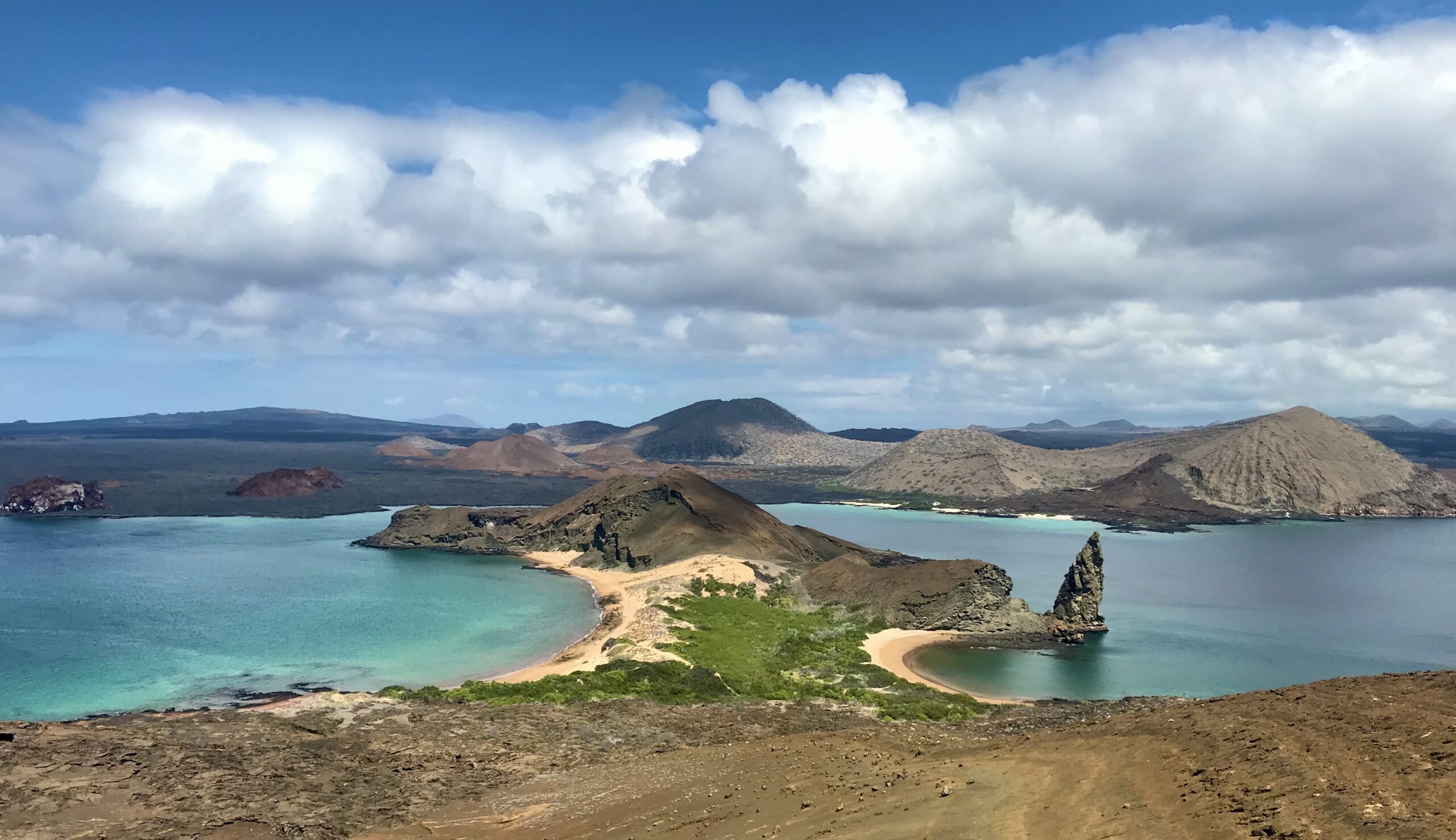
Bartolomé Island, one of the most photographed landscapes in the Galapagos, offering a view of turquoise bays and the Pinnacle Rock formation. Photo credit: Anna Calle
Today, the islands’ biodiversity and volcanic landscapes continue to astonish visitors. But behind their reputation as a pristine paradise lies a story of vulnerability, degradation, and a need for ecological restoration.
Islands: Biodiversity Hotspots and Extinction Hotspots
Islands often have high levels of endemic species, but they are also highly vulnerable to extinctions. With small populations, restricted geographical ranges, and often having evolved with no predators, many island species are especially sensitive to disturbances.
We have seen the consequences before. On Easter Island, deforestation and overexploitation of limited resources led to ecological collapse and the downfall of a once-thriving society. Mauritius Island lost the dodo, one of the first species recognized as extinct due to human activity, in the 1600s. Hawaii has earned the unfortunate title of “the extinction capital of the world” because of its high extinction rates of plants, insects, and birds. Guam has lost most of its native birds following the introduction of the invasive brown tree snake. All of these are reminders of how quickly biodiversity can disappear when island ecosystems are disrupted.
The Galapagos are no exception. With ecosystems that have already suffered degradation, efforts now go beyond species conservation to include ecological restoration.
A History of Degradation
With a recorded human history that starts in 1535 with the arrival of the bishop Tomás de Berlanga, there have been many people that have visited the islands and inevitably have left a mark on them. The first visitors were pirates, whalers, prisoners, and a few early settlers. But they did not come alone. They brought rats, cats, goats, and other animals, many of which became invasive and highly destructive. To give you a scale of the problem, an eradication campaign known as Isabela Project was launched in 1997 and eliminated >140K goats from three islands.
Today, the pressure continues. Around 30,000 people live in the Galápagos, and nearly 300,000 tourists visit every year. Of course, this level of human activity requires infrastructure. The islands now have roads, towns, gravel mines, agricultural fields, and landfills, all of which exert pressure on the surrounding environment. The continuous flow of tourists and imported goods make introduced species a growing threat.
In response, the Galápagos National Park Directorate and conservation NGOs like the CDF have launched multiple ecological restoration projects. I have collaborated in several of these efforts through the GV2050 Program, combining endangered species recovery with ecological restoration strategies.
Recovering Galapagos Endangered Flora
About 60% of Galapagos flora is threatened with extinction. This includes Lecocarpus lecocarpoides, a shrub with yellow daisy flowers that is found only on Española Island and a few nearby islets. Unfortunately, it has almost disappeared from the main island, with a single population left, likely due to past goat herbivory. Although goats were eradicated from Española in the 1970s, L. lecocarpoides has not recovered.
That led us to investigate deeper into its biology. Were the remaining plants producing viable seeds? A study found that yes, there was a large number of seeds in the soil and 80% were viable. Then, why did we rarely see any germination? There was something preventing the seeds from germinating, and the same study hinted at the thick outer seed coat.
In our laboratory, we found that using a scarification technique consisting of carefully cutting the seeds under a stereoscope leads to high germination rates of 75%. As part of the investigation, we returned 29 adult plants to Española and produced over 6000 seeds to continue restoration efforts. These were promising results, but they also led to more questions.
Lankester composite dissection plate of Lecocarpus lecocarpoides showing key plant structures. Created by N. Espinosa-Ortega. Originally published in Calle-Loor & Jaramillo (2024).
How does the scarification process happen in nature? The interactions with other species might play a key role. We have seen moth larvae feeding on the seed coat without damaging the embryo. And we suspect Darwin’s finches might also be involved. They feed on the hard and spiny seeds of Tribulus, which are very similar to Lecocarpus seeds. Could they be helping L. lecocarpoides germinate? This remains to be investigated.
Restoration of Arid Ecosystems
The first island most visitors arrive to in the Galapagos is Baltra Island, where the main airport is located. But few realize it is one of the most degraded islands in the archipelago. A combination of invasive especies and the construction of a U.S. military base during World War II led to habitat destruction and likely to the local extinction of land iguanas, the main seed dispersers. Although they have since been successfully reintroduced through a successful captive breeding program, much of the vegetation has not recovered.
Aerial photo of the U.S. military base “The Rock” in Baltra. Two airstrips, roads, and several buildings can be appreciated. Photo credit: U.S. Army
A challenge when restoring an ecosystem that has been significantly altered, especially when historical records are scarce, is defining what restoration should aim to achieve. To help answer that, we compared Baltra with its neighbor island, North Seymour, which shares similar ecological conditions but has suffered less degradation.
These results can serve as guides for future restoration efforts. For example, for choosing what species to plant and where to plant them. On Baltra, where infrastructure like the airport, roads, and Ecuadorian military base already shape the landscape, restoration should minimize potential conflicts with these other land uses. Instead of trying to recreate the past, efforts should aim to increase connectivity between the two remaining patches of native vegetation to support wildlife movement and seed dispersal.
Recovering Keystone Species: The Opuntia Genus
If there is one Galapagos plant that is underrated, is the Opuntia prickly pear cactus. These cacti are a food source for two of the most charismatic animals of the Galapagos, giant tortoises and land iguanas. They also provide native birds with food, shelter, and nesting structures, including Darwin finches and Galapagos mockingbirds, two groups of birds that inspired Darwin’s theory of evolution by natural selection.
Additionally, they are one of the best examples of plant adaptive radiation in the Galapagos. Their 14 endemic taxa show great variation in form and size, with up to 4-fold differences in height and 100-fold in seed size. Some grow as tall as 12 meters, about the height of a pine tree! Interestingly, tree-like forms are found on islands with giant tortoises, while shorter forms occur where tortoises are absent.
Unfortunately, populations have declined in some islands and low regeneration is a pattern throughout the archipelago. This is exacerbated by the pressure from introduced and native herbivores.
Because of its ecological importance, Opuntia was included in a restoration plan for four islands. Among the actions proposed for increasing its numbers is testing different propagation methods: planting seedlings, cactus pads, seeds from fresh fruits, and perhaps most intriguingly, seeds collected from tortoise and iguana droppings. There is evidence that passing through the digestive system of these animals helps scarify the seeds, improving germination.*
But giant tortoises and land iguanas are not the only species that seem to be helping Opuntia regenerate. We have observed Opuntia growing underneath the protection of trees and spiny shrubs. Could they be shielding them from herbivores or ameliorating harsh environmental conditions? The answer remains unknown, as there have been no formal studies on plant-plant facilitation in the Galapagos. This presents a unique opportunity to deepen our understanding of plant facilitation in island ecosystems and how these interactions can be used to improve restoration outcomes.
Left: Giant tortoise feeding on a broken branch of Opuntia cactus. Photo credit: Anna Calle-Loor. Right: Cactus finch feeding on the pollen of an Opuntia flower. Photo credit: Elena Espín.
From Evolution to Restoration The Galapagos changed our understanding of how new species emerge. Now, they are challenging us to learn how to repair the ecosystems that sustain those unique species. This extraordinary archipelago is no longer just a living laboratory for evolution. It’s becoming a living laboratory for restoration ecology. And if we get it right, the Galápagos can once again inspire the world, this time by showing what successful ecological restoration can look like, not just here, but everywhere.
*Estupiñán, S., & Mauchamp, A. (1995). Interacción planta–animal en la dispersión de Opuntia de Galápagos. Charles Darwin Foundation, Puerto Ayora.
Katalin Török and Melinda Halassy are restoration ecologists specializing in sandy grasslands in Central Hungary. Katalin focuses on botany, ecology, and biodiversity monitoring. Melinda, formerly Katalin’s student, took part in their first restoration experiment and is likely Hungary’s first PhD in restoration ecology. Their research aims to identify barriers to spontaneous restoration and analyze long-term ecological processes triggered by various restoration methods to find the most effective approaches. Both contribute to international ecological research (eLTER) and restoration policy (SERE), working to link scientific knowledge with public policy in ecological restoration.
KIskun LTER Restoration Experiments site is located in a unique sandy landscape of central Europe. Situated at the center of a vast sandy region, the core area of Kiskunság National Park represents one of the largest of its kind in Central Europe, spanning approximately 7,400 square kilometers. This unique environment is especially accessible near the village of Fülöpháza, where visitors can experience an impressive range of sand dunes. The landscape features both open sand steppes and wind-blown dunes, offering a rare glimpse into one of the continent’s most distinctive and unusual natural habitats. Credit: Melinda Halassy, CER2021
The ecosystem
One of Hungary’s most distinctive geological regions is the Danube–Tisza Interfluve (Kiskunság), which is an important reservoir of biological diversity within the Pannonian Biogeographical Region of Europe. Situated at the westernmost edge of the vast Eurasian forest-steppe biome, this region is part of a bioregion that extends approximately 9,000 km from Central Europe to Eastern Asia, covering more than 4.7 million km² (Erdős et al. 2022). The Eurasian forest-steppe represents Hungary’s dominant vegetation type, covering more than half of the country. Although the grasslands in this zone are sometimes misinterpreted as being heavily deforested in historic times, ecological models that integrate climate variability, topography, soil conditions, herbivory, and natural fire regimes reveal that forests and grasslands naturally coexist in a dynamic mosaic within the forest-steppe zone (Erdős et al. 2022).
The largest and most ecologically diverse areas of the region preserve the characteristic ”puszta“, which includes both sandy and alkaline grasslands, sand dune forests, and remnants of former sodic pans, marshes, fens, fen meadows, and wet grasslands. The inland sand dunes, shaped by wind action, consist of coarse-textured, lime-rich soils that are low in water and nutrients, supporting unique vegetation, including specialist plant and insect species. The sandy forest-steppe of the “puszta” consists of poplar-juniper sand dune forests and thickets, as well as open oak-dominated woodlands forming complex mosaics with both open and closed sand grasslands, all of which are considered habitats of high conservation concern by the European Commission. The driest grasslands in the region, known as ”Festucetum vaginatae danubiale“ community, are found on the crests and southern slopes of sand dunes. These grasslands are characterized by tussock-forming grasses such as the endemic grass Festuca vaginataand the protected Stipa borysthenica, interspersed with cryptogam cover of mosses, ferns, lichens, etc. and frequent patches of bare ground.
Sandy Forest-Steppe Mosaic of the Puszta: Poplar-Juniper Stands and Open Sand Grasslands. Dominated by White Poplar (Populus alba), this landscape reflects the natural vegetation adapted to arid, sandy conditions. Credit: Evgeni Dimitrov, eLTER 2023
Throughout the 19th and 20th centuries, the landscape underwent significant human modifications, beginning with river regulation and drainage, followed by agricultural intensification and plantation forestry. As a result, the region is now predominantly covered by agricultural lands, forest plantations, and fragmented remnants of semi-natural grasslands. During the post-socialist transition (1987–1999), large-scale agricultural land abandonment occurred, particularly in low-productivity areas such as the Kiskunság (Valkó et al. 2016). While some native vegetation regenerated spontaneously, abandoned lands also became increasingly susceptible to invasion by non-native species. One of the most problematic invaders is Black locust (Robinia pseudoacacia), a fast-growing, nitrogen-fixing hardwood tree from eastern North America, which has spread extensively. Another notorious example is Common ragweed (Ambrosia artemisiifolia) that we will discuss below. The expansion of invasive species not only threatens native biodiversity and ecosystem health but can also have negative impacts on human health.
Land abandonment presents a valuable opportunity for the spontaneous regeneration of native sandy grasslands, it also introduces significant ecological challenges. One of the most pressing threats to natural recovery is the aggressive spread of invasive alien plant species, particularly Common milkweed (Asclepias serica, formerly A. syriaca). Credit: Melinda Halassy, CER 2021
Restoration experiments
For the past 27 years, we have been conducting restoration experiments at the Kiskunság Long-term Ecological Research site to facilitate the recovery of sandy grasslands on lands degraded by Black locust plantations and arable cultivation. Our research focuses on the long-term effects of various treatments aimed at overcoming barriers to spontaneous grassland regeneration, assessing the positive and negative influences of the surrounding landscape, and enhancing invasion resistance through seed-based restoration.
Our findings indicate that active restoration interventions can significantly accelerate recovery. Specifically, sowing a mixture of locally sourced grass and forb species has proven to be the most effective method for initiating restoration in dry grasslands and controlling invasive species (Reis et al. 2023). Additionally, carbon amendments and mowing can serve as valuable complementary measures; however, they should be applied cautiously in invaded landscapes to avoid unintended ecological consequences (Reis et al. 2022).
Seeding Native Species: A Key Strategy for Restoring Sandy Grasslands. In the restoration of dry sandy grasslands, sowing a carefully selected mixture of locally sourced grasses and forbs has emerged as the most effective strategy for initiating vegetation recovery and suppressing invasive species. Although remnants of native sand grasslands remain in the landscape, their specialist species show limited natural dispersal capacity. As a result, abandoned agricultural fields are often colonized by weeds and invasive alien plants, which significantly hinder the process of secondary succession. Research has shown that even the low-rate seeding of as few as five native species can have a catalytic effect, facilitating the establishment of characteristic grassland communities and accelerating the recovery of degraded former croplands. Credit: Melinda Halassy, CER2021
The success of restoration efforts is further challenged by the presence of other aggressively invasive species beyond Black locust, including the tree of heaven (Ailanthus altissimus) and the herbaceous Common milkweed (Asclepias serica (formerly A. syriaca), which are particularly widespread in forest plantations (Csecserits et al. 2016). Even after the removal of dominant invasive species, new invasions may occur, likely due to legacy effects and the high dispersal capacity of these non-native species (Reis et al. 2023). To mitigate these negative impacts, restoration efforts should prioritize areas with lower invasion pressure or integrate early seeding of native species as a complementary strategy for invasion control (Csákvári et al. 2023, Halassy et al. 2023).
Managing Invasive Species: The Limitations of Mowing in Invasive Species Control. Mowing is widely used as a method to control the spread of invasive alien species. However, experience indicates that mowing alone often fails to deliver satisfactory results. This is largely due to the persistent legacy effects of previous invasions and the limited natural dispersal capacity of native grassland specialist species. While mowing can effectively suppress certain targeted invasives, it does not prevent secondary invasions—the establishment of other non-native species that quickly occupy the disturbed space. To ensure successful and lasting restoration, mowing must be combined with the active introduction of native species, which can stabilize the ecosystem and reduce vulnerability to further invasions. Credit: Márton Kállai 2023
Restoration – human health links; research in progress
Enhancing public health through ecological restoration efforts can be of significant importance. Ecosystem services and direct contact with nature may contribute to this improvement (Millennium Ecosystem Assessment 2005, Marselle et al. 2021), but robust evidence is needed to establish clear links between biodiversity, ecological restoration, and human health at landscape, regional, and national scales.
In Hungary, a national project has recently been launched to investigate these nature–health connections using ecosystem condition maps and health data (https://termeszetem.hu/en). This initiative aims to identify correlations between environmental factors and various health indicators, such as the prevalence of allergies, depression, autoimmune and inflammatory diseases, and self-reported well-being. The research focuses on detecting these relationships at the sub-regional scale and in urban areas, as well as assessing the economic impacts of health conditions. A key initial focus of the project is the highly allergenic Common ragweed (Ambrosia artemisiifolia), which poses significant public health challenges throughout Europe and elsewhere.
Restoration as a Tool to Combat Common Ragweed and Its Public Health Impact. Abandoned croplands provide favorable conditions for the establishment and spread of Common ragweed (Ambrosia artemisiifolia), a highly invasive species known for its allergenic pollen. This plant poses a growing public health threat across Europe and beyond. In 2015 alone, ragweed allergy adversely affected the health of an estimated 13.5 million people in Europe, resulting in public health costs exceeding €7.4 billion (US$8.1 billion). Common ragweed thrives in open, disturbed soils, making abandoned agricultural lands particularly vulnerable to colonization. However, as natural vegetation succession progresses and plant cover becomes denser, ragweed populations tend to decline. This succession process can be significantly accelerated through active ecological restoration, which helps close vegetation gaps more quickly, thereby limiting the window during which ragweed can release its pollen and spread. Credit: Anikó Csecserits, CER 2020
Battling Common ragweed – for ecosystem and human health
Successes so far with reducing invasion of Common ragweed (Ambrosia artemisiifolia) are noteworthy. For starters, note that the disservices of Common ragweed are already serious and likely to get worse throughout Europe since its allergenic pollen affects one in ten people throughout the European continent. Schaffner et al. (2022) estimate that the health of 13.5 million people was adversely affected in 2015 by Common ragweed allergy in Europe alone, generating 7.4 billion euros (8.1 billion US$) in public health costs. Happily, our ecological restoration interventions have already demonstrated their effectiveness in battling this noxious annual weed (Fig. 1).
Figure 1. The decrease of cover of the highly invasive, and allergenic, common ragweed (Ambrosia artemisiifolia), under three different restorative treatments and control. The figure shows the pooled data of three experiments that included mowing (Reis et al. 2021), carbon amendment (Halassy et al. 2021) and seeding (Reis et al. 2023) between 1995 and 2019. Carbon amendment through addition of sucrose and sawdust reduced available N-levels in the soil. Mowing was carried out twice a year, and was followed by removal of dry plant biomass.
The successful reduction of Common ragweed invasion serves as a promising example of how ecological restoration can yield measurable benefits for human health. The new national-scale study aims to provide evidence-based insights into the potential interconnections between ecosystem health and human well-being. These findings could help inform policy decisions related to land management and restoration efforts not only in Hungary but also in other regions.
A potential next step is to investigate links between ecosystem conditions and asthmatic diseases. By analyzing data on general practitioner and specialist visits for asthma-related complaints, as well as the purchase of asthma-specific medications, we can correlate health trends with different ecosystem states across temporal and spatial scales (Nitschke et al. 2022). This approach will allow us to assess the broader health impacts of ecological restoration.
Moving forward, we plan to deepen our research on the relationship between ecological restoration and human health by collaborating with the Ecological Health Network and its member sites and hubs working on similar challenges. We believe that participation in an international social impact network will not only advance our research but also enhance its value and real-world impact.
Dr. Pablo Friedlander, Director of Acción Serrana has initiated and led pioneering restoration and intercultural education projects in Argentina, Brazil and Spain for more than two decades. He also organizes ethnobotanical research and expeditions to the Amazon and the Andes. pablofriedlander@gmail.com
Biologist Romina Torre is the executive coordinator of Acción Serrana, with ten years of experience in mountain restoration, research and educational activities involving rural communities, health practitioners and scientific institutions at bioregional and international levels. torre.romina@gmail.com
Introduction to the Polylepis forests
In the highest mountains of South America, remnants of vast stands of so-called cloud forests dominated by members of the beautiful Rose-family genus Polylepis are found throughout the Andes Cordillera, from Colombia and Venezuela to northern Chile and northwestern Argentina. In addition, in the much older Sierras Grandes de Córdoba, in central Argentina, the endemic Polylepis australis (locally known as Tabaquillo), occurs in scattered fragments of once extensive mid-altitude forests. At the continental scale, the canopies of these open, moist formations, or what remains of them today, comprise 45 recognized species and constitute the highest altitude forests on Earth (Boza Espinoza & Kessler 2022). Sadly, their range and integrity has been drastically reduced by logging, burning, and overgrazing since the 16th century, especially with the introduction of European cattle.Their moss- and lichen-covered branches collect fog, while their roots prevent erosion and regulate water runoff. These forests also contribute to climate change mitigation, by favoring carbon sequestration, and they support diverse endangered species dependent on these habitats. In all seven of the Andean countries where they occur, the restoration and conservation of these cloud forests is of vital importance to local communities and to protect. the headwaters of the main rivers and creeks (del Campo & Friedländer 2023).
This locally famous ‘Grandfather’ Tabaquillo (Polylepis australis) tree grows in the heart of one of the last remaining cloud forest fragments in Córdoba province.The Argentina anole, Pristidactylus achalensis, is an endemic lizard of the Pampa de Achala.
The hand-shaped Polylepis leaves and the soft, multi-layered bark of the trees, draped with epiphytes, mosses and lichens, collect fog and give rise to the compelling and accurate image of the forest “milking” the omnipresent mist and clouds. At a continental scale, these cloud forests when they are healthy and thriving contribute to the ‘biotic pump’ connecting the Andes- the Amazon-and the Atlantic Forest biomes (Beveridge et al. 2024) and regulating water and climate cycles and reducing the risk and severitry of wildfires. The savannas and cloud forests The recent increase of forest fires in all biomes of South – and Meso- and North America – demands more strategic and intercultural, public-private coalitions to increase restoration areas and protection of basins at multiple spatial scales for present and future generations (Argañaraz et al. 2015; Argibay & Renison 2018). Additionally, Polylepis roots and their mutualistic microorganisms retain and enrich soils. They also provide a ‘framework’ for regenerating forest communities undergoing active or assisted restoration. Indeed, when mature, these emblematic forests harbour very high biodiversity, including many endemic species of epiphytic orchids, insects, birds and reptiles, and also provide a wide range of ecosystem services to people at multiple spatial scales. Finally, they have huge cultural significance, and by working in synergy with local communities we aim to introduce and sustain biocultural as well as ecological restoration.
Conserving and Restoring the cloud forests with Acción Serrana and Acción Andina
In 2002, the project “Milking the Clouds” (Ordeñando Nubes, in Spanish) was launched, along with other local grassroots initiatives. Then, after a long learning curve in restoration methods and typical pioneering struggles, the five interrelated projects gradually scaled up their ‘footprint’ and their impact to a bioregional level over the next decade and a half. A big step was taken in 2018 when, together with the ECOAN (Asociación Ecosistemas Andinos) and Global Forest Generation, Acción Serrana was set up as a hub including 5 different local organizations to help in the launching of “Acción Andina” as a a new international ecocultural restoration consortium. In that context, Acción Serrana is now managed by the Fundación de Actividades Biosféricas as part of Acción Andina.
Currently working in Peru, Ecuador, Colombia, Bolivia, Chile and Argentina, with 23 member institutions, Acción Andina partners have planted more than 7 million Polylepis trees, of many different species, and this number is rising each year, as is the success rate of the plantings. In 2023, Accion Andina received the prestigious Earthshot Prize, and in 2024 we were named one of the 7 UN World Restoration Flagships for the UN Decade on Ecosystem Restoration 2021-2030.
Map of the 12 Acción Serrana restoration sites in the Sierras Grandes de Córdoba.
The 12 biocultural restoration areas in the Sierras Grandes of Córdoba under Acción Serrana management add up, at the time of writing, to a total of 3,170 fenced hectares.
The reforestation and restoration campaigns are made possible by 65 permanent staff members and over 1,500 volunteers per year on average. To date, we have produced and planted more than 860, 000 Polylepis australis nursery-grown saplings in consecutive seasons (see https://ecohealthglobal.org/network-sites/accion-serrana-argentina/). All of these trees were grown from seeds collected locally in each of the planting areas managed by the five different partnering organizations or local implementing groups For the 2024-2025 October 2024 to March 2025 planting season, 250,000 trees were propagated in the 29 plant nurseries we maintain, and at the time of writing most of the plantings have been very successful. Since 2023, Accion Serrana has been helping to replicate the same initiative in Northwestern Argentina, with the Project Arbol y Vida in Jujuy Province (in cooperation with various high-Andean communities) and the Germinar Project in Tucuman Province (working with Diaguita communities of the Tafi del Valle bioregion), advising on and synergizing actions and application of techniques and strategies. In addition to this biocultural restoration, another critical line of work is our environmental education program being run in local schools and municipalities for more than a decade already.
The ecosystems of Acción Serrana areSub-Andean and Chaco serrano forests and grasslands(sensu Cabrera 1976), composed of seasonally dry forests or open woodlands with 4 different altitudinal belts in the central Argentina mountain ranges, Sierras Grandes de Córdoba (Giorgis et al. 2011). The land tenure of the areas under restoration inside the Provincial Watershed Reserve of Pampa de Achala, which consists of private landholdings subject to Provincial Management & Conservation plans, or public protected áreas within the National Park Quebrada del Condorito. The numerous activities we carry out include: maintenance and fencing of new areas, native forest tree and shrub seed collection, construction and improvements of nurseries, germination of seedlings, transplanting of seedlings to reusable plastic forest tubes, high mountain transfer of seedlings to the planting areas and their planting in the intervention areas during the rainy season. We establish permanent plots for scientific monitoring and we support research carried out in the intervention areas. Workshops, public talks and training programs are also organized yearly to train and recruit more enthusiastic and qualified citizen restorationists for the work in the mountains.
Acción Serrana team planting the native Polylepis australis of Córdoba province.
Implementation of Acción Serrana with local partners in reciprocity
We work to generate ecological, economic, social and cultural sustainability by reaching agreements with landowners, communities, networks and institutions (municipalities of Mina Clavero and Villa de Las Rosas, the Ministry of Education of the Province of Córdoba, and others).
To help with the local matching needed to be part of the Acción Andina initiative, Acción Serrana had set up the Ayni Plan (“ayni” meaning “reciprocity” in the quechua language of the Andes). Basically this implies the commitment to generate 30% of operating costs through specific fundraising campaigns and by other quantified means. For example the constant one of inviting the public to participate by donations of the costs required for producing a forest (25 trees under monitoring), a tree or a volunteering activity. Then we promote the reception of donations of funds, lands, tools, materials, vehicles, etc.. In addition, we encourage ecotourism with a schedule for each area: summer plantations and seeds, winter transplanting of seedlings and fencing of restoration areas. Acción Serrana aims to increase reciprocity and abundance also throughout the different courses and events both virtual and in-person, and some special community parties, with raffles, concerts, talks, video screenings, and promotion of crowdfunding campaigns. Currently we are running our international matching crowdfunder campaign with the help of the Treeangle Foundation from the United Kingdom, as we have done each year from 2012, to complete the mission of this season January 2024 – March 2025. (See video here.)
In the years ahead, Acción Serrana will propagate and plant a wider variety of native trees and shrubs in pursuit of a Framework species approach to restoration such as that being tested by EHN partner Daniel Perez and his team in Caviahue, Patagonia (Perez et al. 2019; see also here and (here). As a new initiative, we aim to deploy 30% of funds raised to reintroduction of multipurpose Neltuma (formerly Prosopis) species and other framework species in lower altitudes of the mountain system, and 70% to ongoing Polylepis restoration in the high mountains. This year, we have begun studying how to propagate the obvious additional choices of “framework species” namely Maiten (Maytenus boaria), Escalonia (Escallonia cordobensis) and Molle (Lithraea molleoides).
Escallonia cordobensis a formerly common shrub now considered key to restoration.Co-dominant Maytenus boaria and Polylepis australis ‘giants’.
Next steps
Following decades of reforestation and cloud forest restoration, we are working with Indigenous inhabitants in these mountains, including the Comechingones (Henia and Camiare tribes) and Sanavirones peoples, who have been historically marginalized. We are cultivating intercultural bridges (Rojas et al. 2025) in áreas like nursery propagation, environmental education, and llama and alpaca reintroduction and ancestral practices of weaving with camelid wool. This collaborative framework aims to integrate and restore key zones around the Ansenuza Sea, Traslasierra Valley, Pampa Achala, and Pampa de Pocho.
In January 2025, Acción Serrana became a new member hub of the Ecological Health Network, following two fruitful visits from James Aronson. These visits facilitated knowledge sharing and collaboration, furthering our core purpose of scaling up watershed restoration, enhancing environmental education, and deepening intercultural collaboration for research projects. By integrating ecological, social, and economic perspectives and approaches, we aim to share our regenerative experiences across mountains, jungles, deserts and oceans within a quickly growing international network of networks. We are delighted to be part of this movement and consortium with a strong, clear set of values and shared purpose – something we all need to cultivate in these critical times. As a meaningful next step of Acción Serrana, we look forward to participating in multi-site research projects based on the simultaneous monitoring and evaluation of a series of ecological and human health indicators in areas undergoing biocultural restoration protocols. Through these efforts, we are committed to enhancing ecosystem health and strengthening our relationship with nature, ensuring the longevity and health of Andean cloud forests and lower buffer zones of Chaco serrano forests -as well as the local communities living there for generations to come.
The Mount Desert Land & Garden Preserve’s mission is to conserve and share the beauty of our historic lands and gardens, which it does by managing three historic gardens and approximately 1,400 acres (567 ha) of natural land on Mount Desert Island, Maine for ecosystem health. Also, as needed, we undertake restoration interventions, particularly in our post-agricultural meadows.
Mount Desert Island (‘MDI’, ~60,000 acres, 24,280 ha) is well known for its breathtaking, rugged coastal scenery and for holding the largest unit of Acadia National Park (~30,500 acres, 12,343 ha), one of America’s earliest (1916) and most visited (~4 million visitors/year) national parks. The two other units of Acadia National Park include part of Schoodic Peninsula (2,366 acres, 957 ha) and part of Isle au Haut (2,900 acres, 1,200 ha). The Garden Preserve’s natural lands are directly adjacent to Acadia National Park and mirror it ecologically; both are covered by spruce-dominated hills (primarily red spruce, Picea rubens), streams and wetlands.
Acadia National Park (shown in green on map) comprises three primary units. Mount Desert Island is home to the park’s largest unit. The yellow star shows the location of the Land & Garden Preserve’s natural lands (1,400 acres, 567 ha). Map courtesy of US National Park Service.
As the Land & Garden Preserve’s Director of Natural Lands, I am charged with conserving the ecological integrity of the natural lands while ensuring safe public access. Our ten miles of trails and ten miles of carriage roads see over 75,000 visitors per year. A twenty-acre, post-agricultural meadow sits at the heart of the natural lands, and from the nearby carriage road the meadow provides picturesque views of the surroundings, making this a popular destination for walkers, dog walkers, horseback riders, and bird watchers.
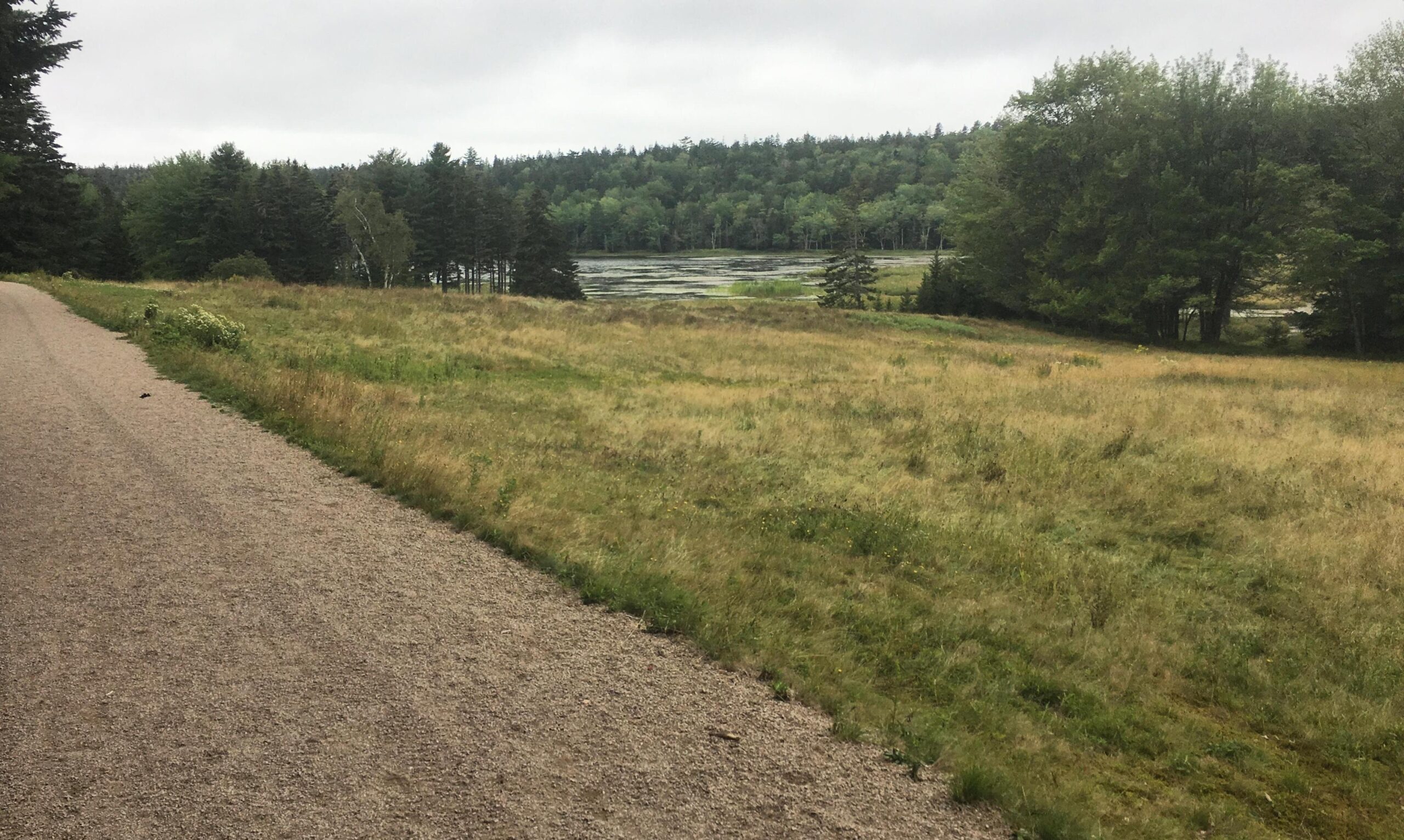
A ‘carriage road’ sits next to the 20-acre meadow. Because of its views, this road is a draw to thousands of walkers and nature enthusiasts. (This and all other photos are by the author unless otherwise indicated.)
I have focused management on Garden Preserve’s meadow because early successional habitats are uncommon on Mount Desert Island (Acadia National Park manages less than 100 acres of upland meadows on MDI) and because of the presence of invasive glossy buckthorn (Frangula alnus), invasive reed canary grass (Phalaris arundinacea), and some other weedy, nonnative plants. To establish a firm understanding of the plant community I commissioned a wonderful field botanist to conduct a survey of the meadow’s vascular plants (completed in 2020). From 2019-2021 we eradicated the canary grass from three monoculture patches (totaling 2,500 ft², 232 m²) and began restoring the area left behind. We have used a 130-year-old dataset – Flora of Mount Desert Island, Maine, published in 1894 – to better understand changes in the meadow’s plant community, and help us select a plant species list for our ecological restoration work. I also visited approximately 15 different meadows – ranging from 2-60 miles (3.2 km – 97 km) away – to develop a loose reference system. The goal of this restoration work was to 1) ensure long term eradication of reed canary grass and, 2) establish an enduring native plant assemblage that could provide habitat and other ecosystem benefits to the meadow’s fauna. I began with a conservative approach to ‘native’ and selected species according to this hierarchy:
MDI>Hancock County>Maine>New England. Most species we use in this restoration naturally occur in Maine.
Aerial photo of a portion of the Land & Garden Preserve’s meadow. Two patches of invasive reed canary grass are visible: center left (with hole in middle of patch), and center (some soil is exposed). Once the grass was eradicated, we restored the areas with native plants. Photo credit: Allison Bourke.
The 1894 Flora of Mount Desert Island, Maine by Rand and Redfield
The Champlain Society was a group of scientifically minded Harvard students who, starting in the early 1880’s, dedicated their summers to learning and documenting MDI’s natural history. Student Edward L. Rand headed up the society’s botanical studies and, along with John C. Redfield, published the Flora of Mount Desert Island, Maine in 1894. The flora is incredibly comprehensive, including nearly 1,500 species of vascular plants, marine algae, bryophytes, and lichen. Remarkably, MDI represents less than 1% of the state of Maine’s land area but supports more than half of its known plant species (Greene et al. 2005).
Members of the Champlain Society at their summer campsite on Mount Desert Island, 1880. These students from Harvard University summered on MDI starting in 1880 and documented the island’s natural history. Photo credit: Mount Desert Island Historical Society.
The 1894 Flora has proven to be a reliably accurate reference for late 19th century plant life on MDI. For example, by reviewing the herbarium vouchers, Greene et al. (2005) concluded that less than 45 taxa were misidentified. As a natural resource professional, this 285-page book serves me as a priceless reference. I even found an original copy signed by the authors in the Garden Preserve’s library!
Old datasets of this breadth, accuracy and credibility are rare, and therefore extremely valuable to understanding how plant communities change over time. When you compare the ‘Flora of Mount Desert Island, Maine’ (1894) to the contemporary ‘Vascular flora of Acadia National Park region, Maine’, (2005) as MacKenzie et al. (2019) did, you can see just how much has changed in approximately 120 years. They report that between 1894 and 2005, 15.8% of the original species are no longer found on MDI, 34.4% declined in abundance, 30.4% experienced no apparent change in abundance, 19.4% increased in abundance, and there were 205 new plant species in 2005.
In their 1894 Flora, Rand and Redfield left us wonderful notes about each taxa’s abundance, special occurrences and locations, which I’ve used to reconstruct something of an 1894 Flora for the Garden Preserve’s meadow (albeit incomplete). For example, many entries include location names where large populations of that taxa could be found, and location names such as ‘long pond meadows’ (the old name of our meadow), ‘Seal Harbor’ (the village where the meadow is found), ‘road to Jordan Pond’ (approximately ½ mile from meadow) provide a direct link to the Garden Preserve’s meadow of the 1880’s. To show how prevalent this anecdotal data is, ‘Long Pond meadows’ is included in 30 taxa entries and ‘Seal Harbor’ is included in over 100 taxa entries.
Where Rand and Redfield did not provide location names, I use their notes on habitat (e.g., ‘fields’, ‘meadows’, ‘open areas’) and abundance (e.g., ‘common’, ‘frequent’, ‘rare’), and what I personally know about these species’ habitats to infer which taxa were found in 1894 at or around the Garden Preserve’s meadow. For example, the entry for New York aster (Symphyotrichum novi-belgii) includes ‘Abundant everywhere in both wet and dry ground’ (pg. 115). Therefore, although Rand and Redfield did not tell us that New York American aster was found at the Long Pond meadows, I can assume that it was.
When I compared my 2020 meadow survey (340 taxa) to the list I recreated from Rand and Redfield’s 1894 Flora, I found that at least nine native forbs were likely present in the late 19th century but are no longer found on or around the Garden Preserve’s meadow. I call these ‘historic’ species. There are more than nine historic species, but for the purposes of this article, I only discuss the taxa considered for meadow restoration. The nine historic forbs I have identified are:
Although I conclude that these species are no longer found in our meadow, they have not been extirpated from Maine. For example, I see Anaphalismargaritacea growing on roadsides on MDI, and I infrequently see Eupatorium perfoliatum in Acadia National Park. Likewise, I see large swaths of Symphyotrichum lanceolatum on the mainland, just three miles from MDI. Other Symphyotrichum species were more difficult to find, but they still turned up when I searched similar meadows approximately 30-60 miles from MDI.
Natural resource professionals can be apprehensive by nature because we fear the slow creep of local species extinction. We understandably get nervous when our data reveal that we lost at least nine forbs in a 130-year span. The reasonable question becomes: ‘With viable populations of these historic species nearby, should we include these in our ecological restoration efforts’?
Using ‘historic’ species in meadow restoration efforts
Starting in 2021 we decided to incorporate eight of the nine ‘historic species’ into our meadow restoration efforts (Virginia virgin’s bower requires different habitat characteristics and was used elsewhere), via two different methods: 1) planting pint and quart-size live plants, and 2) seeding (with associated seed bed preparation). These eight historic species were among a larger group of approximately 25 species, all of which are native to Maine and/or New England and found in similar early successional habitats.
The author monitors the germination of native plants at a restoration site, August, three months after seeding. The site was formerly dominated by invasive reed canary grass. Photo credit: Christa Little-SieboldRestoration site, June, in its second growing season. We used a seed mix of twenty native species (13 forbs, 7 graminoids).Restoration site, August, in its second growing season.
The Mount Desert Land & Garden Preserve operates a propagation facility to support the needs of our three gardens, and the propagation staff enthusiastically grows native plants from seed for our restoration projects on the natural lands.
Staff propagator waters her plants in the Land & Garden Preserve’s propagation facility. Photo credit: Cassie Banning.
While obtaining the seed for the historic species, I employed a ‘local is better’ mindset regarding provenance. I collected seed from populations on MDI where possible, then as near as possible thereafter. Where I couldn’t collect the seed for a given species myself or obtain wild-collected seed from a trusted colleague in Maine, I purchased seed from the Wild Seed Project (Portland, Maine). Some of the asters were only available through larger, Midwestern nurseries such as Prairie Moon Nursery (Minnesota).
A pint sized wavy-leaved aster ready for planting in a meadow restoration site that was formerly dominated by invasive reed canary grass.
The only consistent impediment to historic plant reintroduction and establishment that we have observed has been deer browse, which impacted six of the eight species.
Staff planting native plants in a restoration site.
The National Park Service’s ecologists conducted forest health assessments in Acadia National Park, 2006-2013, and found that forest health is relatively good, and that deer abundance is within the carrying capacity of the park (i.e. tree regeneration is sufficient). In fact, for both of those metrics, the forests of Acadia National Park scored better than the seven other National Park forests in their ‘Northeast Temperate Network’ study. Acadia National Park’s forests may not be experiencing the detrimental effects of deer browse that many other forests in eastern USA are (yet), but my work in the Garden Preserve’s meadow suggests that forb diversity in early successional habitats is – at least in part – influenced by deer. Ask any gardener or farmer in the northeast USA, and they will agree that deer are an issue.
In New England, white tailed deer abundance has risen and fallen in response to landscape-scale land use changes since European colonization. The 1890’s saw the lowest historic deer population in the United States (only 350,000 animals). It is very likely that the flora documented by Rand and Redfield in the late 1800’s thrived in a period of low deer abundance, which allowed some of these more deer palatable historic species to survive.
White tailed deer browse on New England aster in a meadow restoration site. Notice that the terminal shoot has been chewed off.
It’s not currently realistic to manage the deer herd on the Garden Preserve’s natural lands so I have experimented with planting some of the deer-palatable historic species in areas that deer are less likely to access, such as behind pre-existing fences and near buildings and other structures. I have had good success with this.
This fence was erected to manage human and dog traffic entering a pond, but we have since used it to deter white tailed deer from browsing historic species.Here we are using historic species joe-pye weed (pink flowers) and boneset (white flowers) behind a fence where deer cannot reach it. In the absence of deer browse, both species have flourished.Virginia’s virgin bower, an historic species no longer found on Land & Garden Preserve’s natural lands. Here, we use the vine on a fence where it has space and support to grow and spread.
At the Garden Preserve, we are not attempting to recreate past ecological conditions. Incorporating some historic species into our meadow restoration would be nice if it were possible, but I am keeping an open mind going forward regarding which plants we promote versus which plants we try to remove. We have experimented with some (native to Maine) species not currently found on MDI or in the county. So long as deer browse remains an issue, we may need to use plant species that are not native in the strictest sense, and I personally feel comfortable with that. Our restoration work is benefitted by partnering with others in the Northern Appalachian/Atlantic Maritime hub of the Northeast Seed Network.
By: Karin Sternberg with inputs from Sue Milton. All images were taken by the author.
Karin Sternberg is an amateur naturalist and conservationist focused on the study of solitary bees and wild honeybees in the Great Karoo region. Over the past decade, she has conducted research into the ecologies of these essential pollinators, documenting more than one hundred wild honeybee nests during the course of her fieldwork. Her research is self-funded. Sue Milton is an arid zone restoration ecologist based in the Karoo region of South Africa. She is the owner of Wolwekraal Nature Reserve and Wolwekraal Conservation and Research Organisation (https://www.wcro.co.za) that promotes conservation, education and research in the Karoo.
Wolwekraal Nature Reserve in the Great Karoo.
There are 2755 bee species in sub-Saharan Africa, about 1300 of which occur in South Africa. Of these, only the honeybee and 10 species of mopane bees store honey, but all bees are important pollinators of a wide variety of plant species. They pollinate not only fruit and field crops, but most of the annuals, succulents and shrubs that make up the natural grazing lands, particularly in the more arid parts of South Africa. The arid, winter-rainfall region of South Africa known as the Succulent Karoo, is extraordinarily rich in succulent plants—and in the solitary bees that visit their flowers. Bee hotspots with around 700 bee species are found in the arid winter and aseasonal rainfall regions of South Africa.
Nesting sites of the solitary bees Samba (left) and Colletes (right) on the inner edge of an aardvark burrow.
In September 2024, I spent several weeks documenting the diversity and behaviour of solitary bees on Wolwekraal Nature Reserve which lies within the arid, aseasonal rainfall bee hotspot in the southern Karoo. This Nature Reserve protects rare succulent plants, most of which are pollinated by bees and flies, but the reserve is also used for conducting restoration trials. Most of these focus on revegetating patches of bare ground where over-grazing or corralling destroyed vegetation centuries ago and led to wind-blown loss of the shallow topsoil. Over millennia the vegetation here has adapted to withstand dramatic temperature fluctuations, from severe winter frosts to scorching summer heat at times exceeding 45°C, often enduring prolonged periods of drought. Extreme droughts, such as the 8-year-long dry period from 2015-2022, can kill 40 to 80% of long-lived plants, and because perennials do not maintain seed banks there is only limited regeneration of these after drought-breaking rain. Annuals, such as Gazania lichtensteinii (Asteraceae), emerge in their masses, saturating the landscape with colour and scent. This is a cue for the emergence of solitary bees which can remain dormant for months or years.
The barren ground of a deflation hollow which is home to so much insect diversity (left) and the vegetation surrounding the deflation hollow (right).
Dead honeybees and soldier termites in an aardvark burrow following a clash between the two species occupying it as nesting sites.
The flora surrounding this bare ground is a stark reminder of the Karoo’s remarkable resilience, showcasing a rich tapestry of species that thrive in one of the world’s most harsh climates. Yet, amid this tenacity, certain areas of the landscape remain barren and hardened—perhaps trampled centuries ago by fat-tailed sheep held in corals overnight to protect them from predators, or more recently, during the 19th century when the natural rangeland was stocked way over the capacity of the vegetation to recover.
Not long ago, I buried a wild hare—a tragic victim of roadkill—in an aardvark dugout: a deep, empty cavity in an area of hard ground I could never have dug myself. My sister, with her characteristic humour, had remarked, “Everyone needs an aardvark.” Indeed they do. For Aardvarks (Orycteropus afer) are extensive burrowers in sub-Saharan ecosystems, actively modifying their environment in the construction of shelters, and in excavating termitaria for food. This, in turn, generates nest sites and unique habitats that support a variety of other species. Burrows of aardvarks are used as shelter by foxes, porcupines, suricates, birds and honeybees. Moreover, when their large burrows collapse they form dams that capture seeds and water and initiate vegetation regeneration. As I reflected on the hare’s untimely death, I was once again captivated by the number of solitary bees nesting in holes on the inner edges of these burrows. Like the wild honeybees in these landscapes, many species are dependent on the aardvark for their nest sites; a reminder of nature’s interconnectedness. All around the dugout vibrant yellow swathes of Gazania lichtensteinii (Asteraceae) were in flower, their annual beauty enhanced by early winter rains.
The seemingly lifeless stretch of ground, a wind-scoured deflation hollow, was located close to this dugout. Deflation hollows form where vegetation is lost allowing wind to remove sandy topsoil and expose a hard subsoil comprising desert dust cemented with calcium carbonate. They are often associated with stone age human settlements of hunter-gatherers and herders. At this particular deflation hollow, there are various stone tools made from chert including a stone arrowhead. Standing on this hardened ground I was struck by a common misconception: that bare earth signifies death. Often ignored in environmental assessments, this apparently barren, hard ground was, in fact, teeming with life and intrigue. Initially mistaking the sounds I was hearing for a drone congregation area—where honeybee males dart through the sky waiting for a queen—I quickly realised that the sound was emanating from the ground.
Male Tetraloniella solitary bees congregating around the nest holes, waiting for the females to emerge.
A closer look revealed a fascinating gathering of male Tetraloniella bees. These short-horned, longhorn solitary bees were eagerly vying for a chance to mate with a female as she emerged from her underground nest.
Although solitary by nature—females work alone in building nests and provisioning food—these bees form dense aggregations in favourable environments. The apparent barrenness of the ground belied its role as a prime breeding ground, and I counted an astonishing 114 nests in the vicinity.
The evolutionary journey of bees, stretching back around 100 million years, began with solitary, predatory mud-dauber wasps, coinciding with the rise of flowering plants. Today, bees exhibit remarkable diversity. They range in size from a mere 2 mm to 39 mm and come in various forms, from densely hairy to smooth and shiny, often adorned with striking colours and patterns. Most species of solitary bees prefer to nest in the ground, often utilising plant materials or resin to line their nests. On this hard, bare ground, the thriving community of Tetraloniella served as a vivid testament to the vibrant life hidden beneath the surface.
The deflation hollow measured 24 m by 13 m, with nests concentrated in a mere 12 square metres. The solitary male bees have one primary role: to mate. To prepare for mating in the earlier hours of the day, the males press their bodies against the sun-warmed sand, basking to boost their speed for the frenzied mating rituals to come. Many were covered in bright yellow Gazania lichtensteinii (Asteraceae) pollen, evidence of their flower visits for a source of energy-rich nectar.
A small section of the Tetraloniella nest aggregation.
In addition to the Tetraloniella, there were other species thriving in this environment. Among them were various species of leafcutter, dauber and mason bees (Megachilidae) that make their nests in pre-existing burrows. The leafcutters were using both leaves of Lessertia annularis (Fabaceae) as well as petals of Gazania lichtensteinii (Asteraceae) to construct thimble-like cells. One of the females used chewed reddish-pink plant pulp to line her burrow walls. The collected pollens for provision of larvae with food were from plants different from those used for nesting materials, possibly from Melobium candicans (Fabaceae) or Rushia bijliae (Aizoaceae), both in flower and in range of the nest sites and on which Megachilidae were sighted.
Leafcutter, dauber and mason bees thriving on the deflation hollow.
A closer examination of the ground revealed a Camponotus rufopilosis ant carrying a dead conspecific. With mandibles featuring 5 to 7 teeth, these ants defend themselves by spraying formic acid when threatened. Meanwhile, a brown-and-white striped fly (probably in the genus Parisus) hovered above a bee nest, rapidly depositing 33 eggs. This Bombyliidae fly is known to parasitise a range of insects including bees. This observation might represent a new host record, and underscores the intricate relationships between host and parasite.
The climax of my observations came when a chaotic scrum formed around a single nest hole, where male bees gathered in a frenzied attempt to mate with the emerging virgin female. As mating commenced, the male, mounted on the female, used his antennae to possibly fan a courtship pheromone believed to induce receptiveness in the female. Clasped tightly to her, other males attempted to dislodge him, displaying a complex mating struggle.
A mating pair of short-horned longhorn Tetraloniella bees.
While at the study site, I saw numerous other creatures including lizards (rock agama and Namaqua sand), cryptic Sphingonotis grasshoppers, beetles, robber flies (Asilidae), and a wingless female mutillid wasp, entering the nest of a solitary bee by using her abdomen to push aside stones. I also heard barking geckos and, with much patience, managed to photograph one in its burrow. Overhead many kinds of birds flew by, including two pale chanting goshawks. Beyond this deflation hollow, I discovered an extraordinary nest in the shallow of a stone with a Chalicodoma mason bee sealing it closed with mud.
Camponotus rufopilosis ant carrying a dead conspecific (top left) Parisus fly laying eggs (top right) Cryptic Sphingonotis grasshopper (centre left) Mutilid wasp (centre right) Barking gecko (bottom left) Pale chanting goshawk (bottom right).
This study illuminated a critical lesson: even the most unassuming, barren stretches of land may be far from lifeless. They may harbour intricate ecosystems teeming with life that defies initial perceptions. The conservation of these natural ground-nesting habitats is crucial. Therefore, these often-overlooked spaces must be included in environmental impact assessments, as they may support complex and often unnoticed biodiversity, and may be vital for the survival of solitary bees and other species. Though tiny, bees and other insects are the architects of entire ecosystems. Through pollination, they shape which plants thrive or fade, ultimately contributing to the plant composition of particular regions. This, in turn, largely determines the composition of insect communities that maintain overall biome structure.
Bare ground is too rich in life to be ignored; recognising such ecosystems is essential for maintaining biodiversity and ecological resilience, while still allowing for erosion control and restoration efforts such as reseeding rehabilitation and replanting on damaged lands to enhance ecosystem health. While much restoration effort in rangelands is concentrated on revegetating bare ground, some hard, bare soil patches should be left as habitat for specialised soil-nesting bees and pollen wasps. Diversity begets diversity.
For readers interested in a deeper exploration of wild honeybees and solitary bees, we invite you to refer to our published paper in The Science of Nature and to visit our website for additional resources and information.
Note from the editors: This month marks ten years since we started Natural History of Ecological Restoration! During the last decade, we’ve posted 127 times on a wide variety of ecological restoration stories from around the world. At the same time, our global readership has grown from 4,000 viewers in our first full year to more than 14,000 viewers in each of the last five years, with readers coming from 150 countries. At their best, NHER stories illuminate ecological restoration’s natural history, taken in the most inclusive sense to mean stories about the people, places, organisms, institutions, and interactions involved in ecological restoration projects.
This month’s post by Allison Simler-Williamson (Boise State University) exemplifies this standard. In her post, Dr. Simler-Williamson describes how environmental conditions, land manager decisions, and restoration outcomes interact in complex and confusing ways – and she charts a path forward for better understanding the real-world impacts generated by restoration projects.
A “randomized” experiment can be a beautiful and powerful tool in restoration ecology. Randomization ensures that an experimental treatment (such as a restoration action) is unrelated to any other environmental factors that might influence the outcome we are measuring (such as plant establishment). When we confidently compare plots that received an herbicide or planting treatment to adjacent “reference” sites, our estimation of restoration effectiveness hinges on this assumption of randomization.
But, despite their elegance, randomized experiments are labor-intensive and often spatially or temporally constrained, limiting how applicable they may be to new areas or in atypical years. Thus, randomized experiments are increasingly mismatched with widespread ecological degradation and growing needs for restoration. Emerging “big data”, such as the US Geological Survey’s Land Treatment Digital Library, which contains information about more than 65,000 restoration treatments that have occurred on Bureau of Land Management land in the western United States, could help tackle the problem of understanding restoration efficacy across wide spatial and temporal scales.
When we pivot to using these “observational” datasets, which are opportunistically collected, we incur an important tradeoff. We gain generalizability but lose the power of randomization because (and this likely is not a surprise to anyone working in restoration!) real-world management treatments are almost never applied randomly across large landscapes. Restoration occurs in certain parts of landscapes more than others, due to a mix of ecological need, bureaucratic constraints, and stakeholder decision-making processes.
Why is this lack of randomization a problem when we want to leverage these kinds of large datasets? In statistics courses, I like to use some of my son’s favorite bathtime toys as an analogy for what can occur. When you pour water into these colorful pipes, the wheels spin, and my son loves to create networks between them. If the pipes are arranged as below (Figure 1A) with water flowing through them, it would be immediately obvious that there is no direct relationship between the wheels “X” and “Y” – they are simply both being spun by the water flowing out of “Z”. However, if I were to obscure the connections between the pipes (Figure 1B) and instead ask you, “Based on your observations, is there a relationship between X and Y?”, you could detect a correlation. Depending on your understanding of the system, you might assume that this link is a direct cause of X on Y, or vice versa.
Figure 1. Confounding variables (Z) jointly impact a predictor variable (X) and our response (Y), biasing our understanding of the relationship between X and Y.
This phenomenon is an example of statistical “confounding,” in which a background driver can bias our understanding of the relationship between two other variables. This potential for confounding is a big concern if we would like to estimate the efficacy of restoration treatments that were applied in non-random places or times because it can falsely inflate or shrink apparent effects in our analyses. For instance, if restoration actions (X) are disproportionately applied in dry areas (Figure 2a), and drought stress simultaneously reduces plant establishment (Y) (Figure 2b), the correlations between variables can cause a treatment effect to shrink (even if the treatment works!), if we ignore this lack of randomization in treatment applications.
Figure 2. Non-random application of restoration treatments in real-world settings, due to ecological, social, and institutional processes, can bias estimation of treatment effectiveness.
In a 2022 study (Simler-Williamson and Germino 2022), we explored how the ‘non-random’ application of restoration seedings of big sagebrush (Artemisia tridentata) influenced our estimation of treatment effectiveness, using observations of post-fire seedings across the western U.S. in the Land Treatment Digital Library.
When we used statistical models that assumed these restoration treatments were applied randomly, we found a somewhat counterintuitive result: a negative relationship between sagebrush seeding and sagebrush recovery. However, this statistical illusion emerged because of background relationships in our dataset: restoration seedings (Figure 2; X) tended to occur in hotter, drier, and more degraded places (Z), where plant establishment was already more difficult (Y). In short, restoration actions were disproportionately applied in more “dire” ecological settings, creating the illusion of failure.
Next, we compared this approach to two sets of statistical methods designed to minimize the effects of confounders (“Z”) on our treatment effect. The first set of approaches required that we include pre-existing data about the hypothesized confounding variables directly into our model. When we accounted for some of these measured drivers of “non-random” seeding application using existing data about soil types, climate conditions, and fire impacts, restoration efficacy shifted from a negative number toward a neutral effect.
Finally, the last set of approaches instead used repeated observations of sagebrush stands to ‘control for’ confounding variables, by accounting for pre-existing differences between treated and untreated stands before they had been seeded, rather than requiring the direct inclusion of measured variables. Only when measured and many unmeasured differences between treated and untreated sites were accounted for in our analysis, we revealed a positive impact (of ~4-6% in sagebrush cover by 10 years post-fire) of restoration seedings in degraded sagebrush ecosystems.
The pattern we described in that paper underscores two key needs in restoration science: one social and one statistical. These results suggest that we urgently need better information about the socio-economic drivers determining where and when we apply restoration treatments, which are poorly described. The analyses that incorporated some common ecological drivers of restoration need (e.g., fire impacts, climate variables) only accounted for some of the bias in the effects of restoration seeding. The strong shift to positive impacts of restoration after “unmeasured” sources of bias were considered suggests that there are significant additional unmeasured processes that simultaneously shape where we attempt to restore and where plant populations recover. In the focal sagebrush steppe ecosystems, these may include diverse drivers such as seed availability, bureaucratic constraints, aesthetic considerations, cultural values, land use, and grazing management. Collecting and understanding these variables seems essential to advancing our understanding of restoration effectiveness broadly.
But no matter how elegant randomized experiments are as a concept, they may not be able to generate estimates of restoration effectiveness at the broad spatial and temporal scales we require to manage rapidly changing ecosystems. As a community, I think we need to be integrating big, opportunistically collected datasets with statistical approaches that recognize the “messiness” of these data and aim to minimize the risk of confounding in treatment effects. Well-estimated treatment effects can improve how we connect restoration resources (such as seeds, time, and funding) with the locations where the ecological benefits may be greatest, both in space and time.
Removing invasive shrubs is a critical step in ecological restoration projects in many degraded forests and woodlands across the Eastern US. Invasive shrubs quickly spread and outcompete native plants, which leads to declines in plant species diversity and ecosystem functioning. By suppressing these aggressive non-native species, restoration efforts can promote the regeneration of native vegetation that provides habitat and food sources for local wildlife. Removing invasive shrubs also allows more sunlight to reach the forest floor, enabling the regeneration of native tree seedlings and understory plants. Establishing an understory community is necessary to conduct effective management with prescribed burns in fire-adapted systems.
Rhamnus cathartica, also known as “common buckthorn” or “European buckthorn”, is one of the most aggressive invasive species in Eastern North American forests. This buckthorn species is a shrub/small tree originally native to Europe and Western parts of Asia, brought to North America in the 1800s, and planted as a hedge-forming species. Buckthorn biology and control have been studied extensively in recent years due to its significant ecological and economic impacts, particularly in the Midwest US.
R. cathartica native range in Eastern Hemisphere (map from Kurylo et al. 2007).
Many aspects of its growth and reproduction make buckthorn a successful invader.Buckthorn is dioecious (male and female flowers occur on separate individuals) and femalesproduce copious quantities of small berry-like fruits called drupes (like a cherry) that are widely dispersed by birds. Buckthorn can thrive in many soil and light conditions, being especially tolerant to low-light environments caused by shading from other trees and shrubs. It also has unique phenology, holding its leaves late into fall. Like many invasive shrubs, its dense branching physiognomy leads buckthorn to form thickets that shade out native vegetation, decreasing diversity of plant species in invaded forests. In addition to effects on plants, buckthorn invasion has also been linked to changes in soil chemistry and may increase soil erosion through reducing the cover of understory plants.
R. cathartica non-native range as depicted by the Biota of North America Program (BONAP). Light blue denotes counties where buckthorn has been reported, and pink indicates where it is present and state-listed as a noxious weed. This map likely represents a conservative estimate of common buckthorn’s range, which has been expanding in recent years.
Many of the same traits that make buckthorn a good invader also make it very difficult to remove and control when restoring natural areas. It produces extensive root systems that store nutrients, so it can re-sprout vigorously when cut. This means removal requires repeated control efforts over multiple years. The most common control methods used to manage buckthorn include mechanical and chemical treatments. Mechanically, young seedlings can be hand-pulled and saplings can be removed with a weed wrench. More mature plants are often girdled, cut, or mowed to remove most of the biomass, and then application of herbicide is necessary, otherwise, stems will survive and quickly re-sprout within only a few weeks. Herbicide can also be applied to basal bark without cutting, but this method is less effective on large individuals.
Even with persistent effort, complete buckthorn control is rarely successful because it can quickly recolonize areas if not thoroughly removed. Fortunately, there is some good news about the feasibility of buckthorn management. It was previously believed that buckthorn seeds could form persistent “banks” in the soil, with seeds surviving for up to 6 or 7 years, waiting for the right set of conditions to trigger germination. However, our recent study showed that buckthorn seeds actually germinate in one to two years, with 97% germinating in the first year. This is a critical discovery for the management of buckthorn, as it indicates that after removing large individuals, management methods to suppress seedling establishment are key to preventing reinvasion. Moreover, if seedlings are suppressed for the first couple of years, then buckthorn control is possible. Because these fleshy-fruited invaders are so readily dispersed by birds, complete eradication is unlikely, but continued management can keep densities low enough to not impact native plant communities.
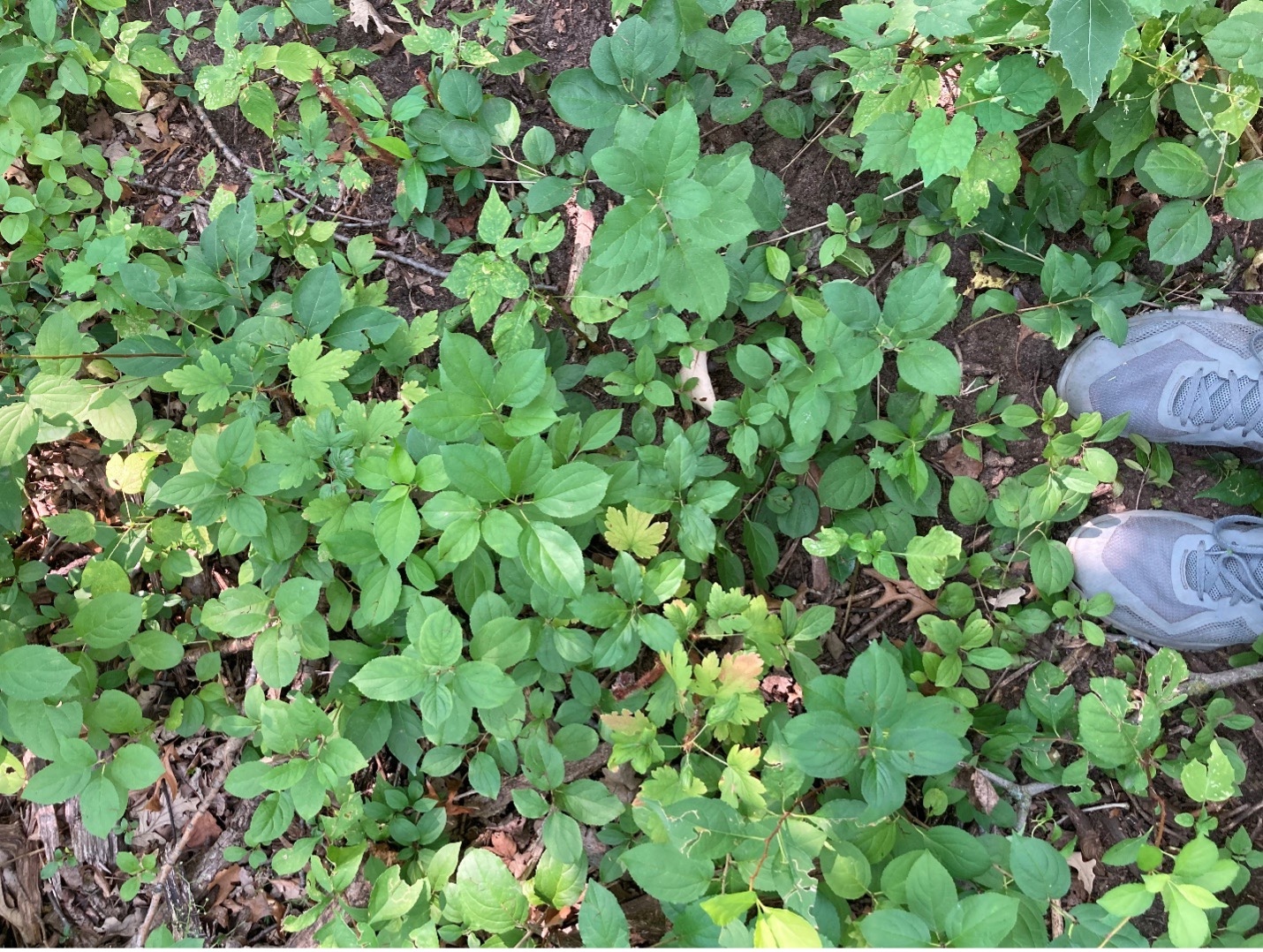
R. cathartica seedlings forming a dense layer near the ground in a temperate deciduous forest in Eastern Minnesota USA (Photo by Andrew Kaul).
Our research group at the University of Minnesota led by Peter Reich has been studying buckthorn for several years, funded by multiple grants from the Minnesota Invasive Terrestrial Plants and Pests Center (MITPPC). Recent work in our group has focused on how to suppress buckthorn regeneration after initial removal of large individuals. The Cover it up! project investigates which methods of revegetation are most effective for restoring the ground-layer with native species that can prevent buckthorn recruitment and growth. Various experimental introductions of native plants have included direct seeding shrubs, direct seeding trees, adding herbaceous seed mixes with variable ratios of grasses to forbs, and treatments with combinations of functional groups. For example, we combined sowing the Standard Cover It Up seed mix of 34 native grasses, and forbs with planting bare-root plants from other functional groups – trees, shrubs, ferns, or sedges.
Across several experiments, one of the most important results has been that the extent to which revegetation treatments are effective in suppressing buckthorn, is mostly explained by their ability to rapidly establish vegetation, preempt space, and shade out buckthorn seedlings. Two of the most successful strategies include 1) planting native tree species and 2) seeding a mix of native Elymus spp. grasses (wild ryes) and wildflowers to establish an herbaceous understory. The native trees used in this experiment included species like Sambucus canadensis (elderberry), Abies balsamea(balsam fir), and Acer saccharum (sugar maple), planted immediately after clearing-out buckthorn. Planting woody native species can reduce buckthorn regrowth by up to 80%, and establishing a grassy herbaceous community can reduce regrowth by 77%.
We recently published A Guide to Forest Understory Revegetation, which makes several science-based recommendations for invasive shrub management based on our research. Revegetation should occur as soon as possible after initial removal of large individuals. Additionally, restoring sites via revegetation will be most effective in areas with at least 10% open canopy so that sufficient light is present for native seedlings to establish. If opening the canopy is feasible by selectively removing some trees, this will facilitate a greater cover and diversity of herbaceous plants in the understory. When conducting revegetation with herbaceous species, planting a native seed mix with a high proportion of cool season (C3) grasses is ideal. These species grow well in shadier environments, establish rapidly, are inexpensive, and produce dense vegetation that can carry a fire to facilitate management with prescribed burns. Shade-adapted wildflowers such as Ageratina altissima (white snakeroot) or Hydrophyllum virginianum (Virginia waterleaf) should be included in the seed mix in order to add value to pollinators and other insects. When conducting revegetation with woody species, planting native tree species can be highly effective in excluding buckthorn, but revegetation through bare-root plantings has its drawbacks, being more expensive and labor intensive. This method would work well if implemented in smaller areas, especially where there are few deer. In general, revegetation plansshould prioritize reducing light reaching the ground where buckthorn seedling are growing.Counterintuitively, this can be achieved by opening the tree canopy to facilitate establishment of herbaceous cover in the understory.
In addition to studying methods of revegetation to suppress buckthorn seedlings, our research group is also investigating novel methods for removal of mature buckthorn plants. In June 2024, we initiated an experiment testing the efficacy of critical period cutting to kill large buckthorn without the use of chemicals. This method was pioneered by Friends of the Mississippi River (FMR) as a strategy for removing buckthorn without using herbicide, which is prohibited in Minneapolis parks. This method involves using a saw or loppers to cut off the top of a buckthorn plant about 1.5 m from the ground early in the growing season. Subsequently, a couple times throughout the growing season, each buckthorn is revisited and stripped (picked off easily by hand) of all re-growth. This process is then repeated the following year, if necessary. Cutting the stem at chest height rather than near the ground has multiple benefits of 1) reducing risk of stumps as a tripping hazard, 2) relocating previously cut stems, and 3) stripping re-sproutsthat usually occur at the end of the stem, which is near chest height.
Given FMR’s success implementing the critical period cutting method, our experiment is examining when this method is most effective in killing buckthorn depending on the size of the individual or its light environment. We are also quantifying the minimal effort required to ensure buckthorn mortality by examining survival of buckthorn over two years of stripping re-sprouts, with 4, 6, or 10 total removals. To test how effective this method is for controlling other invasive shrub species, we are working with collaborators in Wisconsin, Maine, and Missouri, who are also conducing this experiment on the invasive shrubs Frangula alnus (glossy buckthorn) and Lonicera maackii (bush honeysuckle). These are also serious woody invaders of forests throughout the Midwest and our research aims to improve forest restoration outcomes at smaller scales when herbicide or other larger-scale methods are not possible.
Stems of common buckthorn in a study area examining the efficacy of critical period cutting in Minnesota (Photo credit Alex Roth).Experimental stems of bush honeysuckle at the Missouri Botanical Garden’s Shaw Nature Reserve (Photos by Andrew Kaul).
If you are interested in learning about these projects in greater depth, you can read the guide to forest understory revegetation here or learn more about ongoing research in the Cover It Up! project here. If you have any questions, feel free to contact Mike (schuster@umn.edu) or Andrew (akaul@mobot.org).
Eve Allen, Program Director for the Northeast Bioregion, James Aronson, President, and Sefra Alexandra, Educational Coordinator of the Ecological Health Network, share their trip report from a recent visit to Canada’s National Tree Seed Center (NTSC) in June 2024. (In collaboration with Melissa Spearing, Seed biologist, Mary Knockwood, Indigenous Seed Program Coordinator, and Lucie Lavoie, Coordinator and Senior Forester of the NTSC).
In Memory of Melissa Spearing
We dedicate this post to the loving memory of Melissa Spearing, our friend and devoted Seed Biologist at the National Tree Seed Centre, who graciously hosted our visit and played a key role in organizing it.
Melissa’s career was marked by a profound commitment to tree seed conservation. Her work in the collection, storage, and study of seeds from across Canada ensured the preservation of the country’s diverse tree species for future generations. Her contributions to the Centre’s research were invaluable, and her passion for advancing conservation and climate research was unwavering. Her sudden passing on August 19, 2024, has deeply affected all who knew her, both professionally and personally.
As many have shared, Melissa was not just a colleague or mentor but a dear friend to many in the seed conservation community. She was a proactive networker, working to build bridges between the Centre’s work in Atlantic Canada and our efforts in the Northeastern U.S. We are deeply saddened by her passing, yet profoundly grateful for the time we shared with her—experiencing her warmth, enthusiasm, generosity, and the passion she brought to her work. Like all who knew her, we have been significantly touched by her life and the enduring impact she leaves behind.
Melissa Spearing demonstrating tree seed collection at the “Seed Forecasting Walk & Trailer Tools,” workshop with the National Tree Seed Centre Staff at the Huron-Wendat nations Ekionkiestha’ National Longhouse in Wendake, Quebec Canada – during the Two-Eyed Seeing Seed Collection Workshop at the Society of Ecological Restorations RE3 {Reclaim | Restore | Rewild} Conference. June 10th 2023. Credit: Sefra Alexandra
Purpose of the Trip
In June 2023, at the Society for Ecological Restoration’s RE3 Conference in Quebec City, we connected with leaders from Canada’s National Tree Seed Centre (NTSC) during a Two-Eyed Seeing Seed Collection workshop they hosted. We shared a mutual interest in staying connected, as the Northeastern U.S. and Atlantic Canada together form a crucial ecological and cultural transition zone.
We made the trip one year later to visit our friends at the NTSC, Mellisa Spearing, Seed biologist, and Mary Knockwood, Indigenous Seed Program Coordinator, with the goal of testing the waters and appetite in this region to develop a regional hub of the Northeast Seed Network to serve and promote synergy in southern Québec, New Brunswick, Nova Scotia, and Prince Edward Island, as well as Maine, Vermont, New Hampshire, and upstate New York. A possible name for the hub is the Northern Appalachian/Atlantic Maritime Hub.
This region bridges temperate woodlands and boreal forests and is part of the smaller yet globally significant “Northern Appalachian-Acadian Wabanaki Ecoregion,” which holds high ecological and cultural value from a social-ecological perspective. A binational, biocultural consortium called Two Countries One Forest exists already, and EHN and the NTSC would like to work together. Fortunately, there are no significant legal or political challenges when it comes to sourcing or shipping seeds for research or use. A phytosanitary certification can be obtained through the Canadian Food Inspection Agency or the USDA’s Phytosanitary Certification Issuance and Tracking System (PCIT).
Overview of Canada’s National Tree Seed Centre
Canada’s National Tree Seed Centre (NTSC) is the principal national resource for forest seed science and conservation in the country. Located in the Atlantic Forestry Centre in Fredericton, New Brunswick, the center was established in 1967 by the Canadian Forest Service. Initially, the NTSC focused on collecting, storing, and providing native tree seeds of known origin primarily to support the timber industry in Canada. Over the past five decades, this mandate has broadened to include the conservation of genetic resources threatened by invasive pests, pathogens, and climate change.
In 2020, the NTSC underwent a significant renewal to enhance efforts to grow and maintain healthy forests in Canada as a viable economic sector and an effective strategy to address climate change. For example, in 2021, the Government of Canada committed CAD $3.2 billion to establish partnerships to plant two billion trees over ten years, aiming to ‘tackle the dual crisis of climate change and biodiversity loss.’ A 2023 press release reported that the project had exceeded its planting goals and now was intending to plant 56 million more. This project is just one among many ambitious undertakings for which the NTSC is at the helm.
The NTSC’s core function is seed collection management, encompassing the collection, processing, testing, documentation, and storage of seeds from tree and shrub species across Canada. Melissa Spearing organized a phenomenal tour of the facilities, which included a visit to the central laboratory with attached processing rooms, freezers that house seed collections, and cryopreservation storage, as well as greenhouses and on-site nursery installations. The NTSC also maintains an extensive digitized and readily accessible seed collection database.
The Atlantic Forestry Centre is a campus of innovation. Behind each door is an impressive array of machinery for seed cleaning, assessment, preservation, and research operated by enthusiastic teams of scientists and technicians. This centre is tackling the major issues that threaten the tree and shrub diversity of the varied landscapes of the ten provinces and three territories of Canada. Upon our arrival, the halls were bustling with a young, excited seed collection team, assembling their gear to head out on a week-long expedition for plant materials gathering to be safeguarded in the growing ex situ collections. The state-of-the-art greenhouses are propagating germplasm for utilization in restoration projects, and the surrounding grounds are teeming with pollinators dancing through the willows (Salix spp.) trials designed to determine which willow species thrive best for application in improving degraded soils. The dynamic atmosphere is fast-paced, and professional and instills an air of optimism in the face of the massive climate challenges facing the fields and forests of this country.
Overview of Canada’s National Tree Seed CentreStrengthening Indigenous Leadership in Seed Conservation
As mentioned above, while seed collections at the NTSC have predominantly focused on tree species of economic importance to Canada, the center is now placing a stronger emphasis on non-commercial tree species, particularly those of high significance to Indigenous Peoples. Through its Indigenous Seed Collecting Program, the NTSC is advancing Indigenous engagement and inclusivity to help meet Canada’s Two-Billion Tree program objectives (2BT).
In a 2023 press release, Natural Resources Canada confirmed that “Since 2021, the 2BT program has supported 179 tree-planting and capacity-building projects from coast to coast to coast. Ninety percent of these projects planted more than two types of trees, and one in five projects were Indigenous-led. Over 220 species were planted at more than 2,900 sites across Canada.”
Mary Knockwood, the Indigenous Programs Manager, shared how supporting Indigenous leadership and inclusion in seed conservation is the second priority in the NTSC Strategic Plan for 2021-2031, following the goal of supporting the two billion tree program with knowledge mobilization and capacity building. The NTSC recognizes Indigenous Peoples as the original caretakers of ecosystems across Turtle Island (North America) and the earliest seed collectors, processors, and distributors. This grassroots initiative, spearheaded by Indigenous communities nationwide, gathers and conserves tree seeds that hold economic value as well as significant cultural, spiritual, medicinal, and ecological importance to the Indigenous communities engaged in this work. Mary explained in a Simply Science article, “seed collection is important for our forest as it is important to the future of Mother Earth and all the creatures living upon her. It helps not only preserve flora species but also preserve the language, culture, and traditions of our Indigenous partners.” The program began with Mi’kmaq communities in Atlantic Canada, and as word spread, community interest grew. Today, over sixty Indigenous communities and organizations throughout the country are participating. The NTSC holds multiple-day-long workshops where Indigenous citizens come to share their knowledge and learn about seed conservation. To date, 56 field training sessions across Canada and seven lab training sessions at the Atlantic Forestry Centre have provided free training to over 200 members representing 70 Indigenous communities nationwide.
The National Tree Seed Centre regularly tests the viability of stored seedlots to ensure they can be germinated when needed for research or recovery programs. Credit: Sefra Alexandra. Over 1,900 Ash (Fraxinus spp.) seedlots are safeguarded in the -20 Celsius long-term storage seed bank at Canada’s National Tree Seed Centre, including backup collections from the USDA Fort Collins gene bank. This is part of a North American-wide effort to preserve the native species of Ash against local or global extinction from the accidentally introduced Emerald ash borer, Agrilus planipennis. Credit: Sefra Alexandra.
Strengthening Indigenous Leadership in Seed Conservation
As mentioned above, while seed collections at the NTSC have predominantly focused on tree species of economic importance to Canada, the center is now placing a stronger emphasis on non-commercial tree species, particularly those of high significance to Indigenous Peoples. Through its Indigenous Seed Collecting Program, the NTSC is advancing Indigenous engagement and inclusivity to help meet Canada’s Two-Billion Tree program objectives (2BT).
In a 2023 press release, Natural Resources Canada confirmed that, “Since 2021, the 2BT program has supported 179 tree-planting and capacity-building projects from coast to coast to coast. Ninety percent of these projects planted more than two species of trees, and one in five projects were Indigenous-led. Over 220 species were planted at more than 2,900 sites across Canada.”
Mary Knockwood, the Indigenous Programs Manager, shared how supporting Indigenous leadership and inclusion in seed conservation is the second priority in the NTSC Strategic Plan for 2021-2031, following the goal of supporting the two billion tree program with knowledge mobilization and capacity building. The NTSC recognizes Indigenous Peoples as the original caretakers of ecosystems across Turtle Island (North America) and the earliest seed collectors, processors, and distributors. This grassroots initiative, spearheaded by Indigenous communities nationwide, gathers and conserves tree seeds that hold economic value as well as significant cultural, spiritual, medicinal, and ecological importance to the Indigenous communities engaged in this work. Mary explained in a Simply Science article, “seed collection is important for our forest as it is important to the future of Mother Earth and all the creatures living upon her. It helps not only preserve flora species but also preserve the language, culture, and traditions of our Indigenous partners.” The program began with Mi’kmaq communities in Atlantic Canada, and as word spread, community interest grew. Today, over sixty Indigenous communities and organizations throughout the country are participating. The NTSC holds multiple-day-long workshops where Indigenous citizens come to share their knowledge and learn about seed conservation. To date, 56 field training sessions across Canada and seven lab training sessions at the Atlantic Forestry Centre have provided free training to over 200 members representing 70 Indigenous communities nationwide.
NTSC Coordinator Donnie Mcphee demonstrating cut testing for potential seed quality in the field with members representing Grand Conseil de la Nation Waban-Aki in Odanak, Québec with National Tree Seed Centre Coordinator Donnie Mcphee demonstrating cut testing for potential seed quality in the field with Laurentian Forestry Centre Frank Grenon Chief of Forestry Science, Luc Nolet Odnak First Nation, Nicolas Pinceloup representing Grand Conseil de la Nation Waban-Aki in Odanak, Québec. Credit: Mary Knockwood.
The concept of Two-Eyed Seeing (Etuaptmumk in the Mi’kmaq language), articulated and popularized by Mi’kmaq Elder Albert Marshall, is integral to the program. It involves combining the strengths of Indigenous knowledge with those of Western science and technology, using both perspectives together. In Marshall’s words, “Two-Eyed seeing refers to learning to see from one eye with the strengths of Indigenous ways of knowing and from the other eye with the strengths of Western ways of knowing and to using both of these eyes together” (Bartlett, Marshall, & Marshall, 2012, p. 335).” This dual approach forms the foundation of the program. Mary Knockwood emphasizes that Two-Eyed Seeing is about merging not just two methodologies but also two different ways of knowing and worldviews. The same idea is expressed with similar phrases from Indigenous cultures in Australia, Aotearoa/New Zealand, South America, and elsewhere. It is clearly a concept that holds critical importance for moving our global society from an extractive to a restorative culture (Cross et al. 2019).
We note that the Indigenous Peoples of Canada have a long history of seed collection, storage, and use, and NTSC staff are learning from this rich knowledge base while also co-learning and integrating Western scientific practices with traditional ways and wisdom. Concurrently, Indigenous partners are adopting aspects of Western science to enhance their traditional methods, thereby improving processes, extending storage times, and increasing seed viability.
The Indigenous Seed Collection Program aids in Canada’s reconciliation efforts with Indigenous Peoples by fostering deeper collaborations through community partnerships. As Donnie McPhee, Coordinator of the National Tree Seed Centre, explained: “At its core, the ISCP is a mutual network of knowledge sharing amongst Indigenous communities from coast to coast to coast. Different communities are working together and building a network, giving value to what they’re protecting.” The Indigenous Seed Collection Program is designed to listen to the needs of the Indigenous communities and provide training courses to help them reach their goals.
Conservation of Ash Species
The conservation genetics of North American Ash trees (Fraxinus spp.) provide a prime example of how the NTSC’s Indigenous Seed Collection Program is working to preserve cultural and ecological keystone species found in the forests of Canada and for some of them in much of the Eastern United States as well.
Young stand of Fraxinus nigra (Black ash) trees in New Brunswick on Peskotomuhkati lands near the Maine border. Photo credit: Mary Knockwood.
For the past 20 years, the NTSC has worked with a wide variety of collaborators to collect and bank viable seed of all five Ash species native to Canada: 1) Fraxinus americana (White ash); 2) Fraxinus nigra (Black ash); 3) Fraxinus pennsylvanica (Green ash), 4) Fraxinus profunda (Pumpkin ash), and 5) (Fraxinus quadrangulata (Blue ash). Their efforts to preserve native Ash from decimation by the relentless Emerald Ash Borer are especially focused on Black ash, which is of particular importance to Indigenous communities and is the species most at risk of all the native species.
Mary Knockwood explains, “Indigenous Peoples, such as the Mi’kmaw, Wolastoqey, Peskotomuhkati, in the Atlantic who are part of the Wabanaki Confederacy, all the First Nations part of the Haudenosaunee Confederacy, as far west to Manitoba and the Anishinaabek peoples have used and continue using Black Ash to this day. The importance of this species is not only for baskets, but it also carries a spiritual, traditional, and medicinal value to all of these groups. It is also a significant species to many of the Wabanaki Confederacy as it plays a significant role in many of our creation stories.” These trees are integral to their cultural practices, notably in the creation of black ash splint baskets of many designs and uses. Over dozens of generations, these communities have acquired extensive knowledge of locating ash trees, nurturing their growth, and using them for both practical and artistic purposes. Ash trees also play crucial roles in providing materials for firewood, snowshoes, tools for hunting and fishing, canoe paddles, lumber, and various additional types of baskets and woven containers.
Fraxinus nigra (Black ash) tree splints, prepared for use in traditional basket weaving. Photo credit: Mary Knockwood.
As of now, Emerald Ash Borer has spread to nearly 60% of the historic range of Black ash in Canada, expanding at an average rate of about 50 kilometers per year. Based on current projections, it is feared that more than 75% of the total basal area of Black ash will be lost across ~87% of its range in North America by 2035. Census data also indicate that in 2035, fully 98% of Indigenous populations residing within the Black ash’s geographic range in the US will be affected by the catastrophic losses of these cultural keystone trees (Siegert et al. 2023).
In 2019, as the threat of Emerald Ash Borer was seen to be imminently threatening all stands of ash throughout Central and Atlantic Canada, the Committee on the Status of Endangered Wildlife in Canada federally listed all native Fraxinus spp. as “threatened species of important cultural value.” Luckily, that year happened to be a “rare, once-in-every-five-to-seven bumper crop year for Black ash seed production throughout its range in Ontario, western Quebec, eastern Manitoba, and New Brunswick,” reported Donnie McPhee in the May 2020 Tree Seed Working Group News Bulletin. In 2019, during a five-week period, the NTSC’s collecting teams gathered:
648 Fraxinus nigra (Black ash) collections over an impressively large portion of the species’ Canadian range.
And 609 additional ash collections, including 380 of Fraxinus nigra, 210 of Fraxinus americana (White ash), and 19 of Fraxinus pennsylvanica (Green ash), all from different stands to ensure including as large a genetic range as possible for the seed bank.
Conclusions
We were deeply impressed by the NTSC’s robust programs and the dedication of its staff. The NTSC’s commitment to enhancing forest health and biodiversity through innovative seed conservation strategies is commendable and inspiring. In line with Siegert et al.’s (2023) call to support binational collaboration among scientists, resource managers, and Indigenous experts to mitigate Emerald Ash Borer impacts and preserve Black ash resources—given the species’ vulnerability and its cultural and ecological significance—the Ecological Health Network is committed to working with Canada’s NTSC.
A key goal will be to collaborate with new members of the Northeast Seed Network in Maine, Vermont, New York, and Atlantic Canada to establish a sub-regional hub. This effort will enhance our ability to work closely and learn from each other to conserve and restore forests and their woody plant biodiversity throughout the Northern Appalachian-Acadian-Wabanaki Ecoregion, spanning the US-Canada border. Our visit reaffirmed the importance of building networks that bridge political boundaries and ecological ecotones. It also highlighted the urgency of forming alliances to share and safeguard the ecologically and culturally significant species of these regions, ensuring the health of ecosystems for present and future generations.
In closing, we salute Melissa Spearing once again. She will be greatly missed by her family, friends, and colleagues both nationally and internationally. May she rest in peace. In her honor, please consider making a donation to the Kawartha Land Trust.
At Canada’s National Tree Seed Center (left to right): Melissa Spearing (Seed Biologist), James Aronson, Eve Allen, Martin Williams (Forest Genomics Research Scientist), Sefra Alexandra.
Tambopata. For anyone who knows about the Peruvian Amazon, there are few names that are more evocative. All it takes is an hour and a half flight from Lima, quickly leaving behind the parched desert of the coast, flying above snow-capped glaciers, and finally down over the rainforest that surrounds Puerto Maldonado, one of Peru’s three main Amazonian cities.
Established in the year 2000 and covering 270,000 hectares (1,000 square miles), Tambopata is one of Peru’s 17 National Reserves. This is a category within the country’s protected area systems that allows a certain degree of human activities within its borders by the local communities. These include scattered Ese Ejja Indigenous people and more recently established colonists from other parts of Peru. The reserve borders the much larger Bahuaja-Sonene National Park, which itself connects to Madidi National Park in Bolivia, where MoBot researchers have been working for many years.
Considering it’s a city of nearly a hundred thousand souls, the surroundings of Puerto Maldonado are still surprisingly wild. Macaws and poison dart frogs, some of the most common victims of human encroachment in the lowlands due to the never-ending demands of the illegal wildlife trade, can still be found only a couple minutes outside the city. Likewise, howlers and tamarin monkeys, elsewhere either hunted for food or trapped as pets, still dwell in forest patches on the city’s outskirts.
There are a few reasons for this. First of all, there is more of an ecological conscience here than in many other parts of Peru. Visions of giant river otters or flocks of parrots coming in at clay licks, both easily seen in Tambopata, are some of the most ubiquitous marketing features of Peru’s tourism board, right after Machu Picchu, of course. Indeed, there are daily flights between Cuzco and Puerto Maldonado, one of the only flight routes in the country that connects two provincial cities, instead of having to transit through Lima’s hub. As a result, ecotourism represents a substantial share of the region’s income.
Furthermore, one of the main agricultural products of Madre de Dios is the Brazil nut (Bertholletia excelsa, locally called castaña. This is a massive canopy tree, one of the largest in the Amazon Basin, whose fruits are still harvested in a traditional way, within concessions that preserve the existing forest where the castaña trees grow. And of course, much of the region is covered in large protected areas, which are reasonably easy to access, and therefore easier to actually monitor and protect. The Amazonian tracts in central Peru, for example, where ecotourism is essentially inexistent, have been facing much more trouble.
However, Madre de Dios is not a perfect Eden either, far from it. The city proper has only existed for a few decades, and reaching it from Cuzco used to be a journey that could take a week, navigating dubious muddy tracks that were regularly blocked by landslides. But since 2011, the city is reachable by an asphalt road, in only 10 hours from Cuzco. This is the infamous Interoceanic Highway, the only road that connects the Pacific and Atlantic shores of South America, and cuts through an immense swath of Amazonia. Years later, the Odebrecht scandal revealed that over 20 million dollars in bribes had been paid out to ensure its building, and economic studies have since demonstrated its very underwhelming contribution to the economy of either Peru or Brazil. But the damage is done.
There has since been a massive influx of migrants from the Andes, with a very different culture. They practice slash-and-burn agriculture, which regularly results in out-of-control wildfires. But the main environmental plague has been the gold rush that has been gripping the region for the past two decades. There are some 30 to 50 thousand gold miners in Madre de Dios, many of them working in illegal, small-scale operations on remote river tracts. What is left after these illegal operators move away has been described as moonscapes. And they have impacts far beyond the mining sites themselves. The mercury that is used to extract the gold seeps into the water and soils, to the tune of 50 tons per year, resulting in widespread environmental contamination and serious health issues. Furthermore, the region suffers more and more from increased crime and all the other societal ills that characterize resource-rich frontier regions undergoing rapid and poorly planned development.
Fortunately, there are people working to propose alternatives for the future of the region. For example, various NGOs, including WWF, are carrying out restoration projects on abandoned mining sites, in some cases working with the miners themselves. Limiting heavy metal contamination, which plants can help with, is in everybody’s interest, after all.
Another notable initiative is the Hacienda Herrera. This 32-hectare (79-acre) property is located 15 minutes from the city, and reachable only by peque-peque, the narrow, motorized canoes that are the most common means of transportation on the Amazonian waterways. From the small wooden jetty, a path makes its way under massive-buttressed trees towards the buildings of the Hacienda. This land has belonged to the Herrera Segara family for 4 decades, where they used to plant various crops and raise cattle, as the regional government itself gave away cows to local people in order to “settle” the land. However, showing remarkable vision, the family realized the value of the forest they had, and decided to focus on agroforestry systems, growing avocado, orange, cocoa, banana and more, while helping the native forest recover around their crops. Ten hectares of the property (about 25 acres) are occupied by the various organic orchards, while the other 22 hectares (54 acres) are covered in tall forest, which is part of the buffer zone for the Tambopata National Reserve. Then, over 10 years ago, they partnered with CECCOT, the Tambopata Education, Science and Conservation Center, led by Dr. Ursula Valdez, a Peruvian ecologist who now teaches at the University of Washington. Together, they have developed their “forest school” philosophy.
Each year, the CECCOT organizes courses and workshops that bring people from all over the world to learn and train at the Hacienda, on topics as diverse as nature photography, bird banding, tree scaling (a highly valuable skill in research projects involving arboreal camera traps or the collection of botanical specimens, for example), and much more. In addition to foreigners, CECCOT always integrates people from local communities to give them new opportunities for training or simply to learn more about the natural heritage of their land. Many local students, but also children from orphanages and disadvantaged communities have been able to come and learn at Hacienda Herrera.
One of the main goals of the Hacienda is to offer a learning space about biodiversity conservation, but always working hand in hand with sustainable development. Dr. Valdez and her students have been carrying out a long-term study of the birds that use the Hacienda’s organic cacao orchards, and which subset they represent of the avifauna of the surrounding forest matrix. The finding that some of these “cacao birds” include antbirds, understory insectivores that notoriously are some of the first to disappear from fragmented forests, is very encouraging. Camera traps placed along the trails have registered most of Peru’s lowland mammals, including the full suite of felines and even the Short-eared dog (Atelocynus microtis), one of the most elusive mammals on the continent! Sure enough, during my visit, I was lucky enough to photograph a jaguarundi crossing an orange orchard between two forest patches!
At the same time, it has also become a gorgeous space to receive visitors and tourists, with a very strong focus on sustainability. This can be seen through the solar panels that are now the main source of electricity for all buildings, the collection of rainwater and the vegetarian cuisine, using products from the Hacienda’s garden and local producers. These have been implemented over time, with the family and the CECCOT sharing costs for the improvements. Ruth and Kenny, the husband-and-wife team, run everyday business at the Hacienda and they have created a travel company that takes visitors to see other natural attractions in the area, such as the famous Sandoval Lake or the Inkaterra canopy bridges.
The grounds and trails of the Hacienda are a wonderful showcase for Amazonian biodiversity, from the bats that roost under the thatched roofs of the cabins to the massive caiman lizard that hunts water snails around the seasonal pond near the main building, to the multicolored butterflies that can be seen on flowers along the paths or on the muddy riverbanks. Meanwhile, with some 350 bird species, the Hacienda is becoming a hotspot in the booming world of birdwatching, with Peru finally starting to catch up to Ecuador and Colombia, where birds have been a powerful enginefor conservation and sustainable development.
Besides the visitors, the Herrera family is also generating positive change outside its own borders. Some of the first mammals captured on the CECCOT camera traps were neighbors carrying out timber that they’d illegally harvested from the Hacienda itself. But they slowly made inroads with them, inviting them and their children to show them what they had managed to do. The idea was to have the Hacienda be a model for sustainable living. Things such as renewable energy or clean sanitation for their homes, achieved with relatively low investments. Now some of these same neighbors are implementing agroforestry systems on their orchards and planting native trees around them, while others are opening ecolodges of their own.
Just across the river is a stark reminder of how things could have gone, with the regular wildfires, illegal land grabs and health problems. On Hacienda Herrera’s side, people seem to finally have agreed that they want to try something else. Not long ago, when there was a problem with a roaming jaguar snatching dogs from people’s backyards, the neighbors got together. With help from experts at the San Diego Zoo, they agreed to a monitoring program, instead of sending a hunting party. After all, the jaguar, or otorongo, is the most emblematic species of the Amazon, even for Peruvians who aren’t of Indigenous descent. They summed it up in one sentence: “Do we want to be the community that kills our jaguar, or the community that protects him?”
Rachel is a postdoctoral fellow in the Missouri Botanical Garden’s Center for Conservation & Sustainable Development whose research focuses on plant-pollinator interactions and using eDNA to advance the conservation and restoration of biodiversity.
Oak-dominated ecosystems occur in many areas of the northern hemisphere, support considerable biodiversity, and provide vast benefits to humans. Although notably absent from the southern hemisphere, oak-dominated or mixed-oak dominated forests are found across much of southern and central Europe, northeast Asia, and the eastern and central United States. Oak ecosystems range from closed forests with a dense midstory to open forests or woodlands with continuous canopy or widely spaced trees and dominance of herbaceous vegetation in the understory.
Around 80% or more of the plant diversity in oak forest and woodland ecosystems in the eastern US, including a large proportion of rare species, resides in the herbaceous layer, which contributes significantly to nutrient cycling and overall ecosystem function. However, these forests and woodlands have suffered significant degradation over the past century, resulting in dramatic shifts in species composition and structure due to human land-use activities, invasive species, and alterations in disturbance regimes. In particular, fire exclusion has led to the encroachment of fire-intolerant tree species and nonnative shrubs, decreasing both understory light availability and the abundance and diversity of herbaceous plant species.
Restoration of oak ecosystems usually involves prescribed burning or a combination of burning, canopy thinning, and control of undesirable woody vegetation. Although these restorative practices encourage the passive recovery of herbaceous flora, restored oak woodlands often lack conservative species in the understory. Unlike matrix or ruderal plant species, conservative plant species are those that depend on high-quality or minimally damaged sites and rapidly disappear with degradation. In addition, they often fail to recolonize sites naturally, making them potentially important targets for reintroduction.
(Top) Degraded oak woodland at Missouri Botanical Garden’s Shaw Nature Reserve infested with nonnative shrubs and fire-sensitive tree species and (Bottom) Adjacent restored oak woodland after mechanical control of woody encroachment and six prescribed burns. Note the minimal sunlight penetrating the woodland floor and lack of herbaceous species in the degraded woodland relative to the restored woodland. Photo: (Top) Brad Delfeld and (Bottom) Matthew Albrecht.
Conservative species are notoriously challenging to reintroduce in restoration projects, with soil microbes emerging as a key factor influencing their success. Arbuscular mycorrhizal fungi (AMF) are particularly crucial in this context; they enhance nutrient uptake and improve stress resistance, benefits that are especially valuable for conservative plant species with specific habitat requirements. For example, one study found that conservative species were more dependent on AMF and exhibited higher habitat specificity compared to less conservative species (Bauer et al. 2018). The practice of soil inoculation with whole soil, which presumably contains beneficial mutualists like AMF, is increasingly employed to boost plant growth and survival in restoration projects. Despite its growing popularity, though, the effects of soil inoculation on the establishment of herbaceous species in oak-dominated ecosystems remain poorly tested.
Another factor that may affect the establishment of conservative plant species is the timing of reintroduction. Environmental conditions are predicted to be more favorable for the establishment of conservative species later in restoration, in part because soil symbionts facilitating plant establishment may only be found in later-successional sites. Alternatively, early restorations may lack the establishment barriers potentially encountered later in restoration, such as competition with established vegetation or soil legacies from early-arriving species, but could be deficient in important microbial mutualists often required by conservative plant species.
To test these hypotheses, we examined the potential role of soil microbial communities on the performance of conservative herbaceous species using an oak woodland restoration chronosequence at the Missouri Botanical Garden’s Shaw Nature Reserve. First, we collected bulked field soil samples from three sites representing different restoration ages (young, intermediate, and old) based on their onset since restoration began (7, 16, 29 years ago) with prescribed burning, selective tree thinning, and non-native shrub control. We quantified several soil abiotic properties (e.g., pH, phosphorus, potassium, and nitrogen) and employed DNA metabarcoding to describe the microbial composition of the soil. DNA metabarcoding is a cutting-edge technique that identifies many taxa from an environmental sample by sequencing specific genetic markers from extracted DNA. This method provides a comprehensive snapshot of the microbial diversity present, allowing one to better understand otherwise cryptic below ground communities.
Conservative perennial forbs used in a greenhouse study to test the effects of soil inoculation young, intermediate, and old restored woodlands on plant growth: Geum virginianum (left), Solidago argute (center), and Solidago caesia (right). Photo credit: Gerrit Davidse (left) and Missouri Botanical Garden (center and right).
Next, we conducted a greenhouse study with three conservative forb species, Geum virginianum, Solidago arguta, and Solidago caesia, testing their growth responses to soil inoculum from sites that differ in restoration age. These species are components of the regional species pool, but absent from restored oak woodlands at Shaw Nature Reserve. We placed germinated seeds of each species in quart-sized pots filled with a sterilized topsoil mix that mimic oak woodland soils. Each sterile pot (270 in total) was then inoculated with 10 mL of the bulked live field soil (approx. 1% by volume) sourced from one of the three restored sites. Plants were grown for 12 weeks in standard greenhouse conditions and then evaluated for growth using nondestructive measurements.
Planting seeds of conservative forb species into soil inoculum treatments in a greenhouse study. Photo credit: Leighton Reid
Tree species and soil microbial communities in restored oak woodlands Not surprisingly, we found that younger restored oak woodlands, with historically fewer prescribed fires, had a greater abundance of fire-sensitive tree species (e.g., sugar maple, Acer saccharum) than the intermediate and older restored sites. However, younger restored woodlands also exhibited lower levels of soil phosphorus compared to older sites, consistent with previous studies that have shown greater levels of potassium and phosphorus in soils post-burning. Other soil abiotic properties, however, did not differ across the restoration chronosequence.
A grove of sugar maples (Acer saccharum) during autumn in the young restoration site at Shaw Nature Reserve. Photo credit: Mike Saxton
Bacterial and fungal communities varied in composition across the restoration chronosequence. For example, Firmicutes, a phylum of bacteria noted for surviving in extreme conditions, such as in severely burned areas, was more abundant in soils from the oldest restored woodland, which experienced a greater number of prescribed fires than the other sites. In contrast, the fungal phylum Ascomycota was more abundant in restored woodlands of young and intermediate age. Members of Ascomycota include decomposers that break down organic materials and endophytes that form mutualistic or commensal associations with plants.
Plant-soil interactions in response to soil inoculation After 12 weeks of plant growth in the greenhouse, we found that forbs tended to grow larger leaves when grown in soil inoculum from the younger restoration site compared to the intermediate restoration site. Additionally, S. arguta and S. caesia grew longer leaves in soil inoculated from the intermediate compared to the old site, while G. virginianum plants tended to produce longer leaves when grown in inoculum from young relative to the old restoration site.
Leaf length (cm) of three native forbs after 12 weeks of growth in whole-soil inoculations from young, intermediate, and old restored oak woodlands at Shaw Nature Reserve. Geum virginianum (GV), Solidago arguta (SA), and Solidago caesia (SC).
Results from the DNA metabarcoding provide a clue as to why the soil inoculum treatments induced different plant-growth responses. Soils from the young restoration exhibited increased relative abundance of mutualistic microbes, including AMF and cyanobacteria, and decreased pathogenic taxa after conditioning by each of the three species. In contrast, the oldest restoration site had the greatest relative abundance of pathogens and the lowest relative abundance of mutualists. This enhanced microbial profile in young restorations may facilitate better nutrient uptake, and disease and stress resistance in plants. From a practical perspective, early-stage restorations may provide the most favorable soil microbial community for the establishment of conservative plant species in these oak ecosystems. One possible reason for this could be a shift in the increased relative abundance of AMF-associating tree species (e.g., maple) from older to young restored woodlands. AMF-associating tree species may harbor unique AMF taxa that resulted in increased herbaceous plant growth and AMF colonization for plants conditioned with young soil inoculum.
Interestingly, although some microbial taxa exhibited consistent patterns across all plant species within an inoculation treatment, each plant species also associated with unique microbial taxa when grown in the same soil inoculum treatment. For example, the Glomeraceae, which includes AMF, was marginally more abundant after S. caesia was grown in young inoculum, whereas Ascobolaceae – fungi that feed on decaying and dead matter – was significantly abundant only when G. virginianum was grown in old soil inoculum. This means that species reintroduced during different stages of oak ecosystem restoration could influence key ecological functions by selecting for or against certain microbes, including pathogens that regulate plant community dynamics, decomposers involved in nutrient cycling, and mutualists that enhance plant performance.
Overall, our study demonstrates how restoration age can shape interactions between soil microbes and herbaceous plant species in restored oak woodlands. By better understanding these interactions, we can enhance the restoration and recovery of degraded oak ecosystems. However, an important and lingering question from our study is whether differences in plant growth and microbial communities observed in the greenhouse persist after the focal plant species are transplanted into the field. A study currently underway at Shaw Nature Reserve is addressing this question across different restoration ages and competition treatments. Our study reinforces global calls that emphasize the need for more research on the dynamic nature of plant-microbe relationships and interactions over time during restoration. Advancing scientific research on the relationship between the soil microbiota and ecological restoration practices is crucial for meeting local, regional, biome level and global restoration goals.
If you want to learn more about microbial-herbaceous plant interactions in restored oak woodland, we invite you to read our recent paper in Ecology and Evolution.