Matías Barceló is an early career researcher at the Centre for Research and Innovation on Climate Change (CiiCC) at Santo Tomás University, Chile, SECOS Institute and at the Laboratory for Ecosystem Conservation and Human Well-being (LabCBH). His research focuses on local communities and the land-sea interface. In particular, he has worked on assessing the role of local knowledge in adaptive capacity in a rapidly changing world, as well as investigating the various perceived values of nature associated with the various practices of local communities. He is currently assessing how these values can reinforce various initiatives to restore and reconnect degraded and fragmented ecosystems at the land-sea interface.
Chile is often described through its contrasts: deserts, mountains, temperate rainforests, mediterranean-type climate ecosystems, fjords, kelp forests, and one of the longest coastlines in the world with 4,200 km from north to south, roughly the distance from Lisbon, Portugal, to Moscow, Russia. When accounting for its islands, fjords, channels, and intricate geography, its total coastal perimeter exceeds 80,000 km. These ecosystems also include areas of exceptional conservation value, including the globally recognized Chilean Winter Rainfall–Valdivian Forests Biodiversity Hotspot in central and southern Chile.
A map of South America showing Chile (in red) surrounded – and isolated – by the very high Andes mountain range and the Pacific Ocean. Image-generated by Matías Barceló.
Restoration in Chile is growing, but in what way, and in what direction?
Our recent review of 95 restoration initiatives, that comes from a dataset compiled by the Chilean Ministry of the Environment, showed that most projects nation-wide are concentrated in terrestrial ecosystems, particularly in central and south-central Chile, where wildfires and forest plantations are among the main drivers of degradation and transformation (see Figure below). Our work showed that 94.7% of the initiatives were terrestrial while the other 5.3% represent wetlands and there are no initiatives in the database focused directly on marine ecosystem restoration, despite Chile’s extensive coastline.
This review also revealed a key social gap: only 35.7% of the initiatives explicitly involved local communities from the outset, and when communities were included, their role was often limited to operational activities such as planting, cleaning sites, or basic monitoring. In other words, people participated in restoration activities, but not necessarily in defining restoration goals, identifying priority areas, making decisions, or shaping governance processes.
The map on the left shows the restoration initiatives recorded by Chile’s Ministry of the Environment between 2010 and 2021, marked with red dots. The panels on the right summarize key features of these initiatives, including: (A) main causes of site degradation; (B) ecosystem type; (C) land use or land cover targeted for restoration; (D) whether actions involved water bodies; (E) whether local communities were involved; (F) whether seeds were collected from nearby areas; (G) whether seedlings were produced by the initiatives; (H) whether planting was carried out; (I) whether monitoring was in place; and (J) whether a reference ecosystem was selected or assembled.
This is relevant because as mentioned above restoration work should reach beyond ecological goals. If restoration projects focus exclusively on biophysical recovery, they may overlook local livelihoods, cultural values, traditional practices, historical relationships with species, and also the meanings that communities attach to degraded or transformed landscapes. A restoration project can be technically well designed and still fail socially if it does not engage with the people who live in, depend on, and care for those ecosystems. The challenge is to move toward social-ecological restoration, an approach that integrates ecological recovery with local knowledge, values of nature, community participation, and long-term human well-being.
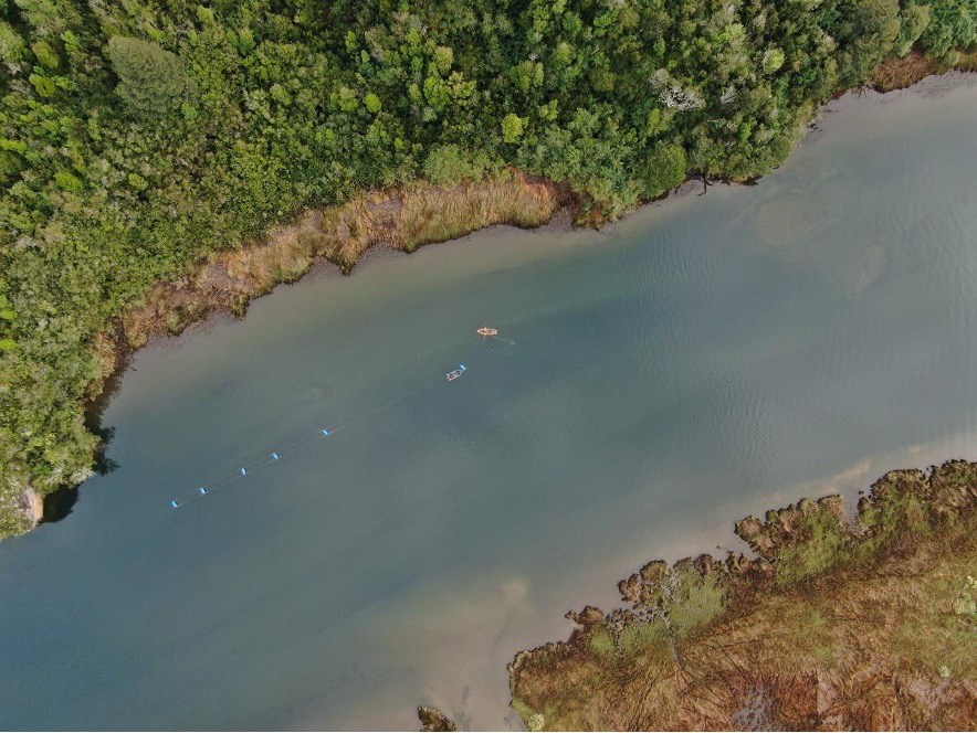
The mouth of the Chaihuín River where it flows into the Pacific Ocean is a highly representative location for studying land-sea interactions via the river. Chaihuín, Valdivia, Chile. Photo credit: Matías Barceló.
Why land and sea must be restored together
Although terrestrial and marine ecosystems are often managed separately, many communities experience them as interconnected territories. Changes in one part of the system can affect the others. Forest degradation can influence water quality, sediment flows, coastal habitats, and livelihoods. Marine degradation can affect food security, local economies, cultural practices, and people’s sense of belonging.
Drying red seaweed species for marketing purposes on the southern coast of Chile. Photo credit: Matías Barceló.Artisanal divers checking water quality monitoring equipment. Photo credit: Matías Barceló
For this reason, we have undertaken a project that focuses on representative coastal sites of southern Chile: Lenca, Puelo, and Cochamó (see Figure below). These places were selected because they represent different but connected expressions of the land-sea interface in the south-central Regions. Lenca combines temperate rainforest, proximity to Alerce Andino National Park, artisanal fishing, seaweed harvesting, and coastal livelihoods. Puelo connects mountain, riverine, freshwater, and marine systems. Cochamó brings together valleys, temperate forests, rivers, coastal areas, artisanal fishing, shellfish harvesting, and community-based tourism. Together, these sites offer a unique opportunity to ask and test how restoration can be conceived not only for “nature”, but also for people.
(a) Dots indicate the study site locations: Lenca (red), Cochamó (yellow), and Puelo (light blue) in Reloncaví (Llanquihue Province, Los Lagos Region), southern Chile. (b) Pink dots show the locations of the study sites in a subcontinental geographic context. Maps created by Matías Barceló.
From ecological restoration to social-ecological restoration
Our project starts with the idea that restoration priorities should be defined by integrating ecological evidence with local perceptions. It combines remote sensing analysis of native and kelp forest change with interviews with local actors about perceived environmental changes, key species, threats, and meaningful places. This information will be co-validated with communities mentioned above, recognizing that scientific data alone is not enough to guide restoration, and that local knowledge is essential to understand degradation and identify restoration needs.
Why values matter for restoration
One of the main contributions of this project is its focus on plural values. People value ecosystems in different ways: some values are instrumental like forests and marine ecosystems that provide food, income, materials, protection, or tourism opportunities; others are intrinsic: species and ecosystems may be considered valuable in themselves, regardless of their usefulness to people. But many values are relational: they emerge from identity, care, memory, responsibility, belonging, and connection to place. These relational values are especially important for restoration.
Our project will explore these values through photo-voice. Participants will be invited to take photographs of places and species that are meaningful to them. Each photograph will be accompanied by a short narrative explaining why the place or species may be relevant for restoration. This method will allow to communicate environmental change not only through words, but also through images, memories, emotions, and territorial experience.
Co-creating restoration futures
Our project moves from diagnosis to action. One approach is relevant here. Pockets of the past, which invite communities to identify values, practices, or ways of life from the past that they want to carry into the future. These may include forms of care, uses of species, relationships with rivers or forests, collective practices that remain meaningful for sustainable futures.
This approach suggests that restoration initiatives can be more legitimate and sustainable when they are grounded in local values, ecological evidence, and community priorities. In this sense, community-led pilot initiatives and methodological guides can serve as useful tools to translate plural and relational values into restoration practice. They offer a pathway for moving from diagnosis to action, while also generating lessons that may be adapted to other land-sea territories facing similar social-ecological challenges.
A window of opportunity: restoring relationships in southern Chile
Chile currently finds itself in a unique institutional moment. The National Landscape Restoration Plan 2021–2030 and the newly established Biodiversity and Protected Areas Service that opens a major opportunity to embed social-ecological restoration into national policy and planning. This opportunity will only be meaningful if restoration moves beyond narrow ecological targets.
Land-sea interface in southern Chile, showing an area used for mussel farming, which is subject to terrestrial environmental changes resulting from potential land-sea interactions. Photo credit: Felipe Torres.
Restoration is often imagined as the recovery of what has been lost such as forest cover, indigenous species, habitats, ecosystem functions. But degradation can also weaken what is relational: knowledge, memories, practices, livelihoods, and the sense of belonging that connects people to place. Restoring green and blue forests in southern Chile is not only about recovering trees or kelp. It is also about strengthening relationships that make restoration meaningful: relationships between people and nature. By placing plural values and community participation at the center, this project seeks to contribute to a broader transformation in restoration practice to build more sustainable, just, and place-based futures.
This research is funded by The National Agency for Research and Development of Chile (ANID) and it is just getting started; if you’re interested, please don’t hesitate to contact the first author at barcelo.matias@gmail.com.
I gratefully acknowledge the collaboration of my friends and collaborators Claudia Rojas & Alejandro Venegas‐González.These gaps and lines of research stem from our recent paper in Restoration Ecology.
By Eve Allen, Geordie Elkins, Heather Liljengren, and Sefra Alexandra
Eve Allen is the US Northeast Regional Director at the Ecological Health Network. In this role, she co-coordinates the Northeast Seed Network. She is joined by Geordie Elkins, the Executive Director of the Highstead Foundation, Heather Liljengren, the owner and president of Local Land Consulting, and Sefra Alexandra- The Seed Huntress- co-founder of the Ecotype Project. Together, they share about the process of the Northeast Seed Network’s Standards and Protocols Committee coming together to develop wild seed collecting protocols for the US Northeastern and Mid-Atlantic States.
The collection of seeds and cuttings from wild plant populations is a critical first step in increasing the availability of cultivated seed and propagated plant materials for ecological restoration. Across nearly all regions of the world, the limited supply of native seeds and plant materials remains a persistent bottleneck, constraining the scale, effectiveness, and long-term durability of restoration efforts.
Seeds and nursery-grown plants are often a key part of carrying out restoration activities, typically through the reestablishment of native species to sites where they have been lost or depleted. This reintroduction is important for supporting recovery on heavily degraded sites and contributes to maintaining genetic diversity, providing wildlife habitat, improving resilience to climate change impacts and disturbance, and reducing the spread of invasive species. As restoration efforts scale up, so does the demand for native seeds and plant materials. Projects spanning hundreds to thousands of hectares can require vast quantities of seed and planting stock. For example, in Minnesota, more than 500,000 kg (1.1 million lb) of seed was used to restore 9,000 hectares (~22,000 acres) of northern tallgrass prairie. Similarly, restoration practitioners at the Massachusetts Division of Ecological Restoration report that individual projects restoring wetlands, streams, and sandplain grasslands may require between 5,000 and 50,000 native plant plugs per project depending on the size and the extent of degradation.
Meeting both current and future demand is challenging because wild populations are often the primary source of seeds and cuttings—a reliance that can place additional pressure on already fragmented and degraded ecosystems. A more sustainable and scalable approach involves bringing native species into horticultural and agricultural production systems to multiply seed and develop reliable sources of propagated plant materials. This step is paramount to building regional seed supply chains that can provide diverse, source-identified seed and plant materials for the range of activities across the Society of Ecological Restoration’s Restorative Continuum.
In this post, we share the story behind the Northeast Seed Network’s Wild Seed Collecting Protocols—why they were developed, how they came together, and what they aim to achieve. These protocols provide a practical framework to help land managers, land trusts, and seed collectors make thoughtful, ethical decisions that protect wild plant populations, maintain genetic diversity, and ensure that seed remains available for future restoration work. Developed with support from a Land Trust Alliancegrant, they are designed both for our regional partners and as a model for others looking to build or strengthen seed collection programs.
While the guidance focuses on common plant species (and does not address the additional considerations required for threatened or endangered plants), the core idea applies broadly: when done responsibly, seed collection can be an important conservation action. This is especially relevant for land trusts, which steward and care for large areas of conserved land and are increasingly engaged in restoration and habitat management to promote conservation goals and objectives. At the same time, our experience across the seed supply chain has shown that collecting from the wild is not always the right first step. Throughout this post, we explore the “why, when, and how” of seed collection, emphasizing a key principle—wild seed collecting should be approached with care, intention, and restraint, and in many cases, considered a strategy of last resort rather than a default approach.
Geordie Elkins, Highstead Foundation, collecting seed of round-headed bush-clover (Lespedeza capitata) at the Wilton Land Trust, Slaughter Fields Preserve, Wilton, Connecticut. Credit: Highstead Foundation.
The Northeast Seed Network: A Regional Alliance of Seed Hubs and Partnerships
At the 2023 National Native Seed Conference, stakeholders came together to formally launch the Northeast Seed Network (NSN) and build a more resilient, region-wide supply chain. It was recognized that strengthening the region’s supply chain to meet the growing demand for ecological restoration activities is too big a job for any entity to tackle on its own. See our shared timeline of key efforts and activities that have helped spark a groundswell of support and enthusiasm for this collective work. The Ecological Health Network currently coordinates the NSN.
Our multi-hub and spoke network currently brings together more than 150 partners—from Virginia to Maine and into Atlantic Canada—including seed farmers, nursery professionals, land managers, Tribal Nations, restoration practitioners, home gardeners, seed bank curators, botanic gardens, land trusts, and regional academic institutions. Learn more about our partners on ourNetwork Directory Map.
Our mission is to foster connection and knowledge sharing among those working to improve access to diverse, source-identified native seeds and plants for ecological restoration, as well as related efforts such as ecological landscaping and regenerative agriculture—activities that increasingly rely on native species to support biodiversity and ecosystem health, and strengthen connections to place and a culture of belonging and stewardship. Learn more about the NSN’s core activities and governance model in ourNetwork Charter.
The Growing Need for Seed
In the eastern United States (US),research has shown that restoration practitioners often source seed from suppliers located an average of 584 km (363 miles) away. One of the clearest needs identified by NSN’s members has been a growing demand for locally sourced seed that can serve as a starting point for the production of bulk seed and native plant nursery stock. Without this initial material collected from wild populations, there is no pathway to scale up supply.
In response, network partners across the region have been working to coordinate wild seed collection and establish seed production fields, often sourcing from multiple populations within the US Environmental Protection Agency’s Ecoregional Level III boundaries to maintain genetic diversity and better reflect local conditions. Once established, these production plots, also referred to as “seed increase plots,” can remain viable for up to five years before farmers begin to see a significant decline in seed production or genetic variation for most species.
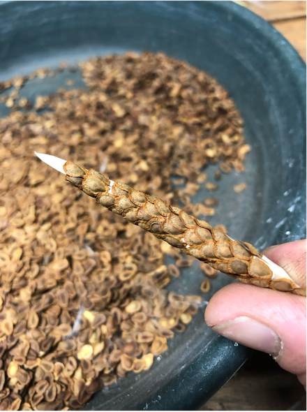
Seed collection of Butterfly Milkweed (Asclepias tuberosa) (left image) and Joe-Pye weed (Eutrochium dubium). Credit: Sefra Alexandra- The Seed Huntress.
The Need for Shared Standards Across the Network
As the Northeast Seed Network (NSN) has grown, so has the recognition that coordination alone is not enough—shared standards are essential for building a functional and trustworthy seed supply system. With partners working across all stages of the supply chain, from wild seed collection to production and use, there is a clear need for consistency in how seed is collected, amplified, documented, and managed. However, developing and agreeing on a set of standards is not enough; we are also providing resources and guidance for those new to working with diverse, source-identified native seeds and plants.
In response to these needs, in December 2023, the NSN established a Standards and Protocols Committee. The goal of the committee is to bring partners together to develop guidance that supports consistency, transparency, and ecological integrity across the network, while still allowing for flexibility across our regional alliance of partnerships and hubs.
One of the committee’s first actions was to apply for and secure funding through aLand Trust Alliance grant. This support enabled the convening of a focused working group to develop wild seed collection protocols for land trusts and create landowner permission templates for organizations and individuals interested in seed collection. Wild seed collection was identified as an immediate and shared priority across NSN hubs and partnerships, given its foundational role in building initial seed supply.
Through this effort, partners from across the region contributed their experience and expertise to co-develop a set of protocols grounded in real-world practice. The process itself was as important as the outcome, helping to align approaches, identify regional challenges, and build a shared understanding of what responsible and effective seed collection would mean for our bioregion. This work represents an early but important step toward broader standardization through shared practices across the network, beginning with one of the most critical entry points in the supply chain.
Populations of northern blue flag iris (Iris versicolor) and cardinal flower (Lobelia cardinalis) at the Highstead Foundation in Redding, Connecticut, are being stewarded as potential seed collection sources for future restoration efforts. Credit: Geordie Elkins.
Wild Seed Collecting Protocols
A working group with private, public, nonprofit, and Tribal partners met monthly from March 2024 to May 2026. Their process involved reviewing existing international literature and established standards, then adapting those approaches to the ecological, logistical, and cultural context of the U.S. Northeast and Mid-Atlantic. This was a critical step, as many existing protocols have been developed for different regions, species, or production systems, and yet none of them was entirely appropriate to the conditions and needs of our bioregion. For example, the Seeds of Success Protocols (SOS), which are widely used across the US and are derived from Royal Botanic Gardens, Kew Millennium Seed Bank protocols, were designed to support the broader goals of the SOS program, including long-term conservation and storage, and largely assume collection from extensive federal land holdings with large plant populations. However, landscapes are much more fragmented across the Northeastern and Mid-Atlantic states, which do not support the same continuous large populations of species as in the US West. Adapting the protocols to reflect smaller population sizes was necessary to reduce the risk of overharvesting. For example, the SOS protocols broadly recommend a 20% “safe seed fraction” for collection. However, we recommend evaluating collection limits on a species-by-species basis to determine whether a 20% threshold is truly sustainable or whether lower collection levels may be more appropriate for certain species or populations. Collections in our region may not need to have an ideal target of 10,000 seeds, especially when collections are intended to provide starter material for seed increase plots. Our collections are also not slated to have a portion sent to a National Seed Extractory, in Bend, Oregon.
From this work, we drew two products:
1) Northeast Seed Network’s Wild Seed Collecting Protocols — a comprehensive guidance document designed to support land managers, seed collectors, and restoration practitioners engaged in ethical and sustainable wild seed collection. The document is intentionally adaptable, recognizing that approaches may need to be tailored to specific species, sites, and organizational goals. It is also intended to be a living resource that will continue to evolve as knowledge grows and the community of practice expands.
2) Wild Seed Collecting Best Practices: Key Messages and Protocols for Land Trusts — an adapted guidance document developed specifically to support land trusts in creating thoughtful policies, partnerships, and practices for ethical wild seed collection. Drawing from the Northeast Seed Network’s broader protocols, this publication provides practical language, decision-making frameworks, and field guidance to help land trusts protect the ecological integrity of their preserves while contributing to the development of a resilient regional supply of locally adapted native seed.
A central principle that we want to emphasize is that wild collection should be justified.Collectors are encouraged to first determine whether seed is already available from existing sources and to proceed only when wild collection is necessary to support restoration, seed increase, or conservation goals. Seed collecting should not be done to commodify a wild product or exploit our natural resources but rather as part of larger programs to strengthen ecosystem health and landscape interconnectedness, for public benefit and for future generations.
Coevolution of plants and pollinators. From left to right: Spicebush swallowtail butterfly (Papilio troilus) on Swamp milkweed (Asclepias incarnata); Fruit fly (Drosophila) on common yarrow (Achillea millefolium); Silver Spotted Skipper (Epargyreus clarus) on Wild bergamot (Monarda fistulosa). Credit: Abbye Carsten at The Hickories seed increase plots, Ridgefield, Connecticut.
Supporting Land Trusts Through Wild Seed Collection
Land trusts are uniquely positioned to play a key role in building a sustainable and ethically sound regional native seed supply. Across the United States, most landscapes are fragmented, and land trusts represent a significant portion of conserved and protected lands. This is especially true in the eastern US, where there is less federally owned and managed land than west of the Mississippi. As a result, land trusts provide some of the best opportunities to collect, safeguard, and regrow native plant populations. These trusts exist to conserve and steward land for ecological, agricultural, and community benefit, with efforts focused on habitat protection, invasive species management, and ecosystem restoration. This places them in a strong position to support the responsible collection and use of diverse, source-identified seed.
Through collaborative seed networks and partnerships, land trusts have become important partners in advancing sustainable wild seed collection as part of broader conservation, restoration, and landscape connectivity strategies. There is growing recognition that seed collecting is not separate from land and landscape stewardship, but rather an extension of it. When done well, and especially where there is planning, protocols, and cooperation, wild seed collecting is a conservation and restoration action supporting conservation, restoration, and reintegration of fragmented landscapes at bioregional levels.
Our work with land trusts to date has demonstrated how seed collection can be incorporated into day-to-day stewardship. This includes collecting seed from healthy populations and, in some cases, growing and planting that seed back into the same landscape to bolster existing populations. It also helps to support restoration both on and off conserved lands.
Wild seed collection also creates meaningful opportunities for engagement. Many land trusts already rely on volunteers, and seed collection can bring people more directly into the work of restoration. It can become part of a full-cycle approach, where seeds are collected, cleaned, grown, and ultimately returned to sites and ecosystems where they are needed. In practice, this work often involves close collaboration among land managers, botanists, seed collectors, and seed bank curators, along with careful monitoring of plant populations to track their health, size, and changes over time. This sustained attention not only improves understanding of how plant populations respond to environmental change and disturbance but also supports more informed conservation, restoration, and land management strategies. At the same time, seed collection must be approached carefully. It should not be haphazard or extractive, but guided by clear policies, ethical frameworks, and strong relationships between land managers and collectors.
Direct seeding of wrinkleleaf goldenrod (Solidago rugosa), little bluestem (Schizachyrium scoparium), and purpletop (Tridens flavus) from wild-collected seed within the Kent Land Trust preserve system in Kent, Connecticut. Credit: Melissa Cherniske, Program Manager.
Conclusions and Looking Ahead
Protecting the long-term health of wild populations must remain the top priority, even as demand for native seed continues to grow. We hope that our new Wild Seed Collection Protocols will provide clear guidance for responsible collection, support ethical decision-making in the field, and help ensure that seed collection practices contribute to long-term ecosystem health rather than placing additional pressure on already vulnerable plant populations.
A next step for NSN partners across all hubs and partnerships is to establish a shared system for documenting wild seed collections and tracking what is currently in production. Improving visibility into existing wild seed collections, regional seed bank holdings, and species currently being increased in production fields can help reduce the need for additional collections from wild populations, thereby minimizing unnecessary and unhealthy pressure on ecosystems and plant communities. Better information sharing can also support more strategic planning across the network, enabling partners to coordinate efforts more effectively and avoid unnecessary duplication.
Meeting the scale and diversity of restoration needs across the Northeast and Mid-Atlantic requires a coordinated yet largely decentralized approach. The region’s wide range of species, habitat types, and restoration priorities depends on many individuals and organizations contributing at different scales and across different geographies. The volatility of native seed markets further underscores the need for flexible, locally driven production and stewardship efforts. At the same time, this distributed model makes strong communication and shared planning even more essential. By using diverse, source-identified seed from local populations, working within appropriate ecological boundaries, and adopting a network-based approach, we can help ensure that restoration efforts place the right seeds and plants, in the right places, at the right time.
At its core, this work relies on building relational capital among a diverse constellation of partners and practitioners. These connections are the foundation needed to sustain wild plant populations over the long term and build the infrastructure for durable, ecologically sound restoration—supporting healthier, more resilient ecosystems and, in turn, healthier human communities.
Acknowledgements
We extend our sincere thanks to the Land Trust Alliance for their generous support in making this work possible. We are also deeply grateful to the Northeast Seed Network’s Standards and Protocol Committee members, as well as the many contributors and reviewers who helped shape and strengthen this work.
Contributors: Geordie Elkins — Executive Director, Highstead Foundation Heather Liljengren — Owner and President, LocalLand Consulting Sefra Alexandra — The Seed Huntress – Co-founder, The Ecotype Project Eve Allen — US Northeast Program Director, Ecological Health Network Dina Brewster — Founder, The Hickories; Northeast Seed Collective; Co-founder, Ecotype Project Lauren Shew — Director of Operations, Ecological Health Network Matthew Garrambone — Principal Consultant at Beechwood Environmental LLC, contracted by Native Plant Trust Seth August — Manager of the Seed Programs, NYC Parks Plant Ecology Center and Nursery Lindsey Feinberg — Native Plants Manager, Hilltop Hanover Farms Emily Baisden —Seed Stewardship Director, Wild Seed project Brooke Fleischman — Conservation Nursery Seed Coordinator, Intervale Center Linda Rohleder, , President, Wild Woods Restoration Project Erin Camire — Ecological Landscape Consultant, Association to Preserve Cape Cod Brigitte Wierzbicki — Plant Materials Program Coordinator, New York State Parks Kate Rakosky — Volunteer / Rhode Island Wild Plant Society; Co-owner of Sagewood Botanical Sanctuary Jay Richardson Grebe — Co-founder and Executive Director of Just Harvest Ashley Senegal — Co-founder, Traditional Eastern Foodways Alliance Jessica Raspitha — Land Resources Program Manager, Saint Regis Mohawk Tribe Dan Brubaker — Director of Conservation and Outreach at Greenwich Land Trust Mary Ellen Lemay — Director of Landowner Engagement, Aspetuck Land Trust Lizzie Hunt — Trustee, Rhode Island Wild Plant Society, and a member of the ReSeeding RI Steering Committee Alliy Gundlach-Massimino — Heritage Nursery Seed Program Manager, Tree Pittsburgh Heritage Nursery Sue Theriault — Vice President, Rhode Island Wild Plant Society, chair of the ReSeeding RI Steering Committee John Price — Native Seed Collection Coordinator, Mid-Atlantic Regional Seed Bank Melissa Cullina — Vice President of Plants and Science, Coastal Maine Botanical Gardens
Charlotte Lorick is the Head of Biodiversity Conservation at the Oak Spring Garden Foundation in Virginia, United States. She also leads the Forgotten Flora Project, an environmental and educational consulting initiative. In addition to this work, she serves as a co-lead of the Restorative Landscape Coalition, a working group of the Northeast Seed Network. In this blog, she shares her hands-on experience organically restoring a meadow in a former horse pasture and hayfield in the eastern United States.
Transformation of former hay fields (left) to native meadow (right) using sod removal for site prep. Photo by Charlotte Lorick.
In Virginia’s Northern Piedmont region, where rolling hills extend from the Blue Ridge Mountains toward the Atlantic Coastal Plain, sits the Oak Spring Garden Foundation (OSGF). Its mission is to support and inspire scholarship and public dialogue on the history and future of plants, including the art and culture of plants, gardens, and landscapes, and the importance of plants for human well-being. OSGF advances this mission through fellowship and residency programs, a renowned research library, and by cultivating a biocultural conservation farm and ornamental gardens. The foundation also convenes meetings and collaborations focused on botany, horticulture, and landscape conservation. In this capacity, OSGF hosted the inaugural meeting of the Restorative Landscape Coalition in 2024.
Among the foundation’s primary goals is conserving and promoting native plants and biodiversity across the 280-hectares (700-acres) of land under its care. This goal can often prove challenging because the land at OSGF, like much of the rich soils of the Northern Piedmont, has long been shaped by agricultural land use. The impacts of agriculture on soil and plant communities are long lasting and can be detrimental to native species richness and diversity. Heavy fertilization favors exotic species over natives and the common practice of heavy tillage forever alters the soil and seed bank, further decreasing native species richness. Indeed, the IUCN considers temperate grasslands the least protected, most heavily altered, and most endangered terrestrial biome in the world. In the southeastern United States in particular, an estimated 90% of pre-European grasslands have been lost due to agricultural practices and other factors. And the small amount that do remain are indicators of the incredible species richness that have been lost. A recent study of Virginia’s Piedmont grasslands demonstrates they are far more biodiverse than previously documented, with surveyed sites having over 100 plant species in a single 100 m² plot.
This ecological and land use legacy raises a common challenge for conservation landowners across our region: how to restore native meadows to ecosystems degraded by intensive agriculture? As agricultural abandonment has increased across the region, converting old pastures to native meadows by removing existing vegetation and seeding a regionally native seed mix has become a common practice to address that challenge. Meadow restoration as a practice can actually mean different things depending on the situation. In the context of the Society for Ecological Restoration’s (SER) Restorative Continuum of activities, most often these kinds of meadow plantings fall along the restoration continuum but are distinct from efforts to fully restore native biodiversity and ecosystem health based on a reference ecosystem. Instead, in our region and at OSGF these meadow restorations emphasize incorporating designed, site-adapted native plant communities into degraded grasslands. We are aiming to increase native diversity in our grasslands and this is one way to accomplish this. However, for several reasons, including lack of robust data on reference communities or access to hyperlocal native seed, we consider these projects as distinct from but complementary to a full-scale ecological restoration effort.
As every practitioner will tell you, restoring a native meadow is a challenging process in this region as the non-native weeds and pasture grasses (that had historically been introduced for cattle and hay production throughout the Eastern US) are tenacious. Removing them effectively to allow establishment from a native seed mix is arguably the most critical yet most challenging part of the meadow restoration process. Conventional methods rely on heavy use of herbicides or tilling, which both have considerable downsides. Yet data are lacking in this region specifically on alternatives. To address this gap and inspire formal research on innovative or alternative techniques to restore native meadows in the Eastern US, in 2023 we trialed a novel method to restore a meadow that could prove a viable alternative for small areas to the conventional herbicide and tillage approaches.
This post details our project, outcomes, and lessons learned. We outline the experimental approach, site preparation methods, and early establishment results, and reflect on the practical implications of this technique. This project is a case study rather than a formal experiment, but we believe that what we learned in the field and are sharing here can havevalue for generating hypotheses and informing land managers interested in applying this method on their land and researchers interested in conducting future studies.
Landscape Context and the Case for Meadow Restoration
The OSGF landscape includes a rich mosaic of open fields, meadows, forests, streams, and wetlands that have been shaped by a long history of anthropogenic influence. In Pre-settlement times, the commonly held theory is that the Piedmont was characterized by oak-hickory landscapes with patches of forest and savannahs often managed by controlled fire. Post European settlement, the land at OSGF was managed, including by enslaved people, for row crops and apple orchards, grazing cattle and hay production, and, in the last 50 years, horse pasture.
Today, through careful inventory of the landscape, we have identified several remnant and globally rare plant communities on the OSGF property that seem to have escaped much of the human impacts. These include a Piedmont upland depression swamp containing cypress-knee sedge (Carex decomposita), a species designated as critically imperiled in Virginia with fewer than five known populations remaining in the state, and false hop sedge (Carex lupuliformis), another exceptionally rare species.
However, most of the open fields on the property are now products of a two and a half century agricultural legacy and are low in diversity, dominated by non-native cool-season grasses and other exotic species. While these non-native grass dominated pastures are actually choice nesting areas for many declining grassland specialist bird species at OSGF (including Eastern Meadowlarks (Sturnella magna), Grasshopper Sparrows (Ammodramus savannarum) and Bobolinks (Dolichonyx oryzivorus), we are selecting areas carefully to convert to native meadow where these birds are not nesting to support other suites of species that benefit from native meadow conversion. These areas hold strong potential for ecological restoration and conversion to diverse native meadow habitat and have become high priorities for conservation for OSGF. For example OSGF is also home to several threatened or declining bird species that depend on diverse grasslands and early successional plant communities. These species include Short-eared Owl (Asio flammeus), Northern Bobwhite (Colinus virginianus), American Kestrel (Falco sparverius), Savannah Sparrow (Passerculus sandwichensis), and Henslow’s Sparrow (Centronyx henslowii). Notably, the native meadows that OSGF has established over the years have become winter hotspots for Short-eared Owls and Northern Harriers (Circus hudsonius) and other birds.
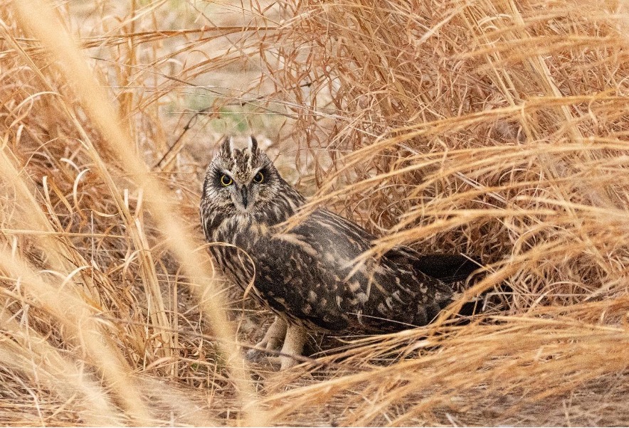
Short eared Owls overwinter at OSGF every year and prefer roosting in clumps of native bunch grasses and in our restored native meadows. Pictured here in native broomsedge (Anatherum virginicus, syn. Andropogon virginicus) and purpletop (Tridens flavus) clump. Photo by Josh Rector, OSGF.
Can Sod Removal Replace Herbicides?
As OSGF transitions away from its historic use of the land for hayfields and pasture, we have initiated several native meadow restoration projects over the past decade, totaling roughly 24 hectares (60 acres). These projects have primarily used conventional installation approaches, including herbicide application or chemical-free methods such as repeated tilling and plowing. The most common conventional method is to apply a broad-spectrum herbicide, such as glyphosate, at least 3 times to create enough bare ground to seed the meadow. But chemical herbicides are not always effective on some of the most aggressive weeds, they are not effective on controlling weed seeds in the seed bank, they can alsonegatively alter the soil, and pose safety concerns for humans and wildlife. Unfortunately the common organic alternative relies on heavy tillage which comes with its own major downsides, including increases in noxious non-native weeds and negative impacts on soil health.
OSGF is particularly interested in restoration strategies that minimize or avoid the use of chemical herbicides. We are not alone. Across our region, many landowners are exploring herbicide-free approaches to meadow restoration. However, robust data on the efficacy of alternative methods are limited.
For this project we decided to try sod removal or scraping. Although this method of site preparation is often employed on small scales for garden installation or lawn conversion, we found little data on this method for large scale restoration plantings. However, we were encouraged by the results of some restoration studies from Europe and California involving topsoil removal.
Sod Removal Project Design: Methods, Site Preparation, Seeding, and Maintenance
The sod removal trial was designed with two main goals: to test an understudied organic approach to meadow restoration site preparation, and to share our case study to encourage further exploration of the approach, and perhaps formal research comparing this method with more common approaches.
The trial took place on a 0.8-hectare (2-acre) parcel of a former horse pasture and hayfield. Baseline vegetation surveys showed it was dominated by introduced cool-season pasture grasses: tall fescue (Lolium arundinaceum), orchard grass (Dactylis glomerata), and Kentucky bluegrass (Poa pratensis).
To track change over time, we established permanent vegetation monitoring plots across the site. Vegetation surveys were conducted at baseline (Year 0) before disturbance and twice per growing season following seeding (2024 = Year 1, 2025 = Year 2). Soil samples were also collected at baseline and in each subsequent year. In November 2023, we removed the top layer of sod using the bucket of a skid-steer at a depth of approximately two inches. Afterward, the soil surface was lightly raked to improve seed-to-soil contact. We hand-broadcast a native seed mix using pine shavings as a carrier at 13.5 kg per hectare (12 lb per acre) and seeded a temporary cover crop of 50% winter rye and 50% oats at 34 kg per hectare (30 lb per acre). The field was then lightly covered with straw using a straw blower. The seed mix included 28 regionally appropriate species, roughly 60% perennial grasses and 40% forbs.
Management during the first two years was intentionally light. In Year 1, the cover crop was flail-mowed once in the spring. Other interventions involved manual cutting or pulling of problem weeds, primarily biennial thistles (Carduusspp.), a single clump of Johnsongrass (Sorghum halepense) likely introduced during site preparation, and spot mowing of creeping thistle (Cirsium arvense). Additional mowing had been planned but proved unnecessary due to relatively low weed pressure. The most common weeds were the annual grass Setaria pumila, which we expected to decline naturally, and white clover (Trifolium repens), which remained low-growing and did not appear to inhibit germination of the native seed mix. In Year 2, the meadow was flail-mowed once in the spring, followed by two days of manual cutting of problem weeds—mainly biennial thistles—to prevent seed set during the growing season.
Progress photos
Year 0 baseline (left) dominated by cool-season pasture grasses with intermittent ruderal forbs. Site prep (middle & right) included sod removal with skid-steer, raking soil, hand seeding and covering with straw. Photos by Charlotte Lorick.Year 1 from left to right, July, September, October. A lot of bare ground in year 1 (left) and complete removal of non-native grasses with pioneering black-eyed susan and mistflower (middle) already blooming. Slower-growing perennials such as hoary mountain-mint were abundant as well (right). Photos by Charlotte Lorick.Year 2 from left to right, July, September, October. Abundant mountain mints and volunteer path rush dominating the wetter section with black-eyed susans in the background (left). Many perennials flowering and fruiting including the gray goldenrod and little bluestem (middle & right). Photos by Charlotte Lorick.
Preliminary but Encouraging Outcomes
Because native meadows take time to establish, we want to emphasize that these observations are preliminary, with only two growing seasons documented so far. We will continue monitoring the site over the coming years and hope to share longer-term results as the meadow develops.
Nevertheless, at this early stage, several encouraging patterns have emerged. Total native species richness approximately doubled in Year 1 and tripled in Year 2 compared to baseline conditions. Native forb richness increased even more dramatically, more than tripling from baseline to Year 2. At the same time, the three most abundant baseline species—all exotic cool-season grasses—dropped from nearly 100% cover in Year 0 to less than 5% cover by Year 2 when averaged across all survey plots. This is an important indicator that sod removal was extremely effective in removing existing non-native vegetation.
Figure 6. Total number of species documented across all survey plots and including incidentals encountered outside formal surveys. Plants were designated native or introduced rank based VA Digital Atlas and given invasive rank based off : https://www.dcr.virginia.gov/natural-heritage/invsppdflistFigure 7. Total number of native forb species documented across all survey plots and including incidentals encountered outside formal surveys.
By the second year, 22 of the 28 species in the seed mix had germinated, with several species already fruiting in the first year. This is a highly successful germination result by year two. For comparison, some of our other meadow restoration projects that used herbicide did not have germination of many of these same species until after year 2.
Species seeded. P = Present but not seen flowering or fruiting, F = Observed flowering or fruiting, 0 = Not observed. *A small number of Midwestern species were included to provide early visual interest and occupy space in the first few years, but are expected to fade as the native perennial species establish. ** This species was only seeded in a small drift to prevent overabundance.
In addition to the seeded species, we documented a number of native volunteer species that were not part of the seed mix and were not recorded in baseline surveys. These included secund rush (Juncus secundus), path rush (Juncus tenuis), forked rush (Juncus dichotomus), sweet everlasting (Pseudognaphalium obtusifolium), green milkweed (Asclepias viridiflora), and sedges such as fox sedge (Carex vulpinoidea), straw-colored flatsedge (Cyperus strigosus) and globe flatsedge (Cyperus echinatus). The arrival of native volunteer species was an exciting bonus and good indicator that some of the legacy native seedbank was still intact and uncovered with sod removal.
Lessons Learned and Key Takeaways
While this project was not designed as a formal experiment, the results have been striking and our hypotheses can inform further studies. Compared to other meadow restoration efforts attempted at OSGF, this planting has performed exceptionally well. It has required far less maintenance and weed management, and the native seed mix established with noticeably higher germination, flowering, and overall cover. The method was also particularly effective at suppressing the dominant cool-season grasses that often make meadow establishment so challenging.
Before seeding, the site supported very little native diversity. And the few native plants that we did find were woody seedlings or ruderal species such as horse-nettle (Solanum carolinense) and pokeweed (Phytolacca americana). Following the restoration work, native forb diversity increased substantially, including the appearance of several volunteer species. Although non-native white clover became the dominant plant by percent cover, its low, spreading growth did not appear to suppress the emerging native seedlings.
Of course, many factors could have contributed to this success. The seed was broadcast rather than drilled, which may have supported quicker germination. Careful site selection, existing vegetation conditions, and even the drought that followed seeding may also have played a role. Still, after more than a decade spent surveying and working in meadows across Virginia, this site stands out as one of the most rapidly successful restorations I’ve ever observed.
Our working hypothesis is that scraping away the existing sod removed much of the weed pressure by removing the grassrhizomes in the uppermost soil profile and some of the associated seed bank. It also slightly reduced the organic matter and nutrient layer at the soil surface—conditions that may have favored native species during establishment by reducingweed pressure (which thrive in more fertile soil). Although a decrease in organic matter may not be ideal for overall soil health, the decline is likely temporary. A growing body of research suggests that over time, the increase in native plant diversity may ultimately improve soil health beyond what we observed at baseline. This is something we plan to monitor in the years ahead with continued soil sampling.
The primary drawback of this method is cost. Removing and relocating large amounts of topsoil requires significant upfront investment, which may be impractical in some situations and at larger scales. However, this material can be reused elsewhere on a property in areas not prioritized for restoration or offered as a resource to farmers or composting operations. It is possible that these higher initial costs could ultimately be offset by reduced long-term maintenance and weed control, but that would take further study to determine.
Another challenge we encountered was sourcing local seed. Ideally, we would have used seed with documented provenance sourced from populations occurring in Virginia’s Northern Piedmont ecoregion, but the native seed supply chain still has significant gaps. To help address native seed shortages, OSGF has partnered with the Northeast Seed Network’s Mid-Atlantic Seed Partnership and the Restorative Landscape Coalition, a working group of botanic gardens, arboreta, seed banks, and allied organizations working to expand the availability of diverse, source-identified native seed for ecological restoration across the Mid-Atlantic and Northeastern United States. For this project we purchased seed from Ernst Conservation Seed in Pennsylvania and although not all seeds were sourced from our ecoregion, we were pleased that all their seed was from very nearby ecoregions and states in the Eastern US.
We hope this project encourages others to explore sod removal for meadow restoration. There is much practical experience still to be gained and there are many questions worth investigating in controlled experiments to compare this method with other site preparation techniques, test different sod removal depths, or variations in seed mix compositions.
In the meantime, we plan to explore the further use of this approach in future restoration projects at OSGF. If you’re curious about the project or interested in collaborating, we’d be happy to connect.
Acknowledgements: Special thank you to OSGF team Clif Brown, Josh Rector, Katharine Perkin, Sarah Krementz, Sam Terry and local contractor Virginica LLC for support of this project.
Tobin Mutiso is a research associate at the Centre for Ecosystem Restoration Kenya (CER-K). He works on plant ecology and taxonomy. He holds a BSc in plant ecology and environmental science from Jomo Kenyatta University of Science and Technology. Email: tmutiso@cerkenya.org
Andrew Gichira, PhD, is a botanist and restoration ecologist specialising in conservation genetics and ecosystem restoration. He currently serves as the head of research at the CER-K. Email: agichira@cerkenya.org
Members of Community Forest Association (CFA) and trainers standing beside a mature Euphorbia cussonioidesat Blue Post, Thika, after a training on phenology monitoring, seed collection, and species-specific propagation techniques. Subsequently, other seedlings and mature individuals of this species were identified in Ndula Village, approximately 22 km from this site.Photo by Tobin Mutiso.
The loss of native plant diversity is reshaping Kenya’s ecosystems in ways that are often subtle but deeply consequential. As woody plant species disappear, so do the ecological functions they support, including soil stabilisation along rivers, food and habitat for wildlife, local climate regulation, and cultural and livelihood values tied to native landscapes. According to the IUCN Red List, national reports, and NGO summaries assessing East African trees, roughly 13% of Kenya’s native tree species are threatened with extinction. Most persist in small, isolated stands where natural regeneration is compromised.
Natural regeneration becomes increasingly difficult for woody species with very small isolated populations in fragmented landscapes. This is because plants depend heavily on trophic interactions such as complex plant-pollinator relationships. When these factors are compromised, seed production becomes irregular, which is further compounded with limited capacity of seedlings to establish in degraded and altered habitats. Even in places with improved protection, these species often fail to recover without deliberate conservation intervention. This reality presents a challenge for restoration efforts that rely heavily on a narrow set of fast-growing or readily available species, leaving threatened trees further marginalised and the ecosystems in which they are a key part vulnerable to further degradation and fragmentation.
Tree and shrub planting initiatives are expanding rapidly, but their contribution to biodiversity recovery depends on whether the species planted match local ecological conditions. Evidence-driven species selection, combined with local capacity to manage planted trees, remains unevenly distributed across projects, with technical guidance often outpacing on-the-ground monitoring. Threatened plant species, in particular, require targeted support, including improved data on their distribution, a deeper understanding of their ecology, tailored propagation and reintroduction protocols, and long-term care, which can be integrated into local land-use systems.
Our project aims to investigate whether a species-focused reintroduction model can be effective in real-world conditions. Working with community forest associations, we have selected 22 threatened tree species, developing propagation methods for each and planting them in multiple sites managed by local communities. The central question is whether ecological restoration, species reintroduction and livelihood benefits could be pursued together without compromising the other. By integrating herbarium records, expert knowledge, targeted field science, and community engagement, we are building a reintroduction and restoration model that is both ecologically fit for purpose and socially sustainable, as well as adaptable to other landscapes facing similar biodiversity loss.
The project is within the Kenyan Highlands, a section of the complex montane ecosystem in East Africa characterised by high habitat heterogeneity and notable levels of biodiversity and endemism (Gehrke & Linder, 2014; Dagallier et al., 2020). Kenya is subdivided into seven plant divisions (K1-K7), which are largely based on the early administrative boundaries (Zhou et al., 2017). Our surveys targeted multiple elevation zones, with a primary focus on the K4 region (1,500–3,000 m) within the central highlands and additional coverage of K7 (Taita Hills, 600–1,640 m) and K6 (Loita Forest, 2,000–2,300 m). Several focal species occur outside the central highlands but occupy comparable altitudinal ranges elsewhere in the country. This broad elevational gradient contributes to high floristic diversity, making the K4 zone a hotspot for Rare, Endangered, and Threatened (RET) species, particularly those of high conservation and use value, including timber and medicinal species such as Ixora scheffleri subsp. keniensisBridson,Prunus africana (Hook. f.) Kalkman and Warburgia ugandensisSprague.
The seven phytogeographical divisions recognised in the Flora of Tropical East Africa. K4 and K7 are the most species-rich regions: K4 represents the central Kenyan highlands (~ 1,200–3,000 m above sea level). K7 mainly comprises the coastal lowlands of Kenya (0–150 m.a.s.l.) with some inland highland areas e.g., the Taita Hills (~1,000–2,200 m.a.s.l.). K2 zone also covers the Ilemi area at the northern border. This study focuses on threatened plant species occurring in high-elevation habitats (1,500 m – 3,000 m.a.s.l).
Starting in the Archives: the herbarium as a roadmap
This work began not in the field, but at the East Africa Herbarium at the National Museums of Kenya. Herbarium specimens, some collected more than a century ago, provided the most reliable baseline for understanding where threatened tree species historically occurred. We also consulted international databases, most notably the Global Biodiversity Information Facility (GBIF). These collections helped trace former distributions, habitat preferences, and altitudinal ranges for species now rarely encountered in the wild.
Table 1: A list of 22 woody species that were targeted for the study based on observations recorded at the East Africa Herbarium and the Global Biodiversity Information Facility. Accessed in June, 2022.
This archival work was complemented by key informant interviews with experienced taxonomists. Their insights helped resolve identification challenges, clarify taxonomic updates, and flag species frequently overlooked in restoration programmes. Surveys of commercial nurseries in the coastal regions further highlighted how threatened native trees and shrubs are systematically neglected in favour of exotic or common species. Literature reviews added further context, helping reconstruct historical range patterns and identify priority floristic regions for field verification. Together, these sources allowed us to move beyond generalized restoration species lists and ask more focused questions, specifically: where do these threatened species still exist, where have they been lost, where does restoration make sense, and, can we create a socio-economic model that sustainably uplifts the livelihoods of local communities while also supporting efforts for ecological and biocultural restoration?
Field expeditions and new records
Guided by this evidence, we carried out targeted field expeditions across multiple landscapes in the Kenyan highlands, spanning 11 counties, including Taita Hills, Kijenge Hills, Thika, Irangi Forest, Ngaya, Thushi River, Nyambene Hills, Imenti Forest and Karura Forest, as well as selected dryland and forest-edge systems, in particular the Loita Hills. These surveys were designed not just to confirm presence or absence but to generate practical ecological insights for restoration practitioners.
Map of survey areas in the Kenyan Highlands. The sites are distributed in phytogeographical zones K4 and K7, with a single record in K6.
In several locations, fieldwork led to the identification of new records or previously undocumented populations. The most significant findings surrounded Euphorbia cussonioides (CR) and Brucea macrocarpa (EN), both species whose known populations have declined significantly in recent decades. Newly recorded individuals and regenerants provided urgently needed information on the species’ current area of occupancy and viable seed sources, as well as evidence that recovery is still possible if sites are protected and managed. Observations of flowering and fruiting patterns revealed clear opportunities for seed collection and assisted regeneration. Other threatened species encountered during surveys included Ixora scheffleri subsp. keniensis(CR), Embelia keniensis R.E. Fr. (CR) ,Encephalartos kisambo Faden & Beentje(EN), and Vepris hanangensis(Kokwaro) Mziray (NT).
Table 2. Newly documented populations and occurrence records of selected threatened woody plant species.
Newly documented natural regeneration (wildlings) of Euphorbia cussonioides were recorded during field surveys at Nkopon village in the Loita Hills. Photo by B. Maina.
At each site, we recorded location, habitat condition, land-use context, population structure, regeneration status, threats, and phenological stage. This level of ecological detail transformed field observations into decision-ready data, helping bridge the gap between research and restoration action.
Communities as conservation partners
From the outset, the project treated local communities as central partners and not just beneficiaries. In areas where threatened species occurred on private or community-managed land, we worked closely with landowners, community forest associations (CFA), and local scouts to monitor the phenophases and liaise with local nurseries in propagating the seeds. In addition, the Kenya Forest Service (KFS) provided planting locations and collaborated with the CFAs to oversee and care for the seedlings.
Training focused on practical, transferable skills, in particular: educating the community on the reasons we conserve plants, identifying threatened tree species, monitoring phenology to track flowering and fruiting cycles, collecting seed ethically with genetic diversity in mind, and applying appropriate propagation techniques. We engaged and trained 138 community seed collectors active as community phenology monitors and seed collectors.
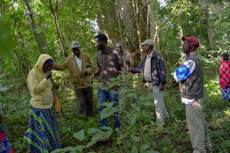
Community members in Embu, Kenya, are undertaking phenology monitoring and seed collection during a training session at Ngaya Forest. Photo by T. Mutiso.
At Ngaya forest, Thika’s Blue Post, Kasigau (Taita) and Upper and Lower Imenti forests, community members were trained to identify threatened woody species in situ using diagnostic morphological traits, to map and tag individual plants, and apply basic protection measures to reduce disturbance. They also monitored flowering and fruit development to inform seed collection and to rescue naturally regenerated wildlings at risk from competition with invasive species, most notably Lantana camara. This hands-on engagement directly supported the propagation of Brucea macrocarpa,Pandanus kajui, Gymnosporia keniensis, Cylicomorpha parviflora, Premna maxima, Vepris glandulosa, and Euphorbia cussonioides.
Pandanus kajui seedlings propagated in Kithunguthia (Embu) community nursery. Photo by T. Mutiso.
These efforts produced tangible outcomes, with over 28,000 seedlings of threatened species raised in community nurseries in Antubetwe (Ngaya Forest), Kasigau (Taita), Kithunguthia (Embu), Male (Laikipia), Kenya Forest Service (Meru), and Kamaruki (Nyambene), thereby creating viable restoration planting stock. Livelihood benefits were created through project-funded payments for seed collection, nursery establishment and management, and continued after-care management of planted seedlings. The financial support is largely from the Fondation Franklinia, and the funds are channelled through the Community Forest Associations. Building on the outcomes of the grant, we developed a community-based seed collection model in which trained local collectors form a coordinated network that sources seeds from RET taxa as well as other native plant species and supplies them to institutional seed banks. These seeds are subsequently made available to restoration practitioners for use in active restoration initiatives. Revenue generated through seed sales is reinvested to remunerate community seed collectors, thereby establishing a sustainable and locally grounded alternative income stream while reinforcing conservation and restoration objectives. The project’s impact and details of the community engagement aspects have been comprehensively outlined in an article published in the BGJournal Vol 22 (1), Seed banks for Biodiversity pages 39-42.
Building practical tools for practitioners
Under this framework, the project has generated insights that have now been consolidated into practical tools for wider application, including species-specific propagation protocols shared with spatial databases linking historical and new records, producing phenology calendars to guide seed collection for threatened and non-threatened native plant species, and a structured framework for community engagement. Currently, the project has generated 21 propagation protocols for the 22 threatened species, including Uvariodendron anisatum, Brucea macrocarpa, Croton alienus, Euphorbia cussonioides, and Premna maxima, whilst others are still under review. In addition to these tools, a growing network of restoration sites and partner nurseries is being established, enabling peer learning, harmonisation techniques, and coordinated tracking of threatened species across landscapes. The emerging practitioner network is now being facilitated through CER-K.
Restoring Kenya’s endangered trees and shrubs to the Highlands is an act of optimism, responsibility, and restoration, rather than just an ecological exercise. We are using science to pinpoint which species once flourished in Kenya’s phytogeographical regions, understand the reasons behind their decline, and determine the most effective way to bring them back. By taking community action, we ensure that restoration is long-lasting rather than temporary. As a result, the communities themselves own, maintain, and strengthen the conservation of threatened species rather than having it imposed upon them. We aim to increase the number of threatened species sites we survey, improve monitoring, develop a practitioner network, and continue to accumulate knowledge that informs successful conservation both in situ and ex situ. Visit https://cerkenya.org/ for more information on our work in general and in threatened species conservation in particular.
The tropical dry forest is a unique ecosystem that challenges many preconceived assumptions about the tropics. Unlike the iconic tropical rainforest, dry forests are highly seasonal, marked by distinct dry and rainy seasons. In some areas, plants may experience up to six months without rainfall. As a result, the species inhabiting these forests have evolved remarkable adaptations to thrive in this challenging environment, giving rise to exceptionally diverse plant communities. However, this unique diversity is under threat, as tropical dry forests are among the most threatened lowland ecosystems in the tropics. Urban expansion, mining, monoculture agriculture, and livestock production are among the main threats to this ecosystem. The loss of these forests not only endangers biodiversity but also jeopardizes the livelihoods of many human communities that depend on them.
Given their threatened status, tropical dry forests have become a major focus of restoration efforts across the tropics. However, these efforts often lack critical information on how these forests naturally regenerate and how abiotic environmental conditions, such as light, water, and nutrient availability, influence seed and seedling survival in this ecosystem. During my PhD, I have been studying how abiotic environmental conditions shape natural seedling regeneration in tropical dry forests across Colombia and Costa Rica. My research focuses on three components of this regeneration cycle: the formation of the soil seed bank, the environmental conditions that drive germination, and the establishment of young seedlings.
Tropical dry forest during the dry season in the Natural National Park Santa Rosa, Guanacaste, Costa Rica. Note how many of the trees lose their leaves due to water stress. Photo by Viviana Londoño-Lemos.
Germination and establishment: the great choices in a plant’s life
Germination is the most consequential choice a plant makes. Because plants are sessile organisms and germination is an irreversible process, the location where a seed germinates determines the environment where the plant must grow, compete, and reproduce for the rest of their lives.
This story begins with a seed, which is the fertilized ovule of a plant. Each seed is a highly specialized structure that consists of three basic components: a protective seed coat, the nutritious tissue, and the plant embryo. Many seeds also include specialized structures that aid dispersal and sense environmental conditions, helping them determine when conditions are suitable for germination.
Once seeds mature, the next step is dispersal in both space and time. Spatial dispersal determines how far a seed travels from its parent, whereas temporal dispersal determines when it germinates. Thus, natural seed regeneration depends on seeds arriving in the right place at the right time. Spatial dispersal of many tropical plants, particularly those dispersed by animal vectors, has been widely studied. In contrast, temporal dispersal, encompassing the study of soil seed banks within plant communities, remains understudied. Understanding both dimensions of seed dispersal is essential for assessing the regeneration potential of plant communities, an important consideration when designing plant-based restoration strategies, because it provides information on what species need to be planted versus which may regenerate naturally.
Soil seed banks are the storage of viable seeds in forest soil. In theory, the soil seed bank of a given plant community contains seeds representing the species present in the vegetation aboveground. But not all seeds behave the same way. Seeds from some species persist in the soil until the next germination season — typically the rainy season in tropical dry forests— after which they germinate or die (transient species). Others persist for years, decades, or in exceptional cases, even centuries (persistent species). Understanding soil seed bank strategies helps identify which species have the potential to regenerate naturally.
Once the appropriate spatiotemporal conditions are met and a seedling emerges, the next step is its establishment, defined as the transition from reliance on maternal sources (the seed) to physiological self-sufficiency. This critical bottleneck in the plant life cycle depends on the biotic and abiotic interactions of the seedling with its new environment. Biotic interactions, including mutualistic associations, predators, pathogens, and natural enemies, are widely assumed to explain the extraordinary diversity of tropical ecosystems. However, in seasonal ecosystems such as the tropical dry forests, abiotic interactions such as water, light, and nutrient availability play an important role in seedling survival. Environmental shifts, particularly in water availability, directly influence whether a seed successfully germinates and whether the resulting seedling survives long enough to establish. Understanding these processes is essential for designing effective restoration strategies grounded in the biology of the species they aim to support.
A seedling of Enterolobium cyclocarpum at the Horizontes Forest Research Station, Guanacaste, Costa Rica. Photo by Viviana Londoño-Lemos.
The hidden regeneration potential of tropical dry forests
When planning a plant-based restoration project, understanding the site’s history, particularly its historical plant communities, is essential. Even after vegetation has been lost, soil often retains biological relics, such as persistent soil seed banks, of past communities. For many tropical woody species, soil seed banks are often considered transient, since tropical forests are not typically viewed as strongly seasonal systems. However, with distinct dry and wet seasons, tropical dry forests are a striking exception.
To determine whether tropical dry forest species rely primarily on persistent or transient soil seed banks, we conducted experiments in the Tayrona National Natural Park in Colombia and at the Horizontes Forest Research Station in Costa Rica. Our goal was to assess how long selected species can survive in the soil. Because this experimental approach can be time-consuming and challenging, we also measured key seed traits such as seed dormancy type, dispersal syndrome, seed coat thickness, mass, volume, moisture content, and embryo-to-seed ratio to identify which seed traits are related to soil seed bank persistence.
Our first experiment, conducted in Costa Rica, aimed to determine the extent to which tropical dry forest species form persistent or transient soil seed banks and whether canopy openness influences soil seed bank formation. For this experiment, we buried mesh bags that contained seeds from 15 liana and tree species under both canopy gaps and closed forest conditions. We retrieved the bags annually over three years and tested seed viability each time. After one year, only five species exhibited a persistent soil seed bank, suggesting that most species form transient soil seed banks and do not persist beyond a single rainy season.
To explore this result in greater detail and determine whether transient species survive only until the first rainy season, we conducted a second experiment with 40 species, using shorter intervals between packet retrievals. This experiment was carried out in both Costa Rica and Colombia, in collaboration with researchers and students at the University of Magdalena. We evaluated seed viability after 3, 6, and 13 months.
Although data analysis is still underway, preliminary results indicate that approximately half of the species employ a transient strategy, while the remaining half are persistent. Transient species tend to disappear from the soil seed bank, either by germinating or dying, by the end of the first rainy season. Persistent species, in contrast, retain their seeds longer, and in some cases germinate only a couple of seeds per year. Some species with persistent seeds tend to survive longer in canopy gaps. As for seed traits, we have observed a tendency for transient species to be wind-dispersed, possess a thinner seed coat, and lack physical dormancy (i.e., no impermeable seed coat). On the other hand, persistent species tend to have seeds with thick coats, physical dormancy, and are more commonly dispersed by gravity (autochory). We expect that our results will help inform decisions in selecting species best suited for planting in restoration efforts. More broadly, the results highlight the importance of understanding the soil seed bank strategies of candidate species in ecological restoration projects.
Soil seed bank experimental setting at the Tayrona National Park in Magdalena, Colombia, in partnership with the University of Magdalena. Each mesh bag contains seeds of a single species; each row represents a harvesting period (3, 6, or 13 months). Photo by Viviana Londoño-Lemos.
Germination sensitivity to hydration and dehydration pulses in the tropical dry forest
Due to the pronounced seasonality, the main germination cue for tropical dry forest species is the onset of the rainy season. However, during the dry season, occasional rain showers may last for a couple of days. This means that the seeds of tropical dry forest species may be exposed to unpredictable rainfall pulses that can trigger premature germination at an unfavorable time of year, placing young seedlings at high risk of mortality.
To understand how sensitive seeds are to hydration-dehydration cycles, we designed an experimental approach under lab conditions. We selected ten tropical dry forest species with varying seed morphology (e.g., seed dispersal types and sizes) and measured imbibition curves to assess the presence of physical dormancy. The imbibition curves also allowed us to determine the rate of water uptake and the time required for the water-intake percentage to reach different levels. Using data from the imbibition curves, we designed hydration and dehydration cycle experiments and set the germination chamber temperature to match the mean temperature measured in the soil seed bank experiments. We are currently working on this experiment. We expect the results of these experiments to inform us about the germination requirements of tropical dry forest species and the extent to which these species are vulnerable to changes in their normal seasonal patterns.
Seedling of Spondias mombin in a nursery of the University of Magdalena, Colombia. This is one of the seedlings from the soil seed bank experiment that is germinating after one year. Photo by Luciano Macías Sposito.
Demographic response of tropical dry forest seedlings to nutrient addition
In addition to studying germination and seed persistence, we also evaluated nutrient limitation, a factor long proposed to limit seedling establishment in tropical ecosystems. A central biogeochemical dogma is that newly formed temperate soils are primarily limited by nitrogen, whereas tropical soils are typically limited by phosphorus. Although many experiments have tested this idea, results across tropical ecosystems are inconsistent, indicating the complexity of nutrient-plant interactions in the tropics.
To investigate nutrient limitation in tropical dry forest species, the Powers labestablished a factorial fertilization experiment with nitrogen and phosphorus at the Horizontes Forest Research Station in Costa Rica. This experiment tested the responses of the adult plant community to nutrient addition. One of the main findings of this experiment was that nitrogen-fixing legumes, a dominant functional group in tropical dry forests, showed a marked increase in growth to phosphorus addition, while non-nitrogen-fixing species exhibited variable responses. However, most studies evaluating seedling responses to nutrient addition are conducted in nurseries, which may not accurately represent field conditions. To determine whether nitrogen-fixing species are limited by phosphorus and whether non-nitrogen-fixing species are limited by nitrogen during their seedling stage, we planted seedlings of ten tropical dry forest species (5 nitrogen-fixing legumes, 5 non-nitrogen-fixing) directly into the existing fertilization experimental plots. We measured their survival and growth for four years. Because field experiments introduce multiple sources of variation, we also measured other environmental variables, such as litterfall, light, soil moisture, and pH.
After tracking these seedlings for four years, we found that fertilization treatments did not increase seedling survival. However, nitrogen-fixing species tended to produce more leaves in response to nitrogen and phosphorus fertilization than non-nitrogen-fixing species. These results highlight significant demographic variation and inherently high mortality rates characteristic of the seedling stage. They also challenge the common assumption that fertilizer addition promotes plant growth and survival in restoration projects. This study will be published this year. Stay tuned if you want to learn more about the findings.
A seedling of Dalbergia retusa at the fertilization experiment at Horizontes Research Station, Guanacaste, Costa Rica. Photo by Viviana Londoño-Lemos.
Some seeds for thought for the future
Together, the chapters of my dissertation aim to deepen our understanding of how tropical dry forest species regenerate from seed. My main goal is to make this information useful for designing more effective restoration strategies for this threatened ecosystem. Across ecosystems worldwide, a key challenge is that it remains difficult to generalize about the factors that enable a seed to survive, germinate, establish, and ultimately become a mature plant. This complexity underscores the importance of continued research on seed and seedling biology, especially in ecosystems as dynamic and highly seasonal as tropical dry forests.
At the Powers Lab, we strive not only to advance fundamental scientific understanding but also to share our findings with the general public. To that end, we develop science communication materials that make our findings accessible and engaging to a general audience. One example of this outreach is a forthcoming book from Missouri Botanical Garden Press, created to introduce children to the tropical dry forest and inspire curiosity about this remarkable and often overlooked ecosystem.
Wes Bollinger completed his master’s in 2025 with Jeffrey Matthews lab in the Department of Natural Resources and Environmental Sciences at the University of Illinois. Wes is now a restoration ecologist in Chicago and runs his own restoration consulting business – Wildshape Ecological Design.
The modern American landscape is crosscut by millions of miles of roadways. This land that was previously part of intact ecosystems has been converted into impermeable pavement and ditches, reducing the quantity and quality of habitat. Roadways also lead to habitat fragments, which can impede the movement of animals around the landscape. Highways in the Midwest (Illinois, Indiana, Iowa, Michigan, Minnesota, Missouri, Ohio, and Wisconsin) amount to more than 100,000 centerline miles (160,934 km) of roadway, and their unpaved right-of-way (roadside margins, medians, interchanges, etc.) total over 1,010,000 acres (445,000 ha) of unpaved land and soil. Highway roadsides typically experience high rates of disturbance due to wind, vehicle traffic and pollution from oil, microplastics from tires and litter, and often agricultural additives like herbicides, insecticides, and fertilizers. These lands and similar areas adjacent to roadways may be either burden or boon to the local ecosystem depending on management regimes and use of disturbance tolerant plant species. Here I recommend an approach to identifying appropriate native species for roadside vegetation, but this perspective may also apply to a variety of marginal greenspaces, such as residential sidewalk strips.
Native species dominated restoration project on a highway roadside in Northern Illinois. Visible flowerheads are pale purple coneflower (Echinacea pallida), lanceleaf coreopsis (Coreopsis lanceolata), black-eyed Susan (Rudbeckia hirta), and Canada wildrye (Elymus canadensis). Photo by Wes Bollinger.
If poorly managed, rights-of-way can become heavily invaded by nonnative plants like common reed (Phragmites australis), teasel (Dipsacus fullonum, Dipsacus laciniatus), and Johnsongrass (Sorghum halepense) among many others. These invasive species inhibit the native grasses and forbs and reduce ecosystem functioning. When heavily invaded, roadsides also cause economic impacts, functioning as source populations of weeds that can impact adjacent agroecosystems. Typically, roadsides are seeded with a mixture of Eurasian turfgrasses like Kentucky bluegrass (Poa pratensis) and red fescue (Festuca rubra). These nonnative grasses are comparatively short both in their above- and below-ground growth. Their short roots do not inhibit the growth of undesirable nonnative species, resulting in more mowing and maintenance than a native plant community to keep areas appearing ‘pristine.’
However, roadsides can be restored with native species and managed using best practices to provide economic and environmental benefits to the region. Native-dominated vegetation can inhibit invasion, protect nearby remnant habitats, promote healthy soil, improve stormwater retention, absorb agricultural additives, sequester carbon, and provide forage and migration corridors for native animals. Though establishing native vegetation on roadsides may have these obvious benefits, there are many knowledge gaps pertaining to this practice such as how and what to seed in these areas to maintain the highest ecosystem fidelity and greatest economic benefits.
We conducted research to determine which native species to seed on highways and the best practices for establishment and maintenance of these areas, with the goals of lowering overall maintenance costs by reducing the frequency of mowing needed to maintain these areas. This work was funded through grants from the Illinois and Indiana Departments of Transportation (DOTs) in conjunction with the Illinois Center for Transportation and the University of Illinois.
I carried out three projects to gain empirical evidence on how to restore Midwestern roadsides with native species. Project 1) reviewed the native seeding practices of the DOTs of the Midwest to identify commonly seeded species and assessed establishment and management practices. For Project 2) we conducted experimental trials in Illinois comparing existing Illinois DOT mixes (non-native and partially native) with novel mixes that we designed to be more diverse and contain only native species. For Project 3) we conducted a field survey of existing native roadside plantings across Illinois and Indiana. Projects 2 and 3 sought to quantify the performance of individual species to determine which ones have the greatest establishment and persistence in roadside conditions, and what conditions lead to favorable native establishment generally.
Project 1)Current native seeding and management practices
My review of Midwestern DOT seeding practices revealed stark differences between DOTs among states, but some commonalities that are noteworthy for establishment and maintenance. Most interestingly was the disparity in native diversity between states. Michigan did not list any native species in their roadside manual, while Minnesota listed 108, the most of any Midwestern DOT. Further, Minnesota listed 11 majority or entirely native seed mixes and had the most comprehensive standard operating procedures for native seeding. Many mixes had average max heights under 3 ft (~1m) to avoid obscuring motorists views on roadsides; however, some states had mixes more than 5 ft (~1.5 m) for tallgrass areas and to increase the invasion resistance of an area by blocking light access with taller plants. Perhaps surprisingly, the states of Ohio and Indiana still list an invasive legume, crownvetch (Securigera varia), in mixes designed for erosion control.
Number of majority native species mixes listed by Midwestern Department of Transportation in order of most to least native species (n) listed.
Several establishment methods were common across states. Native seeds should be sown into low-fertility topsoil using a hydroseeding machine (a device that sprays a mixture of seed, water, and an organic adhesive agent directly onto soil) especially on sloped areas. Hydroseeders show remarkable success in soils with a seed bank containing invasive species, by avoiding tillage which can bring these seeds to the surface and increase their germination. Native straw can be applied as a mulch layer and may be harvested from areas scheduled for maintenance with mowing. Seeding should take place in the fall to allow for cold stratification. Local ecotype seeds are preferred to produce individuals with locally adapted phenotypes and avoid genetic contamination with seeds harvested outside the region. Mowing in the first year of growth is critical to reduce invasive species while native seedlings establish. Minnesota recommends three mows in year one, in May, June, and July, and a singular mow between July and August of year two. Controlled burning of these areas is ideal every 3-5 years but mowing at the same rate is also beneficial.
Project 2) Comparative performance of standard (mixed origin) and native-only mixes
As a method of direct comparison between existing DOT seed mixes and a fully native roadside, I established four trials across Illinois to test differences in seeded, native, seeded native, and nonnative unseeded plant cover and richness, thus also providing information on invasion resistance between four popular mixes (DOT lawn, roadside, north IL, south IL) and four corresponding fully native plant mixes I designed to meet the same general criteria (low growing, disturbance, and salt tolerant) while also being higher diversity (from 9 to 38 species depending on mix). These experimental plots were seeded in November 2023 and surveyed in May and August of 2024. I observed that plantings differed in degrees of success, but every trial showed at least one significant positive result for the native planting over the nonnative IDOT mix. Native richness was higher for all sites by August of the first growing year, and native cover was higher for three of the four experiments. My trial of the IDOT Class 3 North Slope mix against a mix of 38 native species yielded significantly higher seeded cover by August 2024, and higher richness and cover of all native species in both May and August, suggesting that this high diversity mix competed very well against an existing DOT mix which was a combination of native forbs and nonnative grasses. Based on preliminary data collected during 2025, the native species are continuing to outpace the nonnatives in these mixes.
Example paired plot before site prep and seeding (left) and August of the first growth year after establishment (right). IDOT mix on the left, native mix on the right of each image. Yellow flowers are golden Alexanders (Zizia aurea). Photo by Wes Bollinger.
Project 3)Identifying the most successful native species from field surveys
Lastly, I surveyed 34 native plantings on roadways across Illinois and Indiana at various distances from the road edge while collecting data on soil chemistry, surrounding land use, and soil compaction. Sites were more than two years old to avoid plantings early in their establishment. The purpose of this project was to identify which seeded species tend to germinate and persist, and what environmental factors contribute to higher native and invasive success. Of the 153 native species seeded in one or more sites, we found that 28 native species were observed in at least half of the planted sites and 84 species were never observed once despite being seeded in anywhere from one to 12 sites. Five species were found a total of 10 or more times each across all 34 sites: common milkweed (Asclepias syriaca), bee-balm (Monarda fistulosa), black-eyed Susan (Rudbeckia hirta), false sunflower (Heliopsis helianthoides), and switchgrass (Panicum virgatum). These five species along with Virginia wildrye (Elymus virginicus) were also the most observed species at sites where they were seeded. These surveys were not designed to be comprehensive given the size of many of these plantings and it is highly probable some other seeded species were present but unobserved.
I found that native diversity and cover were generally higher further from the road edge, in areas with less salt, more basic soil, lower nitrogen and phosphorous, and a higher seed mix diversity. The opposite was true for nonnative cover and diversity. Richness of the seeded native mix was one of the strongest determinants of both diversity and cover.
In summary, we recommend that seed mixes should be hydroseeded at a rate of 60-70 seeds per square ft. (650-750 seeds per square meter) into low-nutrient, unfertilized soils, and covered in native straw. High-diversity mixes with no more than 10% legumes and an otherwise equal ratio of grasses to forbs should be used. Several species (but no more than 10%) should be early-establishing annual forbs for first year cover. Select species so that there is at least one blooming at all times of the growing season, favoring plants like golden Alexander (Zizia aurea) and native Alliumspecies for early spring blooms. Seed in as large an area as possible to reduce edge effects, consider cloverleaf interchanges as ideal locations for large projects.
For maintenance in year one post-seeding, mow several times (May, June, July, potentially also August in warmer states) to a height of 6-8 inches. In year two, mow at least once between June and September. Controlled burning or mowing can be conducted as needed for persistent weed issues but generally are only required every three to five years. If mowing is needed, areas with low abundance of non-native plants can be harvested as native straw for future plantings.
By Ben Sapperstein, Quinlan Campbell, and Leighton Reid
Ben Sapperstein and Quinlan Campbell are undergraduate researchers in Leighton Reid’s Restoration Ecology Lab at Virginia Tech.
Peter’s Mountain Mallow (Iliamna corei) is among the rarest plants in the world. As of 2025, only five individuals remain in the wild, all of them clustered in a single population on a rocky ridge in southwestern Virginia. In the 98 years since its discovery, Peter’s Mountain Mallow has teetered on the edge of extinction and come roaring back like a phoenix from the ashes, but today its future is again uncertain.
First discovered in 1927 by two botanists from West Virginia, Peter’s Mountain Mallow is a showy wildflower with light pink, hibiscus-like flowers. In full sun it reaches an impressive 2-m stature, with multiple stems covered in fuzzy, maple-like leaves. The blossoms are slightly smaller than the aperture of a coffee mug. They feature prominent columns of fused stamens tipped with yellow pollen. Uniquely, the flowers have no discernable scent.
Peter’s Mountain Mallow (Iliamna corei) in full bloom during happier times. A key difference between this species and its midwestern relative the Kankakee Mallow (Iliamna remota) is that I. corei flowers have no discernable scent. Photo courtesy of the Massey Herbarium.
The mallow’s habitat is a unique pine-oak woodland situated on a rocky ridge above the New River. The ridgetop is underlain by calcareous sandstone, which lends a richer feeling to this site than nearby ridges, which are much more acidic. For example, the plant community includes calciphiles like white-flowered leafcup (Polymnia canadensis), toothache tree (Zanthoxylum americanum), and American barberry (Berberis canadensis). Other species include honey locust (Gleditsia triacanthos) and northern leatherflower (Clematis viorna) – a distinctly rich ridgetop assemblage. Historically, the site had an open canopy that also supported sun-loving plants like Monarda and Coreopsis, but the canopy has apparently closed in and these are no longer evident.
Changing vegetation structure at the Peters Mountain Mallow habitat. Left: an open canopy in the mid 1980s afforded a view of the surrounding landscape. Right: in 2025, there was nowhere that afforded such a view, suggesting that the canopy has closed substantially over the past ~40 years. Authors Quinlan Campbell and Ben Sapperstein (right) inspect an updated version of the herbivore exclosures first built by Johnny Randall (left), Mary Lipscomb, Tom Wieboldt, and others in the 1980s. Left photo by Tom Wieboldt. Right photo by Leighton Reid.
Fire required
Today, Peters Mountain is densely forested, but this may not always have been the case. Pine trees there bear fire scars showing that the mountain burned many times in the past. From the late 18th Century until the 1940s, Peters Mountain burned on average every second or third year, but after the 1940s fires abruptly disappear from the record. This reflects a change in federal policy towards fire suppression that affected forests throughout the United States.
The loss of fire coincided with a decline in the mallow population. In 1927, when Perry Strausbaugh and Earl Core discovered it, they estimated that there were no more than 50 plants. Botanists in 1962 found the population little changed, but by 1985 the population was decimated – with only five individuals remaining.
The US Fish and Wildlife Service added the mallow to the Endangered Species List in 1986, and a recovery plan was written by 1990. Yet in 1993 the population hit rock bottom with just three plants. Researchers at Virginia Tech and elsewhere mounted investigations to understand the cause of the mallow’s decline and clues about how best to assist its recovery.
A germination experiment in the early 1990s revealed a strong connection between fire and Peters Mountain Mallow. Jerry and Carol Baskin at the University of Kentucky tried to germinate a batch of mallow seeds, but only a tiny proportion (3%) grew. When they burned the seeds, the germination rate increased 13-fold, to 39%. The Baskins further increased seed germination by repeatedly heating the burned seeds to 80-90°C, ultimately achieving a maximum germination rate of 71% – nearly 24 times the baseline rate. They concluded that Peters Mountain Mallow forms a persistent seed bank and requires fire to break seed dormancy and trigger germination.
A smoky prescribed fire on the crest of Peters Mountain in May 2017. Photo by Ryan Klopf.
Population restoration
These two lines of evidence – germination studies and fire history – suggested that a prescribed fire campaign would help reinvigorate the mallow population. A consortium of institutions rose to the challenge, including The Nature Conservancy and the Virginia Department of Conservation and Recreation. Burning the site was not easy. Fire crews hand-carried heavy tools, water, and drip torches off-trail up the side of the mountain. They created fire lines through steep, intact forest to prevent fire from spreading into the adjacent Jefferson National Forest.
Initially, the ridgeline habitat was burned twice, once in 1992 and again in 1993. The return of fire led to a dramatic population increase as hundreds of seeds in the soil seed bank broke dormancy and germinated.
In addition, the few remaining adult plants were caged to prevent wandering deer and other herbivores from eating them. Land managers removed trees, shrubs, and herbs with hand tools and herbicide to increase light availability. Two particular targets were white-flowered leafcup and garlic mustard (Alliaria petiolata) – an invasive species.
As a further precaution, experimental populations were created offsite, including two at Virginia Tech. Some of the seeds from these garden plants were preserved frozen at the North Carolina Botanical Garden. Others were broadcast back into the habitat to await the next fire – and their opportunity to recruit into the population.
In June 2004, lightning struck and a hot wildfire consumed the mountaintop. This conflagration followed two exceptionally dry years in which the Peters Mountain Mallow population failed to produce any fruits. The wildfire again stimulated germination of seeds in the soil seed bank, and a flush of mallows appeared over the next two years.
Further burns in 2008, 2009, 2010, and 2011 assisted in growing the population from 74 individuals in 2005-2007 to an average of 110 individuals each year from 2012-2014. In May 2017, a multi-agency team burned the Peters Mountain Mallow habitat one last time. The vegetation was green, and the fire was smoky, but the population that year was robust. The team counted stems (an individual plant can have several) and found 345, down from 630 the year before. This was the last fire ignited on Peters Mountain before the COVID-19 outbreak. There has not been another one since.
Reinvigorating research
On a steamy morning in July 2024, a small group of ecologists, botanists, and land managers climbed the mountain to see how Peters Mountain Mallow was faring. One of us (Leighton) accompanied others from the Massey Herbarium, The Nature Conservancy, and the US Fish and Wildlife Service. What we found was disappointing. The mallow flowers we hoped to see were shriveled and dry from a prolonged drought. Worse, there were only a few of them. We did not do a thorough census, but this trip sparked the notion that the mallow required renewed attention.
Drought-stressed flowers of Peters Mountain Mallow in summer 2024. Photo by Leighton Reid.
For many years, researchers at Virginia Tech were heavily invested in this species – measuring the population, collecting seed, growing plants, performing genetic and physiological studies – even carrying jerry cans up the mountain to water plants during droughts. But this involvement waned as faculty retired and students moved on to other things. It seemed like a good time for a new wave of researchers to join the effort. Moreover, students in the newly-formed Ecological Restoration major had created a Society for Ecological Restoration student association (SER-VT) and were seeking a local project.
Our first action was to formally survey the population. Last July, we laid out a transect to measure and map every individual. It did not take long. Since the last population inventory in 2018, the world’s only population of Peters Mountain Mallow has declined from 155 stems to just ten, representing only five individual plants. This is the same number of plants that there were when the species was first listed on the Endangered Species Act in 1986.
What’s more, only two of the plants were large enough to produce flowers this year, and the flowering times were misaligned so that one plant was setting flower as the other was senescing. Peters Mountain Mallow requires cross-pollination, so no seeds were produced last year.
While disappointing, this information is valuable for understanding the species’ boom-and-bust population dynamics and informing land managers about the acute need to bring fire back onto this landscape in the near future.
Looking backwards to move ahead
We know from the pine tree study that Peters Mountain burned frequently over the past two hundred years, but presumably the mallow has lived here for much longer. In what sort of environment did it evolve? Another undergraduate researcher, Nisha Polk, is using a different approach to construct an older, precolonial environmental history – and a potential reference for land managers to emulate.
In October, Nisha climbed the mountain with Dr. Rachel Reid, a conservation paleoecologist in the Virginia Tech Geosciences Department. Nisha and Rachel inserted PVC tubes into the ground to collect soil cores from small pockets of earth between the boulders that make up the ridgetop. The soil is thin, no more than 25 cm, but it could contain organic matter from as much as 2,000 years ago.
Over the next few months, Nisha will analyze the carbon isotopes from the soil organic matter to learn how old the soil is and what kinds of plants produced it. To age the soil, they will use carbon dating, which estimates when the soil was formed based on how much of the radioactive carbon-14 isotope is present. Then they will study the ratio of stable carbon-13 and carbon-12 isotopes to learn about past vegetation. In essence, lower ratios indicate plants that use a C3 photosynthetic pathway, including most broad-leaved plants that make up the temperate forests in our region, while higher ratios indicate plants that use a C4 photosynthetic pathway, such as warm-season grasses adapted to open grassland, savanna, and open woodland habitats. In other words, carbon isotopes can tell us what the predominant ecosystem was here over hundreds or thousands of years.
Virginia Tech Ecological Restoration majors Nisha Polk (left) and Alex Owusu-Sampah (center) carefully collect a soil core on Peters Mountain with conservation paleoecologist Rachel Reid. Photo by Leighton Reid.
A bright future?
While Peters Mountain Mallow is again in the single digits worldwide, there are reasons for hope. First, the species produces a robust seed bank that may revitalize it when the site is next burned (hopefully soon). Second, the North Carolina Botanical Garden maintains a collection of its seeds – a back-up if the worst should happen. Third, the habitat is owned by The Nature Conservancy, whose land managers are committed to ensuring the species’ persistence. Fourth, the species is protected by the US Endangered Species Act, a 1973 law that is estimated to have prevented the extinction of more than 70 species.
Finally, Virginians should have hope for the future of this botanical crown jewel because a new generation of undergraduate researchers is engaged, bringing fresh energy and insights to the cause, documenting the species’ ups and downs, and uncovering its natural history. Over the next five years, we envision an undergraduate-led research agenda that includes monitoring the mallow population, using paleoecology methods to learn about the long-term environmental history of the species’ habitat, and refining our understanding of its ecological niche.
The New River cuts through Brush Mountain in southwest Virginia, just a bit upstream from Peters Mountain. Photo by Leighton Reid.
I remember starting my PhD in 2012 with a strong desire to develop tools for recovering tropical forests around the world. My background was in ecosystem ecology, which had led me to spend time thinking about soil nutrient cycling and other belowground processes in different temperate forests across the Northeastern United States. What I didn’t realize at the time was that these forests were themselves an incredible regeneration success story.
As agriculture moved westward to more suitable land between the 1870s and 1920s, New England farmers abandoned their fields and pastures, and forests naturally regenerated at scale. This century of intensive agriculture left a patchwork of land-use legacies that continued to influence forest composition and recovery in fascinating ways. I stumbled into this living laboratory as an undergraduate student at the Harvard Forest Long Term Ecological Research site, measuring forest recovery across this patchwork.
One patch has stuck in my head since: a grove of the largest striped maples (Acer pensylvanicum) I’ve ever seen. Striped maple is typically an understory shrub that rarely reaches more than six meters (20 feet) tall. But in this tiny patch, about 20 individuals had ascended to the canopy and completely dominated the overstory. In chatting with one of the landscape ecologists on staff over lunch one day about this pattern, I learned that there used to be a farmstead there and the striped maples thrived on the elevated nutrients still present in the soil more than a century after the farm was abandoned.
Despite having collected hundreds of soil cores in my life, sieved roots out of soil for months on end, and counted tiny soil fauna, I had never fully grasped how strongly soil type and land-use legacy could shape plant communities. That grove of striped maples taught me to look belowground to understand plant composition. Years later, when I began working in tropical forest restoration, some colleagues and I grew to understand that we were missing the same understanding on a large scale — focusing almost entirely on what grows aboveground while largely ignoring what happens beneath our feet when restoring tropical forests.
This disconnect isn’t unique to tropical restoration. Across forest restoration projects worldwide, we count trees, measure canopy cover, and get excited to see the return of birds and dung beetles. These are important signs of recovery, but soils, roots, and the communities of organisms that live within are often overlooked. These living organisms drive water and nutrient cycling, contribute strongly to climate mitigation capacity, and also to long-term resilience that determine whether restored forests can withstand decades of droughts and other stresses to come.
The recognition of this blind spot led some worlds to collide. A group of academics passionate about tropical root dynamics (TropiRoot) began to collaborate with multiple research groups working on restoration science across Europe, Latin America, tropical Africa, and the United States. Our core question was: How can resource-limited tropical forest restoration projects measure belowground recovery in a scientifically robust way? In the fall of 2023, my colleague Dr. Laura Toro and I, along with several others, started a working group to tackle this challenge. We met for three days in October of 2023 at the Yale School of the Environment and brainstormed a project that aimed to distill decades of research on soil science into priority indicators that capture the essence of soil recovery.
Our belowground restoration group meeting at Yale University and online in October 2023.
A clear belowground monitoring gap
As we dug into global restoration monitoring frameworks and the scientific literature, the scope of this oversight became even clearer. A recent worldwide stocktake catalogued more than 4,500 indicators that restoration projects use to measure “success”. Of the 61 indicators chosen as highest priority, just one focused on belowground processes: soil carbon (Gann et al. 2022). Soil carbon is a notoriously difficult indicator to detect changes in, especially over the short timeframes most projects monitor.
We then systematically reviewed almost 200 scientific studies on tropical forest restoration. Only 28 — fewer than one in seven — directly compared above and belowground properties at the same sites. Without these paired measurements, it’s really difficult to understand whether the recovering vegetation reflects holistic ecosystem recovery or if it might be masking soils struggling to recover from previous degradation.
The problem extends beyond academic research. When we surveyed restoration practitioners across 14 Latin American countries, we heard a similar story: projects typically have only resources to evaluate aboveground recovery, and often only for the first few years after planting. This is despite having ambitious goals of restoring entire ecosystem processes and recovering biodiversity (Cole and Werden et al. 2024).The appetite to track recovery holistically is there, but accessible tools and protocols often aren’t, so we developed a short list of six indicators and some rules of thumb for belowground monitoring, lowering the barrier to capture belowground recovery (Toro and Werden et al. 2025). We summarize the indicators below.
Six indicators to track belowground recovery
The strength of these indicators is their simplicity, paired with the ability to robustly summarize belowground recovery over time. Most indicators can be measured with equipment that can be purchased at a hardware store, or analyzed by a basic agricultural soil lab, and the priority indicators selected all change over timescales that matter for restoration
Physical –
Bulk density tells you how compacted the soil is – or how much soil is packed into a given space. When forests are cleared, machinery and/or grazing animals can compress the soil, making it hard for water to soak in and plant roots to penetrate. We measure this by pushing a metal cylinder of known volume into the soil, drying the sample in an oven, and dividing the dry weight by the cylinder’s volume. High bulk density means compacted soil; low bulk density means less dense, healthy soil with space for air and water that roots can grow into more easily.
Aggregate stability captures how well soil particles stick together in clumps, which determines whether rain soaks in or runs off, carrying topsoil with it. In the past, measuring this required laboratory equipment, but now there’s a smartphone app called SLAKES that guides you through the process. You simply just take photos of soil chunks before and after soaking them, and the app calculates an index of how well they held together.
Chemical –
Soil organic matter is often called the engine of soil fertility — decomposed plant and animal material that holds nutrients and water. It’s what gives soil its color and smell. When land is cleared and intensively used, the organic matter is often burned away or gets washed off. As forests regrow, leaves fall, roots die and decompose, and organic matter slowly builds back up. You can measure it by sending dried soil samples to a lab.
Soil pH can be thought of as a whole bunch of soil chemistry compressed into a single number — it determines which nutrients plants can access. Low pH (acidic soils) can lock up nutrients and sometimes reach toxic levels of aluminum. You can test pH easily in the field by mixing soil with water and using a simple pH meter, or sending a sample to a lab.
Biological –
Decomposition rate gives you a window into how active the soil’s living community is, all microbes that break down dead material and release nutrients for plants to use again. We suggest measuring this using “decomposition bags” — mesh bags filled with a standard amount of leaf litter (or even tea bags if available) that get buried in the soil and retrieved after a set time to see how much material decomposed. Faster decomposition usually means a healthier, more active soil community.
Macrofauna abundance is the count of larger soil animals such as earthworms, termites, beetle larvae, and others. These soil animals create tunnels that let water and air penetrate, mix organic matter through the soil layers, and their castings can contain lots of incredibly fertile nutrients. To measure this, you dig a small trench, carefully sort through the soil and litter, and count all the macrofauna you find. It can take time, but these animals can be excellent indicators of soil recovery.
From Toro and Werden et al. 2025 – Conceptual diagram of the importance of the status of soil properties pre-intervention in tropical forest restoration projects, and the six key dynamic soil indicators we suggest measuring. The black arrows represent known links among soil indicators and between soil properties and above- and belowground recovery processes. The color arrows indicate the expected direction of change: green arrows for increases and orange arrows for decreases. Recovery is also shaped by the reestablishment of plant-microbe interactions, which mediate feedback loops between vegetation and soil processes.
A simple way to get started
As part of our paper we also developed some recommendations for practitioners to start implementing belowground monitoring:
When to sample: Before restoration begins, set a baseline, then measure every 5 years or more frequently if possible.
Where to sample: The top 10 cm of soil captures most early changes.
How many samples: 5-10 cores per plot usually gives a reliable average.
How to report: Use standard units so your data can be compared across sites and integrated into broader monitoring efforts.
Other measurements: If you already measure above ground recovery indicators, keep doing that. Some aboveground patterns offer clues about what’s happening below, but in many cases, especially for soil carbon or microbial activity, what you see aboveground doesn’t tell the full story.
Why below recovery matters for restoration
Understanding soil recovery has immediate practical implications for understanding restoration outcomes. Healthy soils speed up seedling establishment, improve drought resistance, and support robust carbon storage that can make tropical forest restoration a viable natural climate solution. But soil recovery can also help projects make better management decisions in real time.
If bulk density measurements reveal severe compaction, you could adjust your species selection to favor deep-rooted trees that can help break up hardpan layers. If organic matter is low, you could experiment with compost additions or mulching. But, without measuring this belowground information at the outset and as your project progresses, these management decisions can become educated guesswork.
An invitation to what’s next
Through the SNAPP Monitoring Restoration Effectiveness (MoRE) working group, we’re now building a collaborative network that connects researchers with practitioners on the ground. Among other things, our goal is to develop straightforward protocols for monitoring belowground indicators. These protocols will be tested in real-world conditions and adapted based on feedback from practitioners. We’re also compiling longitudinal data from any tropical restoration project that has measured an indicator of below- or above-ground recovery for a global synthesis that aims to develop best practices for restoration monitoring.
If you’re working to refine your tropical soil monitoring practices, or if you just generally want to get involved, we’d love to hear from you.
Take our questionnaire on monitoring practices – Here
Learn more about our data synthesis – On our website
J. Leighton Reid is an Associate Professor of Ecological Restoration in the School of Plant and Environmental Sciences at Virginia Tech.
The acid test of ourunderstanding is not whether we can take ecosystems to bits on pieces of paper, however scientifically, but whether we can put them back together in practice and make them work. Anthony Bradshaw, 1987
Ecological analyses in the Choco region are greatly complicated by the inadequacy of the taxonomic data base. Alwyn Gentry, 1986
In northwestern South America there is a long, thin strip of rain forest that stretches from western Ecuador through Colombia to eastern Panama. This area, known as the Chocó, contains some of the wettest rain forests on Earth, with certain areas receiving more than 11,000 mm (433 inches) of rain each year. The Chocó is isolated from the Amazon basin by the Andes, and as a result many Chocoan species are found nowhere else. Despite its relatively small size, the Chocó is home to about 3% of the world’s vascular plants and 63 endemic bird species. Morespecies are described each year.
A few Chocoan endemic species. (A) Amalophyllon miraculum(Gesneriaceae) – so called because it is a miracle that this little forb has survived in the tiny fragments of Chocó rain forest left in the Centinela near the city of Santo Domingo. This species co-occurs there with another Gesneriaceae, Gasteranuthus extinctus, so named in the early 1990s because it seemed inevitable that rapid and comprehensive deforestation in this region would cause its extinction. Photo: John Clark. (B) Little devil poison dart frog (Oophaga sylvatica) – individuals in a population just one hillside to the north are a completely different color. Photo: JL Reid. (C) Long-wattled Umbrellabird (Cephalopterus penduliger) – a beloved and much-studied disperser of surprisingly large seeds. Photo: Luis Carrasco. (D) Banded Ground-Cuckoo (Neomorphus radiolosus) – one of the rarest and most endangered (and most spectacular) birds in the Chocó. Photo: Murray Cooper. (E) Piedrita (Exarata chocoensis, Schlegeliaceae) – a canopy tree with very coriaceous leaves and one of the last species discovered by Alwyn Gentry before his untimely death in western Ecuador in 1992.
Although the Chocó rain forest has been relatively well preserved on the west slope of the Andes and in lowland Colombia, the section in lowland Ecuador is mostly gone. More than two thirds (68%) of lowland northwestern Ecuador has been deforested to make space for cattle pastures, oil palm plantations, and cacao plantations. Federally protected areas have had mixed success in preventing or reversing this decline. The Cotacachi-Cayapas Ecological Reserve in the higher elevations of the western slope is still about 99% forested, while the Mache-Chindul Ecological Reserve in the lower coast range retains only 61% of its forest.
Historical (left) and current (right) forest cover in the Ecuadorian Chocó. Source: Monitoring of the Andes Amazon Program (MAAP): https://www.maapprogram.org/choco/.
Several non-profit organizations are working to shore up protection of the remaining forest and ensure an evolutionary future for Chocoan biodiversity. One of these is the Foundation for the Conservation of the Tropical Andes (FCAT), an Ecuadorian non-profit committed to achieving durable Chocoan biodiversity conservation in collaboration with local residents and scientists, who call themselves the FCATeros. To advance their mission, the FCATeros are researching local ecosystems and socio-ecological systems, building bioliteracy through youth education, developing local capacity for science and conservation, and helping local farmers diversify their income through regenerative agriculture. FCAT is also purchasing land for conservation and to connect remaining forest fragments, with a goal of conserving 10,000-hectares (~25,000 acres) to sustain healthy populations of Chocoan plants and animals. They have already acquired 700 hectares (~1700 acres) – a mix of primary rain forest and regenerating agricultural lands.
FCATeros are local scientists and conservationists working tirelessly to understand and defend the Ecuadorian Chocó. (A) Jorge Olivo fires a nylon cord into the canopy of a piedrita tree to hang a camera trap and observe which animals disperse its seeds. Photo: JL Reid. (B) Domingo Cabrera presses a leaf and preserves fruits and seeds of Clavija eggersiana – a threatened and endemic Primulaceae. Photo: JL Reid. (C) Darwin Zambrano, Alex Gualan, Gregory Paladines, Thalia Duenas, and Cesar Munoz outplanting seedlings of a rare and recently described endemic species, Cedrela angusticarpa (Meliaceae), described this year by Walter Palacios and colleagues.
Some of the degraded land within the FCAT Reserve is regenerating quickly into secondary rain forest. This is particularly the case in areas that were deforested recently and retain many remnant trees, a seed bank, and resprouting tree stumps. Other areas were deforested longer ago and were used more intensively for cattle grazing and cacao production. These areas have more compacted soils, fewer remnant trees, and introduced African forage grasses that inhibit native tree regeneration. As the reserve expands, FCAT will need cost-effective ecological restoration techniques to fill gaps between forest fragments.
A soon-to-be-evicted bull standing amidst remnant trees and tree stumps in a recently deforested pasture in the FCAT Reserve. This area is naturally regenerating quickly. Photo: JL Reid.
The Choconexión Experiment
In 2021, FCAT invited me to help develop a restoration strategy to meet this need. We formed a collaborative local and international team of scientists and conservationists to recommend restoration strategies for about 80 hectares (~200 acres) of degraded agricultural land. For roughly two thirds of the land (the less-degraded part), we recommended a natural regeneration approach; cattle were removed and the area was allowed to regenerate without further intervention. On the remaining and more degraded area, we developed an experimental restoration study to identify a cost-effective strategy for FCAT to apply on other degraded lands. In doing so, we also took the opportunity to test a basic theory about how ecological communities assemble themselves.
Patches of pasture cleared with weedwhackers and glyphosate to prepare them for tree planting at the FCAT Reserve. Tree planting positions are marked with bamboo stakes. Photo: JL Reid.
For our restoration experiment, we chose a technique called applied nucleation, which mimics the patchy spatial patterning of natural forest regeneration. Applied nucleation is intermediate between natural regeneration and more extensive native tree plantations. I studied this method for my PhD research in southern Costa Rica, where over more than 20 years we have found that applied nucleation produced more biodiverse secondary forest more consistently than natural regeneration, and it produced nearly equivalent biodiversity recovery compared to more extensive tree plantations for about 1/3-1/4 the cost. At FCAT, we sought to test applied nucleation in the Chocoan context and to optimize some of the tree planting parameters – including how many species to plant, which particular species to plant, and how widely to space the tree planting patches.
Choconexión Project experimental design. Each plot is 125×125 m (1.65 hectares, ~4 acres). The aerial imagery was produced with a drone in April 2023. It shows (in negative) the tree planting patches, or islands, cleared within the degraded pasture.
In 2022-2023, FCAT installed the experiment by clearing pasture grasses and planting more than 3,000 native tree seedlings into 116 15×15-m plots (roughly 50×50 feet). Native trees were all of which were harvested as seed from mother trees in the surrounding landscape and propagated in hand-made nurseries at the FCAT field station. In half of the plots, we planted 19 tree species, and in the other half we planted four species to test the influence of tree diversity on forest recovery. Tree planting plots were separated from one another by either 10, 20, or 30 m to test the optimal spacing. We assumed that planted trees would be able to extend their branches to fill a 10-m gap within a few years, but that it would take many years for them to fill a 30-m gap.
Experimental treatments and planted species in the Choconexión Project. In each of the large treatment plots, only one type of tree planting composition is used.
Finally, in half of the plots we planted three fast-growing pioneer tree species that we knew would produce a lot of fruit, and in the other half of the plots we planted fast-growing trees that would not produce much fruit, either because they were wind-dispersed or because their fruits were not appealing to most animals. We built this test into the experiment because the vast majority of plants in western Ecuador have seeds that are dispersed by animals. We thought that if we planted trees that quickly produce many fruits, these trees would attract fruit-seeking animals that would visit the sites more often and deposit plant seeds from the surrounding rain forest. If we are right and that effect is strong enough, it might be possible to plant fewer trees or a lower diversity of trees and have animals compensate by planting more trees (and other plants) for us. This would save FCAT money and allow us to reforest larger areas or put more funds into land acquisition and other mission-driven activities.
Yellow-throated Toucan (Ramphastos ambiguus) in a Cecropia tree in lowland Costa Rica. Cecropias produce protein-rich fruits (right) that hang pendulously from beneath its large leaves and are available to fruit-eating animals of all sizes. We hypothesize that restoration plots planted with Cecropias, figs, and rubber trees will recover biodiversity and carbon faster than plots planted with other species that produce less desirable fruits. Photo: JL Reid.
By creating differences in early successional fruit availability, this experiment also represents a basic test of how the first trees to establish in a rain forest influence the types of trees that establish later. In other words, it is a test of priority effects in rainforest reassembly.
There are four high-level processes that determine which species will gain membership in a local ecological community. These are dispersal, selection, drift, and speciation. In many parts of the world, environmental selection imposes strict limits on which species can live in a given place. For example, there is no woody plant that can tolerate the combination of freezing temperatures and inundation in salty water. Thus, mangroves exist only in the tropical and subtropical latitudes and herbaceous salt marsh plants occupy similar environments closer to the poles.
Mark Vellend’s Theory of Ecological Communities posits that environmental selection, ecological drift, dispersal, and speciation are the four high-level processes that determine which species will gain membership in local ecological communities.
It is possible to make very good predictions about the kinds of plants that will form a local community if you know: (A) the traits of the plants in the community, (B) the relationship between those traits and a set of important environmental variables, and (C) the values or ranges of the important environmental variables at a local site. However, these models work best in places with relatively harsh environments, such as boreal wetlands and arid mountain ranges. Predicting rainforest community assembly is harder because the abiotic environment is more benign (generally warm and wet), and as a result, the particular species that arrive and survive may be more strongly determined by biotic gradients – potentially including fruit availability.
A tree planted island in the Choconexión Project in June 2024. After two years of growth, some of the balsa (Ochroma pyramidale) were already 21 cm (8.2 inches) in diameter. A young fig and cecropia are visible in the bottom left; these two species are expected to begin fruiting soon. This plot backs up to a living fence composed mostly of Erythrina berteroana; these and other pre-existing trees have been mapped throughout the experiment. In this part of the experiment, tree planting patches are separated by 10 m (32.8 feet); the tops of the balsas in the adjacent patch are visible at right. Photo: JL Reid.
As of October 2025, the Choconexión Project has been planted for 2-3 years (it was planted in two rounds in 2022 and 2023). Most species survived well (82% overall, range ~40-95%) and those that did not survive are being replanted. Some of the balsa are more than 10 m (32 feet) high after two years of growth, and a fig species (Ficus tonduzii) has begun to produce fruit. This year we will develop tree phenology and fruit availability protocols to characterize the effects that experimental treatments are having on the biotic environment.
A growing number of collaborators and students are monitoring a wide range of ecological variables within the experiment. Last year, an expert botanist, Milton Tirado, established a baseline of the initial woody plant community at 192 points throughout the experiment. Others have also described gradients in soil quality, identified and tagged remnant trees, produced LiDAR data from a flyover at the start of the experiment, and generated annual orthomosaics with a drone. Monitoring is underway for birds, frogs, and other wildlife. Studies have also begun to measure secondary seed dispersal and recovery of the plant-frugivore network. In addition, the experimental landscape is being used for several other projects, including studies of caterpillar predation risk, volatile organic compound composition, and bat disease ecology, among others.
An air sample collector built by Gabrielle Isaacman-VanWertz to collect samples for volatile organic compound (VOC) analysis. This summer two Tulane undergraduates conducted a pilot study to determine how well common VOCs like ethylene predict the abundance of ripe fruit and over what spatial scale. If effective, such detectors could be used to systematically monitor ripe fruit abundance across the experiment. Photo: JL Reid.
In the next few years, we plan to replicate this experiment in additional sites and to develop protocols to measure plant and animal functional traits, abiotic environmental gradients, and seed rain. These will allow us to rigorously test how much more information about rain forest reassembly can be gained when dispersal-mediated priority effects are considered in addition to environmental filters.
More importantly, the results of this experiment will provide pragmatic and timely information to FCAT and others working to preserve the Ecuadorian Chocó. By refining and optimizing applied nucleation designs for this unique landscape, we will make limited conservation funding go farther to restore trophic and landscape connectivity in the fragmented Mache Chindul Ecological Reserve.
A mixed-use landscape in the Mache Chindul Ecological Reserve, where FCAT seeks to re-establish ecological connectivity with a RAMSAR wetland, the Laguna de Cube. Photo: JL Reid.
The Choconexión Project is a collaborative effort that involves too many partners to fully enumerate. The experiment was co-designed by Zak Zahawi, Jordan Karubian, Luis Carrasco, and Carlos Aulestia, with support from many others. Carlos led the reforestation with a team of FCATeros. The restoration was funded by the US Fish and Wildlife Service to provide overwintering habitat for Neotropical migratory songbirds. Subsequent ecological monitoring is funded by the US National Science Foundation (DEB 2339839). Some of the graduate students who have worked on the experiment include Nicole Lussier (birds and bird-plant networks), Sebastián Aparicio Vera (tree seedling performance), Holden Jones (frogs), Phoebe Reuben (bats and their diseases), and Mareli Sanchez (soil). All of the scientific work performed within the Choconexión Experiment has been permitted by MAATE.
In the Midwestern United States, oak woodlands are a diverse ecosystem characterized by tree densities intermediate between open grassland and closed-canopy forest. These woodlands are typically dominated by oaks (Quercusspp.), forming a single layer of overstory trees with a few scattered hardwoods like hickories (Carya spp.) and elms (Ulmus spp.) throughout. The midstory layer is sparse, but the herbaceous understory at ground level is dense and highly diverse. The loosely scattered oaks create canopy gaps with ample sunlight that provide habitat for sun-loving prairie species such as wild bergamot (Monarda fistulosa), as well as shaded areas containing forest species like bluestem goldenrod (Solidagocaesia). Some plants in oak woodland understories, like heart-leaved skull cap (Scutellariaovata) and starry campion (Silenestellata) are specialists uniquely adapted to these patchy conditions. This variation in canopy cover produces a remarkably unique and species-rich ecosystem where dozens of plant species can exist within just a few square meters.
Somme Woods, Forests Preserves of Cook County, is a beautiful, restored oak woodland that clearly shows the single layer of canopy trees, with a diverse and vibrant herbaceous understory community.
Oak woodland species heart-leaved skull cap (Scutellariaovata) adapted to the dappled and patchy sunlight found in this ecosystem.
Starry campion (Silenestellata) are adapted to the dappled and patchy sunlight found in this ecosystem.
Once widespread, the occurrence of open woodlands has been significantly reduced due to human expansion and land use changes. The oak woodlands that remain have been radically altered by factors such as fire suppression and invasion by non-native shrub species. Oak woodlands now typically exist in a degraded state, with closed, dense canopies of non-oak trees such as maples (Acer spp.), a dense shrub layer of non-native species, and an almost absent understory. As a result, many of the species in woodland understories are threatened or already missing from the landscape.
Ecological restoration aims to recover biodiversity by returning oak woodlands to a structure more similar to what was found before degradation. Restoration efforts often include a combination of techniques, but an important component is the removal of undesirable trees, particularly non-oak trees, to open the canopy and reintroduce the gradients of light that were once a vital part in maintaining diversity in the woodland understory. As a graduate student in Plant Biology and Conservation at Northwestern University and the Chicago Botanic Garden, my PhD thesis examines the importance of these gradients of light and the role that a changing canopy structure plays in the restoration of plant biodiversity in oak woodland understories. My three graduate research projects investigate 1) how understory plant diversity changes with canopy cover over multiple decades of management, 2) how canopy cover and addition of native species with seed mixes interact to influence understory diversity, and 3) how shading and order of arrival shape competitive dynamics among understory herbs.
Project 1.
I first wanted to understand how shifts in woodland canopy over the last thirty years have affected understory composition and diversity. Did increases or decreases in canopy coincide with changes in the diversity (i.e., number) of plant species in the understory? Further, were there other factors that might have influenced this relationship between canopy and the understory? To address these questions, I used data collected by the Illinois Natural History Survey’s Critical Trends Assessment Program. This dataset included 120 woodland sites scattered throughout Illinois. Botanists have meticulously surveyed these sites every five years for the past thirty years. During each survey, they recorded detailed information such as all plant species in the canopy, midstory and understory. With this dataset, I was able to build statistical models that characterize the relationship between changes in canopy and changes in the diversity of species in the woodland understory over the last thirty years.
I found that as forest canopies became denser, the diversity of plant species in the understory declined. In contrast, when woodland canopies opened, similar to what often occurs during restoration, understory plant diversity tended to increase. However, that increase in diversity wasn’t always guaranteed. It was most pronounced when non-native shrub species in the midstory were either absent or present in very low numbers. In contrast, sites with a high occurrence of non-native shrubs were less likely to experience increases in diversity with canopy opening. This has important implications for how we approach tree removal in oak woodland restoration. It suggests that opening the canopy is most effective at boosting understory diversity when non-native shrubs are managed first. This study also reveals thirty years of canopy closure and resulting loss of species diversity in the understory, highlighting the urgent need for interventions that restore the canopy structure required to support this diverse ecosystem.
Project 2.
Recognizing that canopy structure can profoundly influence understory diversity, I set out to explore how canopy openings might interact with our other restoration practices in oak woodlands. I was particularly interested in whether canopy openings influenced understory diversity in oak woodlands undergoing native seed additions, just as they would in woodlands without such interventions. Native seed additions are commonly used in restoration efforts to reintroduce species that have been lost from the landscape and to help overcome dispersal barriers imposed by habitat fragmentation. However, while native seeding is widely used to increase diversity and cover of native species, these seeded restorations may behave differently than restorations without native seed additions. It is possible that environmental factors such as light availability become less influential in driving diversity when species are being deliberately reintroduced as part of the restoration process.
To address this possibility, I conducted surveys across seven woodland restorations sites in the Forest Preserves of Cook County, Illinois. These included both sites that had received supplemental seeding and those that had not. I used 1 m2 plots to systematically identify and record the ground-layer plant species, measuring how much of the understory each one covered. I was seeking to get a clear picture of the diversity, that is how many species there were in each plot, as well as the cover of each species. In total, I identified roughly 170 species. I also took hemispherical photographs with a fish-eye lens and digital camera. This allowed me to measure how open the canopy was above each plot and gave me a good understanding of how much light was reaching the understory plants.
A birds-eye view of one of the 1 m2 plots used to survey the plants in the understory of seven restoration sites in Cook County, Illinois. Northwestern University student intern, Kyndall Hadley, with a survey plot and the digital camera set-up used to capture hemispherical photos in the field. A hemispherical photo captured above a survey plot. These photos were then processed with a software package specifically designed to calculate metrics of canopy openness.
I found, once again, that the canopy was important for driving dynamics in the understory. Canopy openness was positively associated with the cover of native species, meaning that areas with more open canopies had a higher cover of native plants. However, the relationship between canopy openness and the diversity of native species depended on whether the site had been seeded. In restorations that had not received seed additions, it seemed that native diversity increased with more open canopies. However, in seeded restorations, canopy openness had no clear effect on native diversity. The reasons for this pattern aren’t entirely clear, but it’s useful to recognize that seeded restorations may respond differently to canopy openings compared to unseeded ones. This underscores the need for further research into how various restoration strategies, particularly the use of native seed additions, influence plant diversity in woodland understories.
Project 3.
Finally, I wanted to explore how light availability might shape the way plants compete with each other in restored woodland understories. Competition, which can have negative effects on plants, occurs when they try to capture the same essential resources, such as light. In ecology, it is typically thought that the more resources there are in an environment, the stronger the competition between species will be. Thus, plant competition in woodlands may depend on how much light reaches the understory. To complicate things, the order in which species ‘arrive’ and have access to that light can also have a strong influence on competition between species. Referred to as priority effects, a species that arrives early—by dispersing, germinating, and beginning to grow before the other—may gain a competitive advantage.
To better understand how plants compete in woodlands, I tested whether competition was stronger with more light and whether arriving early gave species an advantage. I set up an experiment with 180 pots, each containing twelve native plant species commonly used in woodland restoration. These plants competed under three light levels, and I varied the order in which they arrived. The results were striking. Competition had the strongest negative impact on plant growth when light was abundant. I also found that when a species arrived twenty-four days before its competitors, it performed much better than when all species arrived at the same time. Interestingly, this early-arrival advantage was even more pronounced under high-light conditions compared to low light. Overall, this work helps us better understand the factors that shape species growth and success in woodland restorations. With this knowledge, we can continue improving restoration strategies that support diverse, resilient oak woodland ecosystems.
Twelve species were planted together in a single pot so I could measure competition. I also manipulated the order that each species arrived in the pot. This picture was taken when the final plants were added to the pot. There were a total of 180 of these pots throughout the whole experiment.
I used shade cloth to manipulate light in my competition experiment.
Here, you can see the moderate (30% shade) and low (80% shade) light treatments .
Here, you can see the high light treatment (no shade cloth).
Harvest Day! At the end of the growing season, I, with the help of some awesome interns, harvested each plant growing in these pots, separated them by species, dried them and then measured their biomass. This helped me calculate how competition affected each species’ growth under different conditions.
Together, these studies reveal how crucial canopy structure is for shaping plant diversity in oak woodlands. Light availability not only influences diversity and native cover but also mediates competitive interactions and priority effects. As restoration practitioners work to restore and protect biodiversity in this threatened ecosystem, understanding the complex interplay between canopy trees and understory diversity will be vital. My research highlights that while canopy thinning is a necessary tool to restore biodiversity in woodlands, there are areas to refine our knowledge and approaches to this restoration practice. In doing so, we can better ensure long-term resilience of oak woodland ecosystems and the many diverse species they support.
Results from the three studies will soon be submitted for publication to peer-reviewed journals. For questions about this research, please contact Rory at rschiafo@u.northwestern.edu.